Storms
S


Tornado1

Deserted Florida: Miami transforms into ghost town ahead of Hurricane Irma as seven million citizens are ordered to evacuate

Florida coast
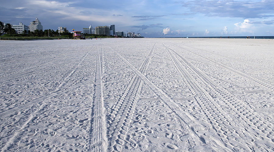
© Saul Loeb / AFPA nearly-deserted beach after residents and visitors evacuated from Miami Beach, Florida, September 7, 2017, ahead of Hurricane Irma.
Eerie footage and images of southwest Florida reveal deserted beaches and cities in areas usually thronging with crowds as residents flee the region ahead of Hurricane Irma making US landfall.

Seven million citizens have now been ordered to evacuate and at least 51,000 people are staying in shelters in southeastern Florida, according to Florida emergency management officials.

The National Weather Service has warned residents that nowhere in the Florida Keys will be safe when Irma hits, while Florida Governor Rick Scott urged any hold-out citizens Friday night to leave immediately.

Looking at footage from the scene, it appears many have heeded the warnings, as bustling tourist hotspots like Miami seem all but abandoned.

Comment: See also:
Hurricane Irma: Florida declares State of Emergency as storm upgraded to Category 5 - UPDATES

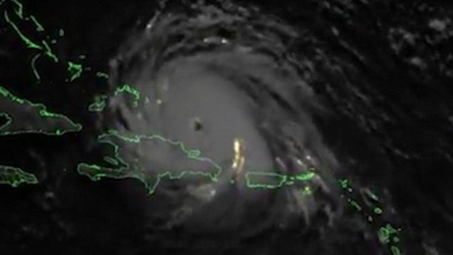
Hurricane Irma crackles with lightning in satellite video


Cloud Lightning

New Zealand blasted by 2200 lightning strikes in 24 hours

The country's been thrashed by lightning as unstable weather takes hold.
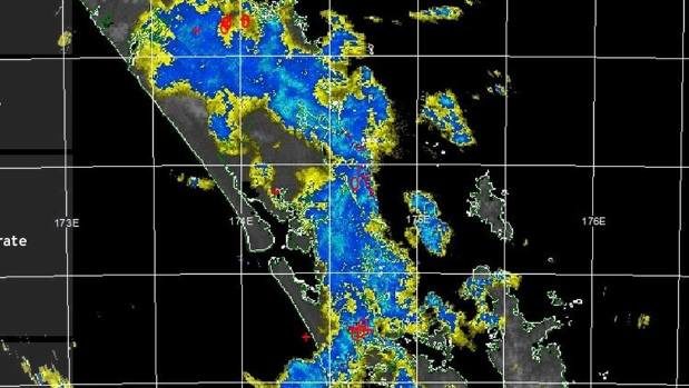
© METSERVICEThe country's been thrashed by lightning as unstable weather takes hold.
New Zealand has been hit by lightning more than 2200 times over 24 hours, with the West Coast of the South Island bearing the brunt of the strikes.

MetService meteorologist Tui McInnes said from 6.15pm on Friday to 7.20pm on Saturday, the country was blasted by 2206 lightning strikes as unstable weather took hold.

Most of those strikes had occurred offshore.

In the 24-hour period, Auckland had been hit nine times, the Bay of Plenty was hit 20 times and Westland was hit 163 times, McInnes said.

Cloud Lightning

Hurricane Irma crackles with lightning in satellite video

irma
Hurricane Irma
Hurricane Irma looks like a gigantic electrified beast in an amazing new video captured by an Earth-observing satellite.

The video, which is composed of imagery taken by the GOES-16 satellite, shows countless lightning storms crackling within Hurricane Irma day and night as the monster storm churns its way toward Florida.

The movie condenses more than 80 hours of observations — beginning Monday (Sept. 4) at about 8 a.m. EDT (1200 GMT) — into 49 jaw-dropping seconds.

"Of interest in this loop is the lightning within Hurricane Irma itself, particularly around the eye of the storm," officials with the U.S. National Oceanic and Atmospheric Administration, which operates GOES-16 along with NASA, said in a description of the video.

"Hurricanes don't often exhibit a great deal of lightning, because their winds are mostly horizontal, not vertical," the officials added. "So, the vertical churning within storms that generates lightning doesn't normally happen."


Cloud Lightning

Hurricane Jose strengthens to become an 'extremely dangerous' Category 4 storm

Hurricane Jose strengthened to an 'extremely dangerous' Category 4 storm
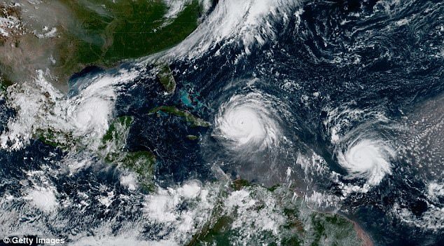
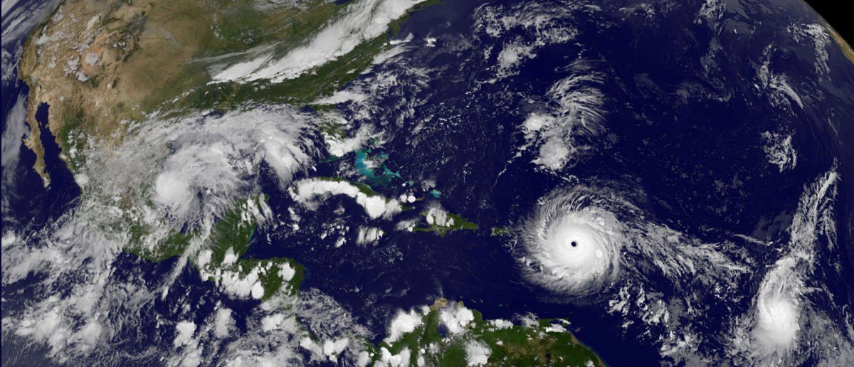
Hurricane Jose strengthened to an 'extremely dangerous' Category 4 storm on Friday with maximum sustained winds of 150mph. This image from the National Oceanic and Atmospheric Administration shows Hurricane Katia (left), Hurricane Irma (center), and Hurricane Jose (right) on Thursday in the Atlantic Ocean
Hurricane Jose strengthened to an 'extremely dangerous' Category 4 storm on Friday with maximum sustained winds of 155mph.

According to the National Hurricane Center, the storm was 265 miles east-southeast of the northern Leeward Islands at a rapid 18mph.

With winds picking up speed quickly, forecasters fear the storm may be on the brink of reaching Category 5 strength.

Jose is expected to pass near or east of the northeastern Leeward Islands on Saturday and is currently threatening several islands that were seriously damaged by Hurricane Irma.

Cloud Precipitation

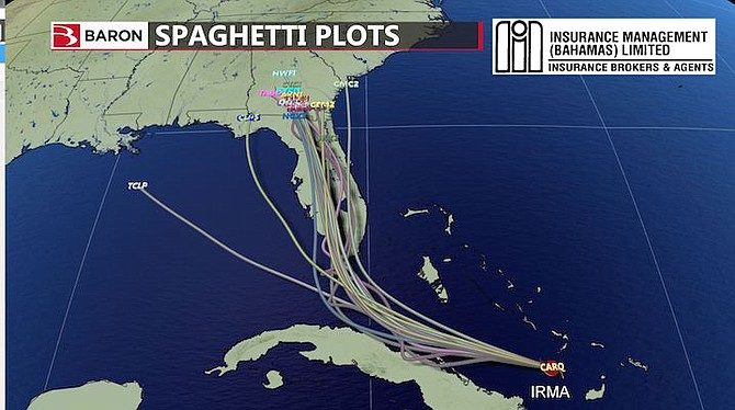
Hurricane shifts slightly west: Majority of the Bahamas 'Will be spared brunt of Irma'

MAP ROUTE
The majority of the Bahamas will be spared the brunt of Hurricane Irma, according to local Meteorologist Ian McKenzie who said the category storm 4 storm has shifted slightly to the west moving the deadly hurricane away from the Northwest and Central Bahamas.

However, Mr McKenzie said Irma has also slowed down, producing more rain and increasing the chances of flooding.

He also said Met officials are keeping a close eye on Hurricane Jose which has strengthened into an "extremely dangerous" category 4 storm with winds near 150 mph, according to the National Hurricane Center.

The storm sits east of the Leeward Islands and is forecast to move west-northwest into the Atlantic Ocean over the coming days.


Tornado1

Hurricanes Irma, Jose, Katia threatening landfall is 'unparalleled' in modern times, tropical storms expert says

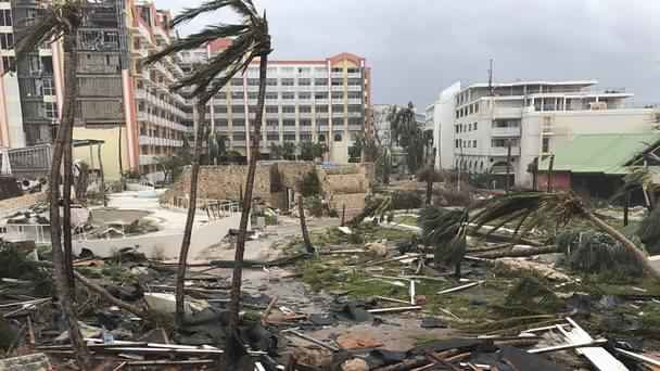
Irma wreaks destruction on St Martin
© Jonathan Falwell/APIrma wreaks destruction on St Martin


Islanders are bracing for more storm damage


The appearance of three strong hurricanes in the Atlantic basin which all threaten land is "unparalleled" in modern times, a tropical storms expert has said.

Hurricane Irma has already caused major damage in the Caribbean and is expected to hit southern Florida, while Hurricane Katia is menacing eastern Mexico, and Hurricane Jose could hit Antigua and Barbuda, which suffered major damage just days ago under Irma.

The last time there were three hurricanes in the Atlantic basin simultaneously was 2010, meteorologists said. Including this year, there are only six examples of simultaneous hurricanes on record, according to the Met Office.

But it is the first time all three have threatened land, according to Eric Blake, a scientist at the National Hurricane Centre.

"Never seen anything like this in the modern record," he said on Twitter.

"Three separate hurricane watches at once for the Atlantic? Unparalleled here and totally ridiculous given Irma."


Comment: In July this year eight tropical cyclones were spinning simultaneously in the north Pacific Ocean for first time since 1974.


Cloud Precipitation

Strong surf pounds eastern Cuba causing flooding as Irma marches west

Cuba prepares for destructive power of Hurricane Irma
Surf surged over the seawall in Baracoa on Cuba's eastern tip as Hurricane Irma began a side swipe Friday along Cuba's northern coast, flooding streets and knocking out electricity in a city already ravaged by a hurricane last year.

At noon the center of Irma, now a Category 4 hurricane, was about 118 miles east northeast of Nuevitas in Camagüey province. Cuban meteorologists say the island is taking an indirect hit from Irma with tropical-storm-force winds buffeting the coastline. But the most damage is expected to come from water.

Waves of 13 to 16 feet have caused coastal flooding from Gibara to Baracoa and heavy rain is pelting the northern coast. The Palenque de Yateras in Guantánamo province recorded 4.6 inches of rain in 24 hours.

"Now Baracoa is under the effects of Hurricane Irma, luckily we have only experienced rains, sea penetrations and some winds... but sincerely, nothing compared to what we were expecting," Radio Baracoa posted on its Facebook page at 9 a.m. Friday. More than 25,000 people from the city were evacuated to safer areas.


Bizarro Earth

'Ginormous'! Hurricane Irma is larger than the entire state of Florida

Hurrican Irma
© Nasa / ReutersHurricane Irma, a record Category 5 storm, churns across the Atlantic Ocean on a collision course with Puerto Rico and the Virgin Islands, is show in this NASA GOES satellite image taken at 1715 EDT (2215 GMT)) on September 5, 2017
Not only is Hurricane Irma the strongest storm to form in the Atlantic outside the Gulf of Mexico and Caribbean Sea, it's also larger than entire U.S. states.

Irma is larger than Florida, the very state forecasts show it reaching by the weekend, according to CBS News weather producer David Parkinson.


Bizarro Earth

Hurricane Irma presents an extreme storm surge threat to the US and Bahamas

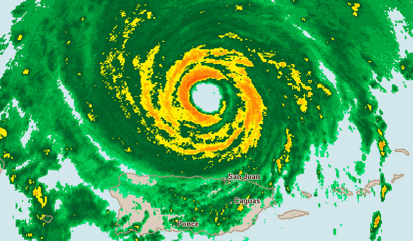
Radar image of Irma from the Puerto Rico radar at 9 pm EDT September 6, 2017.

After clobbering the Lesser Antilles islands of Barbuda, Saint Barthelemy, Anguilla, and Saint Martin/Sint Maarten early Wednesday morning, Hurricane Irma carried its march of destruction into the British Virgin Islands on Wednesday afternoon, still packing top winds of 185 mph. As of 5 pm EDT Wednesday, Irma had spent a remarkable 1.5 days as a Category 5 hurricane, which is the 7th longest stretch on record in the Atlantic, according to Dr. Phil Klotzbach.

Longer-range outlook for Irma: Cuba, The Bahamas, and Southeast U.S.

The 12Z Wednesday runs of our top four track models-the European, GFS, HWRF, and UKMET models-were in strikingly close agreement that Irma will continue on a west-northwest track till Saturday, then arc sharply to the north-northwest. All four model runs placed the center of Irma within roughly 50 miles of Miami on Sunday morning; the latest 18Z GFS was also there. The average track error in a 4-day forecast is 175 miles, but this remarkable agreement among the models lends additional confidence to the NHC forecast track, which brings Irma over or very near southeast Florida on Sunday. All four models move Irma northward along or near Florida's east coast, with landfall in Georgia or South Carolina on Monday.
Cloud Precipitation

According to Texas A&M expert the rainfall from Harvey shattered every record

Hurricane harvey rainfall
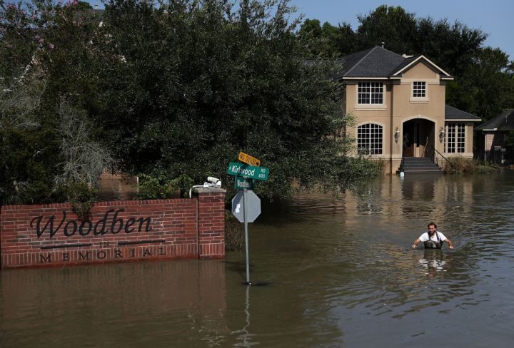
© Justin Sullivan/Getty ImagesChris Ginter wades through deep floodwaters on September 6, 2017 in Houston, Texas. Ginter, a Houston resident, has been taking local residents to their flooded homes in his monster truck which can drive through waters up to 4 feet deep.
Hurricane Harvey was billed as a once-in-every-500-year event, and it more than lived up to its billing. It produced rainfall amounts that will re-write the weather books in Texas and the United States, says a Texas A&M University expert.

John Nielsen-Gammon, who is a Regents Professor of Atmospheric Sciences at Texas A&M and also serves as Texas State Climatologist, says Harvey set new standards for historic rainfall and flooding.
"Harvey is head and shoulders above all previous multi-day storms ever recorded in the continental United States," says Nielsen-Gammon.

"I examined 18 different combinations of storm lengths and area sizes, from two days long to five days long, and standard areas from 1,000 square miles to 50,000 square miles. According to the preliminary data, Harvey was the worst in all but one."
Nielsen-Gammon said that the most amazing record is for the five-day total over an area of 10,000 square miles.
"For Harvey to average 34.72 inches over five days across that large an area is ridiculous," Nielsen-Gammon says. "The previous all-time United States record, set in Texas back in 1899, was estimated at 21.39 inches. Harvey exceeded that record by 62 percent."