Storms
S

Tornado1

San Francisco meteorologists baffled by bizarre isolated winds that whipped Bay Area

wind storm San Francisco
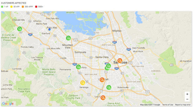
© PG&E outage mapA surprising wind storm caused power outages in San Jose and elsewhere on Monday Sept. 11, 2017.
The gusts knocked some communities while others areas were completely still

KTVU meteorologist Steve Paulson said wind storms gusting up to 40 miles an hour ripped through parts of the South Bay last night but should calm down today. Highs in the 70s to 90s with mostly cloudy skies.

Meteorologists are baffled by strong wind gusts that ripped through concentrated pockets of the Bay Area early Monday morning, while other areas remained completely still.

Tornado1

Storm chaser battles to record 117 mph winds in Florida Keys during Hurricane Irma

Hurrican irma florida keys
© Agence France-PresseStorm chasers recorded winds of up to 117mph on the Florida Keys
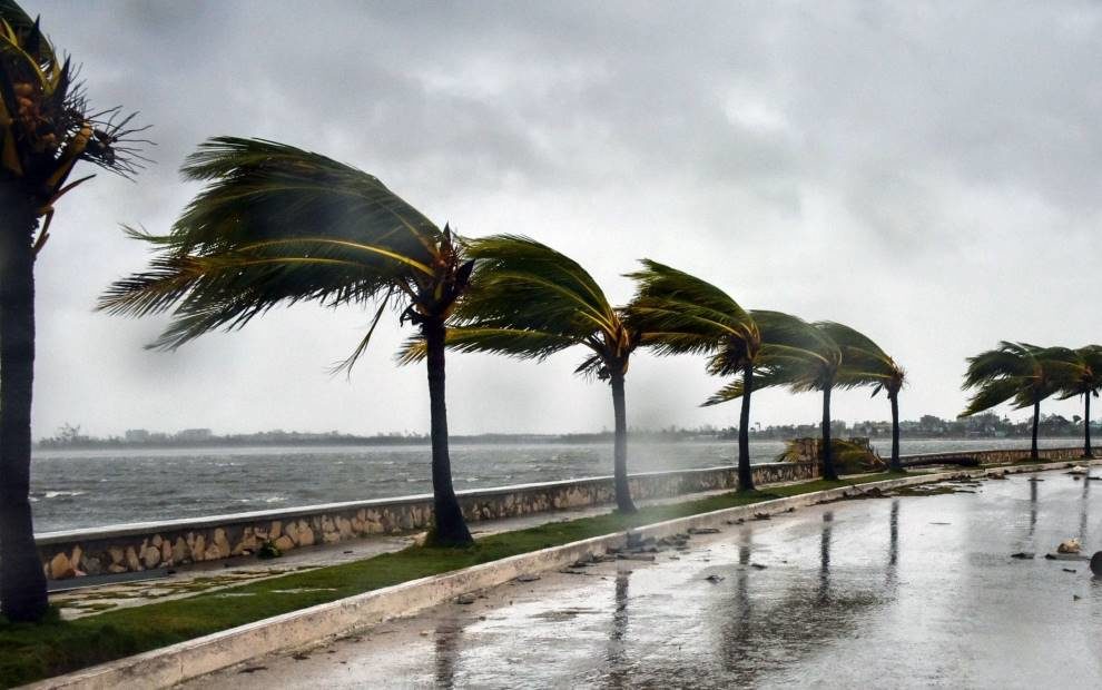
A storm chaser has demonstrated the full force of Hurricane Irma as he attempted to stand up against its lashing winds in the Florida Keys.

Juston Drake, a meteorologist, was filmed stumbling backwards as he battled winds exceeding 100mph in Saddlebunch Keys, just off the mainland Florida.

Wearing a paintball mask, which was quickly ripped from his face, Mr Drake is almost blown off his feet at points as he attempts to get a wind speed reading.

The footage emerged as Hurricane Irma makes landfall in Florida, with the eyewall hitting the Keys, which are a string of islands off its south coast.

Tornado1

Why Hurricanes Irma & Harvey are so powerful - it's cosmic rays not CO2

Hurricane Harvey
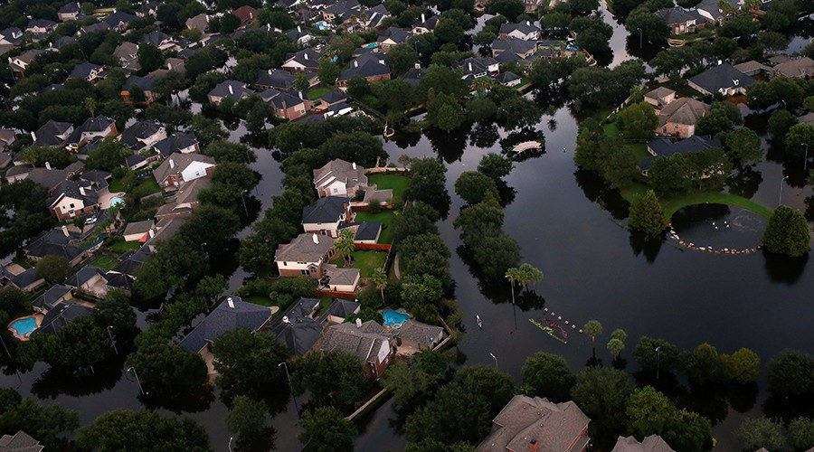
© Agrees Latif / ReutersHouses partially submerged in flood waters caused by Tropical Storm Harvey, Texas, US
With Hurricane Irma bearing down on the west coast of Florida with 140 mph winds, and last week Hurricane Harvey drowning Texas, there is much talk of CO2 causing the weather intensity changes. Why is it that longer term cycles, cosmic rays and the grand solar minimum are not discussed as causes in intensification for the changes globally we are seeing. I present my findings that cosmic rays are causing the extreme weather we are seeing and a timeline for more intensification based on feedback loops of more cloud cover due to a weakened magnetosphere allowing cosmic rays to form more clouds between 15,000-18,500 ft in the Earth's atmosphere.


Tornado1

Ahead of #Irma 'water is literally being sucked out of Tampa Bay'

Hurricane Irma
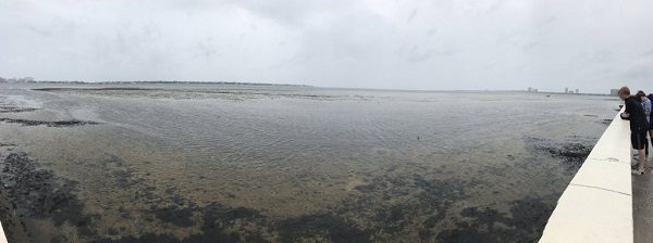
When a hurricane approaches, there is storm surge that piles up water, but when it is out at sea, especially in shallow waters, the vacuum effect of the low pressure of the storm can suck water away from the shores. Offshore winds also play a big role. Such is the case here. This photo, taken by Dana Young and posted on Twitter, shows the effect.

She writes:
Hours before Irma hits, the water is literally being sucked out of Tampa Bay. I took this photo at the end of my street. This was at Albany and Bayshore 15 min ago.

Comment: See also: Hurricane Irma: Florida declares State of Emergency as storm upgraded to Category 5 - UPDATES


Cloud Precipitation

Satellite images reveal eerie 'face' of Hurricane Irma

Hurricane Irma
© NASA
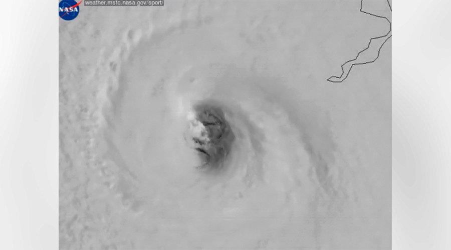
Satellite images have revealed a spooky, face-like formation in the eye of Hurricane Irma as the deadly storm is poised to make landfall in the US.

After roaring its way along the Caribbean leaving a trail of carnage in its wake, the Category 4 hurricane is now set to crash into the coast of Florida, with Governor Rick Scott warning that the state is facing the "most catastrophic" storm it has ever seen.

NASA has been sharing satellite images and timelapse videos as the hurricane hurtled through the Bahamas and Cuba, leaving at least 22 people dead and destroying countless homes, businesses, and even hospitals.

The images convey the immense ferocity of the storm as it barrels along its way, though several social media users have noticed an even more chilling feature in some of the pictures - the appearance of a face.

Tornado1

Hurricane expert Dr. Philip Klotzbach: #Irma at landfall comes in 7th behind 1935 Labor Day storm

While this won't be of much comfort for those that are squarely in it's path right now, it is a small bit of good news. Dr. Philip Klotzbach has compiled rankings of both hurricane Irma and Harvey when they made landfall. Compared to the 1935 Labor Day storm, Irma is a distant 7th, tied with the 1928 Lake Okeechobee storm.

Comment: See also: Winds, fire, floods and quakes: Mother Nature's recent nutty run


Boat

Riders on the storm: Sailor livestreams Hurricane Irma from his boat in Key West, Florida (VIDEO)

Sailor livestreams storm
© S/V Andromeda / Facebook
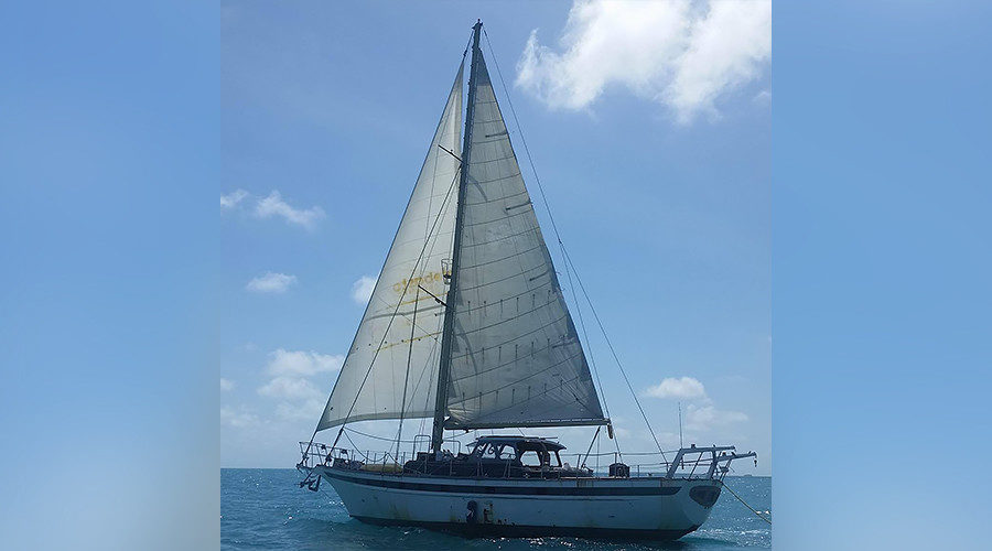
A man livestreamed Hurricane Irma from his boat in Key West, as the Category 4 storm prepared to make landfall over the lower Keys.

The footage was broadcast from the sailing vessel Andromeda on the boat's dedicated Facebook page.

Footage was interrupted on a number of occasions, finally cutting out as the eye of Hurricane Irma was just 20 miles east-southeast of Key West.

Rough seas were seen and strong winds could be heard as the sailor, Ryan Stone, pointed out debris in the water from his docked vessel.

Bizarro Earth

Rare phenomenon caused by Hurricane Irma sucks the water from Bahamas beaches

Bahamas beach disappears
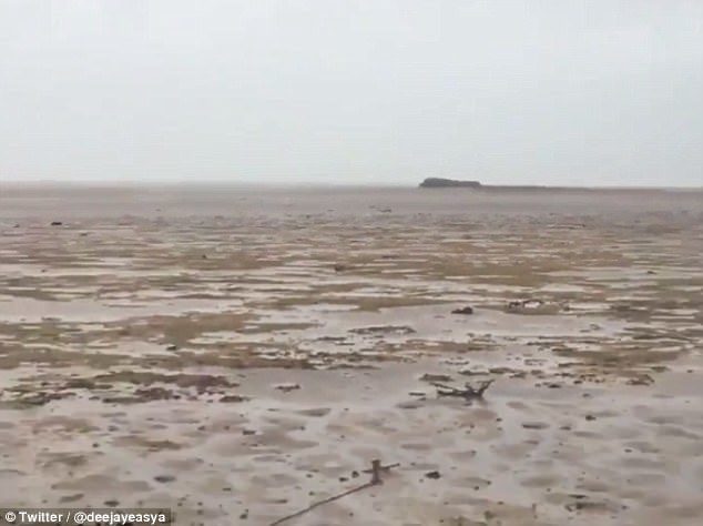
© Twitter@deejayeasyaBefore: Hurricane Irma temporarily changed the shape of the ocean after hitting the Bahamas on Friday
Extraordinary footage from the Bahamas show the shoreline receded much farther than normal, exposing what is usually the ocean floor.

Twitter user @Kaydi_K from Long Island, Bahamas wrote on Friday: 'I am in disbelief right now... This is Long Island, Bahamas and the ocean water is missing!!! That's as far as they see #HurricaneIrma.'

The strange video shows her walking on the exposed ocean floor which is dry and covered in large shells. Another Twitter user tweeted a photo of the exposed beach at a different beach in the Bahamas and showed it was back to normal within less than a day.

Hurricane Irma, which hit the Bahamas on Friday, is so powerful that it has altered the shape of the ocean in Long Island, but it will likely be back to normal by Sunday afternoon.

Pressure in a hurricane's center is low and Irma is so strong that it is pulling water into its core, sucking it away from the ocean, according to the Washington Post.

Comment: Last month the Atlantic Ocean dramatically receded off the coasts of Uruguay and Brazil. See also:

Meteotsunami? Ocean dramatically recedes on South American Atlantic coast as huge waves batter the Pacific side


Tornado1

Paradise islands devastated by Hurricane Irma (VIDEOS, PHOTOS)

St Martin
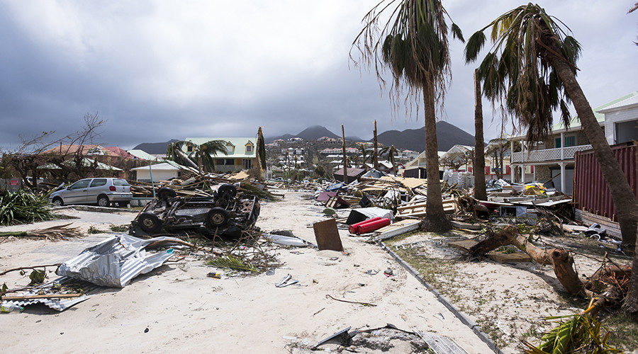
© Lionel Chamoiseau / AFPOrient Bay on the French Carribean island of Saint-Martin, after the passage of Hurricane Irma.
Images of the devastating impact of Hurricane Irma have filled social media, showing how the deadly storm system has reduced tranquil Caribbean island paradises to ruins.

More than 20 people died as extreme weather barrelled across the Caribbean bringing winds of up to 150mph. Whole neighborhoods have been turned-upside down on islands such as Barbuda, St Barts and the Virgin Islands.

Irma continues to travel west towards Florida, and the US Oceanic and Atmospheric Administration has warned that it will bring "life-threatening wind, storm surge and rainfall hazards".

As islanders struggle to come to terms with the natural disaster, and as MSM coverage continues to focus on Florida, here is the latest on the worst-hit Caribbean regions.

Comment: See also: Hurricane Irma: Florida declares State of Emergency as storm upgraded to Category 5 - UPDATES


Blue Planet

Winds, fire, floods and quakes: Mother Nature's recent nutty run

hurricane damage
With four big hurricanes, a powerful earthquake and wildfires, it seems that nature recently has just gone nuts.

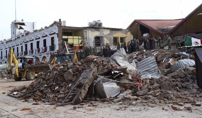
Some of these disasters, like Friday's earthquake in Mexico, are natural. Others may end up having a mix of natural and man-made ingredients after scientists examine them. We also always tend to look for patterns and order in chaos, even when they aren't there, psychologists say.

"Nature's gone crazy," mused Jeff Masters, meteorology director at the private service Weather Underground. "Welcome to the future. Extreme weather like this is going to be occurring simultaneously more often because of global warming."


A look at a rough few weeks in North America: