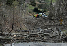
© Craig CunninghamTrees blocked the road and knocked down power lines along Cantley Drive in Fort Hill after Monday evening's storm ripped through the area. Six large trees fell across the road, knocking down power lines.
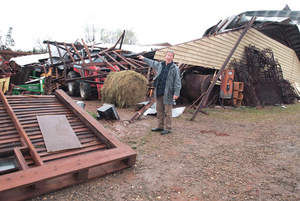
The day after a powerful storm ripped through the Kanawha Valley damaging thousands of homes, the cleanup began.
While homeowners were busy with cleanup, insurance agents began assessing damage so repairs could begin.
Jill Bentz, president of the West Virginia Insurance Foundation - which represents several property and casualty insurers in the area - said it's still too early to estimate how much property damage was sustained in Monday's storm.
"Companies are just overwhelmed with the volume and they just need some extra time to respond responsibly and accurately to their customers' claims," she said.
"We just can't estimate the damage sustained right now."
But the damage does seem to be concentrated within the valley.
"Mostly what we've seen is trees are down because of wind," she said. "A lot of the claims we've received today have been isolated to the St. Albans-Charleston area, and some have been slightly north of Charleston."




Comment: Update: German news report on the bizarre sandstorm: