Wildfires
S


Bizarro Earth

US: Arizona - Wallow Wildfire at 144,000 Acres and Still Zero Percent Contained

More than 2,000 firefighters are combating the Wallow Fire that has consumed 144,000 acres in eastern Arizona, forced residents to flee a handful of communities and put others on the verge of evacuation.

In mid-afternoon Sunday, the Apache County Sheriff's Office said it has ordered the evacuation of the several subdivisions along Arizona 180 near the New Mexico state line and Arizona 191. It was not immediately clear how many residents or structures were involved in the evacuation of Escudilla Mountain Estates, Bonita, Dog Patch, and the H-V Ranch.


As the community of Greer stands ready on a pre-evacuation alert, crews fighting the Wallow Fire continued to fret about warnings of high winds and dry lightning for Sunday afternoon. Fire officials re-calibrated the fire size at 144,000 acres after earlier reports of 184,000 acres proved premature; they said the erroneous numbers may have included areas that fire crews deliberately burned back toward the main fire to rob it of fuel.

Windy, lightning conditions would likely ground aircraft battling the week-old blaze, which is now thought to have been sparked by an abandoned campfire, said Eric Nietzel, a spokesman with the Show Low Fire Department.

Comment: This wildfire is a week old. Here is a report of a possible meteor sighting in Northern Arizona around the same time as the start of the wildfire. Of course, it could be a coincidence, but how often do you hear a spokesman with the Fire Department reference meteors starting wildfires?


Phoenix

US: Arizona wildfire jumps to 40,000+ acres

There's been a dramatic increase overnight in the burned acreage numbers on the Wallow fire 12 miles southwest of Alpine in eastern Arizona.

U.S. Forest Service spokeswoman Jonetta Trued tells The Associated Press the wildfire has increased to more than 40,500 acres with zero containment.


Trued says the wildfire is burning dead trees and branches lying on the forest floor. When an ember hits, there's 100 percent ignition which leads to spot fires and hazardous conditions for fire crews.

Phoenix

US: Wildfire in southeast Arizona burns nearly 50,000 acres

Image
© www.inciweb.org
An evacuation order has been lifted for residents of some communities near a southeast Arizona wildfire.

The Forest Service said Friday that fire crews will stay around Paradise and the Southwest Research Center to patrol the area for fires.

The U.S. Forest Service says west to southwest winds at 10 to 18 mph are expected with gusts of 25 to 30 mph.

Low humidity and slightly cooler temperatures are expected.

Meanwhile, the Horseshoe Two fire has risen to nearly 50,000 acres and is 40 percent contained.

Bizarro Earth

Busy 2011 Fire Season in Mexico

Mexico Fires
© Jeff Schmaltz, MODIS Rapid Response Team at NASA GSFC
May usually marks the end of the fire season in Mexico. Sometime during the month, the first wet-season rains begin to fall, followed by a soggy five months. Yet, on May 20, 2011, when the Moderate Resolution Imaging Spectroradiometer (MODIS) on NASA's Aqua satellite took this image, the fire season was still going strong. Fires, marked in red, were burning throughout the country, casting a smoky haze from the Pacific Ocean to the Gulf of Mexico.

The widespread fires shown here are evidence of the extreme fire season 2011 turned out to be in Mexico. By May 19, more than 530,000 hectares (1,300,000 acres or 2,000 square miles) of land had burned in the country since the beginning of the year, said the Mexican government. In terms of area burned, 2011 surpassed every year since (and including) 1998, making it one of the most challenging fire seasons in 30 years.

What made the 2011 fire season so extreme? In part, the answer lies in the 2010 rainy season, one of the wettest on record. Rains from Hurricane Alex flooded northern Mexico in July, and then torrential rains caused widespread flooding in southern Mexico in September. All of this excess water allowed thick grass to grow. During the dry season, which begins in October and lasts through May, the grass dried, providing ample fuel for fires.

Bizarro Earth

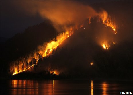
Fears of repeat disaster as fires rage in Russian east

Image
© ReutersSo far the fires are confined to eastern Russia
Russia has reported 421 wildfires burning in forests and peat bogs over the past 24 hours, covering an area of 116,098 hectares (450 sq miles).

The fires were mainly confined to remote parts of Siberia and the Urals, with no blazes reported near Moscow and other central Russian cities.

But the area on fire is twice the size of that for the same period last year.

Drought, fires and smog left dozens dead and ruined crops in 2010, and there are fears of a repeat disaster.

The emergencies ministry said in a report on its website that the biggest fires were in the Sakha Republic (Yakutia), the Amur region and the Krasnoyarsk territory.

More than 6,000 personnel equipped with more than 1,140 units of fire-fighting equipment were deployed against the fires, backed by 42 aircraft.

Of the 421 fires reported on Monday, 241 were extinguished, the ministry said.

Western Russia, the centre of the country's grain production, remains largely unaffected by fire, but officials say the situation may deteriorate if dry weather persists.

Russia's official forecast for this year's wheat crop is 85-90m tonnes compared to some 61m in 2010, 97m in 2009 and 108m in 2008.

Meanwhile, drought conditions have been hitting grain crops in northern Europe, with some forecasters predicting above-average temperatures for the summer months.
Phoenix

Russian wildfires double in size

Wildfires raging in Siberia doubled in size from 1,400 to 3,700 acres over a 24 hour period, Russia's Emergencies Ministry reported Sunday.

"There are 106 hotbeds of wildfires on a total area of 1,492.6 hectares (3,688.2 acres) in Siberia," the ministry said.

Ministry officials said the forest fires are the result of local resident activity, RIA Novosti reported.

It was unclear exactly what kind of activity they were referring to.

Bizarro Earth

Wildfires in Alberta, Canada

Wildfires in Alberta_1
© MODIS Rapid Response Team / NASA GSFC.Acquired May 16, 2011
Wildfires in Alberta_2
© MODIS Rapid Response Team / NASA GSFC.Acquired May 16, 2011
Tan and gray smoke spanned hundreds of kilometers across Alberta, Saskatchewan, and Northwest Territories, Canada, on May 16, 2011. At 10:00 a.m., the Alberta government reported 116 fires burning in the province, 34 of which were out of control. The following day, the total number of fires had dropped to 100, and the number of uncontrolled fires had dropped to 22, but four new fires had started to burn out of control.

The Moderate Resolution Imaging Spectroradiometer (MODIS) on NASA's Terra satellite took this image at 12:35 p.m. local time on May 16. Similar images of central Canada are available twice daily.

The top view shows a wide area to illustrate how far the smoke traveled. The lower image provides a closer view of a massive fire burning south of Lake Athabasca. Fire detections are outlined in red. Strong winds fanned the fires on May 15 and 16, pulling thick plumes of smoke north.

Phoenix

Canada: Alberta Town Burns, Wildfires Shut Oil Facilities

Image
© Agence France-PresseA forest fire is seen in California 2009. A wildfire engulfed the town of Slave Lake in western Canada, forcing the evacuation of its 7,000 residents at the start of the forest fire season, authorities said Monday
Wildfires whipped by high winds destroyed more than a third of a sizable town in northern Alberta and forced oil companies in Canada's largest energy-producing province to shut off tens of thousands of barrels of output on Monday.

Dozens of forest fires flared up across the province during a dry, gusty weekend, forcing the evacuation of several communities, including Slave Lake, a town of 10,000 people in northern Alberta known as a center for oil, gas and forestry.

Numerous homes and some public buildings had been razed in Slave Lake, Mayor Karina Pillay-Kinnee said.

She spoke to reporters from a command center in the town, about 200 km (125 miles) northwest of the provincial capital, Edmonton. It was deserted save for emergency personnel.

"You feel the intense heat, the sharp smell of smoke ... you see some areas still smoking and our fire-fighting crews are trying to contain any spot fires," Pillay-Kinnee said.

Two blazes, driven by winds gusting to 100 km per hour (60 miles per hour), converged on Slave Lake on Sunday. Complicating the situation on Monday were winds up to 50 km per hour (30 mph) in some regions as well as dry conditions.

Evil Rays

Thousands flee town on fire in Canada

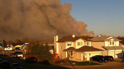
Slave lake, Alberta - A wildfire blazing through a northern Canadian town forced the evacuation of nearly 7,000 people, with many fleeing with just a few belongings before buildings were consumed - including the town hall and the main shopping mall.

Nearly a third of the buildings in Slave Lake were destroyed Sunday after strong winds suddenly turned the flames towards the town in Alberta Province, police said.

All residents were ordered to leave Sunday afternoon, but evacuation proved difficult as smoke and fast-moving flames blocked some of the highways. By Monday, however, 90 percent of residents were said to have fled.

"It was certainly a surreal experience seeing the flames against the night sky," Geoffrey Driscoll was quoted by the Calgary Herald as saying. "We could see behind us parts of the town on fire."

Phoenix

Canada: Forest Fires Force Hundreds to Evacuate from Their Homes Near Slave Lake

Image
© Ray PetlockThe Town of Slave Lake has declared a state of emergency as wildfires force 260 people from their homes
The number of evacuated residents near Slave Lake is climbing rapidly as forest fires continue to rage out of control near the community. So far five homes and ten other buildings have been destroyed while strong winds continue to hamper firefighting efforts.

Close to 1,000 people have been forced from their homes since the fires broke out Saturday afternoon. Initially, about 260 people were evacuated from the Poplar Lane and Mitsue areas but Sunday afternoon, another 700 residents were ordered out of the area because of another fire burning southwest of the community.

Displaced residents are being sent to a Red Cross reception centre at Northern Lakes College. Two schools in the area are being set up as temporary shelters for evacuees.