Volcanoes
S


Info

New study reveals evidence of recurring ancient supereruption

The Marsili Basin
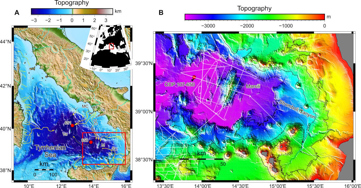
© Geology (2023). DOI: 10.1130/G51198.1(A) The Marsili Basin lies in ~3000 m water depth in the Tyrrhenian Sea. Ocean Drilling Program Leg 107 Sites 650 and 651 marked as red circles. Red box shows map in (B). Campi Flegrei (CF) fields (source of 39.8 ka Campanian Ignimbrite and 14.9 ka Neapolitan Yellow Tuff) shown with nearby submarine canyons (Dohrm [DC] and Magnaghi [MC]) as yellow lines. Ve—Vesuvius; SC—Stromboli Canyon. (B) CHIRP subbottom profiles shown as white dashed lines. Continuous white lines involved the acquisition of additional airgun seismic data. Bathymetry is a merged dataset of a 40-m grid CHIANTI multibeam bathymetry together with EMODNET bathymetry. Contour interval is 1000 meters.
Researchers have discovered a series of large undersea sediment deposits in a region near Italy that were likely formed by an ancient volcanic supereruption.

These deposits, known as megabeds, were found in the western Marsili Basin, an area at the bottom of the Tyrrhenian Sea that surrounds the Marsili Seamount, a large undersea volcano.

By combining geophysical data acquired from a Spanish research project and data from sediment cores collected from a nearby Ocean Drilling program site, scientists were able to show that three deposits are made up of alternating beds of volcaniclastic sand and mud, while the fourth is a volcaniclastic debris flow, a more dense mixture of volcanic sediment and water.

The study's findings, published in the Journal Geology, suggest that these structures were deposited during a volatile time when the Campi Flegrei caldera and the Neapolitan Yellow Tuff supereruption were active.

The new study suggests that these megabeds originated not from nearby volcanoes, but from a volcanic province to the north. That province, researchers think, was an area once near the Campanian Ignimbrite (CI) supereruption of Campi Flegrei, the largest one of its volcanic eruptions since the caldera's formation nearly 50,000 years ago.

This still volcanically active region could pose immense danger in the future, said Derek Sawyer, lead author of the study and an associate professor of earth sciences at The Ohio State University. The discovery of these previously unknown megabeds is pivotal for understanding and measuring the impact of such recurring geohazards over time.
Fire

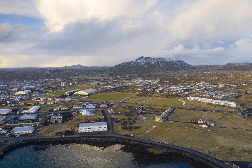
Eruption fears as Iceland's Grindavik residents given five minutes to go home amid earthquakes

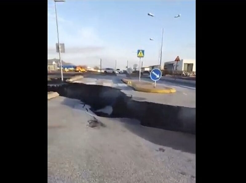
crack road earthquake iceland volcano
© XEarth tremors have cracked a road in the center of Grindavik, Iceland, November 11, 2023
Seismic activity in area around Grindavik has 'increased significantly' in Iceland as eruption is predicted

Authorities in Iceland have declared a state of emergency as the threat of an "imminent" volcanic eruption which "could obliterate the entire town of Grindavik" loomed.

The Icelandic Met Office experts have said a volcanic eruption could last 'for weeks' as 30,000 earthquakes have been recorded since seismic activity began three weeks ago.

Matthew James Roberts, managing director of the service and research division at the Iceland Met Office, told Radio 4's Today Programme: "This would be a lava-producing volcanic eruption along a series of fissures and that would be the main hazard.

"Blowing lava an eruption that persists for weeks possible and that means roads and other forms of infrastructure could be eventually in harm's way."

Fire

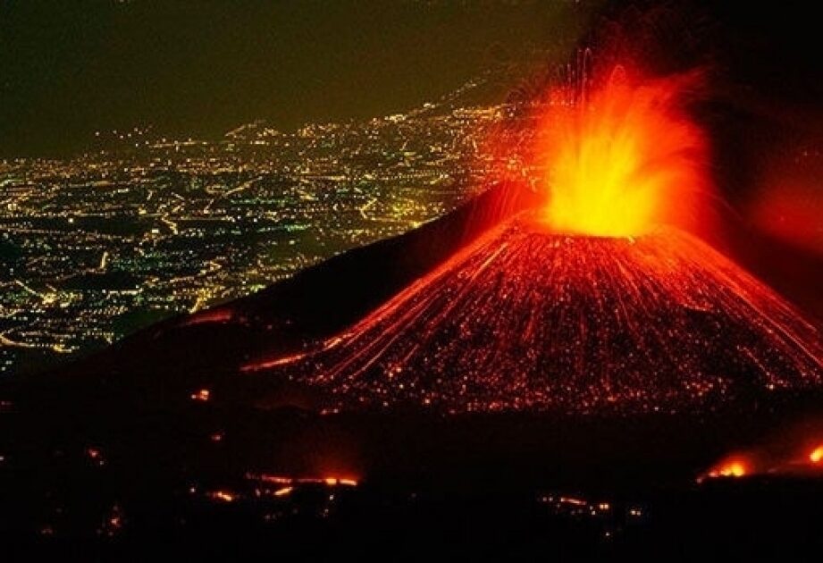
Intense eruptive activity starts at Italy's Mount Etna

Intense eruptive activity starts at Italy's Mount Etna
Intense eruptive activity started at the Mt. Etna, located in Italy's Sicily, local media reported on Monday.

As the volcanic clouds created by the explosions in the mountain have reached an inestimable height, the National Institute of Geophysics and Volcanology (INGV) issued a red code for aviation, noted the public broadcaster Rainews.

INGV announced that a network of surveillance cameras had revealed an increase in Strombolian activity at the southeast crater, accompanied by a lava overflow from the southeast saddle.

From the forecast model of volcanic ash dispersal, the simulation of the eventual dispersion of the volcanic plume indicates an east-southeast direction, it added.

Mount Etna, 3,357 meters (11,014 feet) in height, is one of the world's most active volcanoes and is in an almost constant state of activity.


Info

Best of the Web: Underwater volcanic eruption gives birth to new island in the Pacific

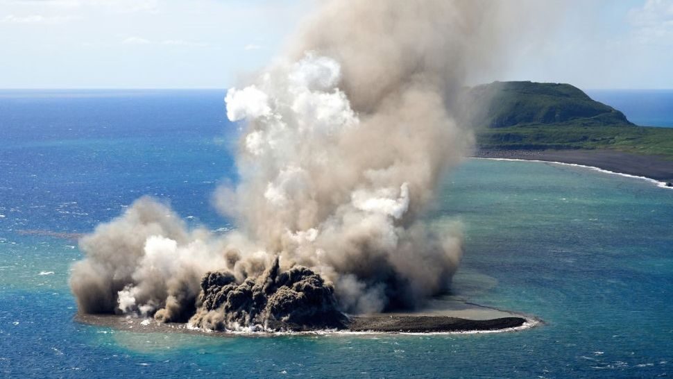
A volcanic eruption off Iwo Jima in the Pacific Ocean on Oct. 30 led to the formation of a 330-foot-wide island just north of the explosion site.
New Land
© The Asahi Shimbun via Getty ImagesEarth and sand are sent into the air above a new islet that appeared after a volcanic eruption off the coast of Iwo Jima.
An underwater volcanic eruption on Oct. 30 has birthed a new island in the Pacific after the explosion flung huge chunks of rock into a pile off the coast of Japan's Iwo Jima island.

An aircraft belonging to the Japanese newspaper Mainichi Shimbun spotted the first signs of an eruption in the southern part of the Izu-Ogasawara arc, roughly 750 miles (1,200 kilometers) south of Tokyo, around midday local time. Explosions occurred every few minutes as red hot magma hit water below the surface, throwing large blocks of rock more than 160 feet (50 meters) into the air, according to a translated statement.

The eruption breached the ocean surface in at least two locations, researchers at the University of Tokyo said in the statement, with explosions occurring only off the southernmost tip of Iwo Jima. Rocks also piled up north of the explosion site, however, forming a round and rugged island about 330 feet (100 m) across. Waters surrounding this new island were discolored and littered with pumice, a type of extremely porous rock that forms during explosive volcanic eruptions.

"Floating pumice and discolored water occur from the entire periphery of the island, suggesting that magma is erupting from this location," researchers wrote in the statement. Rocks on the island formed a concentric pattern, they noted, but there was no sign of a crater on the surface.

Several underwater eruptions have been recorded in this region in recent years. Known as phreatic eruptions, these events are characterized by explosions of steam and volcanic material at the surface. They are triggered when water comes into contact with sizzling magma, lava, rocks or other scalding deposits.

Fire

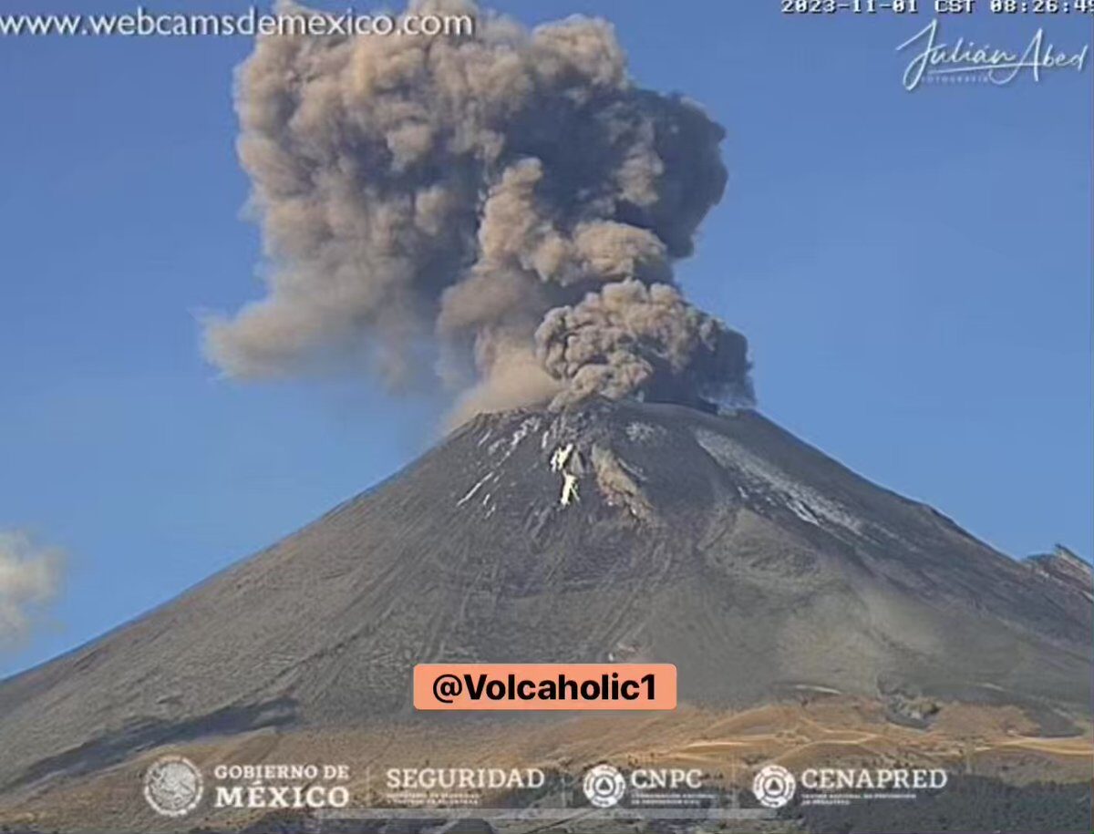
Eruption at Popocatepetl volcano in Mexico

mmmmm

Attention

Ground uplift continues at Thorbjorn Complex, volcano-tectonic unrest affecting wide area of Reykjanes Peninsula, Iceland

Torbjorn
© Golli
Updated 29th of October at 2pm

The latest cGPS deformation data around the Þorbjörn and Svartengi area confirm that the deformation, which started 27 October, continues. As initially stated, the ongoing deformation rates are higher than in previous events which occurred in a similar area in 2020 and 2022. Overall, the seismicity north of Grindavík has been declining over the past 24 hours and there are no significant changes in earthquake depths. However, it is important to emphasise that the current deformation may trigger renewed seismicity in the area that could be felt by people.

New satellite data are expected to be delivered later today, and a new interferogram will be processed as soon as the data are available. The results will allow us to identify and interpret the deformation processes that have occurred on the peninsula over the past 12 days. We expected to publish the results tomorrow.

An episode of complex volcano-tectonic unrest is currently affecting the Reykjanes Peninsula. It is interpreted to result from multiple deformation sources at depth, which are interacting and affecting a wide area across the peninsula.

Fire

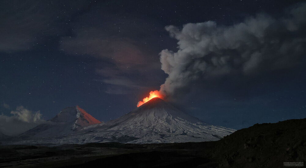
Klyuchevskoy volcano in Russia continues erupting

mmmmmm
Explosive activity continues. Volcanic Ash Advisory Center (VAAC) Tokyo warned about a volcanic ash plume that rose up to estimated 29000 ft (8800 m) altitude or flight level 290 and is moving at 20 kts in E direction.


The full report is as follows:

Fire

Popocatépetl volcano in Mexico registers three explosions

mmmmmm
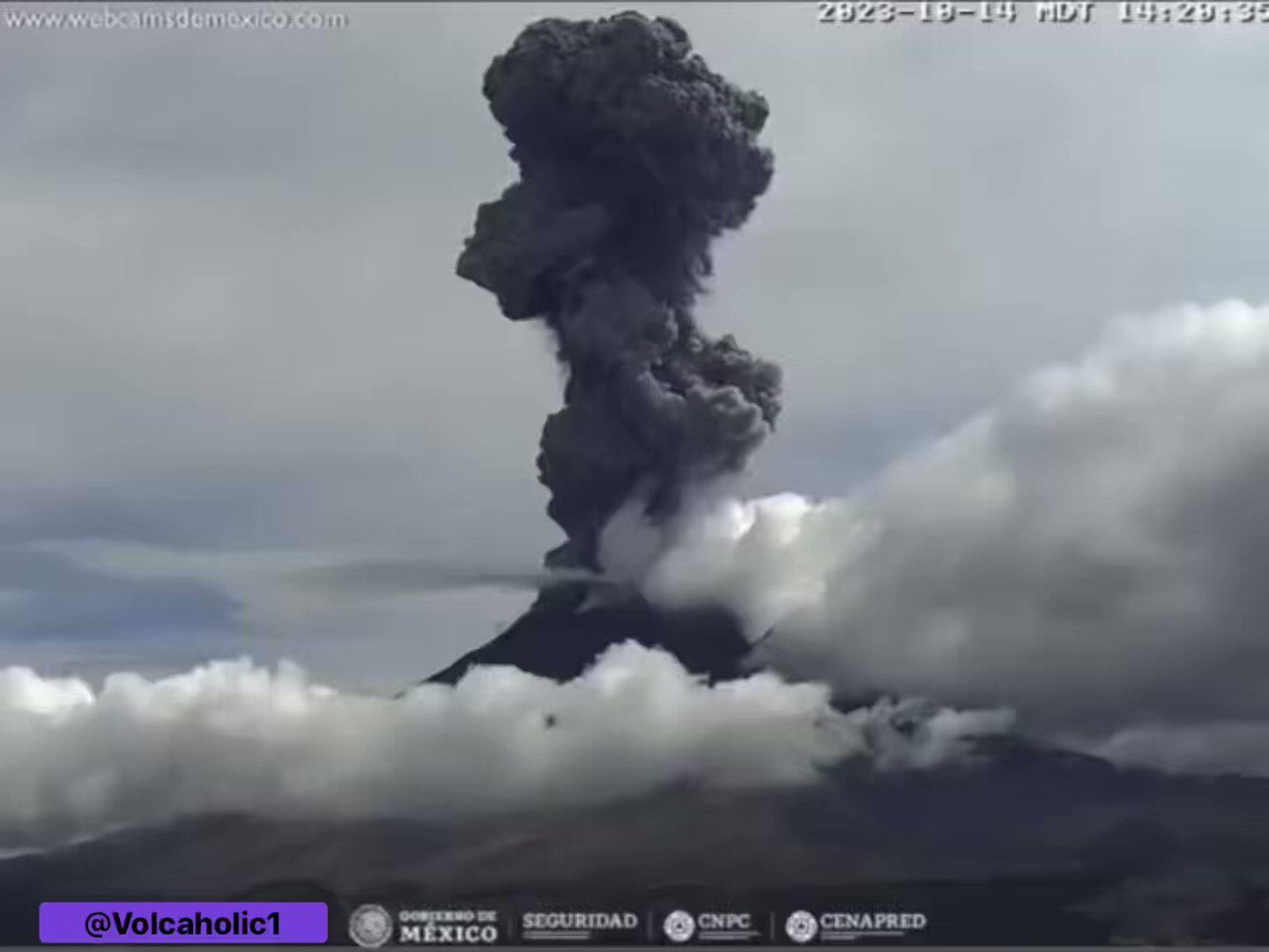
The Municipal Directorate of Civil Protection of the Secretariat of Citizen Security of Puebla reports that the Popocatépetl volcano has experienced an increase in its activity in recent hours, and so far three significant explosions have been recorded , which keeps the population of Puebla on alert. the region.

Until 11:00 a.m., the volcano had recorded a total of 195 low-intensity exhalations in the last 24 hours, accompanied by water vapor, volcanic gases and, sometimes, falling ash.

However, it was around 2:20 p.m. this Saturday when the volcano emitted an impressive column of smoke accompanied by ash and gases , which was visible several kilometers away, but due to the direction of the winds, the ash did not reached the city of Puebla.


Fire

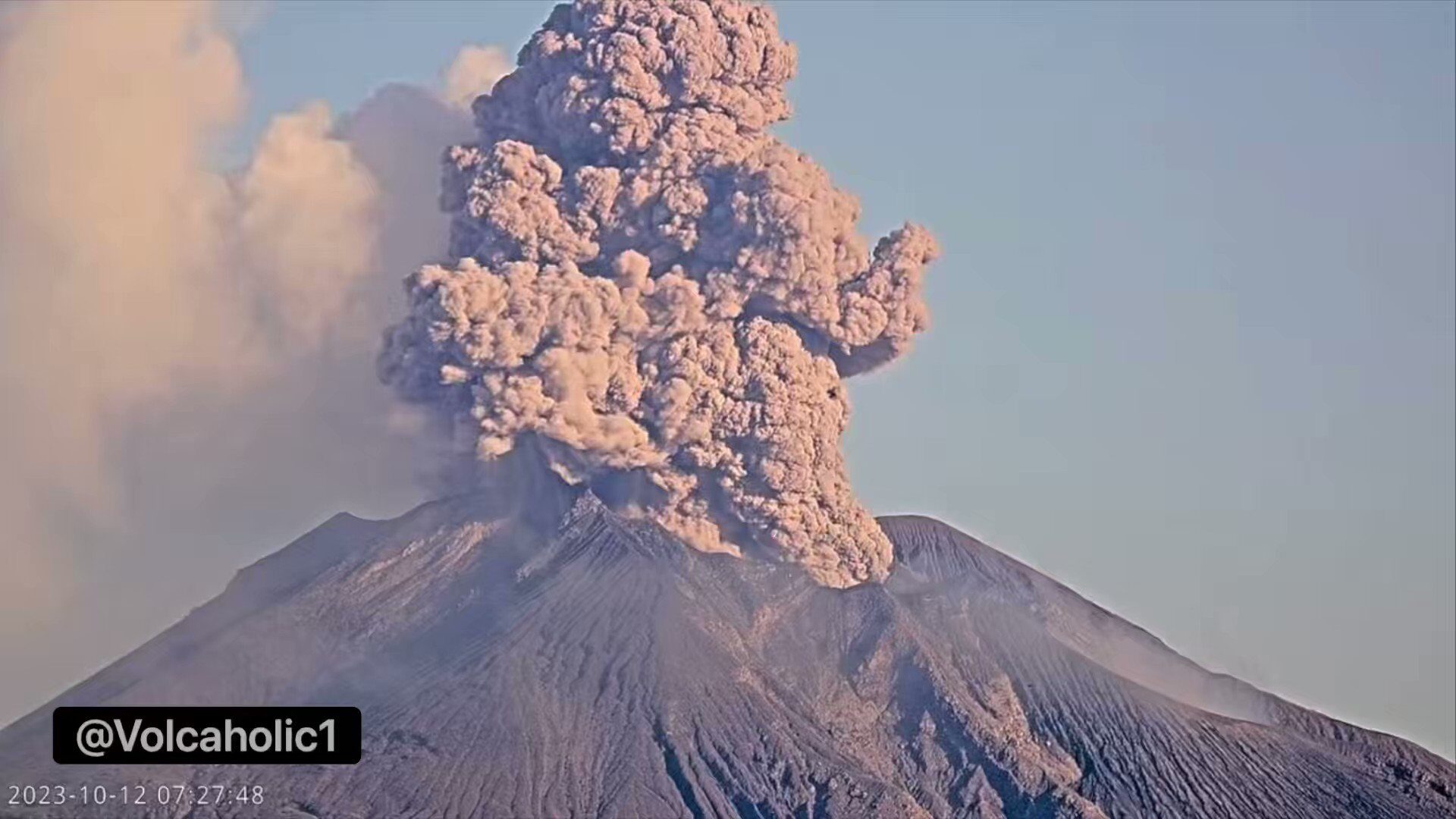
Sakurajima Volcano in Japan erupts

mmmm
Volcanic Ash Advisory Center Tokyo (VAAC) issued the following report:

FVFE01 at 09:18 UTC, 12/10/23 from RJTD
VA ADVISORY
DTG: 20231012/0918Z
VAAC: TOKYO
VOLCANO: SAKURAJIMA [AIRA CALDERA] 282080
PSN: N3136 E13039
AREA: JAPAN
SUMMIT ELEV: 1117M


Fire

Ebeko volcano in Russia releases powerful column of ash

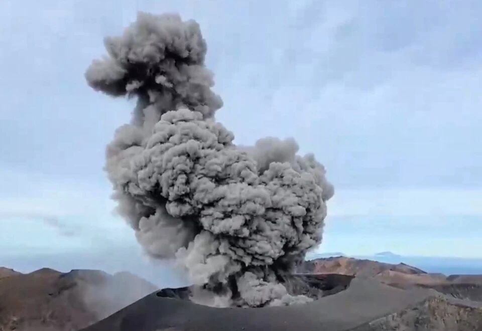
A still image of a video of a blowout filmed by tourists.
Just a week after the previous eruption, the Kuril volcano Ebeko, located on the island of Paramushir, again emitted a powerful column of ash. This time, specialists from the All-Russian State University for Civil Defense and Emergency Situations reported that the volcano had already been assigned an orange aviation hazard level due to its activity. The Shiveluch volcano in Kamchatka is now just as dangerous.

- Volcanic activity is being recorded again in the Far Eastern Federal District. The Shiveluch and Ebeko volcanoes have been assigned an orange level of aviation danger," the VNII GOChS commented on the situation.