Volcanoes
S


Fire

Eruption on newly formed island caught on camera off the coast of Iwo Jima, Japan

mmmmmm
Newly released aerial footage captured by the Japanese coast guard showed a volcano exploding on a new island formed off the coast of Iwo Jima.


Fire

Etna erupts again, sending hot lava down its snowy slopes

Mount Etna eruption lights up the night sky
Mount Etna on the Italian island of Sicily erupted at dawn on Friday, creating a festive spectacle of fire and ice.

At 3,3057 metres, it's Europe's tallest volcano and has been constantly active in the past ten years.

But no one has been injured and no one is in danger.

Volcanologists have described the activity on Etna in recent days as a succession of Strombolian eruptions - which are moderately explosive but short eruptions named after the volcano on the nearby island of Stromboli.


Fire

Mount Anak Krakatau erupts, sparks panic

mmmmmm
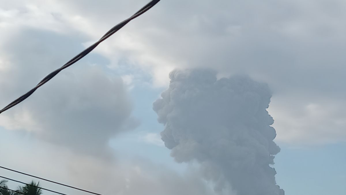
Mount Anak Krakatau, situated in the waters of the Sunda Strait, South Lampung Regency, erupted again this afternoon, Nov. 27, sending a massive ash plume approximately 2,000 meters above the summit or around 2,157 meters above the sea level.

According to the Volcanology and Geological Disaster Mitigation Center (PVMBG), the eruption occurred on Monday at 11.43 a.m. local time and was recorded on a seismogram with a maximum amplitude of 77 millimeters for 116 seconds. The thick gray-black ash column was moving northwest.

The volcano had earlier erupted at 9:32 a.m., spewing ash columns about 1,500 meters above the summit or 1,657 meters above sea level.


Fire

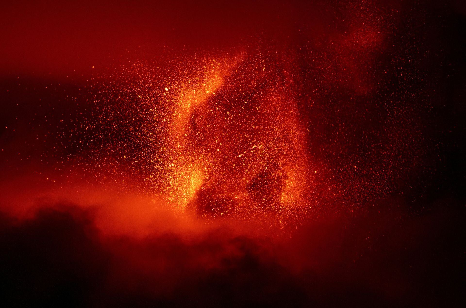
Snowy Mount Etna spurts lava into night sky

Sizzling hot lava streamed down from the snow-covered slopes of Mount Etna late on Friday (November 24).
Lava streamed down from the snow-covered slopes of Italy's Mount Etna.


Attention

Mud volcano erupts in southern Taiwan

MMMMM

Fire

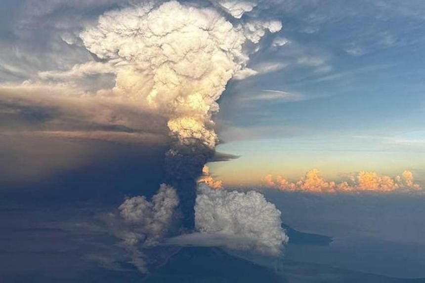
Papua New Guinea volcano erupts sending smoke 50,000 feet into the air

Ash column rises from Mount Ulawun, as seen from an aeroplane window, Papua New Guinea November 21, 2023, in this picture obtained from social media.
A volcano in Papua New Guinea erupted on Monday, and the Japan Meteorological Agency said it was assessing a possible risk of a tsunami for Japanese coasts.

Mount Ulawun on the island of New Britain in Papua New Guinea erupted at around 3:30 p.m. (0630 GMT) Monday, spewing volcanic smoke as high as 15,000 meters (50,000 feet), the agency said, quoting the Volcanic Ash Advisory Center in Darwin, Australia.

The agency said it was assessing a possible impact, including the risk of a tsunami approaching Japan later Monday. First tsunami waves could reach Izu and Ogasawara islands about three hours after the shaking caused by the eruption, JMA said.


Fire

Mount Dukono in Indonesia erupted and sprayed ash 2 kilometers high

The eruption of new material as high as approximately 1,000 meters came out of the crater of Mount Dukono on Halmahera Island, North Maluku, Sunday (19/11/2023).
© ANTARAThe eruption of new material as high as approximately 1,000 meters came out of the crater of Mount Dukono on Halmahera Island, North Maluku, Sunday (19/11/2023).
The Center for Volcanology and Geological Hazard Mitigation (PVMBG) recorded an eruption in the form of volcanic ash bursts as high as 2 Kilometers out of the crater of Mount Dukono in North Maluku. Mount Dukono Observation Post officer Bambang Sugiono in a report quoted by ANTARA, Sunday 19 November, said the eruption occurred at 07.24 WIT.

"The ash column was observed to be white, gray to black with thick intensity to northeast and east. When this report was made, the eruption was still ongoing," he said. Bambang appealed to tourists not to be active, climbing, and to approach the Malumpang Warirang Crater within a two-kilometer radius.

He also appealed to the community around Mount Dubono to always provide a mask or covering of the nose and mouth to avoid the threat of volcanic ash on the respiratory system. The Dukono Mountain which has a height of 1,335 meters is currently at Level II or Alert status. The closest settlement is at a distance of 11 kilometers from the peak of the volcano.


Fire

This week in volcano news: Iceland volcano update, Dukono & Etna erupt

Mount Etna, Europe's most active volcano,
© Giuseppe Di Stefano & Marco RestivoMount Etna, Europe's most active volcano, lights up the night sky with eruptions as seen from Mount Salto Del Cane, Italy November 12.
Due to the ongoing volcanic unrest in Iceland, three other notable volcano related news stories were largely overlooked. As, Mount Etna in Italy produced a stunning paroxysm, while in Indonesia, the Dukono volcano produced its largest eruption in nearly a decade.

Meanwhile, in Hawaii, earthquakes temporarily propagated further down Kilauea's southwest rift zone. And, in Iceland, magma reached shallow depths at the Reykjanes volcano, leading to the complete evacuation of the town of Grindavik. This video will discuss these stories and list the 46 volcanoes which are actively erupting around the planet.

Thumbnail Photo Credit: Mr. Bambang Sugiono, Used with Permission. This photo of the Dukono volcano was cropped, mirrored veritcally (left became right & right became left), sharpened image, increased image contrast, increase image brightness.

A special thanks to Boris Behncke for allowing me to use two of his video's showing Mount Etna's recent eruptive activity.


Attention

Washington volcano Mount St. Helens is 'recharging', 50 small earthquakes recorded in 1 week

st helens
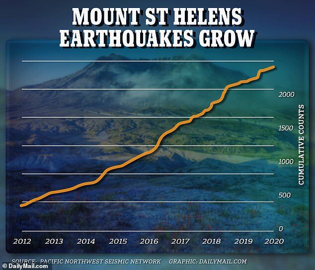
More than 400 earthquakes have been detected beneath the surface of the volcano in recent months. There have been more than 2,000 earthquakes recorded at the site since 2010
Mount St. Helens is starting to rumble again in Washington with a spike in seismic activity recorded at the volcano more than four decades after its deadly eruption.

More than 400 earthquakes have been detected beneath the surface of the volcano in recent months. There have been more than 2,000 earthquakes recorded at the site since 2010.

Specialized equipment has detected that magma has been flowing through chambers deep underground, causing the volcano to recharge.

There are fears the earthquakes could lead to another massive explosion reminiscent of 1980s eruption that left 57 people dead and permanently altered the area's ecosystem.

Comment: This is particularly notable because it comes amidst a spike in volcanic and seismic activity elsewhere: Also check out SOTT radio's:


Info

New study reveals evidence of recurring ancient supereruption

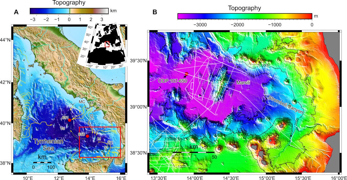
The Marsili Basin
© Geology (2023). DOI: 10.1130/G51198.1(A) The Marsili Basin lies in ~3000 m water depth in the Tyrrhenian Sea. Ocean Drilling Program Leg 107 Sites 650 and 651 marked as red circles. Red box shows map in (B). Campi Flegrei (CF) fields (source of 39.8 ka Campanian Ignimbrite and 14.9 ka Neapolitan Yellow Tuff) shown with nearby submarine canyons (Dohrm [DC] and Magnaghi [MC]) as yellow lines. Ve—Vesuvius; SC—Stromboli Canyon. (B) CHIRP subbottom profiles shown as white dashed lines. Continuous white lines involved the acquisition of additional airgun seismic data. Bathymetry is a merged dataset of a 40-m grid CHIANTI multibeam bathymetry together with EMODNET bathymetry. Contour interval is 1000 meters.
Researchers have discovered a series of large undersea sediment deposits in a region near Italy that were likely formed by an ancient volcanic supereruption.

These deposits, known as megabeds, were found in the western Marsili Basin, an area at the bottom of the Tyrrhenian Sea that surrounds the Marsili Seamount, a large undersea volcano.

By combining geophysical data acquired from a Spanish research project and data from sediment cores collected from a nearby Ocean Drilling program site, scientists were able to show that three deposits are made up of alternating beds of volcaniclastic sand and mud, while the fourth is a volcaniclastic debris flow, a more dense mixture of volcanic sediment and water.

The study's findings, published in the Journal Geology, suggest that these structures were deposited during a volatile time when the Campi Flegrei caldera and the Neapolitan Yellow Tuff supereruption were active.

The new study suggests that these megabeds originated not from nearby volcanoes, but from a volcanic province to the north. That province, researchers think, was an area once near the Campanian Ignimbrite (CI) supereruption of Campi Flegrei, the largest one of its volcanic eruptions since the caldera's formation nearly 50,000 years ago.

This still volcanically active region could pose immense danger in the future, said Derek Sawyer, lead author of the study and an associate professor of earth sciences at The Ohio State University. The discovery of these previously unknown megabeds is pivotal for understanding and measuring the impact of such recurring geohazards over time.