Volcanoes
S


Arrow Up

Philippine's Kanlaon volcano spews 3,200 feet of ash

Kanlaon volcano
© GMA NewsKanlaon volcano
Kanlaon Volcano in Negros spewed ash again on Sunday afternoon. The Philippine Institute of Volcanology and Seismology (Phivolcs) said the eruption lasted for five minutes. It said the ash eruption started at 1:29 p.m. and ended at 1:34 p.m. Phivolcs said the gray ash spewed by Kanlaon was 3,281 feet.

The latest activity was accompanied by an "explosion type earthquake with rumbling sound," it added. In its bulletin on Kanlaon issued at 8 a.m., Phivolcs said it recorded six volcanic earthquakes from 8 a.m. of December 26 to 8 a.m. of December 27.

"Emission of moderate white steam plumes, 50 meters in height from the summit crater that drifted southwest, was observed," the bulletin added. Alert Level 1 remains raised over the volcano, which means it is in a period of unrest.

It said reminded concerned local government units in Negros that "entry into the 4-kilometer radius Permanent Danger Zone is strictly prohibited due to the further possibilities of sudden and hazardous steam-driven or phreatic eruptions."

It added: "Civil aviation authorities must also advise pilots to avoid flying close to the volcano's summit as airborne ash from a sudden eruption can be hazardous to aircraft."

Alarm Clock

Mexico's Colima volcano erupts, spewing smoke and ash 2 km high

Colima volcano erupts
© Milenio (sp)

Residents warned to watch for falling ash and rock


The Colima Volcano was looking lively for Christmas with eruptions on Christmas Eve, Christmas Day and again today.

Yesterday's sent ash and smoke skyward to a height of 2.2 kilometers, prompting more warnings from federal Civil Protection authorities.

Falling chunks of rock of up to 50 centimeters in diameter and ash are the two dangers to watch for by anyone in the vicinity of the volcano.

Civil Protection, state authorities in Jalisco and Colima and the University of Colima maintain ongoing monitoring of the active volcano, also known as the Volcano of Fire, to keep area residents informed of any danger.

In the event of ash fall, they say, a damp cloth or face mask should be used to cover the nose and mouth and the use of contact lenses should be avoided. The eyes and throat should be kept clean with pure water.

The volcano straddles Jalisco and Colima and has been erupting regularly.


Comment: According to Volcano Discovery, 39 volcanoes around the world have recently erupted, and 32 of them are associated with the Ring of Fire, where seismic activity appears to be dramatically increasing amid a progression of recent disasters.

See also: SOTT Earth Changes Summary - November 2015: Extreme Weather, Planetary Upheaval, Meteor Fireballs


Arrow Up

Shiveluch volcano erupts in Russia's Far East, spewing ash 5km high

Shiveluch volcano
© ITAR-TASS/Alexander Petrov, Archive
Columns of ash were raised up to five kilometers above the sea level, scientists say

Lava descending from the Shiveluch volcano in Russia's Far East has raised columns of ash up to five kilometers above the sea level, scientists from the Kamchatka Volcanic Eruption Response Team (KVERT) told TASS on Monday.

"The volcano continues erupting. Lava has descended today from the top of the Young Shiveluch. Columns of ash were raised up to five kilometers above the sea level," scientists said adding that there is no threat to settlements in the area.

The ash cloud is drifting to the east and south-east, with the plume covering the area of around 15 kilometers.

The Russian Emergencies Ministry's department in the Kamchatka region said that no ash falls were reported in the area.

An orange alert was issued over the eruption of the Shiveluch which can spew ash up to 10 kilometers above the sea level at any moment. Airlines that fly near the Shiveluch are recommended to change their routes. There are over 150 volcanos on the Kamchatka peninsula in Russia's Far East, and up to 30 of them are active.

The Shiveluch is located some 450 kilometers (280 miles) to the north-east of the Kamchatka Peninsula's largest city of Petropavlovsk-Kamchhatsky with the population of over 181,600 people. However, nearest residential areas are located within the distance of 50 kilometers (31 miles) from the Shiveluch, which had been regularly spewing out ash since 1980s.

Arrow Up

Indonesia's Mount Bromo volcano in East Java continues eruption

Bromo volcano eruption
© Economic Times India
Mount Bromo volcano in East Java, Indonesia erupted Tuesday spewing column of ash by up to 1.5 km. to the sky, a disaster management agency official here said.

Powerful bursts of hot ash and gravel erupted from the rumbling volcano at 06:00 a.m. local time, heading west to northwest as far as 2.5 km from the crater, Sutopo Purwo Nugroho, spokesman of the national disaster management agency said.

Tourist and visitors are banned from entering the slope by up to 2.5 km from the crater, he said.

"Residences are warned to keep vigilant over continuation of the eruption and possible greater eruption," he told Xinhua via phone.

The agency and local community have prepared for any emergency to counter possible risks of greater eruption, Sutopo said.

The 3,829-meter-high Mount Bromo last erupted in January 2011, forcing airlines to ground their planes.

Mount Bromo is one of Indonesia's 129 active volcanoes.


Attention

Shiveluch volcano in Russia spews ashes over nearby village

Shiveluch volcano
© NASA / JSC / Wikicommons
A volcano in Russia's Kamchatka region has spewed ashes, covering a local village with a thin layer of soot, the Emergency Situations Ministry said on Wednesday, the RIA Novosti news agency reported.

The ash cloud from the Shiveluch Volcano reached 6,500 meters above sea level, the ministry said in a statement, RIA Novosti reported. The volcano is 3,283 meters high.

Winds carried ashes nearly 50 kilometers east of the volcano, reaching the village of Ust-Kamchatsk, where a 1-millimeter layer of ash fallout was registered, the report said.

The incident presented no hazards to local residents' health, the report said.

Attention

Intense, more frequent explosions, new lava flows at Guatemala's Fuego volcano

Fuego volcano eruption
© Maximo Nivel via TwitterFuego volcano eruption, December 15, 2015.
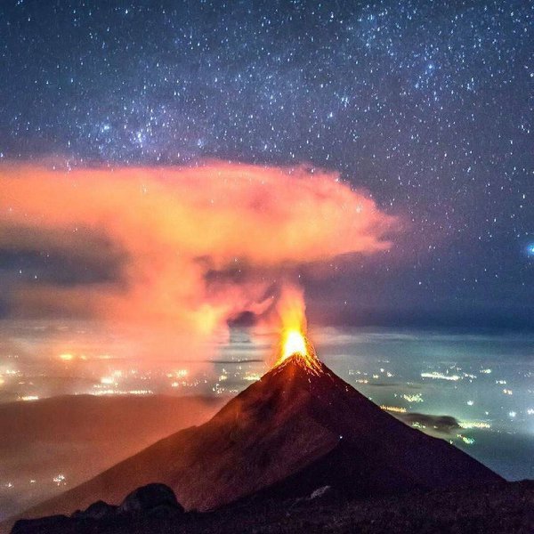
Another phase of strong, increased activity was observed at the Fuego volcano, Guatemala on December 14, 2015, Volcano Discovery reported. Frequent, intense explosions and ash plumes accompanied with loud shock waves marked the 13th paroxysmal episode of the 2015 volcano activity.

Two new lava flows were observed at the Fuego volcano, accompanying intense and frequent explosions on the evening of December 14 (local time). Between 4 and 6 explosions per hour were reported with ash plumes, followed by loud shock waves, rising up to 1 km (3 280.8 feet) above the volcano summit. New lava flows were 800 m (2 624.7 feet) long and have started to head towards the Santa Teresa on west flank, and Trinidad on south flank drainages.

The reported event is the 13th paroxysmal episode of this year, and should the activity of the volcano increase further, dangerous pyroclastic flows could take place over the coming hours or days. Residents have been advised to avoid the river beds and valleys at the feet of the mountain at all times.

INSIVUMEH reported that on November 29, 2015 activity at Fuego increased significantly, characterized by large and strong explosions, ash plumes, and lava flows. Ash plumes rose as high as 2.2 km (7 217.8 feet) above the crater and drifted 40 km (24.9 miles) W and SW. Lava fountains rose 500 m (1 640.4 feet) above the crater, feeding four lava flows that traveled 3-4 km (1.9-2.5 miles) down the Ceniza, Trinidad, Las Lajas, and Santa Teresa drainages.

Fire

Masaya volcano in Nicaragua showing signs of unrest with lava close to surface

masaya volcano
According to local press articles referring to information from INETER, the volcano's activity is on the rise, with "lava being close to the surface".

The main crater of the volcano appears covered with debris from rockfalls from the crater walls, but visible incandescence, strong degassing sounds and small flames (from combusting gasses) jetting from between cracks on the floor, suggest that lava might be not far underneath and could again lead to the formation of a new lava lake, last observed in 1999.

On the other hand, seismic activity has been at low levels and not shown significant variations recently, not suggesting that significant movements of magma towards the surface have taken place.

Also, the incandescence of the vent at the main crater has been there for a number of years already.

Comment: Volcanoes in Nicaragua have been quite active recently as seismic and volcanic activity has increased around the Pacific Ring of Fire.


Attention

Over 100 earthquakes at Copahue volcano in one day, Chile

Copahue volcano
© AFP PHOTO / Antonio HuglichCopahue volcano
Is the Copahue volcano entering a new eruptive phase?

The volcano was hit by 103 earthquakes between December 12 at 10:17 local time (13.17 GMT) and December 13 at 1:09 local time (4.09 GMT), so less than 1 day. Insane.

103 seismic events rattled the Copahue volcano during last week-end as reported by the Service National of Geology and Mining of Chile (Sernageomin).

The earthquakes occurred 12 kilometers from the main crater at depths close to six kilometers underground.

The most powerful tremor was a M3.1 and happened at 12:57 local time (15.00 GMT) on Saturday.

Bizarro Earth

Earth's day is getting longer - Rotation is slowing down

Scientists reveal that the rotation of Earth's core holds a clue to understanding global sea-level rise.

Mathieu Dumberry
© University of Alberta
Scientists are studying past changes in sea level to make accurate future predictions of this consequence of climate change, and they're looking down to Earth's core to do so.

"In order to fully understand the sea-level change that has occurred in the past century, we need to understand the dynamics of the flow in Earth's core," says Mathieu Dumberry, a professor in the Department of Physics at the University of Alberta.

The connection is through the change in the speed of Earth's rotation. Meltwater from glaciers not only causes sea levels to rise, but also shifts mass from the pole to the equator, which slows down the rotation. (Picture the Earth as a spinning figure skater. The skater moves his or her arms in to spin more quickly or out to slow down.) The gravity pull from the Moon also contributes to the slowdown, acting a little like a lever brake. However, says Dumberry, the combination of these effects is not enough to explain the observations of the slowing down of Earth's rotation: a contribution from Earth's core must be added.

Bizarro Earth

Looming threat of volcano disasters in Auckland

Auckland Volcanoes
© Victoria University of WellingtonJenni Hopkins with a map showing Auckland's volcanic field.
Rangitoto, Mt Albert, Lake Pupuke, Orakei Basin, Mt Eden and One Tree Hill are some of Auckland's most familiar landmarks. But they are also reminders of the city's fiery history and the looming threat of future disasters.

A clearer understanding of the risk posed by a new volcanic eruption in Auckland has emerged from doctoral research undertaken by a student at Victoria University of Wellington.

Jenni Hopkins, in collaboration with GNS Science and the University of Auckland, has reconstructed the eruptive history of Auckland's volcanic field, which comprises more than 50 craters dating back around 200,000 years. While currently dormant, the field is expected to erupt again from a new site within potentially as little as a few hundred years.

"The 53 volcanoes in Auckland are almost entirely monogenetic, which means they generally only erupt once," says Jenni. "But what was previously unknown was the order in which they erupted—I wanted to find that out so that we could establish the characteristics of the field and get an idea of what a future eruption might be like."