Volcanoes
S


Bizarro Earth

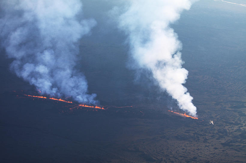
Around 70 earth­quakes in the last 24 hours at Iceland's Bárðar­bunga caldera rim

Image
© Guðmundur K. Sig­ur­dórs­sonAc­cord­ing to the Ice­land Met Of­fice, no sig­nif­i­cant changes are ob­served in the seis­mic ac­tiv­ity around the Bárðar­bunga vol­canic sys­tem.
Ap­prox­i­mately 70 earth­quakes oc­curred on the Bárðar­bunga caldera rim in the last 24 hours re­ports the Ice­land Met Of­fice this morn­ing. The strongest quakes were of the mag­ni­tude of 4.8 yes­ter­day at 13:21 and at 4.6 at 01:36. Seven earth­quakes al­to­gether ex­ceeded the mag­ni­tude of 4, and 15 earth­quakes were in the mag­ni­tude range of 3-3.9. Sub­si­dence of the caldera is con­tin­u­ous.

Ac­cord­ing to the Ice­land Met Of­fice, no sig­nif­i­cant changes are ob­served in the seis­mic ac­tiv­ity around the Bárðar­bunga vol­canic sys­tem.

Around 30 events have been de­tected in the north­ern part of the dyke in­tru­sion, be­tween north­ern Dyn­gju­jökull and the erup­tion site in Holuhraun. The strongest ones were both of the mag­ni­tude 1.4 yes­ter­day at 10:07 and 13:33.

Bizarro Earth

Japan's massive 2011 earthquake may trigger more, and larger, volcanic eruptions

Image
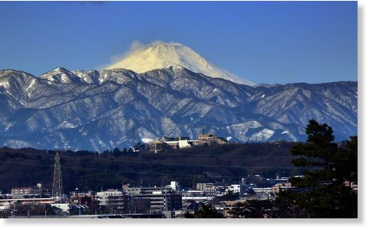
© AFP Photo/Yoshikazu TsunoSnow-covered Mount Fuji is seen from Tokyo, Japan, on February 16, 2014
Japan's massive 2011 earthquake may trigger more, and larger, volcanic eruptions over the next few decades, perhaps even that of Mount Fuji - but predicting them remains close to impossible, a volcano expert said on Friday.

The nation last month suffered its worst volcanic disaster in nearly 90 years when Mount Ontake, its second tallest active volcano at 3,067 meters (10,062 feet), suddenly erupted, raining down ash and stone on hikers crowding the summit.

The eruption killed 56 people, exceeding the deaths in the 1980 eruption of Mount St Helens in the United States. Seven victims remain missing, and recovery efforts have been suspended until the spring.

Japan may well be moving into a period of increased volcanic activity touched off by the 9.0 magnitude earthquake of March 11, 2011, said Toshitsugu Fujii, a volcanologist and professor emeritus at the University of Tokyo.

"The 2011 quake convulsed all of underground Japan quite sharply, and due to that influence Japan's volcanoes may also become much more active," Fujii told reporters.

"It has been much too quiet here over the last century, so we can reasonably expect that there will be a number of large eruptions in the near future."
Arrow Down

Surrounding volcanoes pose threat to Sendai nuclear plant, yet Japan plans to restart the reactor

Mt Ontake
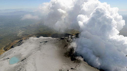
© Reuters/KyodoVolcanic smoke rise from Mt. Ontake, which straddles Nagano and Gifu prefectures, central Japan, September 30, 2014.
A Japanese volcanologist has refuted early claims that two nuclear reactors stationed near a hotbed of volcanic activity were safe, stating that it is impossible to predict an eruption accurately outside the time span of a few days.

The Sendai nuclear power plant in southern Japan could quite easily be the source of a national disaster should a cauldron eruption take place at one of the surrounding volcanoes posing an immediate threat to the site, Toshitsugu Fujii, head of a government-commissioned panel on volcanic eruption prediction told a press briefing on Friday.

"It is simply impossible to predict an eruption over the next 30 to 40 years," Fujii said. "The level of predictability is extremely limited." He added that prediction can happen only in the space of hours or days.

His statements contradict those of nuclear regulators who last month said that the two Sendai nuclear reactors were functioning within the nuclear safety regulations laid out in the wake of the 2011 Fukushima disaster.

Bizarro Earth

Ashen footprints may point to explosive future for Hawaii's Kilauea volcano

Image
© Don SwansonFootprints preserved in Kilauea volcano ash deposits.
Thousands of human footprints cast in ash at Hawaii's Kilauea volcano are the final steps of people killed in a 1790 phreatic eruption - the same kind of unpredictable blast that caught hikers at Japan's Mount Ontake volcano in late September.

The footprints are evidence that the goddess Pele's reputation for power and ferocity were well-earned in the past, even though Kilauea is a tourist's volcano today. From about 1500 to 1800, Kilauea hurled mighty ash plumes into the jet stream and heaved huge rocks out of its deep caldera, the crater at the volcano's summit. And geologist Don Swanson thinks another round of violent eruptions will happen again.

"Too often, geologists and the general public view Kilauea as safe. It's just a stage that you come to and view a performance of great beauty," said Swanson, a geologist and former director of the U.S. Geological Survey's Hawaiian Volcano Observatory. "I hope that people realize Kilauea is not that way at all. Kilauea is an explosive volcano, and when it gets into an explosive period it can be life-threatening."

Bizarro Earth

Indonesia's Mt. Slamet continues to erupt - hundreds of tremors are recorded every 24 hours

Image
© ABC NewsMt Slamet
An expert has warned that Mount Slamet's seismic activity remains high although it has not spewed lava in the past month.

The Energy and Mineral Resources Ministry's Geology Agency head, Surono, said Mt. Slamet's constantly high volcanic activity made it unsafe, forcing authorities to maintain its alert status at "siaga" (level 3).

"Its activities are still high. Hundreds of tremors are recorded every 24 hours; thus, the situation is not yet safe," he told journalists in Purwokerto, Central Java, on Monday.

Surono further said that due to such fluctuating conditions, Mt. Slamet was still closed to climbers. No activity is allowed within a 4-kilometer radius of the mountain.

Mt Slamet's increased volcanic activity during the past month has caused panic among residents in five regencies located on the slope of the volcano in Central Java. Among the five regencies located on the slope of Mt. Slamet are Banyumas, Brebes, Pemalang, Purbalingga and Tegal.

Tremors and harsh sounds have emanate dozens of times a day from the volcano, which in the past has also spewed volcanic ash up to 50 km away from the peak.

Bizarro Earth

Threat of pyroclastic flows from Mt. Sinabung still overshadows Karo residents

Image
© Volcano Alert @infoVolcano / TwitterLarge pyroclastic flow on Sinabung on 9 Oct 2014
It has been reported that Mount Sinabung in Karo regency in North Sumatra is still prone to emitting deadly pyroclastic flows that could occur at any time. During the past week, the active volcano repeatedly erupted, spewing hot clouds and showering the nearby city of Berastagi with volcanic ash.

Head of the Sinabung observation post, Armen Putra, said the pyroclastic flows were expected to continue as the volcano displayed intensifying activity. He said there was a good chance that Mt. Sinabung would keep erupting during the following days. "Based on our observations Mt. Sinabung is still emitting huge pyroclastic flows that could be discharged at any time in greater volumes than ever," he told The Jakarta Post on Sunday.

He said the pyroclastic flows currently travelled down the slopes to the south of several villages. On Oct. 5 they reached 4.5 kilometers to the south, which was deemed the longest descent so far. As of Sunday at 12 p.m., Mt. Sinabung emitted the hot flows on five occasions, reaching 3 km to the south.

"Residents living around the volcano should remain alert because the pyroclastic flows have been continuously released during recent days," Armen said.

Bizarro Earth

Mayon volcano's sustained reduction in sulfur dioxide emission, continuous surface inflation may lead to violent eruption

Image
Mayon volcano
A sustained reduction in sulfur dioxide emission and continuous surface inflation of Mayon Volcano may lead to a violent eruption, the Philippine Institute of Volcanology and Seismology (Phivolcs) warned yesterday. Phivolcs-Bicol chief volcanologist Ed Laguerta issued the warning after Mayon's gas emission dropped to 308 tons last Thursday, way below the normal 500 tons per day in the past 48-hour monitoring period.

He said the reduction in sulfur dioxide emission could mean that the lava dome protruding at the summit of the volcano is gradually blocking the crater. "If Mayon's crater is clogged by lava dome, a violent eruption is very likely to happen," Laguerta told The STAR.

He said they are closely monitoring Mayon's gas emission to determine if the drop would be a prelude to a small or big eruption. But Laguerta noted that even a phreatic or ash explosion may be followed by bigger eruption once the deep-seated magma deposit is depressurized.

He added that the absence of volcanic quakes in the past three days is not an indication that Mayon has calmed down.

Bizarro Earth

One wonders how many of these newly found thousands of volcanic seamounts are producing CO2 that bubble into the ocean

Scientists have created a new map of the world's seafloor, offering a more vivid picture of the structures that make up the deepest, least-explored parts of the ocean.

The feat was accomplished by accessing two untapped streams of satellite data.
Image
Thousands of previously uncharted mountains rising from the seafloor, called seamounts, have emerged through the map, along with new clues about the formation of the continents.

Combined with existing data and improved remote sensing instruments, the map, described today in the journal Science, gives scientists new tools to investigate ocean spreading centers and little-studied remote ocean basins.

Earthquakes were also mapped. In addition, the researchers discovered that seamounts and earthquakes are often linked. Most seamounts were once active volcanoes, and so are usually found near tectonically active plate boundaries, mid-ocean ridges and subducting zones.

The new map is twice as accurate as the previous version produced nearly 20 years ago, say the researchers, who are affiliated with California's Scripps Institution of Oceanography (SIO) and other institutions.

Comment: SOTT's been talking about methane outgassing for quite some time. Just a few results from a cursory search here on methane outgassing:

Arctic Ocean leaking methane faster than anticipated
Vast methane plumes discovered escaping from Arctic seafloor north of Siberia
New climate change threat: Arctic seabed releases millions of tons of methane into atmosphere


Bizarro Earth

Hawaii's Kīlauea Volcano alert level raised to Warning level

Image
© USGS

Current Volcano Alert Level: WARNING


Current Aviation Color Code: ORANGE

Volcanic Activity Summary: The June 27th flow remains active with a narrow flow moving about 30 m (100 ft) ahead of the previously stalled flow front and lava breakouts occurring from the lava tube about 8 km (5 mi) behind the flow front near where lava entered a crack system on August 18. The narrow flow front moved about 75 m/day (245 ft/day) since September 29, overtaking the stalled flow front during the past 24 hours. The leading edge is 2.3 km (1.4 miles) upslope from Apa'a St. and 3.3 km (2.1 mi) from Pāhoa Village Road, and approximately 16.4 km (10.2 miles) straight-line distance from the vent. Because this flow is moving very slowly and lava discharge from the vent remains low, we do not offer a projection of its future movement. Our next overflight is scheduled for Friday.

Pāhoa town is in the Puna District of the County of Hawai'i.

Recent Observations:
[Lava flow] A narrow flow has moved about 30 m (100 ft) past the stalled flow front in the past 24 hours. This flow has moved about 150 m (490 ft) since September 29.

Hazard Analysis:
[Lava flow] The June 27th lava flow from Pu'u 'Ō'ō vent is active with fresh lava being supplied to the flow front. The flow is slowly advancing downslope toward Pāhoa town.

Bizarro Earth

Volcanic eruption 1,200 years ago scattered ash from Alaska to Europe

Image
Microscopic image of a sample of White River Ash from the Yukon. The picture is of a polished surface of the pumice grains mounted in epoxy, which is how the samples are prepared for analysis.
A new study led by University of Alberta researchers has shown that a volcanic eruption 1,200 years ago scattered ash from Alaska to Europe - a discovery that will help researchers understand how future eruptions could affect the world.

Britta Jensen and Duane Froese in the U of A's Faculty of Science led the research, which showed that a distinct deposit of white, sand-sized grains of volcanic ash visible just below the modern forest floor over much of the Yukon and southern Alaska is present not only near the originating Mount Bona-Churchill in Alaska, but also in the Greenland Ice Sheet and across northwestern Europe.

The deposit, commonly known as the White River Ash, is so prominent that locals sometimes refer to it as "Sam McGee's Ashes" in reference to the Robert Service poem.

As part of the study, samples of the White River Ash, along with ash previously assumed to be from Iceland, were gathered from northern Canada, eastern North America, Greenland, Northern Ireland and Germany. By comparing characteristic features of these samples, the researchers showed that all of the ash originated from the same large prehistoric volcanic eruption in Alaska about 1,200 years ago.