Volcanoes
S


Bizarro Earth

Canary Islands: Two New Eruptions Observed in Subsea Volcano

Image
© UnknownTwo new volcanic eruptions were confirmed on Wednesday off the south coast of the Canary Island of El Hierro.
Two new volcanic eruptions were confirmed on Wednesday off the south coast of the Canary Island of El Hierro.

Nearly 600 people from the southernmost village, La Restinga, remained out of their homes Thursday after they were evacuated on Tuesday.

Seismologists have found two separate fissures less than 2.3 miles and 1.7 miles from La Restinga.

"I confirm the existence of two points of volcanic eruption at El Hierro," Laura Otero, a spokeswoman for the local authorities, told AFP.

The first eruption occurred at a depth of 700 meters (2,300 feet) and the other at a depth of 200 meters (655 feet).

Scientists from ING, CSIC, and the University of Cadiz are trying to determine if the subsea volcanic vent is widening and, if so, if it is widening in the direction of El Hierro.
Bizarro Earth

Experts warn over Iceland volcano

Image
© Unknown
Experts are warning that an eruption could be imminent at an even more powerful Icelandic volcano than the one that paralysed air traffic last year.

Seismologists are nervously watching rumblings beneath Katla which could spew an ash cloud dwarfing the 2010 eruption that cost airlines two billion dollars (£1.27 billion) and drove home how vulnerable modern society is to the whims of nature.

Brooding over rugged moss-covered hills on Iceland's southern edge, Katla is a much bigger beast than the nearby Eyjafjallajokul volcano, which blasted ash all over Europe for several weeks in an eruption that local scientist Pall Einarsson describes nonetheless as "small".

Named after an evil troll, Katla has a larger magma chamber than Eyjafjallajokul's.

Its last major eruption in 1918 continued more than a month, turning day into night, starving crops of sunlight and killing off some livestock.

Bizarro Earth

Subsea Volcanic Eruption Underway Near El Hierro (The Canary Islands)

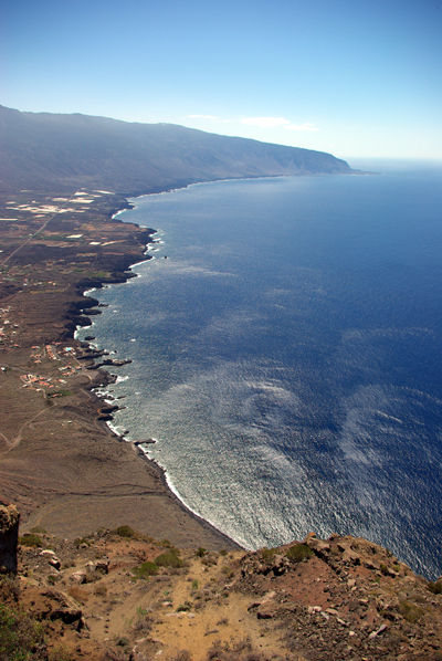
A submarine volcanic eruption is taking place approximately 5 kilometres off the southern coast of El Hierro, the smallest of The Canary Islands.

The Mayor of La Frontera (El Hierro), David Cabrera, confirmed in an interview on Radio iron Garoé that 'underwater eruption' is taking place about 900 metres beneath the sea surface five kilometres south of La Restinga. The eruption has been ongoing for four hours, the Mayor said.

Spanish newspaper laopionion.es quoted the Minister of emergencies of the Cabildo of El Hierro, Maria of Carmen Morales, as saying the eruption is taking place because 'the seismic movement of 4.3 occurred on Saturday afternoon caused a fissure, from where the energy is been released'. Scientists remain unclear if the emissions are gas or lava.

Image
© MODISEl Hierro, The Canary Islands, from space in this MODIS satellite image on Oct. 7 2011

Bizarro Earth

Volcanic Red Alert Issued As Residents Are Evacuated From El Hierro Town

Spain's Instituto Geográfico Nacional (IGN) confirmed on Tuesday that an underwater eruption has occurred five kilometres off the southern coastline of El Hierro, the smallest of the Canary Island. The eruption is Spain's first since the eruption in 1971 of the Teneguía volcano on the island of La Palma (Canary Islands).

The IGN says all three of its seismic stations on El Hierro in the Canary Islands have registered a volcanic tremor of low frequency in the south of the island at La Restinga, the southern-most village in the Canaries. The estimated 537 residents of the town were summonsed to a local football field on Tuesday afternoon to be briefed on evacuation procedures.

Image
© Google MapsEl Hierro.
A Red Alert has since been issued by local authorities for the town. A notice posted on the Emergencia El Hierro website on Tuesday evening stated: "Phase pre-eruptive. It involves the initiation of a preventive evacuation. Make yourself available to the authorities."

Bizarro Earth

Volcanic Activity Continues At Chile's Puyehue Corón-Caulle

A conspicuous plume of volcanic gases and fine ash rose above the volcano on Sunday (October 9, 2011), and blew southeast over Argentina.

In the top natural-color satellite image the mountainous landscape is covered with gray ash, largely snow-free for the first time in several months. To the north and southwest of the active vent is a lava flow, its textured appearance suggestive of thick lava. Immediately west of the vent the flow appears fresh - its dark surface not yet covered by lighter ash.

Image
© NASA image by Jesse Allen and Robert Simmon, using ALI data from the EO-1 Team. Caption by Robert Simmon. Instrument: EO-1 – ALINASA satellite imagery shows that the eruption of Puyehue Corón-Caulle Volcano is continuing after more than 4 months of activity.
In a false-color image made from shortwave infrared, near infrared, and visible light data, the vent and nearby lava flow are bright orange. This is a sign of intense heat, and likely indicates ongoing emissions of lava. These images were acquired by the Advanced Land Imager (ALI) aboard the Earth Observing-1 (EO-1) satellite.

Attention

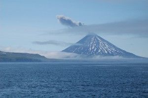
US: Lava builds in Alaska volcano, may threaten planes

Mt. Cleveland Volcano
© UnknownMt. Cleveland Volcano, Aleutian Islands, Alaska
Lava has reached the edge of a crater in a volcano in Alaska's remote Aleutian Islands, indicating the mountain could explode and send up an ash cloud that could threaten aircraft.

The Alaska Volcano Observatory says satellite images show lava at the edge of the crater rim of 5,675-foot Cleveland Mountain on uninhabited on Chuginadak Island, about 940 miles southwest of Anchorage.

Volcano monitors say if the dome continues to grow, it could overflow the rim and increase the possibility of an explosion.

The observatory says an eruption could send up an ash cloud 20,000 feet or more.

The nearest village, Nikolski, is on another island about 50 miles east and has 18 permanent residents. The village was not considered in harm's way in previous eruptions of the volcano.

Source : The Associated Press

Bizarro Earth

Earthquake swarm after officials confirm eruption at Iceland volcano Katla

Image
© UnknownIs Katla about to erupt again?
Iceland's massive volcano Katla appears on the brink of a major eruption just days after officials confirmed they had detected the start of eruptions over the summer.

Measuring devices this morning have picked up a large earthquake swarm, usually a tell-tale sign of a potential volcanic eruption.

The Icelandic Government last month announced it was increasing monitoring Katla, which is one of Europe's most feared volcanoes, following a consistent and strengthening spike of tremors and quakes.

And last week, officials at the Iceland Meteorological Office confirmed a series of smaller eruptions had occurred in July strengthening fears of an imminent, much larger, eruption.

Evidence gathered by geophysicists showed the magma had risen to the height of the glacier ice above the volcano causing it to melt.

They said the high seismic tremors recorded on July 8 and 9 confirmed Katla had become active and started small eruptions.

Bizarro Earth

Indonesia: Anak Krakatau (Child Of Krakatoa) Erupts

Anak Krakatau, a volcanic island in the Sunda Strait between the islands of Java and Sumatra in Indonesia, erupted on Tuesday sending columns of ash and rock hurtling high into the air.

The rise in volcanic and earthquake activity prompted authorities to put in place a 2km exclusion zone for tourists and local fishermen.

The Indonesian Volcanology and Geology Disaster Mitigation Centre reported that an estimated 6,000-7,000 volcanic earthquakes were recorded daily during the weekend and on Monday. Daily earthquake totals usually do not exceed 100-200.

Seismologists are still attempting to determine the type and scale of the ongoing eruption.


Bizarro Earth

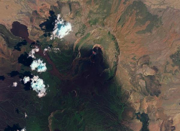
Mysterious African Volcano Still Erupting

Nabro Volcano
© NASAFalse-color image of the Nabro Volcano taken by NASA's EO-1 satellite on September 28.
Satellite images suggest that a restive east African volcano is continuing to simmer - after erupting in more spectacular fashion earlier this summer - in an isolated region where eyewitness accounts are few and far between.

The Nabro Volcano, which lies near the border of Ethiopia and Eritrea, has been erupting since the middle of June. The new images indicate lava is flowing from the 7,280-foot (2,218-meter) peak, which is the tallest of several volcanoes in the region.

Heat from vents in Nabro's central crater is visible as a red glow in this color-enhanced image.

The area south of the crater is dark, blackened by a thick layer of ash that nearly covers the sparse vegetation that grows in this lonely region near the southern tip of the Red Sea.

Just months ago, Nabro rumbled to life for the first time in recorded history. The mountain spewed forth a thick plume of ash, disrupting air travel, and sent rivers of lava running down its sides.

The eruption killed seven people and affected thousands more, according to the Eritrean government.

Better Earth

Geologists Map Birth Of New Ocean

Image
© Unknown
A giant underground reservoir of molten rock has been discovered under the deserts of Ethiopia by British geologists, The (London) Sunday Times reported.

They targeted the Afar region in the Horn of Africa after a recent surge in volcanic activity and earthquakes plus the appearance of giant cracks in the rocky surface. Tectonic plates in the area are pulling apart and gradually creating a new ocean.

Now, the scientists have mapped the colossal underground lake of magma that lies up to 20 miles (32km) below the earth's surface.

"We estimate that there is 3,000 cubic kilometers of molten rock under Afar -- enough to cover all of London ... with around a kilometer of rock," said Kathy Whaler, professor of geophysics at Edinburgh University.

The reservoir is under such pressure that it has forced tongues of molten rock up towards the surface, producing eruptions and earthquakes.