Extreme Temperatures
S


Ice Cube

NASA discovers huge perfectly rectangular iceberg floating in Antarctica

rectangular ice berg
© @NASA_ICE/NASA
A gigantic and perfectly rectangular iceberg has been spotted in the Antarctic by NASA scientists.

The enormous block of ice, known as a Tabular berg, is thought to be a mile in length, experts said.

It was found off the east coast of the Antarctic Peninsula, near the Larsen C ice shelf, by scientists flying over the region.

The iceberg's sharp angles and flat surface suggest it was recently calved from the ice shelf, NASA Ice researchers said.

And it was not the only iceberg formed as a geometric shape the scientists spotted on their flight over the Atlantic last week.

Comment: One wonders the increasing activity of Earth's undersea volcanoes coupled with the cooling above ground is partly responsible for the migrating ice bergs, and perhaps their unexpected shapes: Also check out SOTT radio's: Behind the Headlines: Earth changes in an electric universe: Is climate change really man-made?


Bug

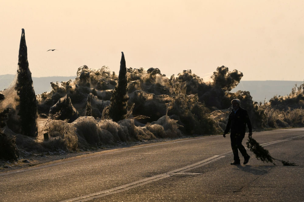
Shore of Greek lake gets covered in gigantic spider webs

A man carries a branch as spider webs blanket shrubs at the banks of Lake Vistonida, Greece, October 19, 2018.
© REUTERS / ALEXANDROS AVRAMIDISA man carries a branch as spider webs blanket shrubs at the banks of Lake Vistonida, Greece, October 19, 2018.
The shores of Lake Vistonida in Greece were transformed into a truly surreal landscape as they became blanketed in massive spider webs.

This peculiar phenomenon was apparently caused by unusually warm weather which led to an increase in the mosquito population and therefore triggered an overpopulation of spiders that feed on these insects.

The spiders are from the genus Tetragnatha, known as stretch spiders due to their elongated bodies.

They are known to build webs near watery habitats, with some species even said to be able to walk on water.


Snowflake

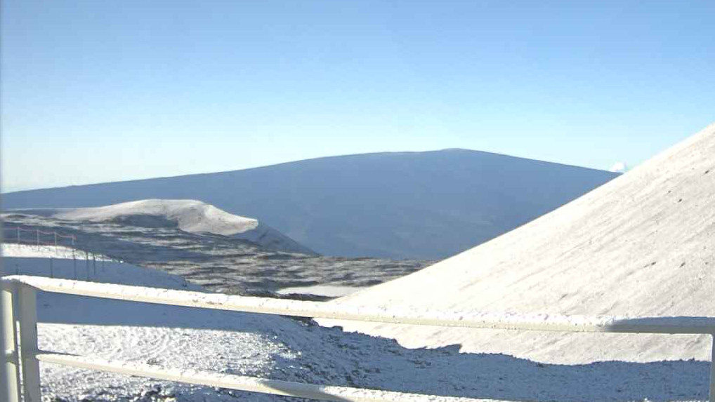
Flake news: More October snow on Mauna Kea, Hawaii

NOAA Mauna Kea cam at 7:12 a.m. on Oct 21
More snow coated the summit of Mauna Kea overnight, as the Flash Flood Watch that has been in effect for Hawaiʻi Island for most of the weekend is no longer in effect.

"The road to the summit of Maunakea is closed to the public at the Visitor Information Station at 9200 ft. due to high humidity, fog, wet and icy road conditions," a ranger message stated this morning.

"Today, the trough aloft will continue to move slowly eastward, with a drier airmass continuing to filter across Maui County and the Big Island during the day," the National Weather Service said. "This should put an end to the threat for flash flooding or thunderstorms, and we have cancelled the Flash Flood Watch. A few heavier showers may still be possible on the Big Island, especially in the afternoon, but thunderstorms appear unlikely as the airmass dries out and stabilizes during the day."
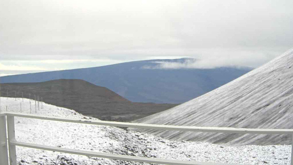
Comment: For a comparison with the above photo, here's a shot taken 2 days earlier on the 19th of October from the same spot:
On Mauna Kea, the Smithsonian Astrophysical Observatory’s Submillimeter Array webcam image looks at the south sky and Mauna Loa in the distance.
Summits in Hawaii receive October snowfall


Snowflake

Adapt 2030 Ice Age Report: Earth's crop yields are now affected by the sun

Calgary was hit by an early fall snowstorm
© Sarah LawrynuikCalgary was hit by an early fall snowstorm Monday night.
Canadian crops destroyed by all-time record snow and cold across Alberta, Canada in October.

All-time means the old records were broken by 5X as daily & monthly totals were crushed in both September and October 2018.

The Eddy Grand Solar Minimum continues to intensify along with decreases in global grain yields.


Sources

Snowflake

Summits in Hawaii receive October snowfall

On Mauna Kea, the Smithsonian Astrophysical Observatory’s Submillimeter Array webcam image looks at the south sky and Mauna Loa in the distance.
The Maunakea and Mauna Loa summits were dusted with snow as heavy showers and thunderstorms moved over the island Thursday night into Friday.

The Kona area saw the most activity with the inclement weather resulting in 1.16 inches of rainfall at Ellison Onizuka Kona International Airport at Keahole, according to the National Weather Service. Kaloko-Honokohau registered 0.84 inches of rainfall.

In Ka'u, Kapapala Ranch recorded 2.25 inches and Pahala 3.26 inches. Closer to the island's summits, Pohakuloa Training Area and Waikii each saw just under a half-inch of rain.

Snowflake

New Hampshire's Mount Washington receives nearly 10 inches of new snow

Snow on Moutain Washington, NH
© MOUNT WASHINGTON OBSERVATORY
It may be October, but it already feels like winter on Mount Washington.

Clear skies on Mount Washington Friday morning revealed nearly 10 inches of new snow, according to a tweet from the Mount Washington Observatory.

The temperature at the summit was about 20 degrees when the tweet's photo was taken Friday morning.

"After many days in sub-freezing fog, with nearly 10 inches of new snow and hurricane force winds, clouds have finally cleared to reveal quite a wintry scene!" the tweet said.

Snowflake

Rain and early season record snowfall delay North Dakota harvests

Snow in Manvel, ND on October 10, 2018.
© Eric HyldenSnow in Manvel, ND on October 10, 2018.
On the same day that Hurricane Michael destroyed parts of the Florida Panhandle, Old Man Winter hit early in the Northern Plains, blanketing fields with snow in eastern North Dakota.

It started as rain shortly before midnight on October 10, but within a few hours the wet stuff changed to the white stuff and fell much of the day. This is according to Dan Riddle, a meteorologist at the National Weather Service (NWS) office in Grand Forks.

Riddle tells FreightWaves that, on average, a trace of snow might fall on any given day in early October, but a record 5.7 inches fell at his office just west of downtown last Wednesday. This beat the old record of 3.0 inches from October 10, 1921. A whopping storm total of 17.4 inches was measured at the Grand Forks Air Force Base, and several other reporting sites received anywhere from 10 to 15 inches.

Comment: View also this report from 8th October: Early cold snap and snow impacts crops in North Dakota and then this from 3 days later: As much as 17 inches of snow dumped on eastern North Dakota as early season snowstorm hits


Snowflake

Snow arrives in South Korea's mountainous region 16 days earlier than last year

snow
South Korea's northeastern mountainous region observed the first snowfall of the season on Thursday, with a torrential rain warning issued for parts of the east coast, the Gangwon Local Meteorological Administration said.

Four centimeters of snow had accumulated by 9:00 a.m. in most parts of the high mountainous region, and snow accumulation of 7 centimeters was observed on the peaks of Mount Seorak in Yangyang in South Korea's northeastern province of Gangwon as of 9:30 a.m.

The snowfall came 16 days earlier than last year, according to the administration.


Snowflake Cold

Adapt 2030 Ice Age Report: Most October snow in 15 years in N.Hemisphere

US record snow
© YouTube/Adapt 2030 (screen capture)
Most snow in 15 years in October and the month is only half over and a blizzard is expected for the New England states over Thanksgiving as a Nor'easter churns up the east coast. Record cold smashes into the 35F below normal category in Texas and Northern Mexico. One can only guess where the climate goes from here and how quickly.


Snowflake

Northern Iowa farmers' crops covered in snow

snow crop
Some farmers in northern Iowa are finally getting back into their fields this week. Monday's USDA crop report showed Iowa's soybean harvest at 19-percent, 11 days behind the average. On Tuesday, April Hemmes - who farms near Hampton - said she was still waiting to start harvesting soybeans.

The harvest was halted this month by heavy rains that turned fields into a muddy mess. Hemmes said her soybeans were coated with two inches heavy, wet snow on Sunday. It's the wettest year she's experienced in 33 years of farming and Hemmes said there's some pod-splitting taking place.

According to the USDA, the 19-percent soybean harvest is the smallest mid-October harvest percentage for Iowa since records began, and the lowest number among the major soybean producing states. Hemmes said, earlier this year, she was excited about her potential soybean yield.