Extreme Temperatures
S


Snowflake

Thunderstorm brings snowfall to Hawaii in July

Image
Mauna Kea Weather Center
An overnight thunderstorm dropped 1½ to 2 inches of snow on the summit of Hawaii's tallest peak in July.

Cameras at Mauna Kea's summit showed some snow still on the ground midday Friday. Mauna Kea Weather Center forecast meteorologist Ryan Lyman says it should be melting quickly.

National Weather Service meteorologist Maureen Ballard says snow can fall on the summit any time of year, though there's a greater chance in the winter.

The latest snowfall came as a thunderstorm extended high into the atmosphere, above the mountain's peak elevation of nearly 14,000 feet.

Ballard says temperatures at the summit were about freezing overnight.

The low in the nearby city of Hilo was 71 degrees. Kailua-Kona on the west side of the Big Island, had a low of 78 degrees.


Snowflake

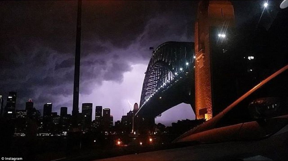
Unusual lightning, a bizarre blanket of fog, freezing temperatures, and first-time snow: extreme weather shocks Australia

Image
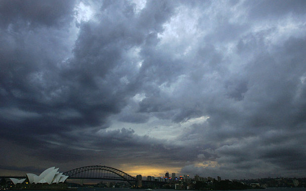
Wild and wintry weather is sweeping through Australia as incredible thunderstorms hit Sydney following a morning of thick fog
Wild and wintry weather is sweeping across Australia overnight, bringing chilly temperatures, lightning storms, frosty winds and even snow.

As temperatures plummet to its lowest in 15 years, Sydney awoke to a cityscape engulfed in thick fog on Saturday morning, which saw the Sydney Opera House and Harbour Bridge disappeared into the thick blanket of fog.

The strong cold front from the Antarctic has continued to drift through the southern and eastern coast of Australia with temperatures dropping three to seven degrees below average for five days running - the coldest spell some states have experienced in five years.

Temperatures in Brisbane are set to dip up to five degrees below the July average and snow flakes are expected to cover Eukey near the NSW border.

By Sunday morning, temperatures in Melbourne are expected to drop five degrees, with forecasters projecting the city will be the second coldest capital in the country after Canberra. Possible snow in some of Melbourne's outer suburbs is expected with forecast to fall down to 500 metres in alpine areas.

People have been warned to batten down the hatches ahead of the worst of the storms overnight as the effects of the icy blast will be felt from Sunday and temperatures are expected to remain chilly until Friday.


Snowflake Cold

Global warming, LOL! Record cold snap brings heavy snowfall to 3 Australian states

Image
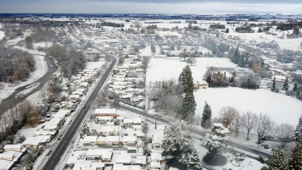
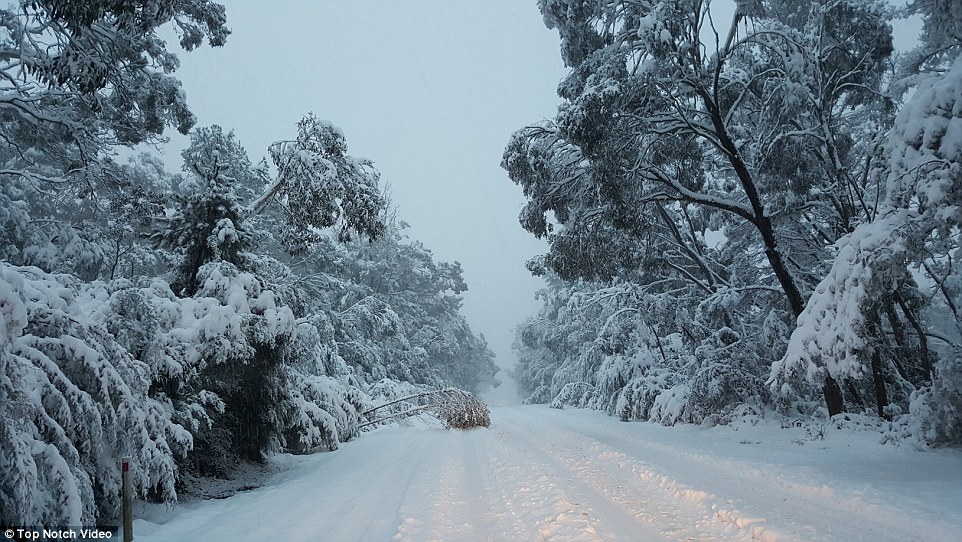
Residents across Queensland, New South Wales and Victoria will rise to find a thick blanket of snow has fallen along the eastern coast after reaching sub-zero temperatures overnight
Residents across Queensland, New South Wales and Victoria will rise to find a thick blanket of snow has fallen along the eastern coast after reaching sub-zero temperatures overnight.

Schools in Katoomba have given students the day off while snow continues to affect train lines and major roads in New South Wales.

Drivers have been stranded after the Hume Motorway towards Sydney, the Great Western Highway between Leura and Katoomba, and the New England Highway near Glen Innes were closed amid safety concerns.

Towns in southern Queensland have seen their best snowfalls in more than a decade, with the cold snap blanketing them in white powder.

Falls of up to eight centimetres have been recorded in Stanthorpe and nearby Eukey overnight, sending residents scurrying outside in their pyjamas to take in the scene.


Image
Towns in southern Queensland have seen their best snowfalls in more than a decade, with the cold snap blanketing them in white powder

Ice Cube

New Zealand records lowest maximum temperatures in decades

New Zealand records lowest maximum temperatures
© John Bisset/Fairfax MediaEmbrace the cold: New Zealand records lowest maximum temperatures in decades.
Complaints about the cold weather this month are justified, as some parts of the country have reported their lowest temperatures.

More than 30 weather stations around New Zealand have also had daily maximum temperature recordings that are either the lowest ever recorded, or at least in the top four coldest for July.

Kaitaia, Kerikeri and Warkworth have all recorded their lowest July temperatures. On Saturday Kaitaia experienced 0°C, while a chilly Sunday brought Kerikeri to -0.7°C and Warkworth to -2.3°C.

Attention

Mid-July frost recorded in central Europe

Image
After the European heat wave of last week, the pendulum has swung to the other extreme.

Currently the weather pattern dominating Central Europe is bringing unusually cold air over the continent, and early this morning regions in a number of countries were hit by ground surface frost.

Parts of Belgium, Luxemburg, Germany, Switzerland, Austria and the Czech Republic saw surface frost - even down to the lower elevations (Belgium is hardly a mountainous region).

German site Wetter24 twittered here a map depicting the frosty areas gripping this 10th of July, 2015. Also see map here.

Swiss meteorologist Jörg Kachelmann here writes and supplies a link showing a German video reporting conditions that the German Eifel region woke up to early this morning. At the 1:50 mark the video reports:
We saw fields that were snow-white. That on the tenth of July I have never seen before. My colleague Fabian had also never seen this before. It just looked wonderful. We just thought that indeed we are not in autumn or spring; we are actually in July. These pictures impressed us, and that we found this frost."

Ice Cube

Unusual cold weather hits northern Vietnam

cold weather in Vietnam
© Dan TriPeople wear coats by a smoke oven in Sa Pa as it became suddenly cold on Monday morning.
Sa Pa, the favorite resort town in northern Vietnam, is going through the second winter in only six months. Or at least that's what it feels like here. The town became suddenly cold on Monday morning and many people had to wear extra coats to deal with the temperature, which fell to 12.6 degrees Celsius (54.7 degrees Fahrenheit) at 7 a.m., right in the middle of summer.

Both locals and tourists in Lao Cai Province said they woke up very surprised. They said it felt cold like winter, but it got warmer later in the day. According to AccuWeather, the minimum temperature will be between 14 and 16 degrees throughout the week. Luu Minh Hai, director of the province's weather forecast center, said the region has been suffering from a depression which caused long, heavy rains the past days.

The temperature in other mountains in the region also dropped to 16 and 17 degrees Celsius. Hai said such low temperature in summer has hardly ever been seen in Sa Pa. The town, which is the only place in Vietnam to have snow in winter, recorded temperature as low as 14.4 degrees Celsius in July 2005.

The cold weather is even stranger considering the country has been going through the hottest year in a decade, with heat wave gripping northern and central Vietnam for months now.

Comment: See also: Winter is coming: Earth approaching 'mini ice age' in 15 year, solar cycle study suggest


Snowflake Cold

Update: Heaviest snowfall in years kills over 171,850 alpacas in Peru

Image
Over 171 850 alpacas died in recent days
State of emergency declared in three provinces of Puno.

10 July 2015 - The Regional Council of Puno declared the state of emergency in the provinces of Sandia, Carabaya and San Antonio de Putina because of the damage generated by low temperatures, snow and ice.

On Thursday, the regional directorates of Transport and Communications, Agriculture, Health, Education, municipalities and other institutions announced that, to date, more than 171 850 alpacas died from the snow and ice.

In response, the regional government of Puno ordered the purchase of 15,000 bales of oats to feed the animals still alive despite the bad weather.

The regional governor of Puno, Juan Luque Mamani, said that compared with previous years, this year is the heaviest snowfall.

Thanks to Argiris Diamantis for this link

Igloo

Scientists say Sun's heartbeat will bring on Ice Age

Sun
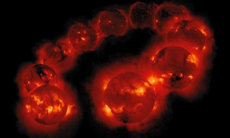
© Yohkoh/ISAS/Lockheed-Martin/NAOJ/U. Tokyo/NASAMontage of images of solar activity between August 1991 and September 2001 taken by the Yohkoh Soft X-ray Telecope, showing variation in solar activity during a sunspot cycle.
A new model of the Sun's 11-year heartbeat suggests that solar activity will fall by 60 per cent during the 2030s, dropping to conditions last seen during the Maunder minimum.

Beginning in about 1645, the Maunder minimum corresponded with the severest portion of the last "Little Ice Age."

Results of the new study were to be presented yesterday by Prof Valentina Zharkova at the National Astronomy Meeting in Llandudno.

Many solar physicists think the solar cycle is driven by a dynamo caused by convecting fluid deep within the Sun. However, when Zharkova and her colleagues added a second dynamo close to the surface, they found that it completed the picture with unprecedented accuracy.

"Our predictions showed an accuracy of 97%," said Zharkova.

The model predicts that the waves from the two dynamos will become increasingly offset during Cycle 25, which peaks in 2022. During Cycle 26, from about 2030 to 2040, the two waves will become exactly out of synch, leading to a significant reduction in solar activity.
Igloo

Coldest snap in five years to hit Australia with predicted snow and hail

Sydney
© Getty Images
Sydneysiders could expect an average maximum temperature of 59F (15C) for four days – a two year record.
Temperatures will drop to freezing on much of Australia's east coast this weekend in what could be the region's bitterest cold snap in five years.

Strong cold winds, rain, snow and hail were expected to batter the nation's south-east for days.

Sydneysiders could expect an average maximum temperature of 59F (15C) for four days - a two year record.

And temperatures across the region were expected to drop three to seven degrees below average for up to five days, according to Weatherzone.

The NSW Bureau of Meteorology warned of a burst of cold weather caused by a series of cold fronts set to move through the state on Friday and continue over the weekend.

Snow was expected at higher elevations overnight on Thursday.

Ice Cube

Almost 50% of Hudson Bay still covered in ice

Image
There is still a lot of sea ice in Hudson Bay, Foxe Basin, Davis Strait and Baffin Bay this week - more than average for this date - with slightly less than average in the Beaufort Sea. Past behaviour of Western and Southern Hudson Bay polar bears suggests the mean date that bears come ashore for the summer this year will be later than average due to the plentiful ice available, regardless of when polar bear biologists decide that "breakup" has occurred.

Hudson Bay, with almost 50% of the bay still covered in ice, has the third highest coverage this week since 1992 (after 2009 and 2004); Davis Strait has the highest coverage since 1992; and Foxe Basin and Baffin Bay have the highest coverage since 1998. For this week, the Beaufort Sea this week has the second highest coverage since 2006 (after 2013), and more ice than was present in 1971, 1982, 1987, 1988 and 1998 - among others.