Extreme Temperatures
Scientists are studying past changes in sea level to make accurate future predictions of this consequence of climate change, and they're looking down to Earth's core to do so.
"In order to fully understand the sea-level change that has occurred in the past century, we need to understand the dynamics of the flow in Earth's core," says Mathieu Dumberry, a professor in the Department of Physics at the University of Alberta.
The connection is through the change in the speed of Earth's rotation. Meltwater from glaciers not only causes sea levels to rise, but also shifts mass from the pole to the equator, which slows down the rotation. (Picture the Earth as a spinning figure skater. The skater moves his or her arms in to spin more quickly or out to slow down.) The gravity pull from the Moon also contributes to the slowdown, acting a little like a lever brake. However, says Dumberry, the combination of these effects is not enough to explain the observations of the slowing down of Earth's rotation: a contribution from Earth's core must be added.

A combination of fossilised midges and climate modelling suggest that melting ice sheets in Scandinavia triggered a dramatic 1,000-year long cold snap in Europe 12,800 years ago.
One such event occurred 12,800 years ago--the so-called Younger Dryas--when Europe was suddenly plunged back into near-Ice Age conditions. The ensuing cold struck Europe and Russia quickly, and hard. But how and why remained a mystery.
Now, a new study has an answer: melting glaciers in Scandinavia set key environmental changes in motion and initiated this dramatic 1,000-year long cold snap.
"The Fennoscandian Ice Sheet in Northern Europe has always been considered an underdog [compared to ice sheets in Greenland and north America] and has received little or no attention in the specialised literature," says lead-author Francesco Muschitiello from Stockholm University, Sweden in an email to ScienceNordic.
But Muschitiello's new research puts the Scandinavian ice sheet at the heart of the mystery. According to him, it is the missing link to understanding this major climate event, which is a key benchmark to understanding how climate can change so suddenly.
The results are published in the journal Nature Communications.
In the Khabarovsk region continues to rage snow cyclone.
All services Khabarovsk work around the clock.
The powerful blizzard, with storm gusts up to 25 meters per second, has dumped a month's worth of precipitation per day.
The city of Khabarovsk has declared a state of emergency according to the "TV Center".
Khabarovsk a city of just over a half million near the Chinese border.
Thanks to Argiris Diamantis for this link

Alaska-Canada snow cover (white) and sea ice (yellow) 28 November 2014 (left) and 2015 (right).
Snow cover in Europe and Asia is also much more extensive than at this time last year

Europe-Asia snow cover (white) and sea ice (yellow) 28 November 2014 (left) and 2015 (right).

The Central Anatolian city of Sivas was quickly covered by heavy snow on Wednesday. There has also been snowfall in the capital, Ankara. (Photo: Cihan)
A number of villages were closed to traffic and temperatures dropped to -2 degree. People had difficulty in reaching the city center from nearby provinces. Municipal teams have been spreading salt on the roads and removing snow on the pavements.
According to the Meteorology Directorate, the snowfall will be ongoing for two days. the depth of snow reached 37 centimeters in higher parts of Palandöken Mountain.
According to the Icelandic Met Office, the previous record was set back in 2011, when snow lay 33 cm (13 inches) deep in Reykjavik on 29 December that year.
The highest ever depth of snow recorded in in Reykjavik was 55 cm (21.5 inches) back in January 1937, and if snows continues to fall on the city, this record might also be broken - and soon.
Now at 42 cm, snow levels in Reykjavik were 32 cm just four days ago on Saturday.

A city of Sioux Falls truck clears 14th Street during a winter storm Monday, Nov. 30, 2015, in Sioux Falls.
The National Weather Service reported that 8 inches of snow had fallen at the Sioux Falls airport by 9 p.m., beating the old record of 7.4 inches set in 1954. The NWS said more than 3 inches were possible to fall in the city by noon Tuesday.
A winter storm warning remains in effect until Tuesday night.
Parts of Sioux Falls shattered the previous record at the airport on Nov. 20 when 14 inches fell in the southern part of the city. Tea reported 18 inches that day.

A series of winter storms have dumped large amounts of snow in the Sierra, and several counties are under freeze warnings through the weekend.
An earlier version of this article said the low in California was minus-14. It was actually minus-11, according to the National Weather Service.
According to the National Weather Service, the Bogard Rest Area in the Lassen National Forest recorded that frigid temperature between Friday night and Saturday morning. The rest area is north of Susanville.
A few other mountain areas posted below-zero temperatures overnight. A series of winter storms have dumped large amounts of snow in the Sierra, with some places receiving more than 20 inches. The NWS said another storm could move in by Thursday.
A good blanket of snow is now sticking to the ground across the mountain range, according to the weather service. The cold temperatures are good news for ski resorts, which are off to a strong seasonal start after several years of drought conditions.
A freeze warning was in place in the Sacramento Valley for Sunday. Officials warned residents to protect outdoor plants and pipes.

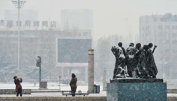
November 22 was recorded as Beijing's coldest day in over 1,000 days, leading some meteorologists to expect record breaking cold in the region.
Northern China's coldest November temperatures on record were minus 12.3 degrees Celsius on November 30, 1970. That record could be broken however with Sunday recorded as Beijing's coldest day in over 1,000 days.
After blizzard conditions on November 22, Beijing had temporary snow again on Tuesday, leading to frozen roads and cold weather warning announcements from authorities.
Peak daytime temperatures in Beijing this week are likely to stay under zero degrees, according to weather forecasts. Meteorologists have estimated that temperatures on November 26 and 27 will hit minus 12 degrees and possibly lower.
CNN reports that the conditions saw more than 200 flights cancelled in Beijing, as well as the closure of schools and roads.