Extreme Temperatures
S


Bizarro Earth

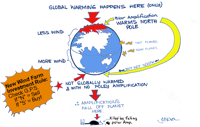
Cartoon science - Global warming will weaken winds in the Northern Hemisphere, but speed them up downunder!

Now they tell us! Climate warming to weaken wind power in northern hemisphere, increase in Australia: study

After building 341,000 wind turbines, mostly in the Northern Hemisphere, now climate modelers reveal that winds will decrease in the Northern Hemisphere!
Warming temperatures caused by climate change are set to weaken wind energy in the northern hemisphere, a study shows, lessening the amount of wind power produced for wind farms.

However the southern hemisphere would see a boost in wind, which could potentially turn north-eastern Australia into an attractive investment for energy companies.
Rush, invest your money now. The theory called polar amplification has the success rate of a coin toss. Buy a wind farm in NE Australia!

Luckily wind speeds are not also influenced by cloud cover, jet streams, oceans currents, forest growth, atmospheric tides, solar factors, magnetic fields, ozone levels, cosmic rays, or butterflies. Otherwise this study might be inadequate, uninformed guesswork being used to inform investment decisions!
Cartoon Science
© JoNova
Key points:
  • Atmosphere instability which creates wind changing in northern hemisphere
  • North-east Australia could become an attractive investment for energy companies
  • At present there is only one operational wind farm in Queensland
Snowflake

Avalanche warnings as Valais in Switzerland recovers from record snowfall

Sion
© Le NouvellisteSion, Switzerland
Police in the canton of Valais have warned skiers to keep on the marked runs as the avalanche risk rises to 3 or 4 out of 5 in resorts across the region.

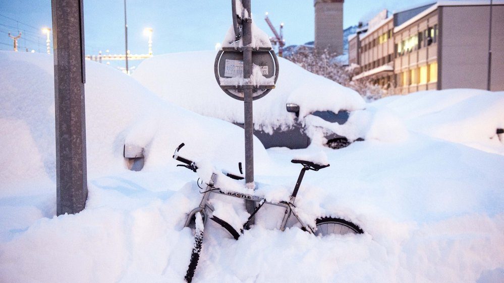
Valais has experienced some of the heaviest December snowfall in years over the last few days, not just in the mountains but down to the valley floor.

Sion, the cantonal capital, received a record 65cms of snow over the weekend, and pictures published by local paper Le Nouvelliste showed residents skiing down the streets. Around 80cms fell at higher altitude.

While most of Switzerland experienced some snow on the weekend, temperatures warmed up on Sunday afternoon turning the precipitation to rain in many places, however the particular meteorological conditions in the Valais meant it kept snowing.

Comment: Even heavier snowfall was recorded in other parts the Alps (as well as other European mountains) over the same weekend, see: Over a metre of snow in 72 hours for the Alps; big falls in the Dolomites and Pyrenees too


Snowflake

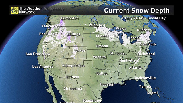
All 50 states have recorded snow two weeks ahead of Christmas

Snow cover as of Dec. 13
As of December 12 2017, 23.6% of the U.S. surface is covered with snow, but what is especially striking is that more than two weeks before Christmas day, all 50 states have seen snow on the ground despite much of it rapidly melting away in some areas. December marks a turning point towards more wintry weather, but it is not so common to see so much snow on the ground this early, especially in some areas of the south and more so with La Niña influencing U.S. weather.

Potent snow storm blankets the South

A total of 17 states saw snowfall (see video below) in one degree or another late last week as a very active cold front colored in white a large swath extending diagonally from New Mexico and Texas, to New England. Record breaking snow of a foot or more was recorded in some counties of Alabama, Georgia and North Carolina.


Snowflake Cold

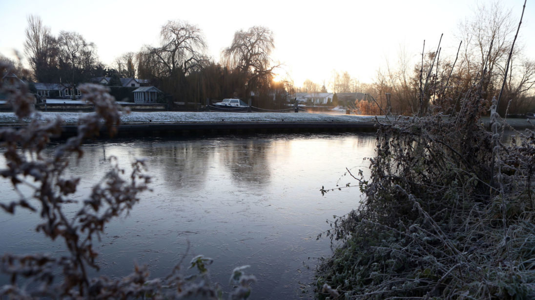
UK reels from five-day freeze with another severe weather warning issued

Severe weather warning for ice issued as UK reels from five-day freeze
A yellow weather warning has been issued by the Met Office for ice
Commuters face another day of difficult journeys as icy conditions look set to continue through rush hour for much of the UK.

Following a weekend gripped by the coldest temperatures of 2017, the freeze is expected to loosen its hold on Wednesday.

But a severe yellow weather warning will continue until 11am across most of England, Wales and Scotland, as remaining ice threatens treacherous conditions on roads and paths.

Comment: The UK is infamous for it's inability to deal with cold weather and with winter only just beginning it's not a good sign what with predictions, and signs we can see all around the world, that we're entering an ice age. This unusual weather is blamed on a 'polar vortex', where the jet stream in the north pole descends further south bringing with it extremely frigid air. And with each year it seems to be behaving more erratically, meandering further south and with an ever increasing regularity. It's effects are being felt all over the northern hemisphere (though the same is happening in the southern hemisphere too) where winters begin more abruply and are much more intense than before. This is all probably related to our sun which is slowing down and causing other unusual weather phenomena on Earth. And it's not just Earth that these changes are being documented, it's happening through the solar system.

For more information see Pierre Lescaudron and Laura Knight-Jadczyk's book: Earth Changes and the Human-Cosmic connection.


Ice Cube

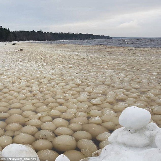
Thousands of ice balls wash up in the Gulf of Finland on the Russian coast

The balls were up to seven in diameter
The balls were up to seven in diameter and no definitive explanation for their existence has been accepted
Strange ice balls that washed up on the coast may have been caused by oil pollution, an ecological expert has said.

A video shows the strangely uniformly sized ice balls washing up in the Gulf of Finland in north-western Russia.

Ecologist Ilya Leukhin told local media that oil spills in the water could have created the ice balls but she was not the only one with a possible explanation for the phenomenon.

Yuryi Shahov, who videoed and shared the sight online, said: 'Seems that someone has thrown snowballs into the Gulf.'

Some believe that snow was rolled together by the waves, or that what look like ice balls could in fact be stones covered with ice.


Snowflake

Over a meter of snow in 72 hours for the Alps - Big falls in the Dolomites and Pyrenees too

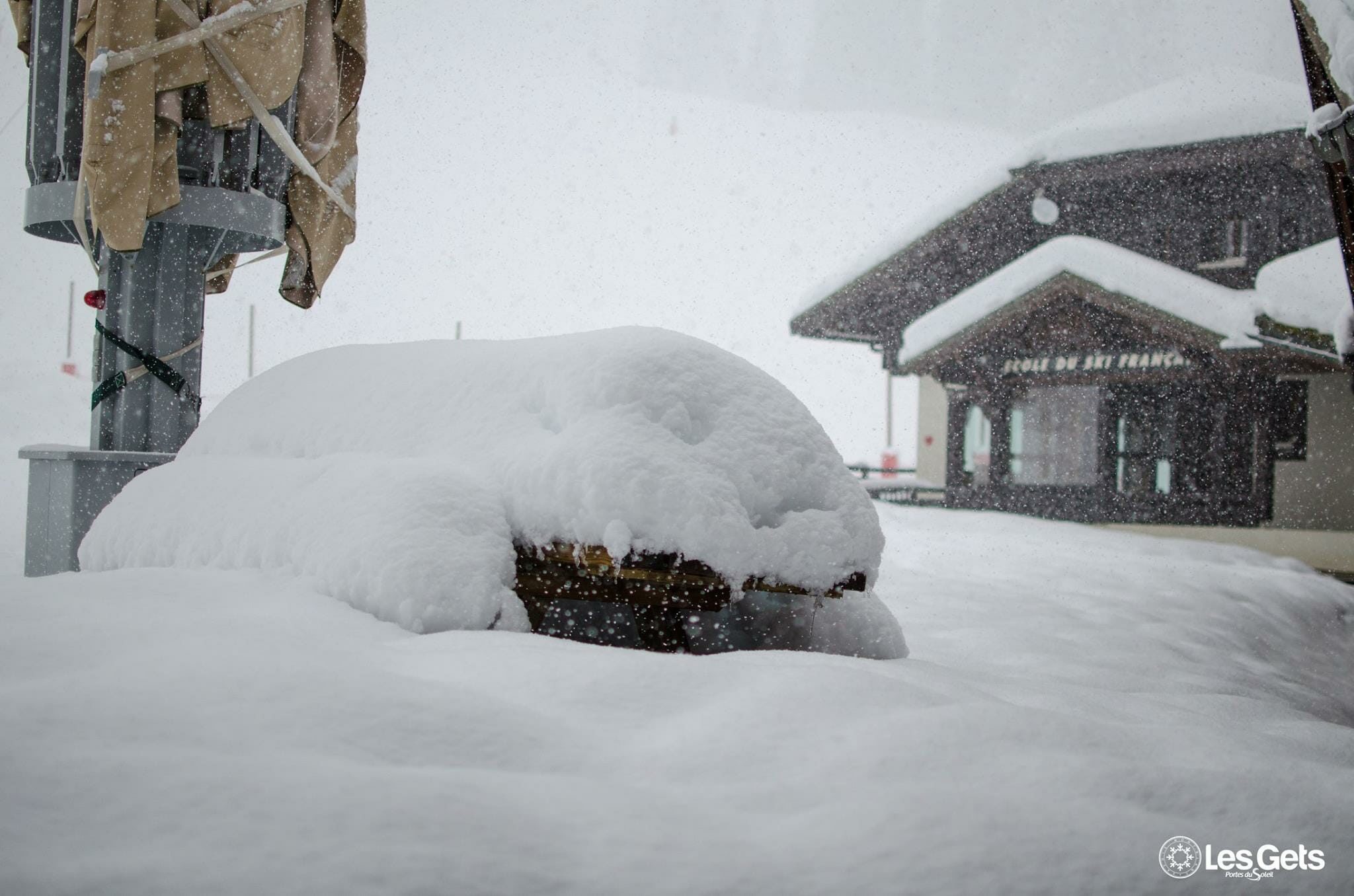
Les Gets.
Les Gets.
Snowfall totals for the past 72 hours have now passed the metre/40 inches mark in the Alps.

Hopes that the start of the 2017-18 ski season would be 'good' after three poor snowfall starts over the last three seasons have now been adjusted so that the start of winter 17-18 looks like the best for many years.

The latest snow comes after a mostly snowy November and October, so bases had already been in good shape before the current massive snowfalls.

The snow is still falling heavily so the totals continue to change but at time of writing two areas were claiming 1.3m (4.3 feet) of fresh snow in the past 72 hours - Madesimo in Italy and Orcieres Merlette (below) in France.

Snowflake

Rare heavy snow hits London, while 120 MPH snowstorms spawn 'snow devils'

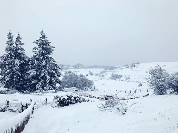
Winchfawr
© Hayley DownWinchfawr, Wales
Unusual climate patterns as increasingly unstable jet streams due to the intensifying Grand Solar Minimum pull warm desert air to the Alps with 50 F /16 C temps, while plunging the UK to a snow bound winter wonder land, snow blocking highways into London. In Poland, winds so strong snow devils appear in the mountains, Italy with 3-4 feet of snow and 120 MPH winds pound the Med.


Sources

Snowflake Cold

Extreme weather creates chaos across Europe

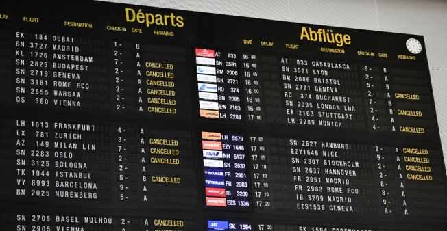
Cancelled flights at Brussels Airport
© Eric Lalmand, AFPCancelled flights at Brussels Airport December 11 2017
High winds and heavy snow in Europe on Monday stranded thousands of travelers, kept schoolchildren at home and even played havoc with international diplomacy.

It was the second day running of nasty weather across the continent, with Britain still digging out from its deepest snowfall in four years.

The snowed-over runways in Brussels on Monday provoked about 90 flight cancellations and some 100 delays, including for the plane carrying Israel's Prime Minister Benjamin Netanyahu back home.

He tweeted a video from his plane that opened with a shot of the white tarmac at the close of his European visit marked by the US recognising Jerusalem as Israel's capital.


Comment: See also:


Snowflake

'Alberta Clipper' region set to bring 10-15 cm of snow by Tuesday night

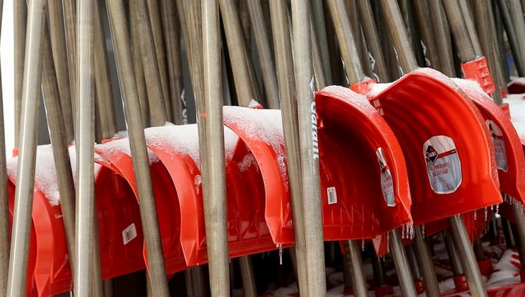
snow shovels
© Julie Oliver / Ottawa CitizenGet those shovels ready.
By Tuesday night, the region will be under a blanket of 10 to 15 cm of snow, Environment Canada predicts.

The flakes that comes along with what's dubbed an Alberta Clipper is expected to hit Eastern Ontario Monday night and taper off Tuesday evening, according to a special weather statement.. Since the forecast is for snow stretching over 24 to 36 hours, it doesn't reach the level of a snowfall warning, when 15 cm is expected per 12 hours.

Snowflake Cold

Heavy snowfall in Netherlands triggers code orange weather warning

Snow blankets Utrecht
© Zachary Newmark / NL TimesSnow blankets Utrecht, 10 Dec 2017.
The Netherlands was blanketed in snow over the weekend and more snow is expected this afternoon. Meteorological institute KMNI issued a code orange weather warning of extremely dangerous weather. And the Rijkswaterstaat warns people to rather work from home today if possible.

A code yellow weather warning is currently in effect for the entire country. Motorists are warned to to be careful of icy and slippery roads.