Extreme Temperatures
S


Comet 2

New evidence that an impact event triggered abrupt climate change 12,800 years ago

Younger Dryas  Event
© Christopher R. Moore, CC BY-NDThe muck that’s been accumulating at the bottom of this lake for 20,000 years is like a climate time capsule.
What kicked off the Earth's rapid cooling 12,800 years ago?

In the space of just a couple of years, average temperatures abruptly dropped, resulting in temperatures as much as 14 degrees Fahrenheit cooler in some regions of the Northern Hemisphere. If a drop like that happened today, it would mean the average temperature of Miami Beach would quickly change to that of current Montreal, Canada. Layers of ice in Greenland show that this cool period in the Northern Hemisphere lasted about 1,400 years.

This climate event, called the Younger Dryas by scientists, marked the beginning of a decline in ice-age megafauna, such as mammoth and mastodon, eventually leading to extinction of more than 35 genera of animals across North America. Although disputed, some research suggests that Younger Dryas environmental changes led to a population decline among the Native Americans known for their distinctive Clovis spear points.

Conventional geologic wisdom blames the Younger Dryas on the failure of glacial ice dams holding back huge lakes in central North America and the sudden, massive blast of freshwater they released into the north Atlantic. This freshwater influx shut down ocean circulation and ended up cooling the climate.

Some geologists, however, subscribe to what is called the impact hypothesis: the idea that a fragmented comet or asteroid collided with the Earth 12,800 years ago and caused this abrupt climate event. Along with disrupting the glacial ice-sheet and shutting down ocean currents, this hypothesis holds that the extraterrestrial impact also triggered an "impact winter" by setting off massive wildfires that blocked sunlight with their smoke.

The evidence is mounting that the cause of the Younger Dryas' cooling climate came from outer space. My own recent fieldwork at a South Carolina lake that has been around for at least 20,000 years adds to the growing pile of evidence.
Snowflake

Photos show winter has arrived early on Mount Washington in New Hampshire

Mount Washington
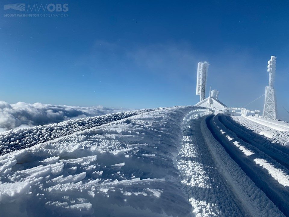
© Mount Washington ObservatoryMount Washington
Many are still enjoying the fall foliage this time of year, but it looks like the dead of winter in one part of New England. Mount Washington State Park shared photos this week of a snowy, frozen landscape on the New Hampshire peak.

"The last couple of days of the season marked 128 MPH winds, bitter temps and the white stuff. Brrrrr," New Hampshire State Parks wrote on Facebook.

Sunday marked the end of the summer season at the park. Facilities won't open again until late spring 2020.

Last week, the Mount Washington Observatory shared photos of a "winter wonderland" at the summit. They've also reported 100+ mph winds resulting in "rime ice feathers" as high as 3 feet.

Snowflake

Unseasonal snowfall hits South Island, New Zealand

snow
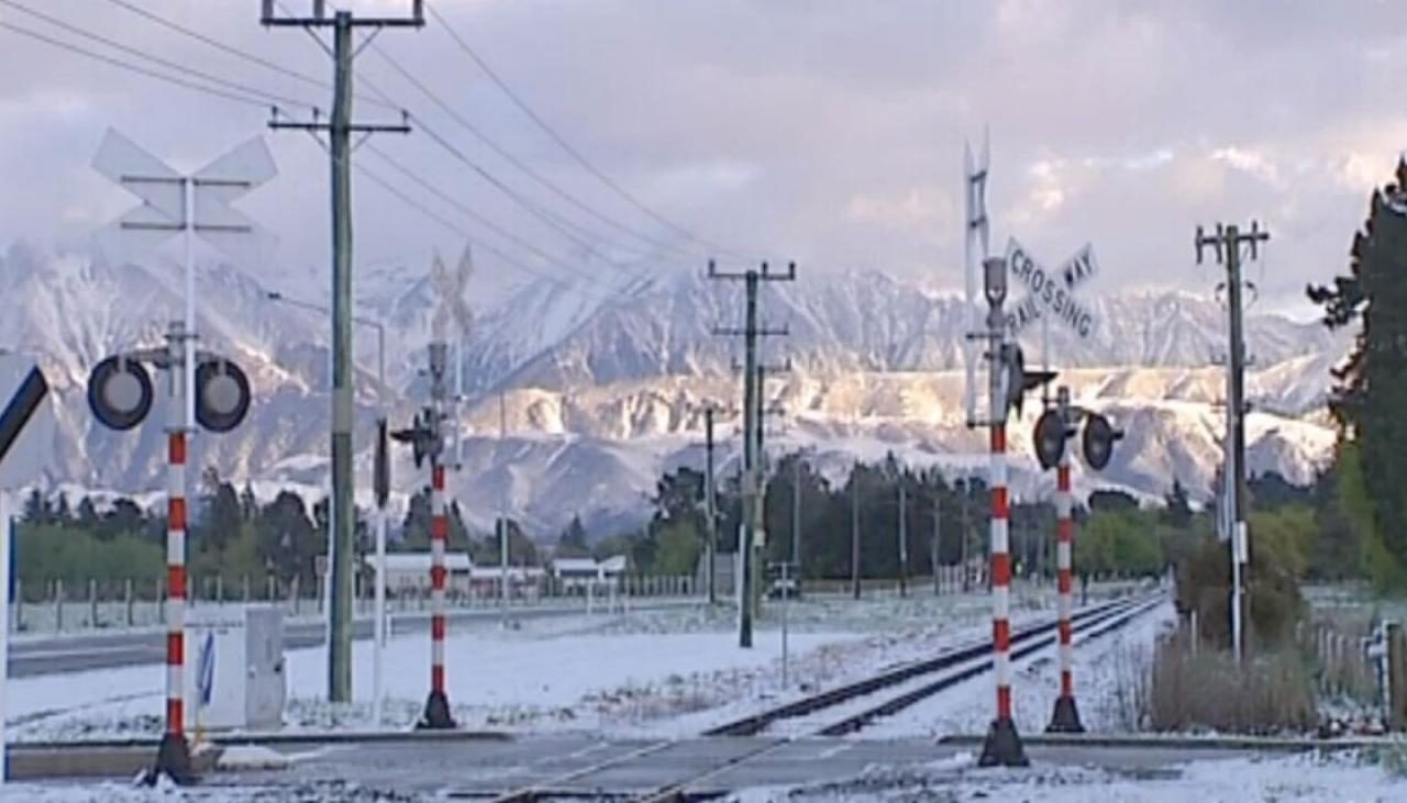
A late-season cold snap has interrupted warm spring weather with snow falling in parts of the South Island.

Canterbury High Country and Central Otago bore the brunt of the southerly cold front, with snow accumulating as low as 600m in Naseby.

Naseby resident Kila Hepi said there had been more snow in the last three weeks than they'd had all winter.

"Oh it's just another day isn't it. When you live at altitude you expect this to happen," she said.

One Sheffield resident, Virginia Stevens, was making the most of the unexpected dusting, donning a dressing gown to take photos outside.

"It's absolutely ridiculous that we get it at this time of year. It's crazy, but it's nice.

Snowflake Cold

Big White ski resort in British Columbia receives 7 inches of early snowfall

snow
Opening day might be five weeks away, but that hasn't stopped mother nature from blanketing Big White with an early snowfall.

Over the weekend the ski resort received 18 cm of snow with more flurries forecasted for later in the week.

Temperatures are expected to hover around zero for the rest of the week helping to stop the snow from melting.

The resort is expected to open on Nov. 28.

Snowflake

Casper Mountain in Wyoming sees 14 inches of early snow cover after latest storm

snow
© Dan Cepeda, Oil City
Casper Mountain saw over a foot of snow fall over the weekend.

As of Monday, Oct. 21, the Casper Mountain Snotel recorded 14 inches of snow cover.

That is according to the National Weather Service's Riverton office.

Snow is likely in the mountains from Tuesday-Thursday, the NWS says. Snow is also possible in lower elevations.

Snowflake

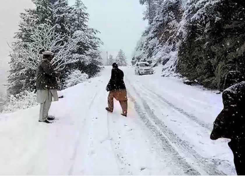
Early 6 inches of snow in northern Pakistan

snow pakistan
Snowfall over high mountains in northern areas of Pakistan covered the region with white pearls of snow from sky in Kaghan Valley and other areas, ARY News reported on Saturday.

The Naran highway leading to Gilgit has been closed for vehicular traffic as Babusar Top, Chilas, Deosai and Nanga Parbat received first spell of the winter snowfall.

Rain with wind or thunderstorm is expected at isolated places in upper Khyber Pakhtunkhwa, northern Punjab, Islamabad, Gilgit Baltistan and Kashmir today, while hail storm is expected at a few places.

Snowfall over high mountains is also expected in Malakand division and Gilgit Baltistan on today, Pakistan Meteorological Department said in its forecast.


Snowflake Cold

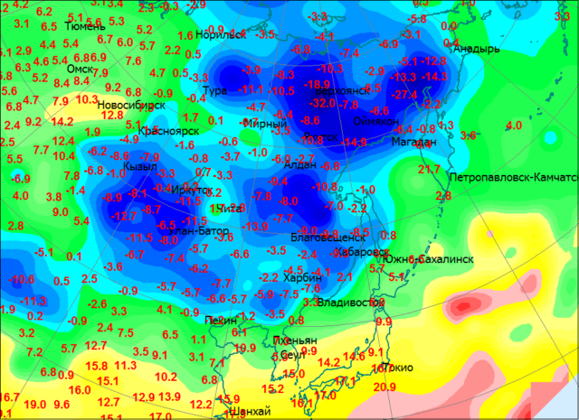
Half-meter snowdrifts and minus 32°C in Russia

cold map
Russian winter is taking its course. As a place for its presentation, the cold chose the central regions of Yakutia. On October 15, at the Iema weather station, the minimum temperature was −32°C.

In addition to severe night frost, in Yakutia there is a large diurnal variation in temperature. At noon the same day, thermometers showed −13°C.


Alarm Clock

State of Emergency: Vital oil pipeline shuttered by snow storms in Canada

snow
TC Energy, formerly known as TransCanada, has declared force majeure on the Keystone oil pipeline after a snow storm in Manitoba disrupted operations, Reuters reports, citing a confirmation from the pipeline operator.

"Due to the recent storm in Manitoba over the weekend, we did declare force majeure as the province declared a state of emergency. We are currently operating at reduced flows," a spokesperson for TC Energy told Reuters in a statement.

The Keystone pipeline has a capacity to carry 590,000 bpd of Canadian crude to the United States refineries. While it is unclear exactly how much TC Energy had reduced the flow of oil through the pipeline, but Western Canadian Select was down on the news, extending a losing streak.

Snowflake

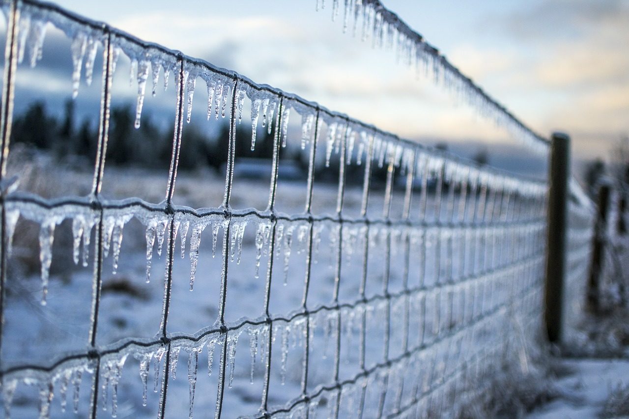
Historic midwest blizzard has farmers "Expecting massive crop losses - as devastating as we've ever seen"

frozen fence
An unprecedented October blizzard that hit just before harvest time has absolutely devastated farms all across the U.S. heartland. As you will see below, one state lawmaker in North Dakota is saying that the crop losses will be "as devastating as we've ever seen". This is the exact scenario that I have been warning about for months, and now it has materialized. Due to endless rain and horrific flooding early in the year, many farmers in the middle of the country faced very serious delays in getting their crops planted. So we really needed good weather at the end of the season so that the crops could mature and be harvested in time, and that did not happen. Instead, the historic blizzard that we just witnessed dumped up to 2 feet of snow from Colorado to Minnesota. In fact, one city in North Dakota actually got 30 inches of snow. In the end, this is going to go down as one of the worst crop disasters that the Midwest has ever seen, and ultimately this crisis is going to affect all of us.

According to the USDA, only 15 percent of all U.S. corn and only 14 percent of all U.S. soybeans had been harvested as of October 6th...

Snowflake

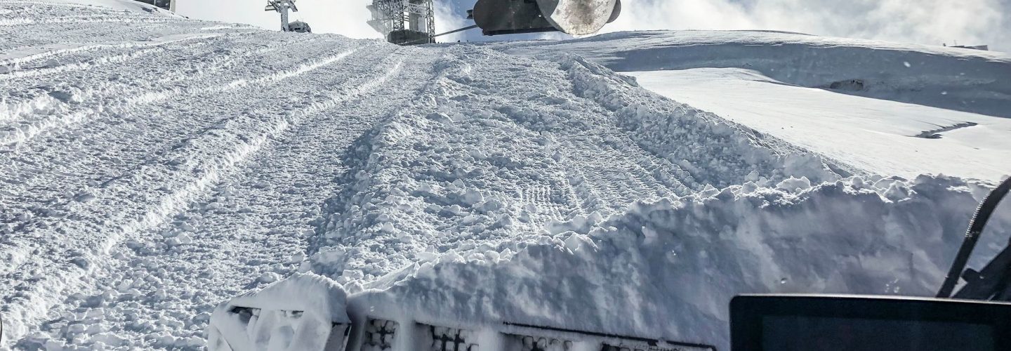
Foot of snow in 24 hours at Engelberg, Switzerland - widespread heavy snowfall across the Alps

snow
Engelberg in Switzerland has become the first ski resort to issue a powder alarm for more than 20cm of snowfall in 24 hours this morning after 30cm of snowfall was recorded.

The heavy snow was measured on the resort's Titlis glacier which only opened for the 2019-20 ski season last weekend.

Engelberg benefited from heavy snowfall that was widespread across the Alps yesterday, where more than a dozen glacier ski areas have already opened their high slopes for the start of their 2019-20 ski seasons.