Extreme Temperatures
S

Snowflake Cold

Snow piles on across New England for second time in a week

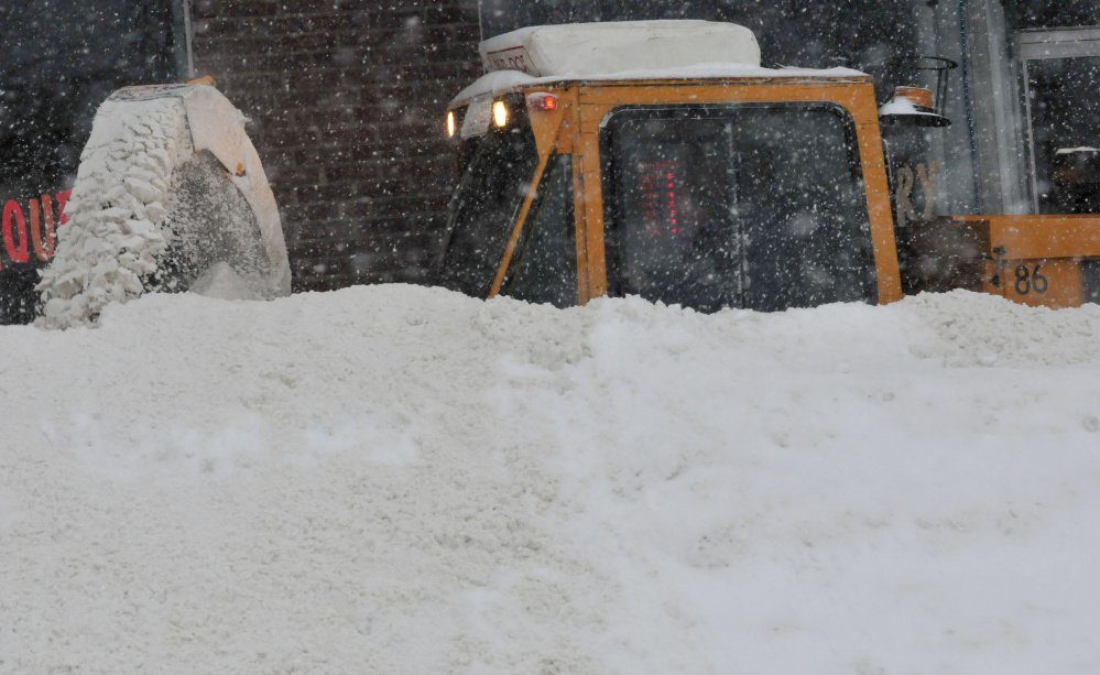
A Waterville Public Works department employee struggles to clear the sidewalk of snow along Elm Street in Waterville during the storm on Monday.
© David LeamingA Waterville Public Works department employee struggles to clear the sidewalk of snow along Elm Street in Waterville during the storm on Monday.
Heavy snow fell Monday across the Northeast, closing schools and government offices, snarling roads and cancelling flights with a forecast for 8 to 16 inches expected from New York to Maine.

By morning, some towns in Upstate New York already had a foot of snow on the ground.


The storm, called a nor'easter, will bring blizzard conditions across Maine with strong winds, which the weather service warned could bring heavy snow and reduced visibility.

Travel could be dangerous during the height of the storm as road crews have difficulty clearing roads, according to AccuWeather.com. Blizzard warnings are in effect for eastern Maine, according to the weather service.


Snowflake Cold

Severe weather closes every major highway in British Columbia's lower mainland

Coquihalla Highway
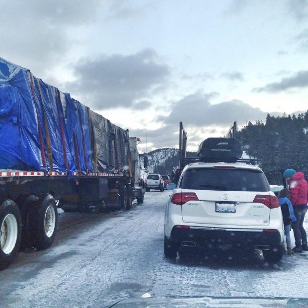
© Daniel HirnerCars on the Coquihalla Highway, a major route in and out of B.C.'s Lower Mainland, were stuck until at least 10 a.m. Friday after the road closed Thursday afternoon.
A 24-hour period of freezing rain across the south coast of B.C. led to the closure of every highway heading into the Lower Mainland โ€” stranding hundreds of drivers โ€” as well as blackouts across the region.

The rain began Wednesday night and carried into Thursday morning, blanketing the area with slick sheets of ice.

By Thursday afternoon, Highways 1, 3, 5 and 99 had all shut down due to the dangerous conditions. Many parts of those highways remained closed on Friday morning.

North Vancouver's Joanna Hirner and her family had been stuck on Highway 5 โ€” known as the Coquihalla โ€” since 8 p.m. PT on Thursday. They were trying to get to Big White Ski Resort, near Kelowna.

Snowflake Cold

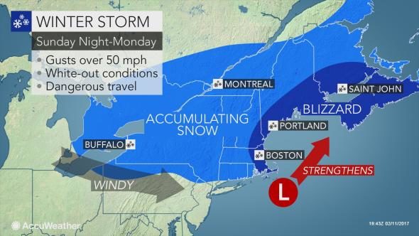
Blizzard conditions, feet of snow forecast to bring New England to a standstill by Monday

WEATHER MAP
A snowstorm with blizzard conditions will unleash feet of snow and threaten to bring travel to a halt across New England late on Sunday into Monday.

In some areas, this will be the second storm in less than a week to unleash a blizzard and over a foot of snow.

Behind a weak system that returned snow to New England to start the weekend, a second and more potent storm will follow late on Sunday into Monday.

"The storm has the potential to bring 1 to 2 feet (30 to 60 cm) of snow to parts of central and northern New England and parts of the Maritime Provinces of Canada," AccuWeather Senior Meteorologist Alex Sosnowski said.

Locally higher amounts can occur in parts of central and eastern Maine, New Brunswick and Nova Scotia.

There will be a sharp variation in snowfall across northern and southern New England, where a distance of a few dozen miles could mean the difference between a slushy inch or two of snow and well over half a foot.

Cloud Lightning

People experience rare thunder snow across New England

A commuter walks through the snow at the Metro North Greenwich train station in Connecticut.
© Timothy A. ClaryA commuter walks through the snow at the Metro North Greenwich train station in Connecticut.
The nor'easter battering New England Thursday has wrought a rare phenomenon: thunder snow.

As the storm swept across the region, people posted videos that captured the rumbling snowfall โ€” and sometimes their startled reactions โ€” online.

"It shouldn't surprise you if you hear thunder and see some lightning during the storm," Boston.com meteorologist Dave Epstein said of Thursday's storm. "If this is the case, you are experiencing thunder snow โ€” and some of the most intense snowfall rates we'll see."

According to Epstein, the heaviest snow Thursday will occur from 10 a.m. to 5 p.m. with some areas seeing a foot or more of accumulation.


While none of these reactions can top The Weather Channel's Jim Cantore's thunder snow excitement in 2015, it's still getting a lot of love from New Englanders.
We just had Thunder Snow here at the NWS Office in Taunton.

โ€” NWS Boston (@NWSBoston) February 9, 2017
#Thundersnow in Northern RI @JimCantore @PinpointWXTeam @NWSBoston 10:15am pic.twitter.com/9hcfO803FX

โ€” John Piascik (@Woods826) February 9, 2017

Snowflake

Heavy snowfall cuts power, disrupts transport along Sea of Japan coast

Snow Japan
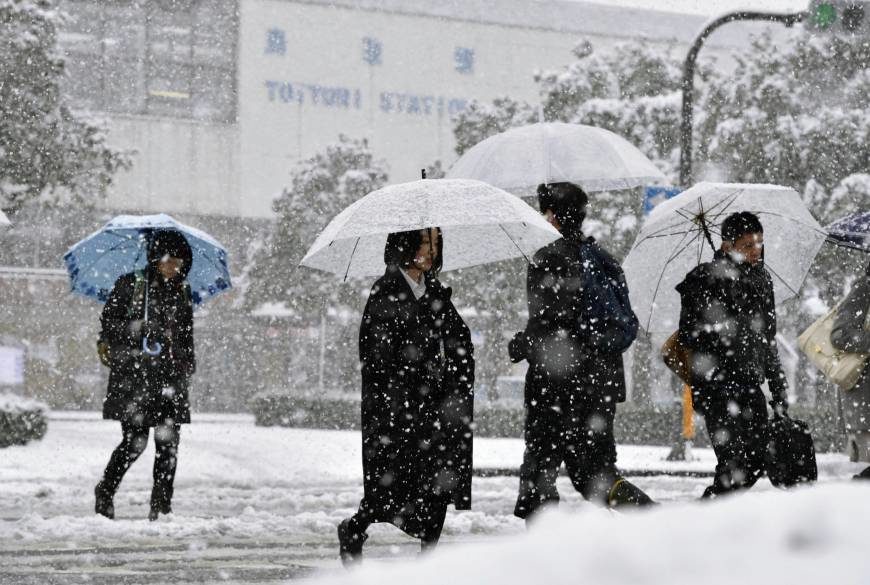
Heavy snow plastered much of the Sea of Japan coast on Friday as a cold wave hit the archipelago, disrupting transportation and causing power outages.

The Meteorological Agency warned the snowfall could continue through Sunday and spread to the Pacific coast.

In Kurayoshi, Tottori Prefecture, around 1,300 households lost power after a snow-laden tree fell onto a power line, Chugoku Electric Power Co. said.


Snow also prompted West Japan Railway Co. (JR West) to suspend part of the Inbi Line in Tottori and Okayama prefectures and part of the Geibi Line in Hiroshima Prefecture. Delays were also reported on the Sanin Line.

A glitch apparently caused by snow also left around 40 passengers in a cable car to Mount Koya trapped for about 90 minutes in the town of Koya, Wakayama Prefecture, Nankai Electric Railway Co. said.

Sun

Sydney hit by record temperatures during heatwave

Sydney heatwave
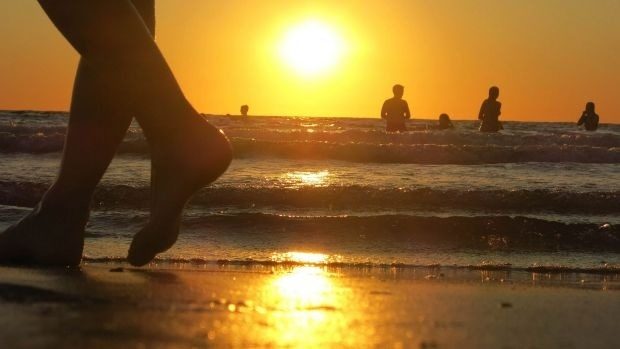
The beaches are expected to be packed as people seek relief from the heat.
With temperatures over 40C in parts of Sydney, it is now officially the hottest summer in the city's 158 year recorded history โ€” with 10 summer days over 35C.

At Sydney Airport, temperatures reached 42.9C at 2.30pm today, and broke the previous record for the area set in 1980.

And the worst heat could be still to come.

Tomorrow, for the first time in the history of Sydney grade cricket, all matches have been called off due to the extreme heatwave.

Cricket Australia and NSW doctor John Orchard pushed strongly for the unprecedented step to be taken, and NSW Cricket has advised all associations to follow suit and cancel junior and senior matches.

Similarly at Royal Randwick, tomorrow's much-anticipated racing has been postponed until Monday.

While residents have yet to be hit by power outages, locals in the inner west were given a short preview of what could occur if power shedding is necessary.
Bizarro Earth

Blizzard Warnings as Winter Storm Niko hammers US Northeast

US East coast storm
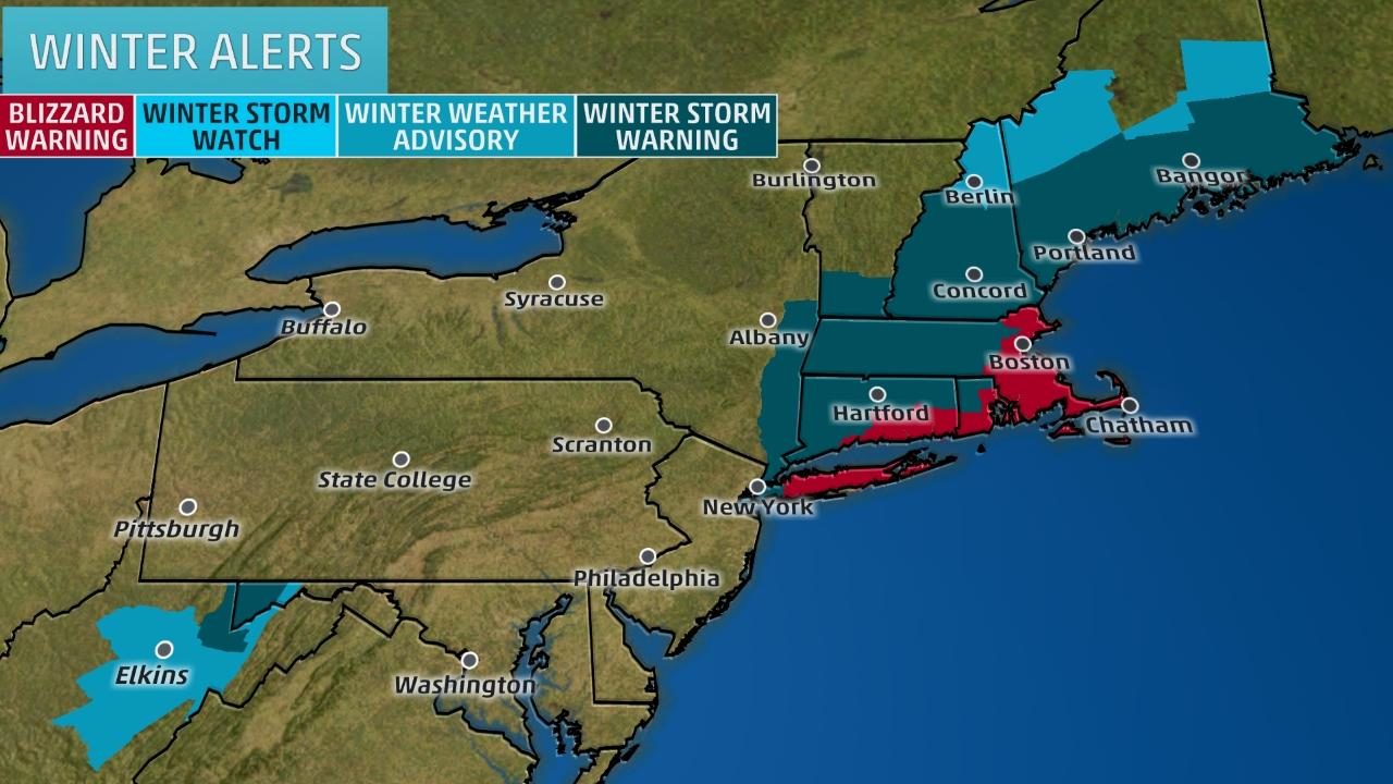
© National Weather ServiceWinter Weather Alerts

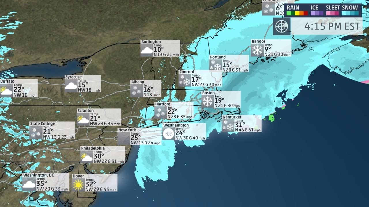
Winter Storm Niko continues to lash the Northeast with heavy snow, high winds and, in some areas, blizzard conditions, making travel treacherous, if not impossible in Boston and New York City.

A blizzard warning has been issued for Boston and all of eastern Massachusetts, including Cape Cod, Martha's Vineyard and Nantucket, as well as parts of Rhode Island, including Providence, much of Long Island in New York, and southeastern Connecticut.

Winter storm warnings stretch from Maine southward through New England, eastern New York and into northern/eastern New Jersey. This includes Hartford, Connecticut, Albany, New York, and New York City.
US East coast winter storm
© Weather ChannelAreas shown in darkest teal have the best chance of snow. Areas in pink may see either snow, sleet or freezing rain. Areas in purple may see sleet or freezing rain. Areas shown in darkest green have the best chance of rain.

Snowflake Cold

Whistleblower: No more global warming, NOAA scientists falsified temperature data, MSM ignores

Unstable land readings
Retired NOAA climatologist Dr Bates, comes out with the bombshell of the century that there is no global warming.

NOAA changed temperature data to show warming to effect political will to get USA and other countries to sign 2015 IPCC global climate accord.

Also $100 billion in funding to be lost if no warming continues.


Sources

Snowflake

Historic winter storm dumps more than 5 feet of snow in parts of Montana

 East Glacier
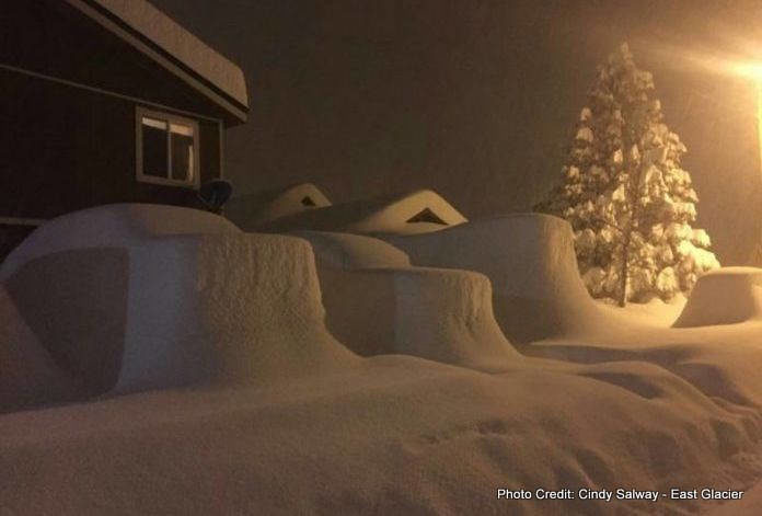
© Ciny Salway East Glacier
The final numbers are in and Montana's recent winter storm is one for the record books.

More than five feet of snow fell along the Rocky Mountain Front, breaking long-standing snowfall records at a few locations.

St. Mary (Glacier County) reported a total of 64" of snow during the 4-day period beginning February 3 and ending February 7. This smashes the previous 4-day extreme of 43" set back in November 1990.

The National Weather Service in Great Falls says Babb reported an unofficial total of 60", and the most snow ever reported over a 4-day period prior to this storm was 24" back in 1954.

At Many Glacier, an automated SNOTEL station recorded 63" of snow -- the previous 4-day record was just 36".

Browning reported 3 feet of snow during the storm, which ties for the 3-day record set in September 1908.

NWS Great Falls reports more than six feet of snow fell in some areas at higher elevations, but exact figures have not been determined.


Click here to read the NWS report (PDF); below are highlights.

Snowflake Cold

Thickest snowfall in 25 years for Kashmir Valley, India

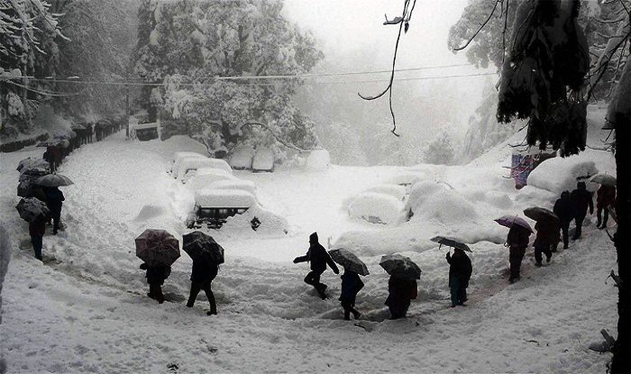
Kashmir Valley receives thickest snowfall in 25 years
Earlier, it had snowed heavily in February 2006 but it wasn't as much as this year's snowfall. This year's wildest washout is coinciding with 'chillai kalan', which is the harshest period of winter in Kashmir.

The beautiful Kashmir Valley turned into a picturesque after receiving a thickest whiteout in 25 years this February. The India Meteorological Department (IMD) release dated February 3 mentioned that the minimum temperatures were less than 5.0ยฐC at many places over Jammu & Kashmir and at a few places over Himachal Pradesh and Uttarakhand. January received three spells of heavy snowfall of over 16.2cm in January alone. A total of 23cm snowfall has been recorded so far in the Valley this year, IMD reported.

Earlier, it had snowed heavily in February 2006 but it wasn't as much as this year's snowfall. This year's wildest washout is coinciding with 'chillai kalan', which is the harshest period of winter in Kashmir. The 'chillai kalan' lasts from December 21 to January 30. The heavy snowfall in the Kashmir Valley triggered landslides at several places, bringing normal life to a standstill.