Extreme Temperatures
S


Cloud Precipitation

California mountain blizzard may bring up to 100 inches of snow

sierra nevada snow
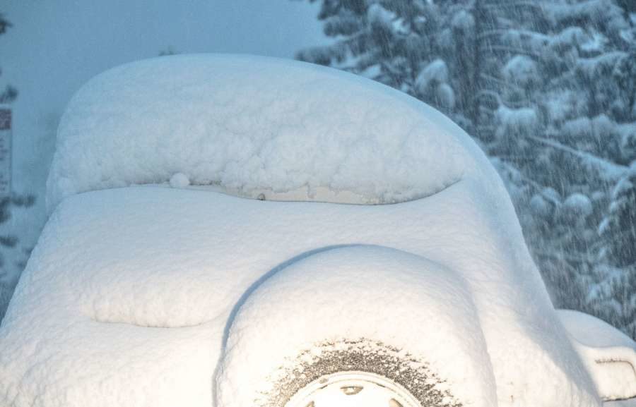
A large storm is coming ashore on the California coast and it's bringing flooding rains and heavy mountain snow. Above 5,000 feet, the snow is being measured in feet. Multiple feet.

Blizzard and Winter Storm Warnings are in effect for those areas expected to receive 80-100" of snow from the time the snow started yesterday through Thursday evening. That's more than 8 feet of snow in just a days of days. To put that in perspective, that is more snow than Roanoke has seen in 5 years.

Snowflake Cold

New study claims global warming is causing colder winters and more snow in Europe

snow cover
© AFP/Getty Images
From the "with models, we can make anything believable" department.

New paper argues for a stronger influence of Arctic sea-ice loss on recent Eurasian cooling, thus causing colder winters and more snow in Europe due to climate change.

A reconciled estimate of the influence of Arctic sea-ice loss on recent Eurasian cooling

https://www.nature.com/articles/s41558-018-0379-3 (paywalled)

Abstract

Northern midlatitudes, over central Eurasia in particular, have experienced frequent severe winters in recent decades1,2,3. A remote influence of Arctic sea-ice loss has been suggested4,5,6,7,8,9,10,11,12,13,14; however, the importance of this connection remains controversial because of discrepancies among modelling and between modelling and observational studies15,16,17.

Here, using a hybrid analysis of observations and multi-model large ensembles from seven atmospheric general circulation models, we examine the cause of these differences. While all models capture the observed structure of the forced surface temperature response to sea-ice loss in the Barents-Kara Seas-including Eurasian cooling-we show that its magnitude is systematically underestimated. Owing to the varying degrees of this underestimation of sea-ice-forced signal, the signal-to-noise ratio differs markedly.

Comment: Bunk. See: Global warming? - Still no warming for 17 years 9 months


Snowflake Cold

Snow depths in the Alps reach 6 metres (20 feet)

Loser
Loser, Austria
The deepest snow depth at a ski resort currently being reported in the Alps, and the entire world, has reached 6 metres (20 feet) ...but the sun is out again.

The Swiss resort of Andermatt-Sedrun (pictured below) has reported this depth on its upper ski runs with 95cm at resort level. Road access to the village was cut off earlier this week although a rail tunnel allowed people to still get in and out.

Andermatt-Sedrun
Andermatt-Sedrun, Switzerland

Sun

Warmest first half of January ever recorded in Seattle since the 1890's

Seattle
© Bettina Hansen / The Seattle TimesA’joure Johnson, 6, of Seattle takes a leap while visiting Me-Kwa-Mooks Park in West Seattle recently.
If you feel like it's been a mild winter so far, you're not imagining things. This has been the warmest first half of January ever recorded in Seattle, according to the National Weather Service in Seattle.

"The average high temperature at Sea-Tac (International Airport) for the first 16 days of January was 51.8°," the weather service tweeted Thursday.

Those temperature records go back to marks taken at the Federal Building in downtown Seattle since the 1890s, meteorologist Dana Felton said.

A high of 50 degrees is expected on Thursday, Felton said.

There were, however, a few cold mornings: Lows dipped to 33 degrees on Jan. 1, 32 degrees on Jan. 2 and 31 degrees on Jan. 15, he said.

The warmest day so far was last Friday, Jan. 11, when the high climbed to 61, Felton said.

"A 60-degree day is pretty rare in January," he said. "There have only been 16 in the 75 years of records at Sea-Tac."

Snowflake Cold

Sierra resorts can count snowfall totals in feet - here's what they look like on Thursday, January 17

Heavenly Mountain reported 12 inches of snow in 24 hours Thursday morning.
© Heavenly Mountain ResortHeavenly Mountain reported 12 inches of snow in 24 hours Thursday morning.
Several ski resorts in the Tahoe area, including Squaw Valley Alpine Meadows and Northstar California, reported receiving two feet of snow between Tuesday and Wednesdayand that's before the brunt of the storm hit.

The snow continued to pile up Wednesday night into Thursday morning, as the storm dumped wet, heavy 'Sierra cement' in the Tahoe basin.

The resorts started to boast about how much snow fell in their neck of the woods and the numbers were impressive all around. Sugar Bowl had received 15 inches of snow just overnight. Squaw Valley reported 28 inches of snow in the past 24 hours, Northstar had 26 inches, Kirkwood had 16 inches, and Heavenly had a foot. June Mountain Ski Area reported a 24-hour total of 36 inches at 7 a.m. Thursday.


Snowflake

Storm dumps up to 18 inches of snow in a day on Lake Tahoe resorts, blizzard warning issued for next 24 hours

Heavenly Mountain
Heavenly Mountain
Some Lake Tahoe ski resorts are reporting over 1 foot of snow Wednesday morning, less than 24 hours into several days of winter storms.

Snow started falling late Tuesday morning and continued throughout the day. After a brief break, snowfall picked back up Wednesday morning.


Here are the 24-hour totals reported by resorts in the South Lake Tahoe and Incline Village areas:

Snowflake Cold

Turkey hit by harsh winter, snowfall

SNOW TURKEY
Roads to thousands of villages covered by thick snow

Harsh winter conditions dominate many parts of Turkey, affecting daily life.

An old woman in eastern Bingol province was killed when an avalanche of snow fell over her from the roof of her house.

The roads to thousands of villages across Turkey were covered with snow. In Ovacik district of eastern Tunceli province, the height of snow reached three meters (10 feet).

Roads between Ankara-Izmir, Afyonkarahisar-Usak and Afyonkarahisar-Kutahya cities in western Turkey were blocked early Wednesday due to heavy snow.


Snowflake

Best of the Web: ENORMOUS 'spinning ice disk' appears on river in Maine - Largest one yet?

maine ice disk
A very unusual and impressive sight took shape in Maine this week, a nearly perfect disc of ice -- forming in the Presumpscot River.

The massive ice disc drew curious onlookers to the banks of the river. It's not clear how or exactly when it formed.

According to an official with the city of Westbrook, the disc is roughly 100 yards across and is spinning in a counter clockwise direction.

That same official captured this breathtaking drone footage of the amazing sight.


Comment: That thing's almost 100m across!!!

It is an unusual sight, and so why are these ice disks, and a number of other out of the ordinary but related phenomena, suddenly occurring all over the globe?


Snowflake Cold

Snow Report: Latest conditions in the Alps - metre and a half fell in parts of Austria over weekend

snow
The Alps came up for air today (Tuesday) after another weekend of record-breaking falls, which cut off some Austrian resorts and saw the avalanche risk hit 5 - the highest level.

Up to a metre and a half fell in parts of Austria, in particular the Arlberg region around Lech and St Anton, which were both cut off completely, as were Stuben and St Christoph. Only six lifts in St Anton - out of a possible 39 - were turning yesterday, due to high winds.

Obergurgl was also inaccessible because snow was overwhelming efforts to clear the roads and some lifts in nearby Ischgl were stopped because they were completely buried in places.


Snowflake Cold

Cold wave intensifies in North India: Pahalgam witnesses coldest January night in 5 years at minus 14.6 degrees Celsius

A view of a snow covered hut in Gulmarg, 55 kilometers north of Srinagar,
A view of a snow covered hut in Gulmarg, 55 kilometers north of Srinagar.
Cold wave conditions continued across North India on Monday with fresh bouts of snowfall reported in the Kashmir valley, Ladakh region and Himachal Pradesh. Several places also witnessed a sharp drop in minimum temperatures at night. The Valley, however, saw a sunny Monday morning despite the cold conditions.

Kashmir

Kashmir is under what is known as the 'Chillai-Kalan' — the 40-day harshest period of winter when snowfall is frequent. Chillai-Kalan ends on 31 January and is then followed by a 20-day-long 'Chillai-Khurd' (small cold) and the 10-day 'Chillai Bachha' (baby cold).


Comment: See also this report from early January: Heavy snowfall disrupts life in Kashmir - up to 3 feet measured.