Extreme Temperatures
S


Snowflake Cold

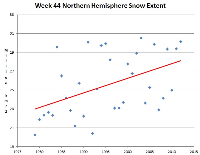
Autumn snow extent has increased by 25% since records began

Week 44 northern hemisphere snow extent has increased by 25% since the start of the satellite era in 1979, and this year has the second highest snow extent during that period. Russia and Canada are almost completely covered with snow.
Image
Rutgers University Climate Lab : Global Snow Lab.

http://climate.rutgers.edu/snowcover/table_area.php?ui_set=0&ui_sort=1
2012 also set the record for the greatest Antarctic sea ice cover ever measured.

Climate experts tell us that declining snow and ice cover is an essential ingredient of global warming.

Snowflake

Ice Age Cometh? Coldest weather for one hundred years coming to Britain

cold weather
A severe bout of cold weather looks to be heading Britain's way
Britain will grind to a halt within weeks as the most savage freeze for a century begins.

Temperatures will fall as low as minus 20C in rural areas, forecasters warned last night, while heavy snow and "potentially dangerous" blizzards will close roads and cripple rail networks.

James Madden, forecaster for Exacta Weather, said: "We are looking at some of the coldest and snowiest conditions in at least 100 years. This is most likely to occur in the December to January period with the potential for widespread major snowfall across the country.

"Parts of the North, Scotland and eastern England are likely to experience a run of well below average temperatures, which will include some potentially dangerous blizzard conditions at times."

He warned the South faces a bout of "unusually heavy snowfall" in December.

Leon Brown, meteorologist for The Weather Channel, said snow could arrive as early as next weekend, with temperatures falling to minus 5C in the North.

"There is a 30 per cent risk of some snow over lower levels in Scotland on Friday."
Snowflake Cold

Brutus breaks snowfall record in Helena, Montana

Image
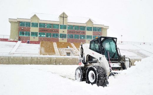
Maintenance crews work to remove snow from Nelson Stadium Friday for Carroll College's final game of the season Saturday against Dickerson State. In the last 48 hours the Helena area has received about 12 inches of snow, which made for intense work to clear the stands and field.
Helena crushed a snowfall record Thursday, and was on the way to doing the same Friday as winter storm Brutus brutalized the town.

Helena saw 8.8 inches of snow Thursday. The previous snowfall record for Nov. 8 was 2.3 inches, set in 1903.

Zach Uttech, a meteorologist with the National Weather Service in Great Falls, said the south-west flowing air mass from Canada has created an ideal scenario for widespread snow over the region, blanketing Montana with an abundance of snow.

Total snow accumulation could hit nearly 14 inches in downtown Helena, which would put Thursday and Friday among the top for highest snowfall in a two-day period for the month of November, Uttech said. As of noon on Friday, the two-day total was 12.6 inches.

Snowflake Cold

Edmonton auto body shops 'chaotic all day' after massive snowfall

Image
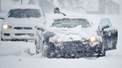
© John Lucas, Edmonton JournalA motorist gets a push on Ada Boulevard in the heavy snow in Edmonton on November 7, 2012.
Edmonton police say roads are faring better following the city's near-record snowfall, despite frigid overnight temperatures that left surfaces slick and icy.

The number of crashes recorded so far Thursday morning is down by half compared with Wednesday. Between 6 a.m. and 9:30 a.m., police responded to 23 crashes, including three that caused injuries, compared with 53 crashes, seven of which caused injuries, at the same time one day earlier, said spokeswoman Lisa Sobchyshyn.

Environment Canada reports that Edmonton received between 14 and 31 centimetres of snow, while St. Albert got a whopping 35 cm.

With more than 200 crashes recorded between 6 a.m. and 4 p.m. Wednesday, auto body shops around the city saw a major increase in customers.

Snowflake Cold

Winter storm Brutus threatens snow, severe weather for US West, Midwest

Image
© Weather.com
Even before Winter Storm Athena can finish pulling away from the Northeast, we have another significant winter storm system to deal with in the western half of the country: Winter Storm Brutus. This time, not only will there be a wind-snow combo on the cold side of the system, but there will be a warm sector with severe weather potential - eventually.

But first things first.

Wintry Side: Snow, Wind, Blizzard?

With strong low pressure developing over the northern Rockies and a strong high pressure zone to the north over western Canada, the stage is set for a wind-driven snow.

That snow will develop over Montana and central Idaho on Thursday. There will also be snow farther west over the Oregon Cascades and the northern Sierra Nevada in California.

Snowflake

Record-breaking blizzard freezes Beijing before Congress

Beijing snow
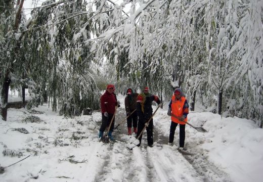
© (STR/AFP/Getty Images)Workers clear a snow-covered street after a heavy snow-fall in the outskirts of Beijing on Nov. 4, 2012.
Netizens and scholar point to traditional culture, and posit causal link

A blizzard swept through northeastern China on Nov. 4, shutting down transportation in Beijing just before the opening of the 18th Party Congress. The unexpectedly early snow storm was commented on heavily, with Internet users drawing a connection between the inclement weather and the Chinese Communist Party's upcoming political meeting.

Breaks Records

In the early morning on Nov. 4, Beijing's Weather Bureau issued their most severe weather warning, a red alert, for the western and northern parts of the city and a second most severe warning, an orange alert, for the entire city, reported the state-run China Daily.

Igloo

How Earth's oceans plunged the planet into a catastrophic big freeze - and it wasn't caused by humans

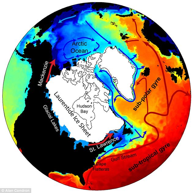
The planet's last major cold spell 13,000 years ago was caused by a catastrophic deluge of frigid fresh water from north-west Canada into the Arctic ocean, a new study suggests. Detailed computer simulations show meltwater from the enormous Laurentide Ice Sheet halted the sinking of very dense, saltier, colder water in the North Atlantic.
Image
© Alan CondronDetailed: A new model of flood waters from the melting Laurentide Ice Sheet shows how water first flowed north-west into the Arctic, weakening deep ocean circulation and leading to the Earth's last major cold period
That stopped the large scale ocean circulation - the so-called thermohaline circulation - that transports heat to Europe and North America, causing the continents to dramatically freeze. The findings offer a new explanation for the cause of this last big chill, which scientists had thought was caused by freshwater flowing into the Atlantic through Canada's Gulf of St Lawrence.

It led to a cold spell lasting more than 1,000 years known as the Younger Dryas or 'Big Freeze', during which temperatures in parts of the northern hemisphere fell to about 10 degrees C colder than they are today.

Snowflake Cold

Up to 40,000 New Yorkers may need to be relocated - freezing temperatures and more rain and wind from a 'nor'easter' storm

Image
Up to 40,000 New Yorkers may need to be relocated as the city prepares for freezing temperatures and more rain and wind from a 'nor'easter' storm. It is expected to hit New York and New Jersey with gusts of up to 55mph by Wednesday. The strongest winds are forecast for Long Island, with 40mph more likely for New York City. There is also the chance of more beach erosion, coastal flooding and trees weakened by Superstorm Sandy being felled.

Up to four inches of rain is expected along with snowfall in more inland mountainous areas and a tidal storm surge of up to 5ft is possible, forecasters say. New York City Mayor Michael Bloomberg said tens of thousands of people were in need of shelter, including 20,000 in public housing. Almost 2million people still have no power as cold weather sets in - a week after Sandy wreaked havoc on the East Coast, killing at least 113 in the US.

Hundreds of thousands of commuters today faced tricky journeys into the city as public transport remained patchy. Rail service was reduced and the subway was at 80 per cent of its normal service. Most schools were due to reopen today, but some lacked power and others were being used as shelters.

Cloud Precipitation

Blizzards sweep in leaving 6in blanket of white as heavy rain sparks flood warnings across Britain

  • Snow fell in the South and the West Country overnight, including in Somerset, Dorset, Wiltshire and Devon
  • Heavy rain in parts of the South-East and East Anglia has led to flood warnings
  • Tomorrow will be the coldest Bonfire Night since daily records began 14 years ago
  • People have flocked to bet on a white Christmas; Ladbrokes have already slashed the odds
  • snow UK
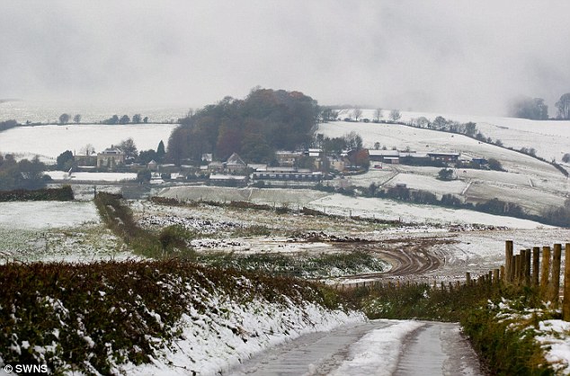
    © SWNSRolling hills: The Met Office reported 'heavy snow' in places as up to an inch of snow settled by morning on higher ground in Somerset, Dorset, Wiltshire and Devon.
    Your calendar may say November... but the weather seems to think otherwise.

    Blizzards swirled across the North East and snow blanketed parts of the West Country yesterday.

    A light scattering of snow was reported in Gloucestershire, an inch fell in Dorset, and up to six inches fell in Somerset in Bath, Frome, Midsomer Norton and the Mendip Hills, after temperatures plummeted on Saturday night.

    snow UK
    © SWNS.comWinter's arrived: The snowfall was England's fifth in nine days amid an early winter - after snow in the East last Saturday, in the West on Thursday and the North on Friday and Saturday.

    Snow Globe

    Surprise snow blasts Britain - despite none in the forecast

    snow UK
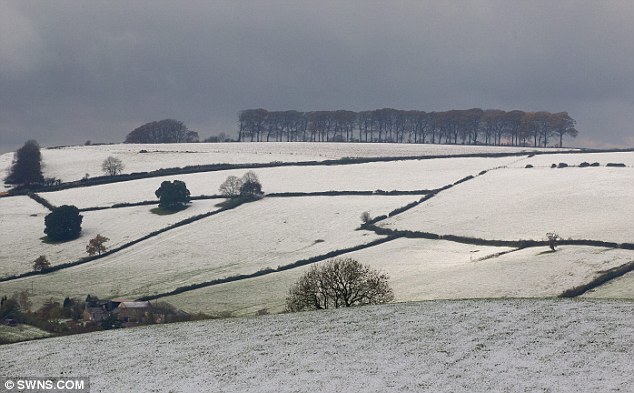
    © SWNS.comStunning: Snow coats the countryside near Bath, Somerset, as heavy snowfall hit the region this morning.
    Several inches of snow fell on parts of the West Country despite none being forecast in the region.
    Up to six inches of snow was reported in areas including Bath, Frome, Midsomer Norton and the Medips.

    Bath and North East Somerset (Banes) Council said it had been caught unaware because no snow was forecast.

    Buses and trains were suspended, while Wiltshire police confirmed that several vehicles had become stuck in snow near Bradford-on-Avon.