Extreme Temperatures
S


Binoculars

Stunning rare duck from the Arctic seen in Aberdeen, UK

Image
A stunning rare bird, hailing from the Arctic, has been spotted in Aberdeenshire.

The beautiful drake King Eider was found off St Combs in Aberdeenshire, on Wednesday.

Described as one of North America's most spectacular species, the King Eider forms large flocks during spring migration, sometimes exceeding 10,000 individuals, however, this duck appears to have been split from the flock.

Elsewhere a Ridgway's Cackling Goose was spotted at Castle Kennedy near Stranraer in Dumfries and Galloway.

The rare goose is native to North America. It breeds in northern Canada and Alaska in a variety of tundra habitats.

Source: The Press and Journal

Ice Cube

5 rescued after huge ice jam causes floods near Louisville, Nebraska

Image
@OPDABLE1

Known victims have been rescued, @OPDABLE1 is heading back for fuel & returning to recon for more victims.

8:20 AM - 27 Jan 2015
A one-mile long ice jam is moving down the Platte River in Nebraska has caused flooding near Two Rivers State Park, about 30 miles west of Omaha.

Authorities have rescued five people and pets from the floods and ice. Three of the victims are thought to have been in their vehicle when it became trapped in flood waters. Around 20 residents have evacuated the area.

The National Weather Service in Omaha said:
Ice jam flooding along the Platte River in southwestern Douglas, western Sarpy county, and eastern Saunders counties. Warning in effect.
They predict that jam will move towards the South Bend area, just west of Louisville.

Cloud Precipitation

Flooding hits parts of Massachusetts coast after winter storm Juno

Image
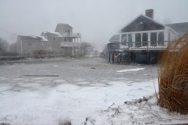
© U.S. Army National Guard photo by 1st Sgt. Don Veitch, Massachusetts National Guard Public AffairsFlooded ares of Scituate, Jan. 27, 2015.
Winter storm Juno hit the eastern US states of Connecticut, Rhode Island, Massachusetts, New Hampshire and Maine with 75 mph winds and 30 inches of snow. Snowfall amounts, travel bans and power outages and have all been well reported in US media.

The storm also brought flooding to some coastal areas, with the coastal areas of Massachusetts worst hit. Areas along the eastern Massachusetts coast,south of Boston, including north and northeast facing shorelines of Cape Cod and Nantucket faced some of the highest waves and storm surges. NWS warned that floods could reach 3 feet high in places.


Snowflake Cold

Powerful snowstorm buries New England, cuts off Nantucket

Image
© Dominick Reuter/Reuters.
The first major storm of the winter blasted across eastern New England on Tuesday, unleashing whiteout conditions driven by gale-force winds that pelted faces like small icy daggers and made cars disappear under igloo-like formations.

The storm may not have lived up to its billing in New York City, but it more than delivered in New England. It cut off the island of Nantucket, where almost all 12,000 year-round residents lost power and telephone service, and it flooded the Atlantic coastal town of Scituate, where a car floated downtown.

As snow continued to swirl Tuesday afternoon, forecasters were still expecting the predicted two to three feet. In Shrewsbury, about 40 miles west of Boston, 31 inches had fallen by 10 a.m.; Worcester, nearby, had received 26 inches and was on track to break records.


Igloo

Lethal weather forecast for the UK; crippling snowstorms next week

Image
© Net Weather/Getty Images
Panicked forecasters raised the alert in the past hour after spotting the freak system on the weather models.Rare in the UK it is identical to the phenomenon which triggered crippling whiteouts and ice storms in the United States.Sparked by the frenzied and volatile behaviour of the jet stream it threatens to bring the fury of the North Pole tearing across the country next week.

Forecasters say temperatures will plunge to below -15C (5F) while feet-deep snow drifts on a par with the worst winters in history are likely.The whole of the UK will be scourged by screaming Arctic gales and blizzards right through the first half of February.

A repeat of the historic freeze of 2010 which brought the coldest temperatures on record and ground airports to a standstill, is feared. Weather experts say they have issued a stark warning to emergency services and the Government to take action now.Airports, railway lines and roads are expected to grind to a shivering halt with extreme cold threatening the lives of thousands of people.

Piers Corbyn, forecaster for WeatherAction, warned a "catastrophic" set of circumstances have come together to trigger a lethal spell of weather. He said: "This could lead to anything, gales, huge snowstorms and the lowest temperatures of winter so far. "We are now 95 per cent certain that the whole of the country will be affected from the start of February.

"Such is the severity of this situation I have written to the Government's Cabinet Office Briefing Room (COBRA) committee urging them to take immediate action." The terrifying prediction is the result of a deeply meandering jet stream which has been largely responsible for the erratic weather this winter.

At the start of the season forecasters warned this big freeze would hit towards the end of December, but the frenzied deviation of the jet stream nudged it out of the way.The fast-flowing band of air is now poised to shift to a much more southerly position allowing the contents of the North Pole to flood into the UK.Swathes of the UK face knee-deep snow drifts with roads set to turn into deadly ice rinks sparking travel chaos.

Mr Corbyn said: "This is going to be a severely damaging spell of weather, the NHS is thoroughly unprepared and has been lucky up until now as it has not been too severe."But this is about to change dramatically with a displaced Polar vortex likely to dominate the weather for the first half of next month."

Comment: U.S. East Coast threatened by 'historic' snowstorm with possible significant snow accumulations


Snowflake Cold

U.S. East Coast threatened by 'historic' snowstorm with possible significant snow accumulations

Image
New England is braced for "paralyzing, crippling blizzard-like conditions" as the second East Coast winter storm in as many days threatens to dump up to two feet of snow in some areas, forecasters said.

Boston and New York City will see high winds and possibly "significant" snow accumulations as an Alberta clipper moves through the Ohio Valley Sunday and off the Mid-Atlantic coast Monday before intensifying over Long Island and New England through Wednesday.

"This is going to be a big one, historic," Weather Channel coordinating meteorologist Tom Moore said. "There could be paralyzing, crippling blizzard conditions. They're going to be talking about this one for a while."

Philadelphia, Baltimore and Washington D.C. were already set for a messy Monday morning commute with up to three inches of snow expected overnight Sunday.


Ice Cube

Flooding from broken water main instantly glaciates apartment block in Siberia

Image
You see this car? It's almost a meter deep frozen into the ice. Why is that? Yet another horrible accident midst winter cold when the pipes got ruptured and nobody seemed to care for time enough for tens of cars were flooded and frozen. The name of this location is Dudinka.

The locals of Dudinka say that the administration was asking them to constrain from publishing comments or photos on Internet. But you know, once posted cannot be unposted.


See more photos of this aftermath inside:

Snowflake Cold

Snowstorm brings record snowfall to parts of Texas Panhandle

Image
© Lindsey TomaschikCentral park looked like a winter wonderland on Thursday morning.
Last week the National Weather Service in Amarillo had mentioned the possibility of a winter storm impacting our region on Wednesday and into Thursday of this week.

Many residents didn't buy into the potential snow storm. That might have been because of the 70 degree weather we had just this past weekend or the fact that so far all the snows have been "duds" this year.

As the storm system got closer and closer the forecast model projections went up and up in their total accumulation expected. It got the point that it was not a matter of if we would see snow, but how much. A lot of that depended on where the convective bands of snow set up. One was on top of Pampa early in the system and that is why we got a higher total than projected.

A co-op observer recorded 4.4 inches of snow one mile northwest of Pampa. Another co-op observer recorded eight inches four miles west southwest of Lake McClellan. A public report came into NWS of nine inches for Pampa city limits.


Igloo

2014 is among the 3 percent of coldest years in 10,000 years

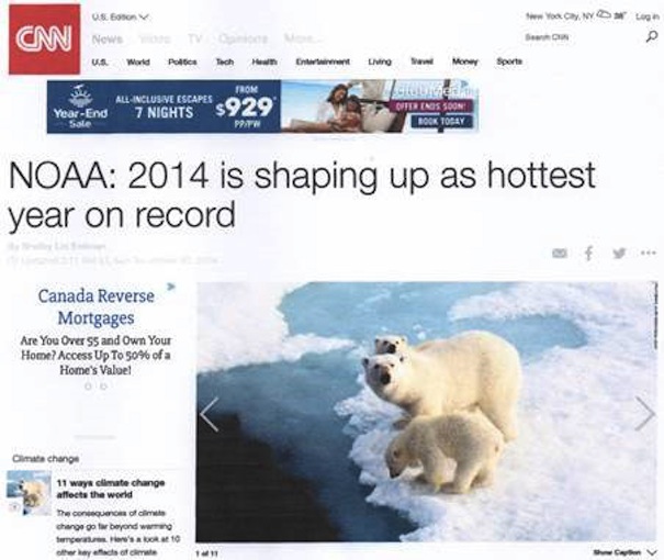
We were told in October, before 2014 was over, that it was heading toward being the warmest year on record (Figure 1). The visual link of polar bears underscored the message. In fact, 2014 was among the coldest 3 percent of years of the last 10,000, but that doesn't suit the political agenda.
Image
© CNNFigure 1
We know the headline referred to NOAA's projection, but the public only remember "warmest year". It is a routine of manipulation of headlines practiced by bureaucrats and supporters of the Intergovernmental Panel on Climate Change (IPPC), from the start. The claim was not surprising, because NOAA was pushing 2014 as warm beginning in January with this headline "NOAA: January 2014 fourth-warmest on record." Various months were identified during the year, for example, "NOAA: August 2014 Was The Warmest On Record," noting August was the warmest by a fraction. But they had already reported,

The summer of 2014 is officially the hottest since the modern instrumental record began more than 130 years ago, according to the latest state of the climate report from NOAA's National Climatic Data Center.

By October they were summarizing the year.

"This makes the first ten months of 2014 the warmest January to October period on record and puts 2014 on track to be the warmest year recorded in the NOAA archive, which dates back to 1880."

Bob Tisdale provided an excellent summary of the "Anticipation" for two surface records from GISS and NCDC. He was not surprised when these records appeared, showing 2014 was the warmest, according to them, by 0.02°C. Remember, this is from a record that is restricted by the historic record to measurements of 0.5°C. We also know the two satellite records, RSS and UAH, both show it was not the warmest year.

To counteract the headline you need something very dramatic, because there is nothing significant about the 2014 temperature as Tisdale plans to identify in an upcoming article titled, "The Uptick in Global Surface Temperatures in 2014 Doesn't Help the Growing Difference between Climate Models and Reality". He is interested in seeing how Gavin Schmidt, who replaced James Hansen at the Goddard Institute for Space Studies (GISS), is carrying the torch. History shows that GISS readings are consistently higher than all other sources. It is just one indicator of the temperature adjustments made so the AGW hypothesis fits the political agenda.
Comment: Read the book Earth Changes and the Human Cosmic Connection to learn more about ice ages and the bizarre weather we are having on this planet. A new ice age may be just around the corner.


Sun

Brazil power company orders rolling blackouts due to increased demand in record breaking heat

Image
© Eletronuclear.gov.brAdmiral Álvaro Alberto Nuclear Power Station
Rolling blackouts swept across parts of Brazil on Monday as the grid operator ordered select power cuts to avoid a larger crisis, drawing attention to a fragile electric system that is buckling under the strains of record-breaking heat and dryness.

Grid operator ONS said it orchestrated 2,200 megawatts of controlled outages in eight states as the hottest day of the year in Sao Paulo, where the temperature hit 36.5 Celsius (97.7 Fahrenheit), and other southeastern cities led to surging demand from air conditioners and other power-hungry appliances.

Eletronuclear, a unit of state-run power company Eletrobras , said nuclear reactor Angra I powered down automatically at 2:49 p.m. local time (1649 GMT) due to a drop in frequency on the national grid. The company said there were no risks to workers or the environment due to the stoppage.

Brazilian officials have repeatedly denied the need for energy rationing, even as the driest spell in more than 80 years drains hydropower reserves and forces the use of more costly thermal plants. The drought has also raised the specter of water rationing in Sao Paulo, Brazil's business hub and South America's largest metropolitan area.

Shares of electric companies tumbled on the Sao Paulo stock exchange, dragging an industry index nearly 5 percent lower as news of the power cuts spread. CPFL Energia SA fell more than 7 percent, while AES Eletropaulo, Light SA and Copel each lost around 6 percent.

A privately run subway concession in Sao Paulo, ViaQuatro, said it suffered an electric failure at 2:35 p.m. After 90 minutes ViaQuatro said it had restored service to part of the subway line, but two downtown stations remained closed.

ONS said the national grid was back to normal by 3:45 p.m. after controlled outages affecting less than 5 percent of the system's total demand.