Extreme Temperatures
S


Ice Cube

Niagara Falls freezes over as extreme winter weather continues

Image
Niagara Falls has frozen over due to temperatures which dropped to 16F on Wednesday
Extreme winter weather has been causing problems for millions across the East Coast, but it has also made for some beautiful sights.

Among those beautiful sights is Niagara Falls, which has now frozen over due to temperatures which dropped to 16F on Wednesday.

And it looks like the popular tourist destination may stay frozen, as temperatures are expected to drop even lower come Thursday.


Snowflake

Another snowstorm to pound Turkey: 5-12 inches expected

Barely a week after the last snowstorm pounded Turkey, another is bringing snow across much of the country as a trough of low pressure digs southward.

Moisture being pulled to the north from the Mediterranean Sea will combine with cold air from Russia to produce a widespread and long-lived snowstorm.

While western Turkey was hit hard by the previous storm, the worst of this snowstorm is expected to occur across central and east-central Turkey.

The higher terrain of northwestern Turkey can still get a significant snowfall, while Istanbul experiences rounds of snow squalls.

Additional accumulating snowfall is expected in Istanbul Tuesday night through Thursday. Rain will mix with the snow at times, especially during the afternoon hours and when light precipitation falls, but snow will be the primary problem.

Snow totals will vary greatly across the Istanbul area; however, the hardest hit areas could get total snowfall of 15-25 cm (6-10 inches) through Thursday. The period of heaviest snowfall is expected on Wednesday when low visibility and snow-covered roadways are expected.
Image
Snow began on Monday across many areas in central and eastern Turkey, but the heaviest snow will fall into Wednesday in areas such as Erzincan and Erzurum. Occasional snow may even continue to fall into Thursday in some places.

Snow accumulations of 13-25 cm (5-10 inches) are expected to be widespread in central Turkey with local amounts in excess of 30 cm (12 inches). In the highest terrain, total accumulations could near 60 cm (24 inches), which is great news for the many ski resorts scattered across the region, but bad news for travelers.

Snowflake

New Brunswick resident shares viral video of insane snowfall

Image
© Reuters/Nathan RochfordA man walks near a snow plow after a winter storm hit Charlottetown, Prince Edward Island February 16, 2015. Canadian media reported that 80 cm (2.6 feet) of snow hit the province, breaking a single storm record.
One New Brunswick man made it his mission to prove the East Coast has it worst than the rest of the country by uploading a YouTube video documenting just how much snow they've received.

It worked. You win, East Coast. We concede.

Kevin McGrath, a resident of Dieppe, probably wasn't expecting his home video showing off the amount of snow congregating around his house to hit almost 84,000 views on YouTube in two days but that's precisely what happened.


Ice Cube

Record breaking winter in Boston; 16.2 inches of snow during blizzard

Image
© CBS
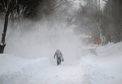
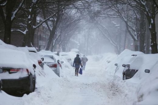
Gov. Charlie Baker asked Bay Staters to stay off the roads on Sunday as another powerful winter storm pounded the region.

"Driving conditions will be very difficult and we continue to urge everyone to stay off the roads for the entire day," Baker said in a morning news conference.

Boston measured 16.2 inches of snow in the storm, making this winter the city's third-snowiest on record. Blizzard conditions were verified in Chatham, Plymouth, Hyannis, Martha's Vineyard and Falmouth, where visibility was one-quarter of a mile or less with 35 mph-plus winds for three hours or more.

"There's a little bit of déjà vu all over again," Baker said.

The snow was expected to stop by midday, but the central and eastern parts of the state are under a blizzard warning through Monday morning because high winds will blow snow and reduce visibility.

With the storm falling on a weekend and students set to start February vacation on Monday, no travel ban was issued.

"The most important thing people need to do today is stay safe and take care of themselves," Baker said. "Someone who gets trapped out there. . . it's just going to be a very bad day to be on the roads."

MBTA service was suspended for the entire day on Sunday, and a decision will be made in the afternoon on Monday' service. Flights are not expected to leave or arrive at Logan Airport before mid-afternoon.

Transportation Secretary Stephanie Pollack said more than 3,000 pieces of equipment are treating the roads.

"We're going to need time," she said. "Just because it stops snowing in your area does not mean you should clear your car out and get out there right away."
Snowflake

Another push of arctic air to freeze Midwest, Northeast U.S. this week

Image
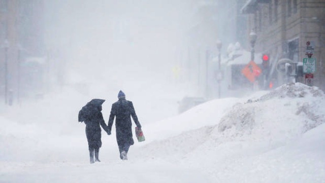
Old Man Winter will be unrelenting across the Northeast and Midwest this week as yet another blast of arctic air dives into the regions.

This next push of arctic air is expected to bring air that is just as cold, or even colder than the air that brought subzero lows to the Midwest and Northeast during the weekend.

Millions will shiver from Chicago to New York City as record lows are challenged during this bitter blast. Records may also fall across parts of the Southeast where temperatures manage to fall into the teens and single digits.

Floridians will even experience a taste of the arctic chill with temperatures dipping down to the lower 30s in cities such as Orlando.

The worst of the cold is expected to focus on the Midwest on Wednesday before shifting east over the Northeast for Thursday.

AccuWeather.com RealFeel® temperatures below 0 F will be common across the regions during the daytime hours, including cities along the Interstate 95 corridor. These values can then drop by as much as 20 degrees during the overnight hours, making for a bitterly cold morning commute.

It is possible for some snow showers or flurries to accompany the arrival of the harsh cold, especially across the Tennessee and Ohio valleys. This could drop a few inches of snow, leading to some slick travels.

Snow showers are also likely to develop downwind of the Great Lakes late in the week even though the lakes are quickly becoming covered in ice.

Cloud Lightning

Weatherman goes berserk over 'thundersnow' in Boston

Image
Cantore stands in front of the camera as a Thundersnow bolt of lightning strikes
It's always nice to see a man enjoying his job.

Just take the Weather Channel's Jim Cantore as an example. The 51-year-old meteorologist displayed the infectious enthusiasm of a child while reporting on Sunday's blizzard in Massachusetts, US.

In the video below, which has gone viral over the past 24 hours, Cantore can be seen tramping around in knee-deep snow when the screen suddenly flashes pure white in a rare example of 'Thundersnow' - when lightning occurs during snowfall.

"Oh yes! Yes! Yes!" he exclaims. "We got it baby! We got it! We got it! Woo! Woo! We got it! Yes! Listen to that! Listen to that! Oh baby!"

Just as Cantore begins to regain his composure, the screen again flashes white, setting the excitable weatherman off on another bout of wild celebration. "Oh again! Again!" he shouts, throwing a handful of snow into the air. "That's a two-fer. That's a two-fer, baby. Oh my goodness!"

Four further flashes illicit similar exultations, as the meteorologist gives up any pretence of hiding his excitement.


Snowflake Cold

Record setting snow and brutal cold cause New Hampshire town to cancel ice carnival

cambridge MA blizzard
© Reuters/Brian Snyder Pedestrians make their way along a snow covered street during a winter snow storm in Cambridge, Massachusetts in this file photo taken on February 9, 2015.
Following a series of record-setting snowfalls, New England on Friday got a new metric for how severe its winter has been: The town of Alton, New Hampshire called off its annual ice carnival due to a forecast calling for more snow and brutal cold.

"It'll be zero degrees and blowing snow, and that's not a good time for everybody," said Roger Sample, who owns a construction business in the town on the shores of New Hampshire's Lake Winnipesaukee and serves as the carnival's chairman.

The carnival, which Sample said has been held for more than two decades, typically draws about 1,000 visitors out onto the frozen lake's Alton Bay for games and rides, as well as to see small planes that land on the ice.

Comment: The northeast USA cannot seem to get a break from the record setting cold and snow, which shows no promise of ending soon:


Ice Cube

Ice breaker rushes to free vessel stuck in thick ice during Antarctic summer

Image
© AP
Coast Guard Cutter Polar Star opens a channel through the ice.
Australian 207-foot ship, the Antarctic Chieftain, hit ice up to 10 feet thick and suffered propeller damage near the Ross Sea

A rescue vessel is rushing to free a damaged Australian fishing ship with 27 people aboard which has become trapped in thick Antarctic ice.

The 207-foot ship, the Antarctic Chieftain, suffered propeller damage after hitting a chunk of ice on February 7 in an isolated region near the Ross Sea, south-east of New Zealand. The ship, which is used for harvesting Patagonian toothfish, became stranded in ice floes up to 10 feet thick and lacked the power to break free.

Les Scott, managing director of Tasmanian-based Australian Longline, which owns the ship, said an underwater video inspection showed three of the four propeller blade tips were damaged. None of the crew has been injured.

Igloo

Valentine's weekend blizzard to rage in Northeast; bitter cold, powerful winds, whiteout conditions possible

Image
A storm moving through the Northeast during the Valentine's Day weekend will develop into a blizzard with snow, fierce wind and bitterly cold air.

While the first of two clipper storms this week will stay weak until swinging east of New England, the second clipper storm rolling in this weekend will strengthen significantly.

People on weekend ski trips or partaking in other travel from the Great Lakes to New England will run the risk of getting stuck in the storm and the frigid air moving in.

According to AccuWeather.com Senior Meteorologist Henry Margusity, "The storm could bring life-threatening conditions, especially in New England with very low temperatures and strong winds combining with snow to bring blizzard conditions."

Initially, light snow will move across the Midwest Friday night into Saturday. However, winds will increase after the snow begins as bitterly cold arctic air arrives and AccuWeather RealFeel® Temperatures plunge below zero F.

The snow and increasing wind will move into the central Appalachians during the day Saturday and will reach the Interstate-95 corridor in the mid-Atlantic and southern New England Saturday afternoon and evening.

Image
As the storm reaches the Atlantic Ocean Saturday night, it will strengthen.

The storm has the potential to bring a moderate to heavy snowfall from the upper part of the mid-Atlantic to southern and central New England Saturday night into Sunday.

Ice Cube

Frigid air to bring harshest winter conditions to Midwest, East through mid-February

Image
Waves of arctic air will bring the lowest temperatures and the harshest conditions of the winter from late this week through the middle of the month.

The arctic air will be pushed along by a couple of Alberta Clipper storms with rounds of light snow in parts of the Midwest and the potential for a couple of heavy snow events in part of the coastal Northeast.

In perspective, the benchmark low, or the coldest it has been thus far this winter, in New York City was 8 F, on Jan. 8. On that same day, the temperature dipped to minus 2 F in Detroit, minus 1 F in Boston, 11 F at Atlanta and 12 F at Washington, D.C.

Like the frigid air during early January, the waves of arctic air moving in could bring disruptions to some of the trains in the northern cities. The prolonged cold penetrating deep into the ground could also cause water main breaks from the Midwest to the Northeast.

According to AccuWeather Meteorologist Brian Lada, "The combination of frigid air will not only be painful to endure for short periods of time outdoors but can bring life-threatening conditions for those not properly dressed."

The dangers will range from difficulty breathing to frostbite and hypothermia.

The first blast of arctic air will sweep from the Midwest to the Atlantic coast through the end of the week.

During multiple days, temperatures will not climb above zero F in northern Minnesota and part of northern Michigan.

While on the coldest days temperatures will climb into the single digits and teens from Minneapolis to Chicago, Detroit, Pittsburgh and Boston, AccuWeather RealFeel® Temperatures will be below zero for many hours on multiple days. Actual nighttime low temperatures will dip below zero on occasion.
Image

Comment: In January, an extraordinary amount of snow was dumped all over the world. It looks like February might do the same.

Checkout the latest SOTT Summary Video - January 2015: Extreme Weather, Earth Changes, and Fireballs