Extreme Temperatures
The brutal weekend heatwave has continued in large parts of the country's east and south, with temperatures reaching well into the mid-forties in central NSW, Queensland and South Australia.
The Bureau of Meteorology issued an extreme heatwave warning on Tuesday after temperatures peaked as high as 18C above average.
On the other end of the scale, snow is due to hit alpine regions in Tasmania on Wednesday.
As originally reported by sify.com, the city of Shimla, Himachal Pradesh was greeted with a fresh spell of snow and sub-zero temperatures on Thursday, November 26 (see featured image), with Keylong district clocking the northern state's lowest temperature, a nippy -2.6C (27.3F).

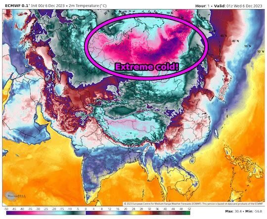
The forecast heat map for the first day of summer with a renewed heatwave across inland eastern Australia
Sydney CBD surpassed 40 degrees Celsius (104 F) on Saturday while swathes of western New South Wales, South Australia and northern Victoria baked through even higher temperatures nearing 45 degrees.
Temperatures are expected to cross 40 degrees for a second straight day on Sunday while the Bureau of Meteorology has predicted a five or six-day heatwave for parts of northern New South Wales and southeast Queensland.

A member of Ulkatcho First Nation measures the snow on Friday, Nov. 27, 2020 showing that more than 60 cms of snow has fallen since a snowfall warning went into effect for northern portions of the Chilcotin on Thursday
More than 60 cm of snow has fallen in parts of the Chilcotin since a snowfall warning went into effect Thursday, Nov. 26.
On Friday afternoon Graham West, a member of Ulkatcho First Nation near Anahim Lake, forwarded a photograph to the Tribune depicting a measuring tape with a snow level of 64 cm or two feet and one inch.
"Just got word the RCMP are on a snowmoblie with a nurse delivering meds to clients within the community," he said.
Earlier in the afternoon West said he hoped to get up on his roof to shovel because the snow was getting heavier.
Comment: More about Solar Cycles and their influence on the Earth's climate:
- NASA announces Solar cycle 25 has begun, will be weakest since records began in 1755
- The solar retrograde cycle and ice ages
- Ice Age Farmer Report: CORN SHORTAGE: Grand Solar Minimum kills crops (New study)
- Solar Minimum increases atmospheric radiation by +15%, reaching a 5-year high
- Brilliant pink auroras are dazzling the Arctic Circle amid an ongoing solar storm
- Adapt 2030 Ice Age Report: Solar, economic and ice age cycles
- Professor Nils-Axel Mörner: 'The approaching grand solar minimum and little ice age conditions'
Denver International Airport tallied 5 inches of snow. This is a record daily snowfall for Nov. 24, breaking the old record of 4 inches set in 1946. Even more notably, it was the first daily November snow record to fall in the city since 1994. Snow totals across the rest of the metro area generally range from 3 to 6 inches, with heavier amounts up to 10 inches in the western suburbs.
This was a rare November snowstorm in the Denver area beyond the record-breaking amount. Another rarity lies within the heavy and wet nature of the snow.
A record-setting blizzard shut down parts of Labrador, forcing the closures of roads, provincial government offices and flights Tuesday, as well as schools in Happy Valley-Goose Bay, North West River and the regional College of the North Atlantic campus.
The potent low had already slammed Ontario and Quebec with a blast of widespread, heavy snow last weekend, and also brought strong winds and heavy rains to Newfoundland through Tuesday.
Comment: See also: