Extreme Temperatures
S


Snowflake

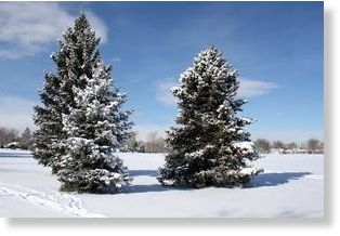
First snowfall of Northern winter freezes Russia and Poland

Image
The first snowfall of winter in Europe has fallen in Russia and Poland, with freezing temperatures being recorded earlier than usual.

Heavy snow fell throughout Poland, in what some are calling an "early winter", leaving three people frozen to death. The snow cut power supplies to about 70,000 in the Warsaw area and caused transport delays across the country. During the night, snow clearing machines were used to make roads drivable and workers spent the evening shoveling snow from pavements.

In Moscow, melting snow resulted in areas of the city, including parks and some of the central squares, becoming waterlogged.
Image

Snowflake

First measurable snow in Valdez, Alaska, occurred 17 days earlier than last season

Valdez, Alaska snow
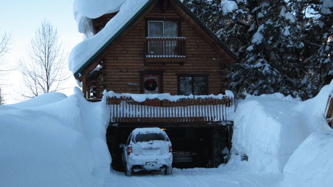
© UnknownSnow surrounds this home in Valdez, Alaska on Jan. 9, 2012.
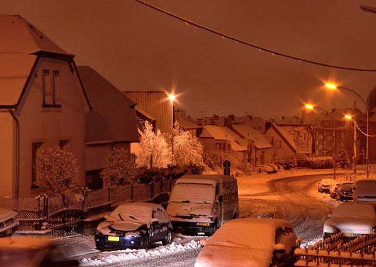
Why on earth are we starting off with the photo above? It's not January!Saturday, Valdez, Alaska, America's snowiest city, witnessed its first measurable snow of the season, picking up 1.6" accumulation. This may have inspired a sense of dread in the area, given last season.

A whopping 438" of snow fell in Valdez last season. That's 36 feet of total snow accumulation! The 2011-2012 season delivered over 100" above the average (326").

In fact, after a whopping 98" of snow fell just in the first 12 days of January 2012, the National Guard had to be called in to help rescue folks buried in both Valdez and nearby, Cordova, AK. Incredibly, snow invaded a home of one unlucky Valdez resident.

Here's the kicker. Yesterday's first measurable snow in Valdez occurred 17 days earlier than last season. Of course, there's no predictive value to this, much as an early start to the hurricane season doesn't usually say much about the rest of the season.
Snowflake Cold

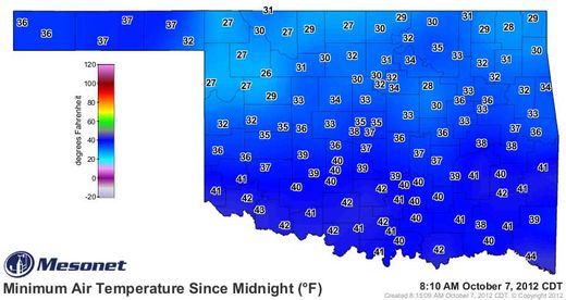
Freeze in Tulsa, Oklahoma the earliest EVER!

Image
© newson6.com
After a very chilly weekend, we're in store for a modest warm up today and tomorrow before another weak cold front passes the area Tuesday night. The end of this week will feature a very active weather pattern, including the threat of severe storms across the southern or central plains.

The weekend cold snap is just about over. Low temps this morning in the 30s will be replaced with highs in the upper 60s this afternoon along with sunshine and south winds. Temps Tuesday will move into the mid or upper 70s along with gusty south winds, but a cold front will pass the area late Tuesday evening bringing highs back down into the upper 60s to near 70 Wednesday afternoon.

Igloo

Snow and unseasonably cool weather hits New South Wales

Image
Snow has fallen across New South Wales and the ACT as a cold snap hits the region. The unseasonal weather saw residents in areas including the Blue Mountains and southern tablelands waking up to snow on Friday. There is also snow around Canberra, following the coldest October day there in more than 40 years. There was a maximum temperature of 8C in the Canberra area on Thursday, 11 degrees below the October average and the coldest since 1967. Overnight snow fell in the hills between Canberra and Bungendore and in areas around Goulburn and Crookwell to the north.

The Bureau of Meteorology said many areas could see snow, frost and hail as the result of a low pressure system moving across NSW. "We've had quite a few reports of snow. We're expecting snow down to 700m over many parts of the state," said meteorologist Julie Evans. There has been 2.5cm of snow on the ground reported at Nerriga, in the southern tablelands. In the Blue Mountains, snow has been falling between Blackheath and Katoomba.

Snowflake Cold

Snow causes havoc across eastern Australia -- Video


The Bureau of Meteorology says snow falls have occurred right along the Great Dividing Range and as far north as Queensland's Granite Belt.

At its height, snowfalls of 15 centimetres and wind damage cut roads and rail access to the upper Blue Mountains for more than six hours.

In the Blue Mountains, 300 cars were stranded by the mountain road closures.

But the SES's Jennifer Finlay says most of the 550 calls for help came from further to the south.

"The Illawarra south coast got hit pretty hard with lots of trees down a bit of roof damage, fortunately nothing too severe," she said.

Endeavour Energy reconnected more than 2,000 properties to power on Friday afternoon, but hundreds of outlying properties between Mount Victoria and Medlow Bath and in the Megalong Valley will not get power back until Saturday.

With temperatures predicted to get down to 3 degrees Celsius overnight, the company has urged people in areas where the power is out to check on neighbours who live alone.

Comment: Note how the meteorologist claims "it's not unprecedented" because there were similar conditions in 2008. Well that's alright then! Nothing to worry about!


Ice Cube

Surprise! Now there's more ice at South Pole than ever (So much for global warming thawing Antarctica!)

Ice around the South Pole has expanded to cover a record area, scientists revealed yesterday - a month after saying that the North Pole had lost an unprecedented amount of its ice. Researchers say - rather confusingly - that both occurrences are down to the 'complex and surprising' effects of global warming. The record Antarctic sea ice cover was revealed in satellite images from the US National Snow and Ice Data Center in Colorado.
Image
September 26, 2012, when ice covered more of the Southern Ocean than at any other time in the satellite record.
At the end of the southern winter in September, ice covered 7.51million square miles of sea - more than at any time since records began in 1979. For the last 30 years the amount of Antarctic sea ice has been increasing by 1 per cent each decade. While the rest of the world has been getting warmer over the last 50 years, large parts of the Eastern Antarctic have been getting cooler. Scientists say a cooler Antarctic fits in with the unpredictable nature of climate change.

Comment: For more on 'global warming', read: Climate Change Swindlers and the Political Agenda


Igloo

Australia storm gives rare snow: First October snow in a century


An unusually cold storm in southern Australia has dished out the first October snow in a century.

Snow whitened the ground along the Mount Lofty and southern Flinders ranges, east and north of Adelaide, South Australia, the Australian ABC News website said.

Images published Thursday on the ABC website showed snow-covered ground at Hallett, in an upland valley north of Adelaide. Posted videos showed falling snow in the hills east of Adelaide.

At low elevations, rain fell late Wednesday to early Thursday at temperatures in the lower to middle 40s, weather data available to AccuWeather.com showed.

Normal low temperature in Adelaide is about 50 degrees, whereas the typical high is in the lower 70s.

Snowflake

Arizona October Snow? Strong fall storm headed for northern Arizona

Image
A strong fall storm moving into Arizona on Thursday is expected to drop up to three inches of snow in the higher elevations. The National Weather Service said the greatest likelihood of severe storms will be from Thursday evening through Friday morning. Daytime temperatures Friday will be about 15-20 degrees cooler than earlier this week.

Up to three-quarters of an inch of rain is expected in some areas, with the possibility of tornadoes.

Forecasters said snow levels could drop to as low as 7,500 feet on Friday. The Kaibab Plateau, San Francisco Peaks and the White Mountains could see between one inch and three inches of snow.

Cloud Lightning

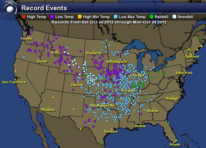
Shhhh, the Media doesn't want us to see this - "Some spots were 25-30 below normal, breaking record-cold lows. Some records over 100 years old!"

100-year-old cold records broken, but nary a word. "An incredible departure from normal happened with yesterday's lows out there," says reader Ralph Fato. "Some spots were 25-30 below normal, breaking record-cold lows. Some records over 100 years old!"
Image

Snowflake

Minnesota and North Dakota see new snowfall records and power outages in October

An early season snow event produced significant snow amounts for northeast North Dakota into northwest Minnesota for early October. The heaviest snow fell in Roseau county where around a foot of heavy wet snow has been reported as of 3 pm Thursday October 4. This heavy wet snow has also produced numerous power outages across this area.

These snow amounts appear to be record amounts for this early in the season for many areas. The previous record snowfall for October 4 or earlier at the NWS in Grand Forks was 2 inches on October 2, 1950. The NWS at Grand Forks reported 3.5 inches of snow with this storm on October 4, 2012. While records from around the area indicate that the October 2, 1950 storm produced about 2-5 inches around the region with localized higher amounts, with Leeds, ND receiving 7.0 inches on October 2, 1950, and Hallock 4.5 inches.