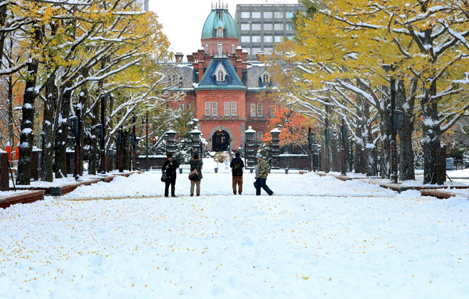
Extreme Temperatures
Temperatures up to 22C meant thousands flocked to beaches around the South and South West Coasts.
But they were greeted with a strange sea mist.
The "haar" or "sea fret", as it is known, is caused by warm air condensing over the cold sea and creating a fog. It is typical for this time of year but more pronounced than usual as the air is so warm and the sea is so cold following the coolest April for 24 years and the coldest March for 100 years.
The sea fog was worse over the south coast and south west as the wind was blowing the fog onto land. Today (Tues) the hear is more likely to settle over the north and east, where it is more common, as the wind changes direction.
Calum Maccoll, forecaster at the Met Office, said the sea was unusually cold.
"The sea temperature is 9C, it should be in the double figures but the cold March has brought it right down.
"As it takes a long time to warm up it is colder than it normally would be at this time of year, and as mild air is passing over the surface, mist is being created."
The storm will continue to drop accumulating snow through Friday morning and reaching even more unlikely locations over the Plains, Midwest and the South before it is all said and done.
Omaha, Neb., Mason City, Iowa, and Rochester, Minn., are but only several cities that have been clobbered by their biggest May snowfall on record. In many cases in the major cities in the Plains, those records date back to the 1800s.
While snow is not unheard of away from the Rockies and northern tier states during May, it is the amount of snow and the extent of that snow that is so unusual. Snowstorms during May in the Midwest are typically highly localized.
Minneapolis/St. Paul managed to avoid the heaviest snow from this storm. However, areas less than 50 miles to the southeast of the Twin Cities received between 6 and 12 inches of snow Wednesday night into Thursday. As much as 18 inches fell on part of southeastern Minnesota and northwestern Wisconsin.
The heaviest snow had moved east of Hayward at noon but was still falling in Park Falls, Ironwood and Ashland.
The Wisconsin Department of Transportation earlier advised no travel because of heavy snow on U.S. Highway 53 between Spooner and Gordon; U.S. Highway 63 from Spooner to Hayward; and state Highway 70 from Stone Lake to Siren.
Other highways are reported to be snow-covered, including U.S. Highway 2 east of Iron River.
The unusual May snowstorm moved just south and east of the Twin Ports but hovered over southeastern Minnesota, north-central Wisconsin and into Washburn, Bayfield, Ashland and Iron Counties where up to 14 inches fell overnight.
The NFSCo figures show 64,000 more animals died on farms in England, Scotland and Wales between January and April 2013 compared with the same period 12 months ago. It is a rise in deaths of more than 24%.
In addition to this, Northern Ireland recorded stock losses of 29,000 in the blizzards at the end of March. A further 8,000 animals died on the Isle of Man, taking the toll to 101,000 animals over the four-month period.
A statement released by NFSCo pointed out that the figures excluded animals collected privately and those categorised as "special services" by collectors.
Special service operations are carried out by collectors where losses are more numerous than normal, the NFSCo statement said.
"Consequently the figures here will be a minimum, and will increase as new data is received," it warned.
The toll
English, Scottish and Welsh sheep losses in April were 50% higher than April 2012 costing 35,000 extra lives
Welsh cattle losses in April were more than double 2012's equivalent to almost 2,700 head
Cattle losses in England and Scotland in April were about a quarter more than 2012 (23% and 25% to 13,800
and 9,700 head respectively)
Cattle losses for England, Scotland and Wales were up 34% and more than 7,000.
Duluth, Minn., for example, has seen 51 inches (130 centimeters) of snow this April. That's not only the most snow the town has seen in any April - breaking the old mark of 31.6 inches (80 cm) - but the most snow the town has received in any month, ever, according to government records. As of Monday (April 22), a total of 995 snowfall records have also been broken so far this month, according to AccuWeather. Over the same time period last year, 195 snowfall records had been broken.
More than 91 percent of the upper Midwest also has snow on the ground as of today (April 24), meteorologist Jason Samenow wrote at the Washington Post's Capital Weather Gang blog. "Snow cover in the previous 10 years on this date hasn't even come close to reaching this extent (ranging from 19 percent to much lower)," he wrote.
So why has spring failed to take hold? Blame the jet stream.
The record snow and below-average cold is due to a trough or dip in the jet stream, which has brought blasts of freezing air as far south as the Mexican border, said Jeff Weber, a scientist with the University Corporation for Atmospheric Research in Boulder, Colo.
As with the Lower 48 states, spring is late and cold here in central Alaska. Fairbanks reported a record low of 2 degrees F above zero Sunday, breaking the previous record of 8 from 1924.Story here: http://www.adn.com/2013/04/29/2883299/interior-alaska-sees-record-breaking.html
Here in Anchorage, looks like we are around 3 - 4 weeks late with ice of local lakes and snow off the ground. Winter was not particularly hard, but it all changed with a very cold April. And at this point it does not appear things will be warming up soon. So much for manmade global warming due to carbon dioxide emissions.
Yes, have a look at the image at right.
Here is a complete list of record lows for Alaska in the past 7 days, 996 new record lows were set (click low temp and details tab):
http://wx.hamweather.com/maps/climate/records/7day/usak.html?cat=maxtemp,mintemp,snow,lowmax,highmin,
Cities such as Rapid City, S.D.; Duluth, Minn.; and Boulder, Colo., have all endured their snowiest month ever recorded. (In all three locations, weather records go back more than 100 years.) In fact, more than 1,100 snowfall records and 3,400 cold records have been set across the nation so far in April, according to the National Climatic Data Center. Unfortunately for warm-weather lovers, after some mild temperatures the past few days, the chill is forecast to return as the calendar turns to May: Accumulating snow is forecast overnight Tuesday night and Wednesday in Denver and in Minneapolis-St.Paul by Wednesday night and Thursday, said AccuWeather meteorologist Mark Paquette.
Spain has been struck by unseasonal weather which has seen snow falling across the country.
Extreme weather warnings are in place in 18 provinces, with small roads blocked as temperatures continue to hover around freezing.
Simon McCoy reports.
The UK Met Office long term Central England Temperature record has kept a continuous and consistent data set since the 1660s. It appears to be reliable and to have maintained its quality. It has not been adjusted as have so many other official temperature record.
Although the CET record covers only a small part of the northern hemisphere, it has shown a consistent rise since the end of the Little Ice Age in 1850 at a rate of about +0.45°C/century or about +0.67°C in the last 150 years. This rise accords well with other temperature records.
However since the year 2000, diminishing solar activity in solar cycle 24 (moving back towards little ice age patterns) appears to be having a real effect.

Hedgehog emergence is a month behind where it was in 2011 and 2012, suggesting that it is likely to have been a particularly difficult winter for this declining species.
Difficult winter
The latest results from the British Trust for Ornithology's (BTO) Garden BirdWatch show that Hedgehog emergence is a month behind where it was in 2011 and 2012, suggesting that it is likely to have been a particularly difficult winter for this declining species. The weekly 'reporting rate' graph (below) shows how the cold weather of February and March held emergence back, underlining that Hedgehogs are only now emerging from hibernation.