Extreme Temperatures
Cortina d'Ampezzo (Belluno ) has been without electricity since early morning due to exceptional heavy snowfall that is creating considerable discomfort around the Cadore.
The fresh snow has reached half a meter in height, closing several roads leading to Ampezzo and Cortina, which are currently only accessible from the main road. Mountain passes are closed.
On Falzarego six people were trapped in their cars by the snow and were recovered by rescuers and taken to the shelter Col Gallina.
Even the tourist town of Madesimo (Sondrio ) in high Vallespluga remains isolated from the rest of Lombardy for the entire night because of heavy snowfall .
On the whole alpine it has been snowing copious hours without a break, and is still snowing heavily.
"Exceptional" snowfall in Cortina d' Ampezzo, Italy
Thanks to Dr Mirco Poletto in Italy for this link
"There will be enough snow, that issue doesn't disturb us," head of the Russian Weather Service, Rosgidromet, Alexander Frolov told reporters, reports Xinhua.
On the contrary, he said, there are concerns that heavy snowfall could seriously disrupt the competition in Sochi.
He warned that weather in that subtropical zone is very volatile and snowstorms there, once started, might last for two or three consecutive days .
In December, the Russian Emergency Situations Ministry has once issued an avalanche warning in Sochi, anticipating blackouts, disruption of communications, housing services and transportation in the mountainous area.
Source: IANS
A scientific mission ship, trapped in dense pack ice off East Antarctica since Christmas Day, is close to being rescued as a Chinese icebreaker nears.
The crew can see the Snow Dragon icebreaker, which will try to cut a path through the ice allowing the research vessel to reach open water.
The Russian Academic Shokalskiy ship has 74 on board and is being used by the Australasian Antarctic Expedition.
They are following the route explorer Douglas Mawson travelled a century ago.
One of the leaders of the expedition, Chris Turney, tweeted an image of the Snow Dragon icebreaker on the horizon as it approached the ship.
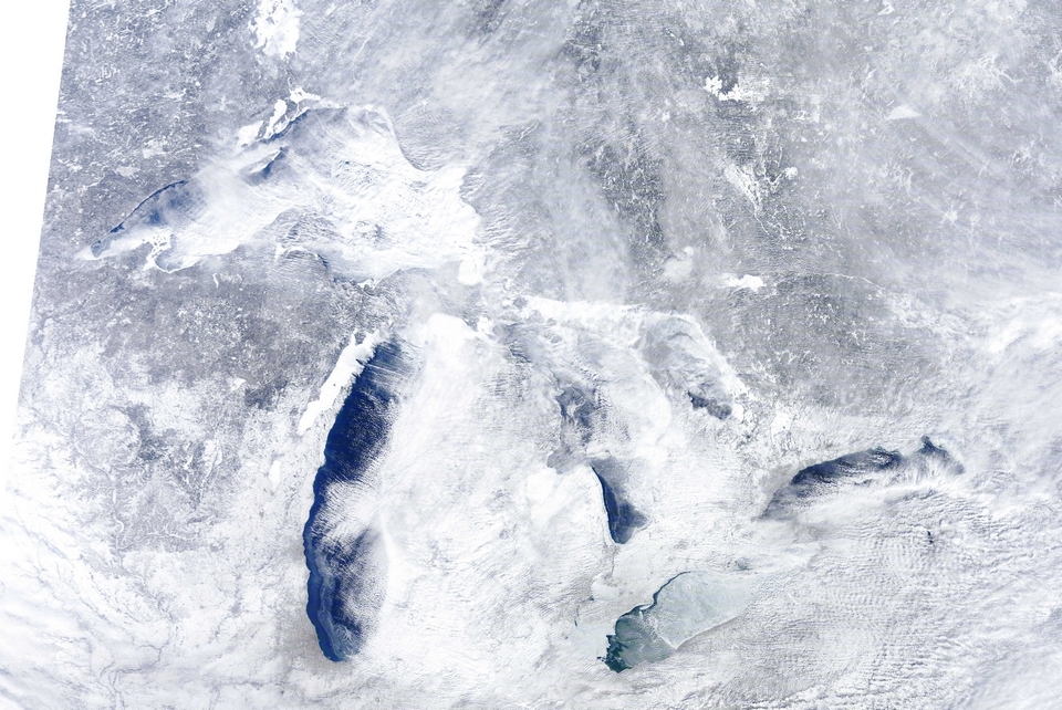
The US National Weather Service said more snow was expected to move into the Northern High Plains and Central Rockies on Tuesday before rolling into the Great Lakes and Midwest by Wednesday morning.
In Canada, five people were reported dead from apparent carbon monoxide poisoning. Police said two people in Ontario died after using a gas generator to heat their blacked-out home northeast of Toronto. Police in Quebec said carbon monoxide poisoning was believed to be the cause of three deaths in a chalet on the province's North Shore. Earlier, five people were killed in eastern Canada in highway crashes blamed on severe weather conditions.
In the US, the nationwide death toll from the storm reached at least 14 on Tuesday, when a 50-year-old man in Knox, Maine, was overcome by carbon monoxide fumes from a generator. It was the second reported death attributed to fumes from a generator during the storm. Police in Michigan also attributed two deaths in a traffic collision that happened Monday to the storm.
As temperatures plunged into the low single digits (below minus 15 Celsius) in Toronto - where some 90,000 customers remained without power Tuesday - authorities reported a dramatic jump in calls for suspected carbon monoxide poisoning, responding to 110 calls in a 24-hour period. Officials said they typically see 20 such calls a day.
As of Dec. 15, snow covered 53 percent of the Lower 48, the National Oceanic and Atmospheric Administration (NOAA) reported. That's a significantly higher portion than in recent years. In 2006, for example, snow covered just 12 percent of those states on the same date, according to Climate Central, a climate news Web site.
November and early December have also been quite chilly for much of the country, below the 20th-century average, Climate Central noted. "With the noteworthy exception of Alaska, nearly every state was affected by the unusually cold air at some point during the November-to-December timeframe," Climate Central reported.
What's going on?

The M6 motorway in Cheshire: driving conditions are expected to worsen over the next 24 hours.
Gusts of up to 90mph are forecast in some areas on Monday and Christmas Eve, as heavy rainfall sweeps into south Wales and south-east England. The wintry showers have increased the possibility of a white Christmas in parts of Britain, with odds slashed in cities including Edinburgh, Glasgow and Manchester.
The Met Office issued a severe weather warning from dawn on Monday and advised travellers to brace themselves for chaos on the roads and rails.
"There is scope for very heavy rain, potentially some localised flooding, and strong winds in some areas so there is a risk of travel disruption," said Calum MacColl, a Met Office forecaster. An amber alert for rain was issued for south Wales and parts of southern England on Sunday, with conditions expected to worsen over the next 24 hours due to a low-pressure weather system swept in from across the Atlantic.
"[Monday] will start quite nicely in some places, but there will soon be heavy outbreaks of rain in the south-west of England and south Wales. That will quickly move into the north-east, and will bring gales with it."

This is a Weather Underground forecast for Saturday, Dec. 21, 2013, for the U.S. A storm will produce showers and thunderstorms from Texas to Tennessee. Rain will be likely from the southern Plains to the Ohio Valley and portions of the Northeast. Snow will fall from the central Plains to Lower Michigan and northern New England.
Some of the millions of people who hit the roads and airports by midday Saturday squeaked through before any major weather had hit, but the cancellations and flight delays started to mount as the afternoon wore on.
Forecasters warned motorists that roads that seemed passable one minute could turn treacherous the next, as a cold blast on the storm's back end turns rain to ice and snow.
The system's strange swirl of winter and spring-like conditions produced starkly different weather at times in areas separated by a couple hundred miles. While drivers in Oklahoma and eastern Missouri were navigating ice-slicked streets Saturday, residents in Memphis, Tenn., were strolling around in T-shirts in spring-like temperatures in the mid-60s.
Numbers released by the Florida Fish and Wildlife Research Institute in St. Petersburg this week showed the number of dead manatees at 803 as of Dec. 13. That's about 16 percent of the state's estimated population of 5,000 manatees.
And 173 of the dead were breeding-age female manatees, Martine DeWit of the institute's Marine Mammal Pathology Laboratory said Thursday.
Although it's too soon to say how this will affect the future of the species, she said, "It must have an impact to lose these important breeding females."
For comparison, last year's total number of manatee deaths was 392, which is more in line with what's normal.
The old record for manatee deaths, set in 2010, resulted from a lengthy cold snap that killed hundreds of manatees, pushing that year's number of deaths to 766. That cold snap mostly affected younger manatees that had not yet attained breeding age, DeWit said.
This year's record die-off was driven by two causes - one of which remains a mystery.
The online Thailand pattayamail.com reports "Hundreds of thousands of residents of northern and northeastern Thailand are suffering from the current cold snap, with many areas having been declared disaster zones. [...] Some 100,000 people are suffering from the cold and in need of winter clothing. "
The German language thailand-tip.com reports that the "Meteorological Institute forecasts temperatures in the north to fall another 4 - 7°C by Thursday."