Extreme Temperatures
S


Cloud Precipitation

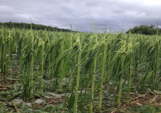
Servere hailstorm causes damage to crops in Northeastern Wisconsin

Image
© Samantha Hernandez/Door County Advocate Growing corn shorn from its stalks along Walker Road in the town of Sevastopol after a localized hailstorm ravaged crops Monday night.
A severe hailstorm caused significant damage to crops in northeastern Wisconsin, farmers and researchers said.

Matt Stasiak, an agricultural researcher, tells the Door County Advocate the hail crushed cherry trees, grapevines, winter wheat, corn and other crops in Sevastopol on Monday night.

"A lot of foliage was stripped right off the cherry and apple trees," he said. "I saw some corn that had been ripped down to the stalks."

Stasiak also said five or six unfinished experiments at the Peninsular Agricultural Research Station were ruined. His team will have to wait until next year to repeat them.

A farmer tending to 60 acres of corn said the storm reduced the crop to one foot tall from four feet. The farmer said he remembers a similar hailstorm that hit the area 51 years ago, but it didn't leave behind "snowbanks" like the one on Monday night.

Igloo

Quiet sun: Current solar cycle one of weakest in over a century

solar cycle 24
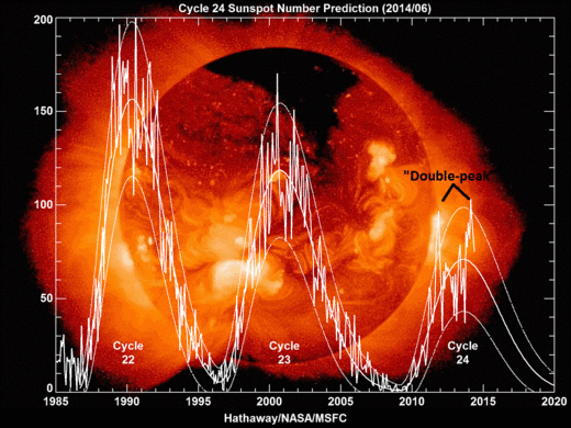
Ten days ago, the sun was quite active and peppered with several large spots. Now the sun has gone quiet and it is nearly completely blank. It appears that the solar maximum phase for solar cycle 24 may have been reached and it is not very impressive. It looks as if this solar cycle is "double-peaked" (see below) which is not all that uncommon; however, it is somewhat rare that the second peak in sunspot number during the solar max phase is larger than the first. In fact, this solar cycle continues to rank among the weakest on record which continues the recent trend for increasingly weaker cycles. The current predicted and observed size makes this the smallest sunspot cycle since Cycle 14 which had a maximum of 64.2 in February of 1906. Going back to 1755, there have been only a few solar cycles in the previous 23 that have had a lower number of sunspots during its maximum phase. For this reason, many solar researchers are calling this current solar maximum a "mini-max". Solar cycle 24 began after an unusually deep solar minimum that lasted from 2007 to 2009. In fact, in 2008 and 2009, there were almost no sunspots, a very unusual situation during a solar minimum phase that had not happened for almost a century.

Comment: For more information on the electrical nature of the universe and the factors that are currently affecting the sun and the weather here on earth, read Pierre Lescaudron's new book, Earth Changes and the Human-Cosmic Connection.


Binoculars

Wrong place, wrong time: Pacific (Arctic) loon spotted in New Hampshire

Image
© Wikimedia Commons/Tim Bowman, USFWSPacific loon
An immature Pacific loon was seen at Seal Rocks along the coast in Rye on Saturday and Sunday.

This bird normally spends its summers in the Arctic making it a rare sighting in New Hampshire. It is also listed in Roger Tory Peterson's Field Guide to the Birds East of the Rockies as an Arctic loon.

It was reported as part of the New Hampshire Audubon's Rare Bird Alert for Tuesday, July 15.


Attention

The Ice Age looms: Record cold summer temperatures across many U.S. states

Image
Just scan down this list! It's amazing. Feels like October in Oklahoma, Iowa, Alabama, Michigan, Ohio, Georgia, Florida, Indiana, South Dakota, Nebraska, Minnesota, Mississippi, West Virginia, Wisconsin, Kansas, even Manitoba. Have you seen much about this in the mainstream media?

Cold front brings record-breaking temperatures to Oklahoma City

Temperatures in Oklahoma City climbed only to 72 degrees Wednesday, according to the National Weather Service. The record for the coolest high temperature for July 16 in Oklahoma City was 74 degrees, set in 1967, according to National Weather Service records.

Cold front brings record-breaking temperatures to Oklahoma City on Wednesday

Record low temperature for Sioux City, Iowa

The National Weather Service recorded a low of 49 degrees at Sioux Gateway Airport in Sioux City, breaking the old record of 50 degrees set in 1976.

After record low, Sioux City to see warming trend

Cold Breaks 128-Year Record in Mobile - Huntsville ties 69-year-old record low

Forecasters say Mobile, Alabama, has broken a 128-year-old record with a low temperature of 64 F, one degree cooler than the low of 65 F set in 1886. Meanwhile, Huntsville tied a record low for the date of 59 degrees set in 1945. In fact, temperatures ranged from the mid- to upper 50s across north Alabama.

Cold temps break 128-year record in Mobile

Sun

Where did all the sunspots go? Eerie quiet descends on the sun

Image
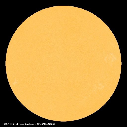
This week, solar activity has sharply declined. There is only one numbered sunspot on the Earth-facing side of the sun, and it is so small you might have trouble finding it. Click to enlarge this July 17th image from NASA's Solar Dynamics Obervatory and see if you can locate AR2113:

In case you couldn't find the sunspot's tiny decaying core, here it is.

Long-time readers absorbing this image might be reminded of 2008-2009, years of spotlessness when the sun plunged into the deepest solar minimum in a century. The resemblance, however, is only superficial. Deep inside the sun, the solar dynamo is still churning out knots of magnetism that should soon bob to the surface to make new sunspots. Solar Max is not finished, it's just miniature.

Until the sunspots return, solar flares are unlikely. NOAA forecasters estimate the odds of an M-flare today to be no more than 1%. Updates on Twitter @spaceweatherman.

Cloud Lightning

Family of four struck by one lightning bolt during unusually high numbers of "fierce thunderstorms" in Norway

Image
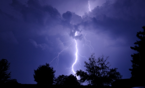
© ShutterstockLarge lightning bolt at night
Four members of the same family were all struck by a lightning bolt on Saturday in Rennebu, South Trøndelag.

Around 5pm on Saturday, a married couple, both 57 years old, and their son, 24, and daughter, 23, were all admitted to St Olav's Hospital.

The couple and their daughter suffered only minor injuries from the lightning attack, but the young man was seriously injured. He was taken to intensive care at the hospital where his condition is said to be stable. He received vital heart and lung rescue at the scene of the incident after having a heart attack.

Tore Kyllo, operation leader with the local police, confirmed to NTB: "It is a family of four that is struck. One of them got a cardiac arrest, but resuscitation made his heart beat again."

Attention

Cold weather records for July in Saskatchewan, Canada

Single digit lows recorded throughout the province

Image
© CBCFive cold weather records were set in Saskatchewan Monday morning.
Saskatchewan evenings have definitely been on the cool side lately, with at least five low temperature records falling Monday morning.

Assiniboia, La Ronge, Weyburn and Wynyard all broke July 14 records with single digit overnight lows.

Elbow, meanwhile, was colder this morning than it has been on this date since 1973.

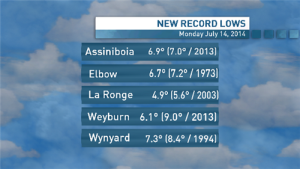
Here are the communities, their Monday low temperatures in Celsius degrees and previous lows:

* Assiniboia 6.9 (7.0, 2013)

* Elbow 6.7 (7.2, 1973)

* La Ronge 4.9 (5.6, 2003)

* Weyburn 6.1 (9.0, 2013)

* Wynyard 7.3 (8.4, 1994)

According to CBC weather specialist Farah Singh, it's all thanks to cool air sweeping down from the north, combined with clear skies that let the heat escape at night.

Sunday was cool in the evening and early morning, too, with cold weather records for July 13 set in Elbow (7.0), Meadow Lake (4.0), Moose Jaw (7.5), Rosetown (6.3), Spiritwood (5.9), Uranium City (4.8) and Weyburn (6.1)

Igloo

Record low temps hit Winnipeg in July!

Thermometer
© cjob.com
It's not the kind of record you want to be hearing about in the middle of July.

David Phillips, senior Climatologist for Environment Canada, joined Richard and Kathy on Winnipeg's Morning News. He confirms that yesterday's high, 15.7 degrees Celsius, was the coldest July 13th in Winnipeg since 1884.

He puts the reasoning behind a type of polar vortex - that cold low which is sitting over the heart of North America.

However, the good news is that it will be short lived according Phillips. He says starting tomorrow the mercury will continue to rise and by the weekend we should be hitting temps around 30 degrees.

That's, not the end of it either. Phillips forecasts the heat to continue over the next couple of months.

Snowflake

The Ice Age looms: Heavy snowfall forecast in the Alps this week

Image
More weather that is not supposed to happen.

-------------------------------------------------------------------------------------------------------------------------------------------

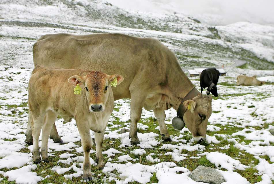
11 July 2014 - "Although summertime snowfall high up in the Alps is not an unusual occurrence, snowfall down to 6000 feet elevation IN JULY is something that wasn't supposed to happen nowadays," writes P. Gosselin on notrickzone.com.

20 inches of snow

Last Tuesday, July 8, the Swiss online Blick reported that meteorologists were predicting snowfall down to 1800 meters elevation (6000 ft.), forecasting up to 50 cm (20 inches) of snow in the Canton of Valais.

Blick writes that the snowfall presented a problem for grazing cattle, which would either have to be brought down to lower elevations or housed in mountain shelters stocked with feed.

By evening, passes were closed and avalanche warnings had been issued.

Snowflake

First ever snow falls in South Urals in mid-summer

Snowfall in South Urals
© RIA Novosti/Aleksandr Kondratuk
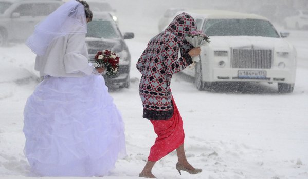
Heavy rain in the town of Zlatoust in Russia's South Urals on Sunday, July 12, suddenly gave way to a blizzard in a rare twist of weather for the summer season.

"It wasn't just rain and snow, but real snowfall with snowflakes as white as during winter. T melted quickly, of course. A fantastic sight," ITAR-TASS quotes an eyewitness, Valery Semyannikov, as saying.

In some areas of the Chelyabinsk region, snow lay 5-10 cm thick.

It's the first ever mid-summer snowfall in the South Urals.

The Chelyabinsk weather service predicted "wet and windy weather with moderate to heavy rain throughout the region, thunderstorms and soft hail in the east and ice hail in the mountains."