Extreme Temperatures
S


Snowflake

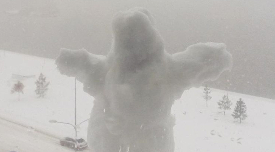
Kamchatka cut off from outside world by heavy snowfall, Russia

snow
In Kamchatka, the airport "Yelizovo" was closed due to coming to the region of a snow cyclone.

The ministry reported that a powerful cyclone from Japan hit the southern regions of Kamchatka and brought heavy snow and wind.

Rescuers were working on high alert to quickly respond to possible emergency situations. However, residents of the region do not survive because of huge snowdrifts and snowstorm.

Social networking photos and videos reveal the snow disaster.

Here some video's from Kamchatka, all posted Dec 26, 2015.


Snowflake Cold

Arctic sea ice extent sets another record

The extent of thirty percent concentration sea ice in the Arctic has reach 10 million km² in December for the first time since at least 2004.
Shown sea ice extent values are therefore recommended to be used qualitatively in relation to ice extent values from other years shown in the figure.
Arctic sea ice
© Ocean and Ice Services - Danmarks Meteorologiske Institute
Source: Ocean and Ice Services | Danmarks Meteorologiske Institut

Snowflake

Ho, ho, ho! Las Vegas, Nevada got snow

Las Vegas snow
© Via twitter@LeeCanyonLV
"Ho, ho, ho! Vegas got snow!"

That was a Christmas morning posting by the National Weather Service, heralding flurries mixed with rain showers after a windy cold front swept through the Las Vegas area.

Meteorologist Chris Stachelski noted that the trace of snow recorded at McCarran International Airport tied a Christmas Day record set in 1941. Traces also were recorded on Christmas in 1988 and 2008.

Nothing stuck on the sidewalks of the Strip, but some northwest Las Vegas neighborhoods received a dusting of snow. It melted as the morning dawned clear and sunny with temperatures in the high 30s.

Meteorologist John Salmen says the wet weather blew in with windy squalls that brought gusts up to 38 miles per hour between midnight and 2 a.m. Friday.

Snowflake

Snoqualmie Pass, Washington buried in snow; 85 inches on the ground

Sqnoqualmie Pass snow
© Cliff Mass Weather Blog
Last year, Snoqualmie Pass had very little snow and the ski areas remained shut for most of the winter.

This year Snoqualmie is being BURIED IN SNOW.

Every day at 6 AM, Washington Department of Transportation measures snow depth in the pass. Here are the latest numbers: 26 inches of snow between 6 AM Monday and 6 AM Tuesday, with 85 inches on the ground. An increase of 50 inches in 5 days. To quote Darth Vader: Impressive, Most Impressive.

The Wednesday report shows another 11 inches of new snow, but compaction resulted in only a 1 inch increase in depth.

Snoqualmie snow fall
© WSDOT
The pass has been closed several times during the past few days, with chains often required. So far this year over 12 feet of snow has fallen in Snoqualmie, eclipsing the total snowfall of the entire last year.

But it is not over. Last night, another frontal system moved through, bringing a surge of heavy snow. Here is the forecast of 72-hour snow total for the region (a circle indicates the location of Snoqualmie Pass). Another 2-3 feet!

Ice Cube

Winter storm to bring heavy snow, strong winds to West, Plains, Upper Midwest; possible blizzard conditions to High Plains

Winter Storm Goliath has been named and will spread snow from the mountains of the West to parts of the Plains, Upper Midwest and possibly New England through early next week. Some of the heaviest snow amounts may target parts of the southern High Plains where strong winds could also cause blizzard conditions.

In addition to snow, the warm side of Goliath will produce severe thunderstorms and heavy rain this weekend. For more on that story, click the link below.

Particularly Dangerous Situation Tornado Watch Issued: Outbreak of Severe Weather Underway in the South, Ohio Valley

Winter Storm Goliath will occur in two separate phases

Phase 1: Upper-level energy moving into the western states Thursday will spread snow through the mountains of the West and into parts of the northern Plains and Upper Midwest Thursday through Saturday.

Phase 2: Some of that upper-level energy will develop into an area of low pressure aloft over the Southwest and southern Plains. In response to this, a surface low pressure system will develop in the southern Plains this weekend, which combined with sufficient cold air to its north from high pressure, will result in heavy snow for parts of the southern Plains. That area of low pressure will then track towards the Midwest early next week, bringing snow to parts of that region and eventually New England.

Uncertainty remains with the details, including the exact location and timing of the snow for parts of the Plains, Midwest and New England this weekend into early next week. Below is an overview of our forecast right now, but keep in mind that changes are likely in the days leading up to the storm.

Winter Storm Goliath Storm Timing

Thursday

The upper-level energy associated with Goliath will spread snow from the Cascades of Washington and Oregon to California's Sierra Nevada and parts of the Intermountain West. Total accumulations of 1 to 2 feet are likely above 4,500 feet in the Sierra Nevada.
Christmas eve day forecast

Attention

120 cold-stunned sea turtles found stranded on Cape Cod beaches

Kemp's Ridley Sea Turtle (Lepidochelys kempii)
Massachusetts Audubon Society volunteers recovered about 120 "cold-stunned" sea turtles during the weekend after strong winds caused them to wash up on the shores of Cape Cod Bay.

The majority of the reptiles found on the beaches of Wellfleet, Truro, Eastham, and Brewster were Kemp's ridley sea turtles, a critically endangered species and the rarest type of sea turtle.

It was an unusually large late-season stranding for the turtles, who most often get stuck on Cape Cod shores around Thanksgiving as they try to make their way south to warmer waters for the winter.

Young sea turtles often feed in Cape Cod Bay during the summer but can get trapped in the "hook" of the Cape and become hypothermic as temperatures drop, according to Mass Audubon.

Fire

Extreme fire danger for Victoria, Australia: Temperatures soar to 45 degrees with strong north winds

Victoria bushfire
© 9NEWSThe Wandin North bushfire in Victoria, Australia
Victoria will roast under temperatures tipped to soar as high as 45 degrees in the state's north-west on Saturday, with Melbourne not expecting a reprieve from the dangerous heatwave until Sunday afternoon.

"Extreme" fire danger ratings have now been applied to four Victorian fire districts for Saturday, Central - which includes Melbourne and surrounds - North Central, Wimmera and South West. A further four districts are facing "Severe" fire danger conditions.

A total fire ban has been declared for the whole weekend and a number of parks have been closed. Ambulance Victoria meanwhile is bracing for what could almost be a "perfect storm" on Saturday night, due to the extreme heat and the potential for people to party too hard.

Higher wind speeds than were earlier expected, which could gust to 70 or 80km/h on Saturday and Sunday, have increased fire danger ratings.

Melbourne is expecting a staggering 41 degrees on Saturday - an unusual peak before Christmas - with northerly winds in the morning of 35 to 50km/h. The hottest temperature for Saturday, 45 degrees, is forecast for in the Mallee including the small towns of Werrimull and Underbool.

Snowflake

Daily snowfall record broken in Denver, Colorado

Snow near Loveland
© CBS4Snow near Loveland
The biggest winter storm to hit Denver so far this season has also broken a daily snowfall record for the city.

As of 5 p.m. the official measurement since midnight at Denver International Airport was 7.7″.

That is both the biggest one day snowfall so far this season and a new record for December 15.

The previous daily record for Dec. 15 was 2.8″ set in 1897.
The snowfall record for Dec 15th in Denver is only 2.8" set in 1897. 3-6" expected along the I-25 Corridor. #COwx pic.twitter.com/cClpNx0RQX

— NWS Boulder (@NWSBoulder) December 15, 2015

Snowflake Cold

Winter storm sends temperatures plummeting across western US - Arizona hits zero

Salt Lake City Snow
© AP/Rick BownerSalt Lake City on Monday, December 14, 2015.
A storm that drenched California over the weekend has turned an Arizona town into one of the coldest cities in the lower 48 while making for a rainy commute in Phoenix, where it was colder than New York City.

Here's a look at the winter weather across the West:

Arizona

An icy storm in northern Arizona left Bellemont, a small community west of Flagstaff, with a temperature of zero at sunrise Sunday - one of the chilliest temperatures in the lower 48 states at the time, said David Vonderheide of the National Weather Service.

The morning commute in the region Monday was slow as an initial band of snow showers neared an end and a second wave arrived. The Arizona Department of Transportation urged people to stay off major highways if possible.

Weather forecasters said wind gusts up to 40 mph would send snow swirling and further complicate travel.

Meanwhile, rain fell in central and southern Arizona, dropping temperatures in Phoenix to the mid-40s - some 10 degrees colder than New York City.

Bellemont's low temperatures were due to its location in a flat area surrounded by low hills where cold air struggles to escape, Vonderheide said. At 7,100 feet, it's slightly higher in elevation than Flagstaff.

"There are mornings every winter where Bellemont is the coldest in the lower 48," he said.

Utah

The state's first major winter storm dumped a foot of snow in some parts of the Salt Lake City area, creating harrowing commutes.

Comment: Weather records are being broken all over the world. Check out our latest SOTT Earth Changes Summary for November 2015: Extreme Weather, Planetary Upheaval, Meteor Fireballs.


Camera

827 villages in Turkey inaccessible due to snow

Snow Turkey
© trtturk.com
This short video reminds me of why I don't want to live in snow country.


In Van and Hakkari, roads to 827 settlements have been closed due to snow.

In Van, 317 districts are inaccessible due to snow. The Regional Directorate of Highways and Municipality snow-fighting teams continue working to open the roads.

The Directorate of Meteorology Regional in a statement reported that more snow is expected at noon, and that the temperature will fall up to 3 degrees below zero.

In Hakkari, the snow has closed the roads to 136 villages of 374 hamlets.

Comment: Cosmic karma? From two weeks ago: Snowfall shuts 290 village roads in eastern Anatolia, Turkey