Earthquakes
The New England Seismic Network at the Weston Observatory of Boston College reports quake measured 2.6 at 5:09 p.m. It was located about 4 miles south of Woodsville.
The social media site Facebook rocked with residents from Woodsville through Bath, Landaff and Lisbon reporting that they felt their houses shake for several seconds and that they could hear a loud bang. Some said they thought there had been an explosion nearby.
Sheila Brill of Woodsville, not far from the epicenter, said she was opening a door and heard a loud bang and then house shook.
"I thought at first my furnace had malfunctioned," she said. "I didn't know whether to stay inside or go outside, so I stayed inside just long enough to pour a glass of wine, which I took outside."
Emergency dispatchers at the Grafton County Sheriff's Department said there have been no reports of injury or damage.
Several residents called 911 to report hearing a loud noise and feeling the ground vibrate between 10 a.m. and 11 a.m. Thursday.
Hall County Maj. Jeff Strickland tells The Times of Gainesville that most reports were from the area of Browns Bridge and McEver Roads.
Lt. Col. James Wilson, a spokesman for Dobbins Air Reserve Base in Marietta, said the cause was probably not an aircraft coming to or from the base. He said its flight schedule does not indicate any aircraft would have been passing through the area then.
Base officials say they've received calls from local law enforcement agencies, and are still looking into the matter.
Thursday, July 07, 2011 at 09:10:52 UTC
Thursday, July 07, 2011 at 09:10:52 PM at epicenter
Time of Earthquake in other Time Zones
Location
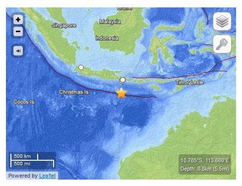
28.941°S, 176.732°W
Depth
19.9 km (12.4 miles)
Region
KERMADEC ISLANDS REGION
Distances
119 km (73 miles) ENE of Raoul Island, Kermadec Islands
346 km (214 miles) NE of L'Esperance Rock, Kermadec Islands
878 km (545 miles) S of NUKU'ALOFA, Tonga
1185 km (736 miles) NE of Auckland, New Zealand
The temblor was confirmed by Lamont-Doherty Cooperative Seismographic Network in New York, though seismologist Mitchell Gold said he had to look very hard to find the evidence. It was recorded at 6:37 a.m.
Gold said it was about 2 kilometers (1.2 miles) west of Cornwells Heights, close to where a 1.72-magnitude quake struck May 27. The largest earthquakes in the region in recent decades occurred in 1994, when two quakes measuring 4.2 and 4.6 hit Reading on the same day, Gold said.
According to the United States Geological Survey, the earthquake struck at 12.37PM on Wednesday in an area that has seen more than a dozen quakes in the last 20 years, including two very large ones in 2006 that were felt as far as Harare.
The earthquake was severe in Chipinge where panic-stricken residents scurried for cover.
No deaths or injuries were recorded, Zimbabwe's Herald Online reported on Thursday.
Zimbabwe's Goetz Observatory in Bulawayo said it was still busy putting together all readings.
The earthquake was magnitude 7.6 and occurred in the Pacific tectonic plate close to the Kermadecs. The epicentre was 160km from Raoul Island and 920km from Tonga.
The orientation of the earthquake's fault rupture was north-south and most of the tsunami energy radiated perpendicular to the fault plane.
The largest observed peak-to-trough wave-height caused by this was 1.9 metres at the two tsunami gauges at Raoul Island, operated by GeoNet. This puts the top of the wave at about one metre above the normal tide level.
GNS Science tsunami scientist Dr William Power says small tsunami arrivals, not much larger than normal 'sea noise', were subsequently observed on tsunami gauges at Great Barrier Island and East Cape.
"The mechanism of the rupture was that of a normal fault, rather than a subduction thrust event, but both can produce a large vertical movement of the seafloor."
There were no immediate reports of damage, Chief Cabinet Secretary Yukio Edano told a news conference after the 7:18 p.m. quake, which measured upper 5 on the Japanese seismic intensity scale of 7 and was followed by several aftershocks including one with a magnitude of 4.4 that occurred 16 minutes later.
All local train services operated by West Japan Railway Co. in the western prefecture south of Osaka were briefly suspended, but the quake did not affect expressways, bullet train services, or nuclear power plants, according to local officials.
The disaster prevention office of the Wakayama prefectural government said a boulder fell from a hillside in Hidakagawa, and broken windows were discovered in Hirogawa, but added no injuries or substantial damage to property was reported. The temblor registered upper 5 in both towns.
The quake struck at 7:03 a.m. Its epicenter was 131 miles east of Raoul Island, part of the Kermadec archipelago, and was only 30 miles deep, the USGS said.
The Kermadec Islands are a remote outpost that are generally uninhabited aside from a weather station and a hostel for visiting New Zealand scientists.
The U.S. Pacific Tsunami Center said that it did not yet know whether an actual tsunami had developed but said that if it had, it would hit East Cape in New Zealand within two hours and Auckland within three hours.
Tremors
"The building rocked up and down right after 10 o'clock in the morning and I felt dizzy, so I rushed to the elevator with about 60 colleagues," said a 35-year-old woman who gave her surname as Lee and works on the 20th floor. The water in plastic bottles and leaves of potted plants shook visibly, she added.
A staffer of Prime Center, the property firm managing the mall, said, "Mild tremors occurred, but we regard them as temporary since there were no signs of further tremors."
The 39-story building complex was built based on an anti-earthquake design so that strong winds can shake the building from side to side.
According to tenants, tremors were felt mainly on floors 18 to 39. But some people on the seventh and ninth floors also said they felt tremors. "I thought it was an earthquake," said an office worker on the 22nd floor who gave his surname as Choi. "At the time, people who were walking fast or talking on the phone didn't feel the tremor, but nearly everyone who was sitting down did."
No damages or injuries have been reported. According to the U.S. Geological Survey, several people in Santaquin immediately reported feeling the quake.
The USGS reports that the quake, which was less than a mile deep, struck at 9:26 p.m. Monday.
The quake was centered 4 miles south-southwest of Santaquin and 23 miles south-southwest of Provo.
Source: The Associated Press