Earthquakes
S


Seismograph

'Monster' quake recorded on Mars by NASA's InSight, largest quake ever detected on another planet

mars quake
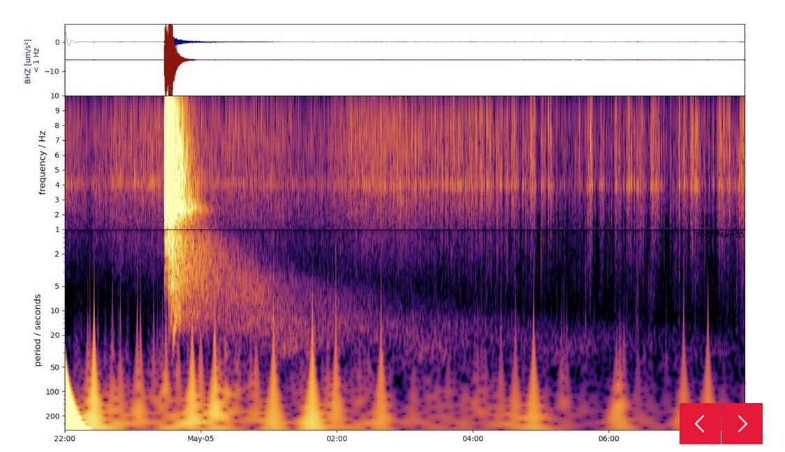
© NASA/JPL-Caltech/ETH ZurichThis spectrograph shows the largest quake ever detected on another planet. Estimated at magnitude 5, this quake was discovered by NASA's InSight lander on May 4 2022, the 1,222nd Martian day, or sol, of the mission.
NASA's InSight Mars lander has detected the largest quake ever observed on another planet: an estimated magnitude 5 temblor that occurred on May 4, 2022, the 1,222nd Martian day, or sol, of the mission. This adds to the catalog of more than 1,313 quakes InSight has detected since landing on Mars in November 2018. The largest previously recorded quake was an estimated magnitude 4.2 detected Aug. 25, 2021.


Comment: Notably the two largest were recorded more recently.


InSight was sent to Mars with a highly sensitive seismometer, provided by France's Centre National d'Études Spatiales (CNES), to study the deep interior of the planet. As seismic waves pass through or reflect off material in Mars' crust, mantle, and core, they change in ways that seismologists can study to determine the depth and composition of these layers. What scientists learn about the structure of Mars can help them better understand the formation of all rocky worlds, including Earth and its Moon.
Comment: See also: And check out SOTT radio's: MindMatters: The Holy Grail, Comets, Earth Changes and Randall Carlson


Seismograph

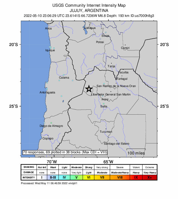
6.8-magnitude earthquake hits Argentina: USGS

MAPS
An earthquake with a magnitude of 6.8 jolted 78 km NNW of San Antonio de los Cobres, Argentina at 23:06:29 GMT on Tuesday, the U.S. Geological Survey said.

The epicenter, with a depth of 193.81 km, was initially determined to be at 23.6141 degrees south latitude and 66.7236 degrees west longitude.


Seismograph

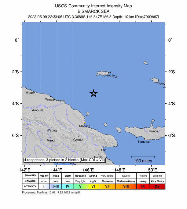
Shallow 6.3-magnitude earthquake strikes off Papua New Guinea

maps
A 6.3-magnitude earthquake struck Tuesday in the Bismarck Sea about 200 kilometres (120 miles) off Papua New Guinea's coast, the US Geological Survey said.

A preliminary USGS assessment said there was a "low likelihood of casualties and damage from the quake", which had an estimated depth of 10 kilometres. There were no tsunami warnings.

Papua New Guinea sits on the so-called Pacific Ring of Fire, which is a hotspot for seismic activity due to friction between tectonic plates.

A 7.5-magnitude quake that hit the rugged highlands region in February 2018 triggered landslides, burying homes and killing at least 125 people.

Source: AFP

Seismograph

6.3-magnitude earthquake strikes off Taiwan's coast

maps
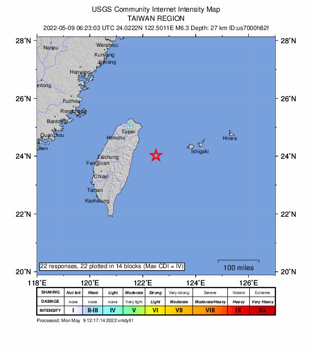
A 6.3-magnitude earthquake struck off the coast of Taiwan on Monday afternoon, according to the U.S. Geological Survey, with buildings in capital Taipei sent swaying.

The offshore quake hit just before 2:30 p.m. at a depth of 27 kilometers (17 miles), about 70 km southwest of Okinawa's Yonakuni Island, not far from Taiwan, according to the USGS report.

Taiwan's Central Weather Bureau said the shake, the fifth this year above a magnitude of 6.0, was felt across the island, though there were no immediate reports of damage.


Seismograph

6.0 magnitude quake hits Philippine Islands

maps
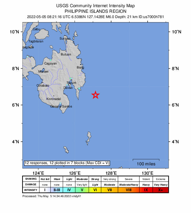
An earthquake of magnitude 6.0 on the Richter scale hit Philippine Islands on Thursday, the National Center for Seismology (NCS) confirmed.

"Earthquake of Magnitude:6.0, Occurred on 05-05-2022, 13:51:19 IST, Lat: 6.55 & Long: 127.11, Depth: 20 Km ,Location: Philippine Islands," NCS tweeted.

Earlier, the Philippine Institute of Volcanology and Seismology said that a magnitude of 5.7 jolted Davao Oriental province in the southern Philippines.

The quake, which occurred at 5:41 a.m. local time (2141 GMT Wednesday), hit at a depth of 96 km, about 136 km southeast of Tarragona town of Davao Oriental province, according to the Philippine Institute of Volcanology and Seismology.

There are no reports of casualties or loss of properties as of now.

Further details are awaited. (ANI)

Seismograph

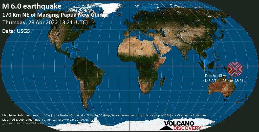
Magnitude 6.0 earthquake in Bismarck Sea near Papua New Guinea

maps

Very strong magnitude 6.0 earthquake at 10 km depth

Date & time: Apr 28, 2022 13:21:13 UTC
Local time at epicenter: Thursday, Apr 28, 2022 at 11:21 pm (GMT +10)
Magnitude: 6
Depth: 10.0 km
Epicenter latitude / longitude: 3.8986°S / 146.6605°E (Bismarck Sea, Papua New Guinea)

Arrow Up

Two large Marsquakes recorded on planet's far side

MarsQuakes
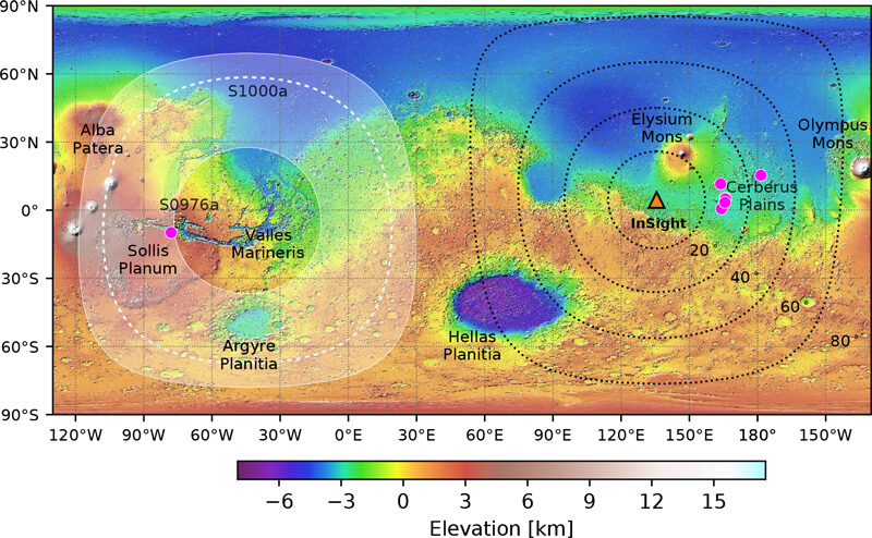
© Horelston et al. (2022) TSRMars surface relief map showing InSight’s location (orange triangle), other located marsquakes (purple dots) that cluster around 30° distance, close to Cerberus Fossae, and S0976a, located within Valles Marineris just north of Sollis Planum. S1000a’s location is predicted to be somewhere within the shaded region between 107° and 147° from InSight.
The seismometer placed on Mars by NASA's InSight lander has recorded its two largest seismic events to date: a magnitude 4.2 and a magnitude 4.1 marsquake. The pair are the first recorded events to occur on the planet's far side from the lander and are five times stronger than the previous largest event recorded.

Seismic wave data from the events could help researchers learn more about the interior layers of Mars, particularly its core-mantle boundary, researchers from InSight's Marsquake Service (MQS) report in The Seismic Record.

Anna Horleston of the University of Bristol and colleagues were able to identify reflected PP and SS waves from the magnitude 4.2 event, called S0976a, and locate its origin in the Valles Marineris, a massive canyon network that is one of Mars' most distinguishing geological features and one of the largest graben systems in the Solar System. Earlier orbital images of cross-cutting faults and landslides suggested the area would be seismically active, but the new event is the first confirmed seismic activity there.

S1000a, the magnitude 4.1 event recorded 24 days later, was characterized by reflected PP and SS waves as well as Pdiff waves, small amplitude waves that have traversed the core-mantle boundary. This is the first time Pdiff waves have been spotted by the InSight mission. The researchers could not definitively pinpoint S1000a's location, but like S0976a it originated on Mars' far side. The seismic energy from S1000a also holds the distinction of being the longest recorded on Mars, lasting 94 minutes.

Fire

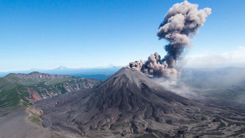
This week in volcano news - Mount Rainier earthquake swarm, large eruption at Karymsky

karymsky volcano
Karymsky volcano
In the last week, several major volcano related news stories broke. In Washington state, the dangerous volcano known as Mount Rainier produced a swarm of earthquakes directly underneath its glacier covered peak. Meanwhile in Alaska, part of the Aleutians received large volumes of sulfur dioxide which originated from a very large eruption of the Karymsky volcano in Russia. And, in New Zealand, the Ruapehu volcano is continuing to show signs of unrest as it has been producing its longest period of volcanic tremor since 2002.


Seismograph

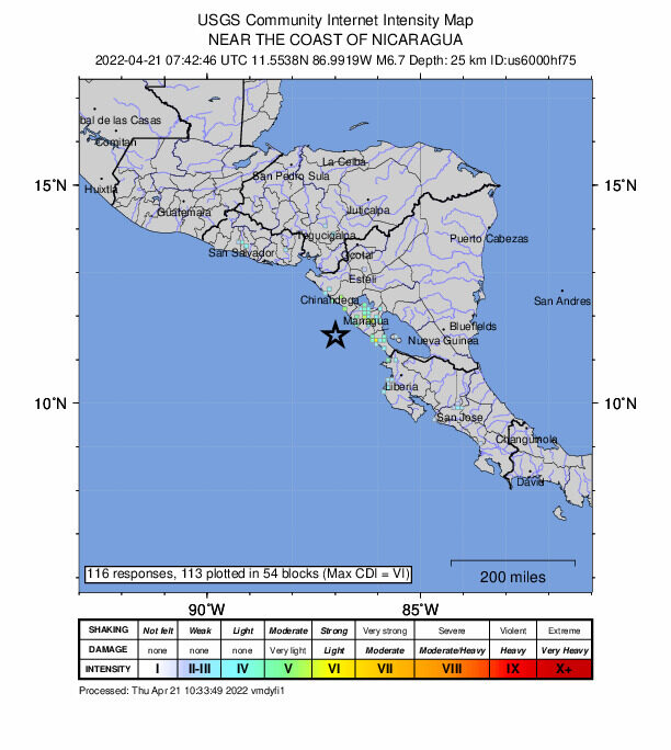
Magnitude 6.7 earthquake strikes near coast of Nicaragua region - USGS

maps
A magnitude 6.7 earthquake struck off the Pacific coast of Nicaraguaon Thursday near a fishing village popular as a vacation spot, with no initial reports of damage.

The quake's epicenter was at sea, 58 km (36 miles) from the village of Masachapa, which lies about an hour's drive southwest of the capital Managua, where strong shaking was also reported, the United States Geological Survey said.

Tremors were also reported in Nicaragua's Central American neighbors El Salvador and Costa Rica, USGS said.


Seismograph

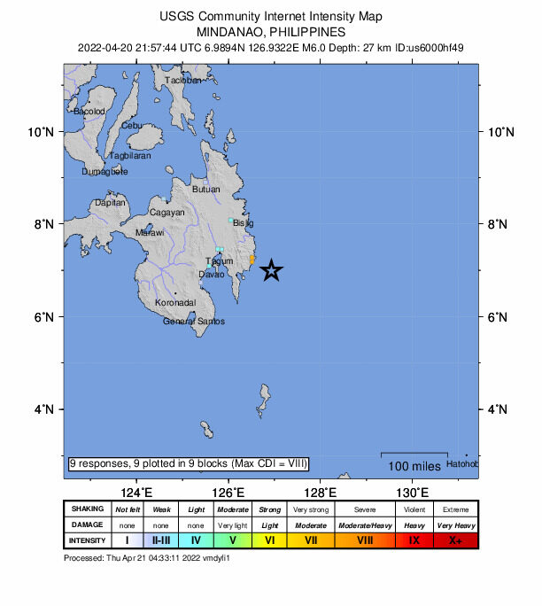
6.0 magnitude earthquake off Davao, Philippines

quake
6.0 magnitude earthquake 52 km from San Ignacio, Davao, Philippines

UTC time: Wednesday, April 20, 2022 21:57 PM
Your time: Wednesday, April 20, 2022, 10:57 PM GMT+1
Magnitude Type: mww
USGS page: M 6.0 - 50 km ESE of Manay, Philippines

Comment: A day earlier the same area was hit by 6.1 magnitude quake.