Earthquakes
S


Bizarro Earth

Earthquake Left 20-Meter Crack in Mount Fuji

Image
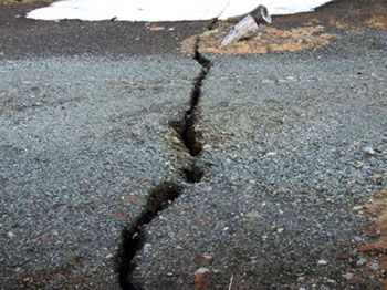
© KYODOOpening up: In a photo taken in March 2011, a crack can be seen near a shrine at the Fifth Station of Mount Fuji. Experts say it is unlikely to be a sign of an impending eruption or any other abnormality.
Kofu, Yamanashi Pref. - A 20-meter-long crack was found halfway up Mount Fuji in Yamanashi Prefecture after a 6.4-magnitude earthquake hit on March 15, 2011, centered around eastern Shizuoka Prefecture, local authorities revealed Tuesday.

They ruled out the possibility of an eruption.

"No abnormalities have been observed regarding Mount Fuji and the mountain shows no signs of an eruption," an official at the Meteorological Agency said, indicating the crack was caused not by volcanic activity but by the temblor.

Bizarro Earth

USGS: Earthquake Magnitude 5.6 - Eastern Mediterranean Sea

Image
© USGS
Date-Time
Monday, July 09, 2012 at 13:55:00 UTC
Monday, July 09, 2012 at 04:55:00 PM at epicenterTime of Earthquake in other Time Zones

Location
35.623°N, 28.925°E Depth
56.5 km (35.1 miles)

Region

EASTERN MEDITERRANEAN SEA Distances
83 km (51 miles) SSW of Kalkan, Turkey
111 km (68 miles) SE of Rodos, Greece
112 km (69 miles) S of Fethiye, Turkey
112 km (69 miles) SE of Trianta, Greece

Target

4.4 earthquake hits Labrador, Newfoundland

Image
A 4.4 magnitude earthquake hit central Labrador, about 150 kilometres south, southwest of Happy Valley–Goose Bay on Sunday, July 8, 2012. (CBC)
At 8:13 Sunday morning a 4.4 magnitude earthquake hit central Labrador, about 150 kilometres south, southwest of Happy Valley - Goose Bay.

There were no reports of damage and none would be expected according to Steven Halchuk, a seismologist with Natural Resources Canada.

"An earthquake of this size is not large enough to cause any damage whatsoever, but if you were close to it you would feel significant shaking," Halchuk told CBC News.

Earthquakes in the area are rare occurrences, according to Halchuk.

"There is a scattering of earthquake activity that extends from the Gulf of St. Lawrence up through Quebec and Labrador past Happy Valley - Goose Bay [but] it's usually small. The last earthquake I can find of this size in the region happened about 50 years ago, in 1962 actually," said Halchuk.

Radar

3.1 and 3.9 quakes strike near The Geysers, California

Image
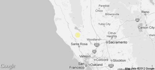
Two earthquakes in quick succession were reported Sunday afternoon near The Geysers, according to the U.S. Geological Survey.

The first was a shallow magnitude 3.1 earthquake two miles from The Geysers, according to the USGS. The temblor occurred at 5 p.m. Pacific time at a depth of 1.9 miles.

According to the USGS, the epicenter was four miles from Cobb, six miles from Anderson Springs, 26 miles from Santa Rosa and 74 miles from Sacramento.

The second was a shallow magnitude 3.9 earthquake three miles from The Geysers, according to the USGS. The temblor occurred at 5:01 p.m. Pacific time at a depth of zero miles.

Radar

Continuous earthquake activity recorded in El Hierro volcano

Image
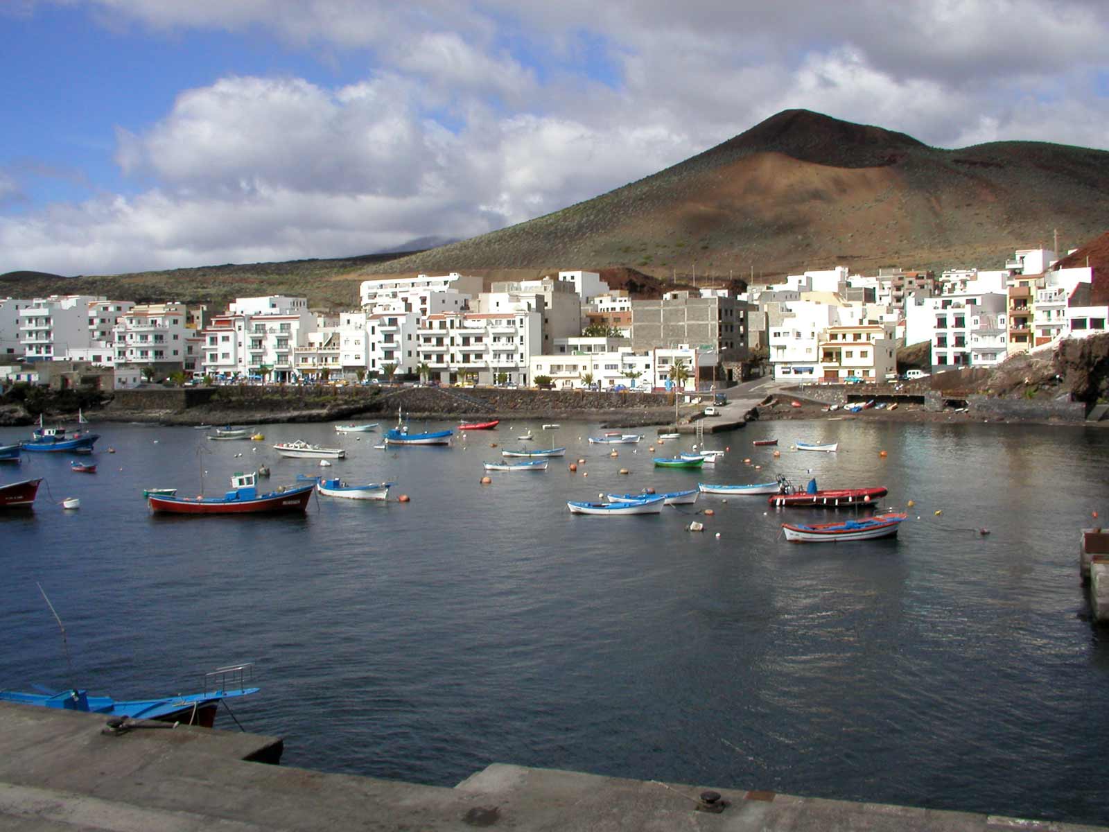
Fishing boats in La Restinga, El hierro Island, Canary Islands
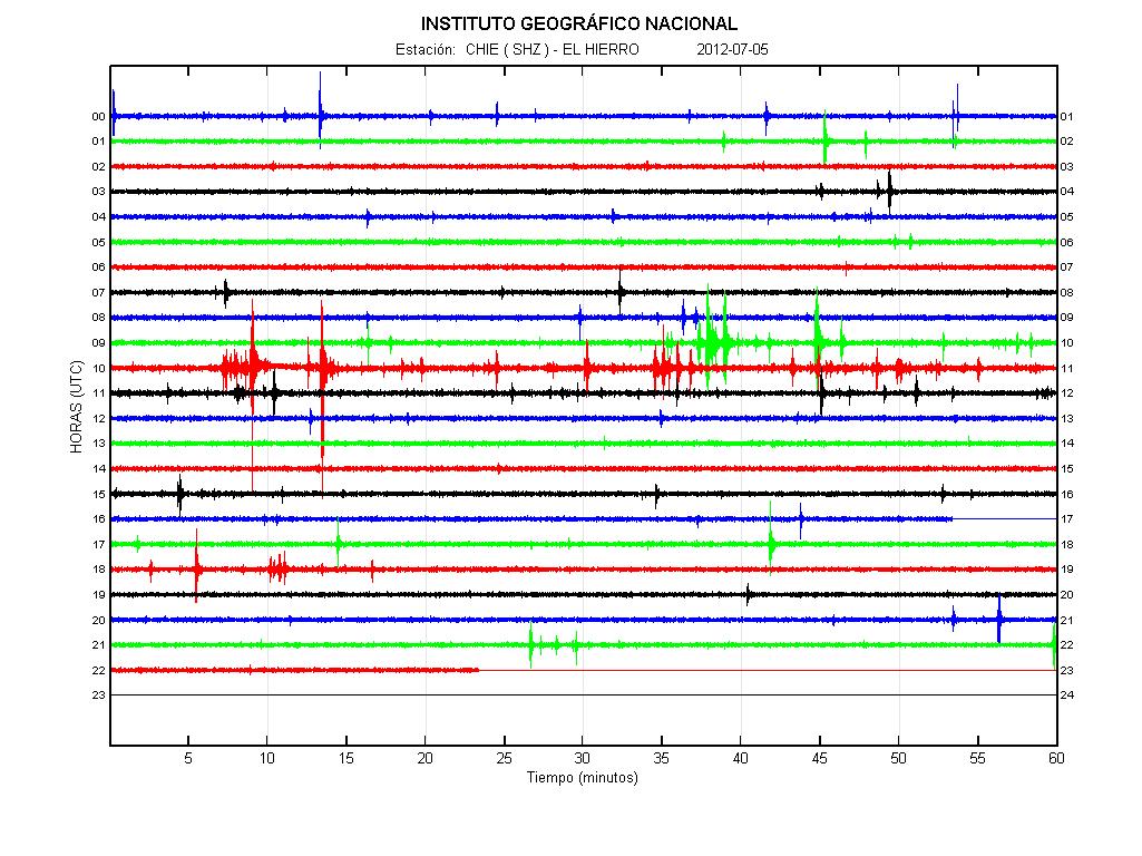
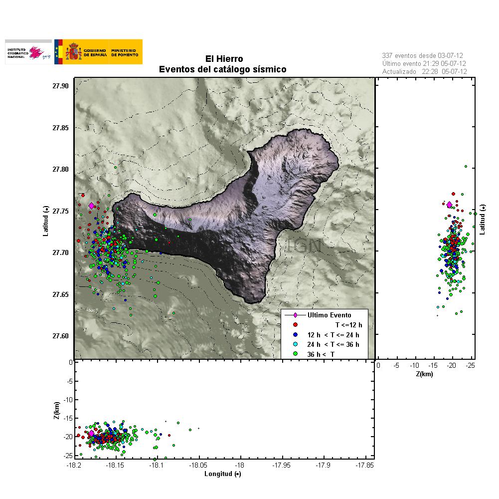
There have not been great changes in El Hierro volcano. Currently no eruption has taken place. There are also no signs of magma movement on tremor plots on seismometers stations that are located on El Hierro Island. The dike intrusion in El Hierro volcano is continues, but at slower rate then before. But that it is continuing means there is continued risk of an eruption where the earthquakes are currently taking place. Currently the rate of earthquake is around 3 to 8 earthquakes during the hour. Most of the earthquakes are around ML1.5 to 3.4 in magnitude. Please note that I am missing all earthquakes with the magnitude of ML0.0 and up to ML1.5. So there might well be a lot more earthquakes taking place in El Hierro volcano then I am seeing on IGN web page.
Image
© IGNCurrent tremor plot of El Hierro volcano. The spikes are earthquakes in most cases.
Image
© IGNLast 36 hours of earthquakes in El Hierro volcano. It shows clearly where magma has pushed it self into the crust. Creating inflation and earthquakes. The spikes are earthquakes in most cases.

Radar

Magnitude-4.3 Earthquake Rocks Northern California

Image
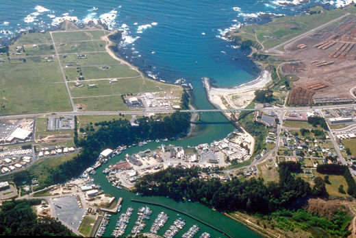
© WikipediaFort Bragg
A magnitude-4.3 earthquake hit just outside Fort Bragg in California on Sunday at about 5:05 a.m. PDT (8:05 a.m. EDT), according to the U.S. Geological Survey, or USGS.

Local police reported neither injuries nor significant damage were caused by the earthquake, the Associated Press said. At this time, no aftershocks have been reported by the USGS.

Quakes of magnitude 4.3 rarely cause significant damage, but they are quite noticeable and occasionally cause damage in areas with poor building codes. About 13,000 earthquakes of this size occur each year.

According to the USGS's listings, Sunday's earthquake is California's largest since early last month. Because California sits on several fault lines, the area is prone to earthquakes. Most quakes in the area, however, are rarely rated above magnitude 3.0, meaning they are normally too small to be felt.

Bizarro Earth

5.1 magnitude earthquake strikes Dominican Republic

Image
© USGS
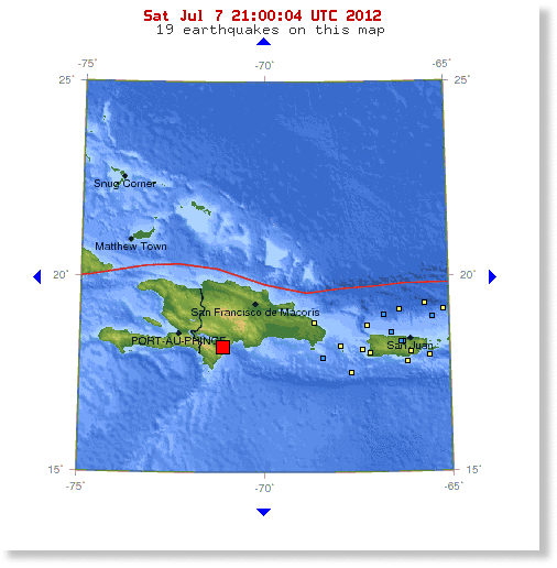
A moderate 5.1 magnitude earthquake has struck the island nation of the Dominican Republic. The epicenter of the earthquake was 113 km (70 miles) W (260°) from San Cristóbal, San Cristóbal, Dominican Republic and just 128 km (80 miles) ESE (106°) from PORT-AU-PRINCE, Haiti. The earthquake had a depth of 19.9 km (12.4 miles) and may have caused some preliminary damages though reports coming in are scant in details.

Bizarro Earth

New Zealand's North Island shaken by 5.7 earthquake

Image
© Thinkstock
Some people described the shaking as 'huge'.
North Islanders were again rattled by a strong earthquake yesterday, but experts say the tremor was not related to a much larger quake four days earlier.

GeoNet reported a magnitude 5.7 quake struck 10km south of Turangi at 12.50pm. The quake was 90km deep and, though police said there were no reports of damage, some residents said trinkets had been smashed.

It came four days after a magnitude 7 earthquake, centred at a depth of 230km and offshore from Taranaki, rattled residents from the Bay of Plenty to Canterbury, but caused little damage.

Shaken people took to social media and message boards yesterday to share their experiences, some describing the shake as "huge".

Bizarro Earth

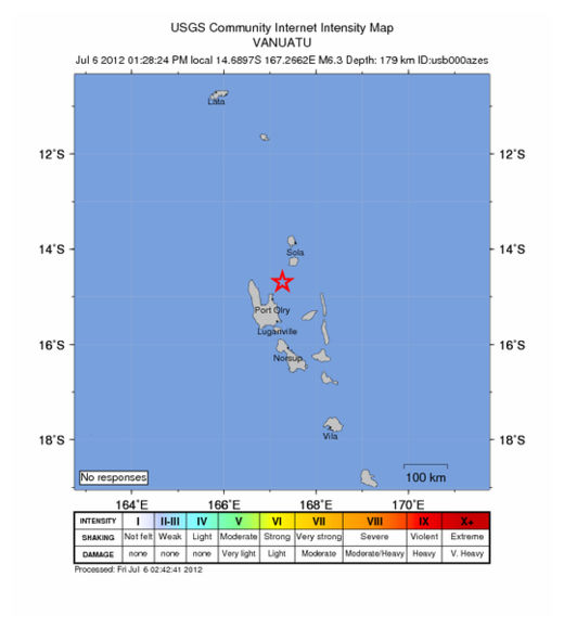
USGS: Earthquake Magnitude 6.3 - Vanuatu

Vanuatu Quake_060612
© USGS
Date-Time
Friday, July 06, 2012 at 02:28:24 UTC

Friday, July 06, 2012 at 01:28:24 PM at epicenterTime of Earthquake in other Time Zones

Location
14.690°S, 167.266°E

Depth
179 km (111.2 miles)

Region
VANUATU

Distances
46 km (28 miles) NNE of Port-Olry, Vanuatu

93 km (57 miles) N of Luganville, Vanuatu

355 km (220 miles) NNW of Port-Vila, Vanuatu

689 km (428 miles) N of We, New Caledonia

Alarm Clock

SOTT Focus: Reign of Fire: Meteorites, Wildfires, Planetary Chaos and the Sixth Extinction

Image
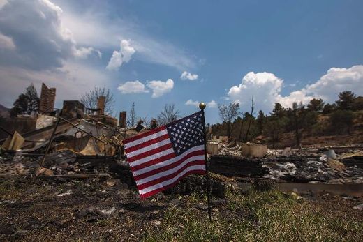
© Reuters'Damn you al-qaeda!' An American flag waves in front of a house leveled by the Waldo Canyon fire in the Mountain Shadows community in Colorado Springs, Colorado, 2 July 2012
Over the past 18 months, we've been growing increasingly concerned for the future of all life on planet earth. Sure, the signs that things have been going 'south' have been there for some time, but our concern began in earnest at the very beginning of 2011, when masses of birds began to fall dead from the sky around the world. The phenomenon continued for several months, and birds around the world are still dying for officially unknown reasons. None of the dead birds showed any sign of disease, but in several incidents birds were found to have 'external injuries' like they had been "hit by some kind of blunt instrument". All sorts of explanations for the deaths were offered (like fireworks or birds colliding with each other) including the predictable attempts by 'science experts' to downplay any significance to the bizarre deaths. But among the flurry of speculation, one report stood out.

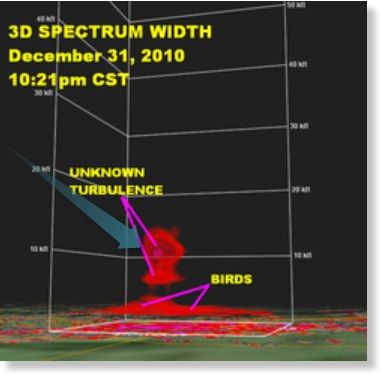
NewsChannel5 Chief Meteorologist Mark Johnson decided to take a look at the the Doppler radar images from Beebe, Arkansas from the night when many red-winged blackbirds had fallen dead to the ground, and he discovered something interesting.
"There it was. This huge plume of turbulence over the Beebe birds just as they began their frenzied flight," Johnson said.

The turbulence appears above the birds between about 7,000 and 12,000 feet. Johnson realized there are only a few possible explanations for this phenomena.
Having homed in on the probable cause, Johnson then introduced some nonsense:
"Birds don't fly that high, and he quickly ruled out military action, a sonic boom, meteor shower or alien invasion."
While we can understand why Johnson ruled out military action or a sonic boom (there were no flights over the area at the time), Johnson never explained why he ruled out a "meteor shower", although we can understand the inclusion of "alien invasion" - to ridicule by association the idea of a "meteor shower" or other meteorite-related phenomenon.

Johnson then went on to say:
"Something in the atmosphere, something mysterious, occurred over Beebe, Arkansas that night... And I believe it was part of what caused those birds to fly and then die."
Indeed, but with the answer staring him in the face, Johnson lost the plot completely:
Johnson's research captured an unseen temperature reversal just above the birds' roosting area at about 1,500 feet above the ground. This temperature "inversion" acted like a megaphone, amplifying all the noises that occurred in Beebe at that time. As the fireworks exploded, the sound was amplified by the inversion and became much louder than normal. This appears to have startled the birds so much that they burst into flight, running into each other, and nearby buildings. Thousands of the now-disoriented birds then crashed to the ground, dying from blunt force trauma.
Image
The Doppler radar image used by Johnson to explain the bird deaths. We have added the blue-green arrow to illustrate the trajectory of a meteor reaching that altitude before exploding in the lower atmosphere.
Temperature reversal? At 1,500 feet? But previously Johnson stated that the 'turbulence' occurred between 7,000 and 12,000 feet. He even produced a graph of the Doppler radar images that shows this. While temperature inversion does occur and can amplify sound, when birds are startled by noise they don't generally fly into each other and buildings in large numbers. What's most likely, is that the bird deaths of January 2011 (and later) were caused by an overhead meteorite or comet fragment (MoCF) explosion, with either the actual shock wave killing the birds (through blunt force trauma) or associated electrical effects 'frying' their 'circuits'.

This electrical effect can also explain the massive fish die-offs around the same time. Consider this report, just in today, about two children being mysteriously electrocuted to death as they swam in a lake in Missouri on 4th July. The thousands of dead fish found upstream from Beebe on New Year's Eve 2010 could well have had their circuits fried because of significant electrical discharge that accompanied the overhead MoCF airburst. Now check out this Tunguska blast simulation by Sandia lab. An incoming bolide exploding overhead would knock the wind out of anything within a radius relative to the extent of its blast. It would probably knock airplanes out of the sky too - more on that below.