Earth ChangesS


Cloud Lightning

Come Rain or Come Shine

One of the claimed dangers of a few degrees warming of the Earth is increasing drought. Drought is a very difficult thing to fight, because it is hard to manufacture water. So this is a frightening possibility.

I have long claimed that "a warmer world is a wetter world". I have said this without any actual data, based solely on the following logic.:
Increased temperature - > increased evaporation - > increased precipitation.
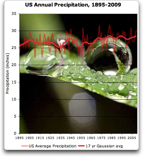
Today I graphed the numbers for the US precipitation. I used the USHCN state-by-state precipitation database, which also includes area-averaged values for regions of the US, and for the US itself.

First, here is the change in precipitation in the US since 1895:
Image
Figure 1. Annual precipitation in the US.

Document

Queens University of Belfast told to hand over tree ring data

Image
Queen's University in Belfast has been told by the Information Commissioner to hand over 40 years of research data on tree rings, used for climate research.

Douglas Keenan, from London, had asked for the information in 2007 under the Freedom of Information Act.

Mr Keenan is well-known for his questioning of scientists who propose a human cause for climate change.

Queen's University refused his request saying it was too expensive, but it is now considering its position.

The university claimed that as the information was unfinished, had intellectual property rights and was commercially confidential information, it did not have to pass it on.

Sun

Flowrate of World's 4th Largest River Linked to Solar Cycle

Image
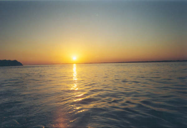
Sunset over the Paraná River
A new study has postulated a link between solar activity and the flowrate of one of the largest rivers in the world, and suggests that it will lose water as the current low solar activity continues.

The quantity of water flowing down a river is a good climatic indicator since it integrates rainfall over large areas. In a paper submitted to the Journal of Atmospheric and Solar-Terrestrial Physics, Pablo Mauas and Andrea Buccino of the Institute of Astrophysics, and Eduardo Flamenco of the National Institute of Agricultural Technology, Argentina, follow-up a previous study of the influence of solar activity on the flow of the Paraná River - the fourth largest river in the world by outflow - and second only to the Amazon in South America.

They find that the unusual minimum of solar activity observed in recent years has a correlation with very low water levels seen in the Paraná's flowrate. Additionally they report historical evidence of low water levels during the Little Ice Age.

They also consider flowrates for three other rivers (Colorado, San Juan and Atuel), as well as snow levels in the Andes. They conclude, after eliminating secular trends and smoothing out the solar cycle, there is a strong positive correlation between the residuals of both the Sunspot Number and the flowrates of these rivers as well.

Roses

How the Iceland volcano ash cloud is crippling Kenya's flower industry

Ash cloud
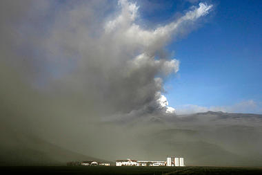
© Brynjar Gauti/APA plume of ash from the Iceland volcano covers the farm of Pall Eggert Olafsson, in Thorvaldseyri, Iceland, Monday.
Kenya's flower and vegetable industry, which employs tens of thousands of workers and contributes over a fifth of the country's GDP, is losing $3 million per day because ash from the Iceland volcano has grounded freight flights.

Clouds of ash from the Iceland volcano are forcing thousands of workers at farms near the Equator to down tools and robbing Kenya's flower and vegetable industry of $3 million per day.

The East African country freights 1,000 metric tons of roses, carnations, French beans, snap peas, and other produce daily on overnight flights to Europe. About 1/3 of the cut flowers sold in the European Union are grown in Kenya.

But the Kenyan, British, and Dutch airlines that fly from Nairobi have been grounded since Thursday, following flight bans due to risks to aircraft from volcanic ash spewing from Iceland's Eyjafjallajökull eruption.

Already $12 million worth of flowers and vegetables destined for European supermarkets have had to be destroyed or given away.

Binoculars

Incredible Images of Iceland Volcano from Just a Few Kilometers Away

Image
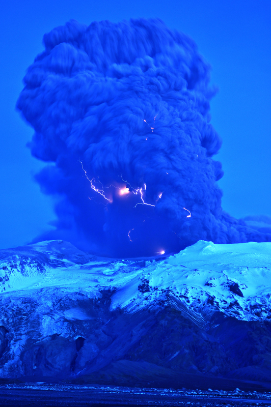
© Snaevarr GudmundssonLightning visible in the plume of the Eyjafjallajokull volcano in Iceland on April 17, 2010.
Astronomer Snaevarr Gudmundsson from Iceland was able to travel to within just a few kilometers from the Eyjafjallajokull volcano, and shared his incredible close-up images with Universe Today. "I stayed near the volcano from about 16:00 hours to 22:00 hours on Saturday and watched its impressive eruption," Gudmundsson said in an email to me. "Amazing event, awesome explosions of 1200 °C hot magma reaching ice and water. I shot more than 550 images during these hours of continuous enjoyment. Sounds ridiculous but its ever changing appearance was never boring."

The massive plume put on an impressive display - from lightning forming within the plume to an incredible amount of spewing ash. On one of following pictures you can see helicopter for size comparison of the plume.

Gudmundsson said he and other photographers were a safe distance from the eruption, but were a few kilometers away. "Nearby was a small river and its prominent sound prevented us from hearing much in the eruption itself except a loud roar from thunders from time to time," he said. "During daylight we even glimpsed some lightning but at dusk (the photo is taken at about 22:00 in the evening) they were easily spotted especially during active periods of explosions."

Bizarro Earth

How volcanoes can change the world

Image
Palisades, New York - The recent volcanic eruption in Iceland is stranding hundreds of thousands of air travelers at Heathrow Airport in the UK and other airports across northern Europe, due to its voluminous clouds of volcanic ash that can clog airplane engines and limit visibility.

However, this is by no means the first such volcanic eruption in Iceland to affect human activities. Long before the advent of air travel, the eruption of Iceland's Laki volcano in 1783-84 had profound effects on climate, not just in Iceland but around the globe.

Volcanologists Thorvaldur Thordarson and Stephen Self estimated that a comparable event in the modern era would release enough ash and other eruptive materials into the atmosphere that the resulting ash cloud and sulfuric haze would probably disrupt air travel over much of the Northern Hemisphere for about five months. But there were impacts well afield of Iceland and Europe at the time of Laki.

Cow

Iceland's farmers try to save herds from toxic ash

Herd in Iceland
© Brynjar Gauti | Associated PressVolcanic ash can cause internal bleeding and bone damage in animals, which are most of Iceland's farm economy.
Skogar, Iceland - In Europe, the volcanic ash danger travels at high altitudes, but for Iceland's farmers the problem is very much on the ground.

Farmers across the region where the volcano erupted this week under the Eyjafjallajokull glacier have been scrambling to protect their herds from inhaling or ingesting the ash, which can cause internal bleeding, long-term bone damage and teeth loss.

Near Skogar, south of the volcano, the ash blew down from the mountain, blotting out the sunlight and covering everything - pastures, animals and humans - in a thick, gray paste.

Berglind Hilmarsdottir, a dairy farmer, teamed up with neighbors Saturday to round up her cattle, some 120 in all, and get them to shelter. In the panic, some of the animals got lost in the fog of ash, and the farmers had to drive around searching for them.

"The risk is of fluoride poisoning if they breathe or eat too much," Hilmarsdottir said through a white protective mask.

The fluoride in the ash creates acid in the animals' stomachs, corroding the intestines and causing hemorrhages. It also binds with calcium in the blood stream, and after heavy exposure over a period of days makes bones frail, even causing teeth to crumble.
Comment: Fluoride is poisonous? But why do they put it in our water supplies then?

Fluoride: Worse than We Thought

Cloud Lightning

Airlines lobby to reopen European airspace closed by Eyjafjallajökull

Image
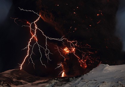
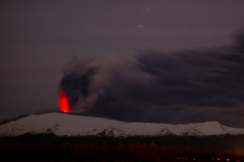
Eyjafjallajökull erupting at night on April 17/18, 2010, with impressive incandescent explosions.
European airlines are taking "test flights" to see the effect of the ash on their aircraft in hopes to convince EU officials to reopen airspace. Now, officials from KLM say that everything went fine in their test flight, but I haven't seen any details about flightplans, altitude and all the sorts of info you'd want to see if you want to believe these test flights are representative. However, the president of KLM does have a bit of a point in saying that this ash is not unprecedented in the world of aviation - volcanoes are erupting along Indonesia, Alaska, Japan, Kamchatka and elsewhere around the world without widespread problems. However, the key question is how similar is this eruption to those that occur around the world all the time - and at what timescales could ash concentration change in the air over Europe. One other thing I don't know - and maybe somebody out there does - do most commercial pilots get trained on ash avoidance? However, there is still no word on when all of European airspace will reopen - but we may see up to 50% of normal flights by Monday.

Sun

Heat wave claims 80 in India

A severe heat wave sweeping across the country, with temperatures of almost 44 C, has killed at least 80 people so far, officials said on Sunday.

Majority of deaths were reported in Orissa. A state government official said they were investigating reports of 53 deaths from various parts of the state. "District collectors have been asked to investigate and submit reports on other deaths," said Mr Bhimsen Gochhayat. Orissa has decided to shut down schools from next Tuesday, advancing the annual summer holiday.

Other deaths were reported from Uttar Pradesh and Madhya Pradesh. New Delhi recorded a maximum temperature of 43.7 degrees Celsius on Saturday, presaging a hot summer in the next two months in the nation's capital and other parts of northern and eastern India.

Bizarro Earth

Undersea Anomalies in Aceh to be Studied

A special geological assessment team will be sent to Aceh to see whether the strong 7.2-magnitude earthquake this month had significantly altered the geography of the area.

Ridwan Djamaluddin, director for mitigation and regional development at the State Agency for the Assessment and Application of Technology (BPPT), said on Sunday that a team of 15 researchers from the BPPT was expected to arrive in Aceh Singkil district on Wednesday.

Residents on Banyak Island, off Aceh Singkil, which was near the epicenter of the quake on April 7, have claimed that the seabed has risen dramatically since the temblor. Undersea fissures were also reportedly spewing out mud and rocks.

"We will be observing the area and the team will be coordinating with the local government as soon as they arrive, collecting the data they need and making their assessment," Ridwan said, adding that Aceh Governor Irwandi Yusuf had invited the agency to visit the site.

"The Acehnese governor tells us that local people are starting to get worried and they are thinking of moving to a safer place," he said. "We are going to tell them if it is actually dangerous or not after conducting a thorough analysis."