Earth ChangesS


Tsunami

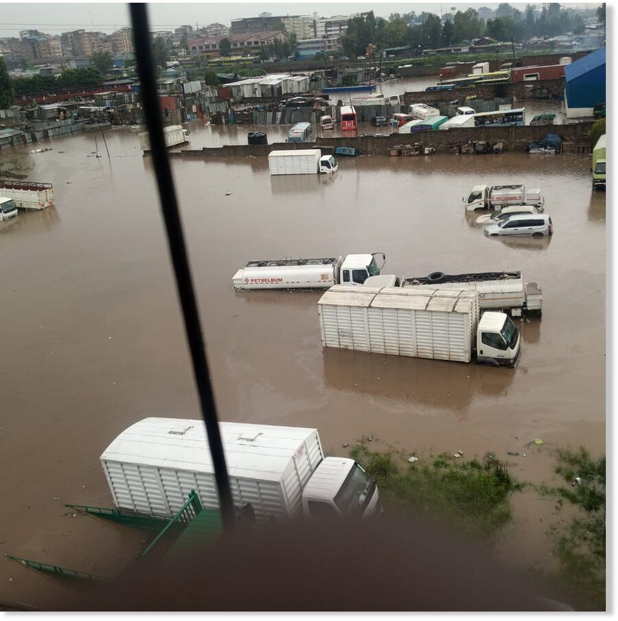
5 inches of rainfall in 12 hours brings the Indian city of Bengaluru to its knees

The IMD forecast predicts no relief for the city, with continued rain expected over the next two days.
© PTIThe IMD forecast predicts no relief for the city, with continued rain expected over the next two days.
Battered by 130mm rainfall in about 12 hours from Sunday evening till dawn on Monday, Bengaluru is scrambling to count its losses: Three dead, 500 homes flooded, 20-plus lakes ready to overflow, dozens of streets in tony areas reduced to waterways, flooded underpasses and flyovers closed to traffic, vehicular movement suffering miles-long disruption for hours and public bus services sputtering to a halt in several areas of the city.

Heavy rain-triggered by convergence of two low-pressure systems and accompanied by intense thunderstorms-pounded south, north and eastern parts of the city. IMD has forecast more heavy rainfall for the next five days.

As distraught citizens picked up the pieces to start a fresh week, Greater Bengaluru Municipal Corporation chief commissioner Maheshwar Rao termed it the second-highest rainfall in a decade and said, "Sometimes, things get out of hand - we are working on it."


Seismograph

Shallow 6.4-magnitude earthquake strikes near Papua New Guinea

nnnnn
An earthquake with a magnitude of 6.4 struck near the northern coast of Papua New Guinea on Tuesday, according to the United States Geological Survey (USGS).

The quake was registered at a depth of 10 kilometers at 3:05 pm UTC. Its epicenter was recorded 81 kilometers east-northeast of the town of Angoram, the seat of Angoram District in Papua New Guinea's northwestern East Sepik Province.

There were no initial reports of casualties or material damage, and no tsunami warning was issued by the US Tsunami Warning Center.

Cloud Precipitation

Hail the size of ping pong balls slam southern France as violent storms, floods hit - 10 inches of rain in a few hours

mmmmm
Severe thunderstorms with large hail hit parts of south-west France on Monday afternoon.

Meteo-France - the French weather service - had issued amber weather warnings in the Midi-Pyrenees and Aquitaine regions for thunderstorms and flash flooding. The service has provisionally reported that one person has been killed and another has been reported missing.

To the south of Toulouse, residents captured video of impressive hailstorms which ripped off tree branches and damaged crops.

Some of the large hail was reported to be the size of ping-pong balls.

The area of thunderstorms, producing approximately 13,000 lighting strikes in south-west France, also gave some significant rainfall totals.


Comment: The Connexion reports:
Three reported dead, two missing as violent storms hit southern France

Up to 250mm of rain falls this morning around Lavandou

Violent storms are traversing the south of France
© Aleksei IgnatovViolent storms are traversing the south of France
At least three people have died in the south of France as violent storms hit the Var department today (May 20).

Two people died near Le Lavandou after the vehicle they were in was swept away by torrential rain, with nearly 250mm falling in a few hours before midday around the commune.

The elderly couple - born in 1939 - were 'surprised' by rapidly rising water when they were out driving in their vehicle, reported Var public prosecutor Samuel Finielz

Another person was reported dead in Vidauban, and several other people in the department are missing according to the latest reports by departmental authorities.

"Everything's flooded, the roads are cut off, areas near the beach have collapsed, the bridges are completely destroyed," said mayor of Le Lavandou Gil Bernardi (quoted in local media Var Matin).

He has asked authorities for emergency aid to help with the catastrophe.

Residents in areas worse-impacted are being asked not to travel by departmental authorities, to reduce the risk of further accidents.

The weather conditions are a continuation of violent storms that battered south-west France yesterday (May 19), causing severe damage, flooding, and disrupting the regional rail network.

Firefighters in the south-west were called out to hundreds of homes yesterday before storms moved eastwards overnight.

Emergency services in the Var have already responded to dozens of callouts so far today.

Some areas in the Var have seen record rain levels for the month of May surpassed this morning alone.

Water levels of the Môle river rose several metres this morning, stated official flooding website Vigicrues, with several roads nearby flooded and off-limits to vehicles.

The airport next to the river - that serves popular holiday destination Saint-Tropez - has been closed due to flooding.

Early images show severe damage in towns including Cavalière.


Several roads in the Var are flooded, making travelling through the department difficult.

More than 500 homes are without electricity, and 300 without running water.

Parks and other public locations in Nice and Cannes, in the neighbouring Alpes-Maritimes department, have been closed due to the storms.

The rail network in the south-west remains severely disrupted today, and several schools in the area have been closed.

Local mayors in the south-west are calling for natural disaster zones to be declared by the government to help with insurance claims for damaged homes.

Hail and floods hit south-west hard

Yesterday's storms were accompanied by torrential rain and powerful hail measuring up to 7cm in diameter.

Toulouse and the surrounding suburbs were in particular affected.

A school in the outskirts of Toulouse was damaged by the hail and in rural areas it caused widespread damage to farms.

Communes in the Tarn department including Lautrec and Puylaurens were affected by flooding, as excess rain caused water to gush through streets.


The flooding has led to tier-two yellow warnings over rising river levels, however no severe alerts (tier-three or above) are currently in place, and it is unlikely river levels will continue to rise now rain has mostly subsided. .

Trains stuck overnight, TGV passengers evacuated

The flooding also disrupted rail connections in the south, with several local services cancelled due to the conditions.

Some of these services, particularly around Toulouse, are cancelled today (Tuesday May 20), so if you are planning to travel check journey schedules in advance through the SNCF Connect website or local alternative.

High-speed (TGV) connections from Toulouse to Paris are also set to face disruptions for a number of days - on Tuesday all direct high-speed services are cancelled, with passengers needing to travel via Montpellier or via 'Intercités' trains.

Connections between Bordeaux and Toulouse are expected to be disrupted for several days, as are local services around Agen.

A TGV with over 500 passengers on board was blocked near Tonneins (roughly equidistant between Toulouse and Bordeaux) after heavy rain forced it to stop last night.

Passengers were stuck for over three hours before they were evacuated and spent the night at emergency accommodation in the commune due to damage on the tracks.

Areas of the Tarn-et-Garonne were also impacted, as was Tonneins in the Lot-et-Garonne.

The train remains stuck in place, local media reports, due to severe damage on the tracks.

"It is a miracle the train didn't break up... it is also a miracle there were no casualties," said firefighters at the scene (quoted in local media Actu).

The driver reacted quickly after spotting damage on the tracks, dropping the train's speed down to 30 km/h.

Another train scheduled between Paris and Toulouse was stopped near Agen due to the rain, with passengers stuck in the train overnight according to an AFP journalist who was travelling on the route.


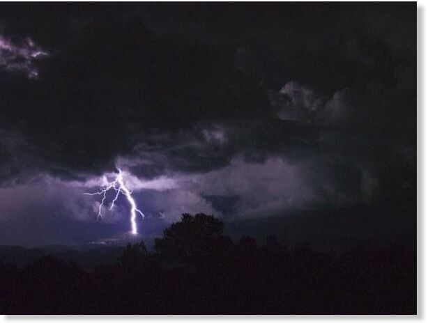
Lightning

Lightning hits police car in Newcastle, Oklahoma amid severe weather; no injuries reported

nnnnnn
The Newcastle Police Department witnessed a shocking sight when lightning struck a patrol car during severe weather Monday evening.

According to Newcastle Emergency Management, the lightning strike did not injure anyone nearby.

The car is seen on video being struck, and smoke rises from the vehicle afterwards.


Lightning

Lightning kills 237, injures 908 across Nepal in 4 years

File Photo
File Photo
Lightning strikes have killed 237 people and injured 908 across Nepal over the past four years, according to the National Disaster Risk Reduction and Management Authority (NDRRMA).

From July 17, 2021 (Shrawan 1, 2078 BS) to May 19, 2025 (Jestha 5, 2082 BS), the country recorded 1,118 lightning incidents affecting 1,607 families, said Roshni Kumari Shrestha, Joint Secretary at the NDRRMA. Nepal ranks fifth globally in lightning-related disasters, with high-risk zones identified in Jhapa, Udayapur, and Makwanpur districts.

Koshi Province recorded the highest number of lightning events - 295 incidents - resulting in 51 deaths, 84 injuries, and property losses amounting to Rs 16.045 million. Some 420 livestock also perished.

Comment: For the years between 2013 and 2019: 773 people killed by lightning in 7 years across Nepal


Lightning

Over 40 goats, sheep killed by lightning strike in Kashmir, India

Lightning strike kills over 40 livestock in Kangan
At least 40 sheep and goats of a nomadic herder died in a lightning strike late last night in the forest area of Hariganiwan in Kangan area of Ganderbal district.

An official said that the livestock belonged to Abdul Wahid Khattana of Sunderbani, Rajouri, who is presently putting up at Chechi Pati, Hariganiwan, as part of seasonal migration.

The lightning strike occurred amid a brief but intense thunderstorm, catching the animals in the open and resulting in their instant death. (KNO)

Tsunami

Heavy 3 hour downpour triggers widespread flooding in Accra, Ghana

mmmmmmmm
A downpour on Sunday afternoon has once again exposed the fragility of Accra and its surrounding municipalities to flooding, leaving parts of the city and Tema West submerged and commuters stranded.

The rain, which began around 3:00 p.m. and lasted nearly three hours, caused significant flooding in several neighbourhoods, including Weija, Kaneshie, Adabraka, Adentan-Dodowa, and parts of Tema.

The situation was particularly dire in the Adjei-Kojo Kanewu area in the Tema West Municipality, where residents say their homes have been inundated, disrupting daily activities and damaging property.

The residents of Adjei-Kojo Kanewu have expressed frustration over what they describe as the worsening of flooding conditions in recent times, which they blame on the construction activities of Letap Industries, a pharmaceutical company operating in the area.

According to the residents, the company has allegedly blocked the community's main drainage systems, preventing the free flow of rainwater and leading to severe backflows into homes.


Boat

192,000 affected by flooding in Maguindanao, Philippines

THE 33rd Infantry Battalion rescues residents in Barangay Tuka, Mamasapano, Maguindanao del Sur from flooding over the weekend.
© 33rd IBTHE 33rd Infantry Battalion rescues residents in Barangay Tuka, Mamasapano, Maguindanao del Sur from flooding over the weekend.
The number of affected residents in the massive flooding in Maguindanao del Sur rose to 192,005 as of 5 p.m., Monday, May 19, the National Disaster Risk Reduction and Management Council (NDRRMC) reported.

The number of affected barangays also went up to 47 from 98 barangays in the towns of Ampatuan, Datu Abdullah Sangki, Datu Piang, Datu Salibu, Datu Saudi Ampatuan, Datu Hoffer Ampatuan, Mamasapano, Guindulungan, Shariff Aguak Shariff Saydona Mustapha, and Sultan sa Barongis, the NDRMMC added.

The NDRRMC added that the marshy town of Mamasapano has the highest number of affected residents with 34,700.

The massive flooding was caused by torrential rains due to the Intertropical Convergence Zone (ITCZ) since May 14.

The Mamasapano Disaster Risk Reduction and Management Council said that eight of 14 affected barangays have been submerged in floodwater for five days.


Comment: Related: How Little Ice Age displaced the tropical rain belt

From the above link notice where the tropical rain belt rain belt is according to the map for this time of year (May). That is not over the Philippines.

Tropical rain belt
© Wikipedia / Mats Halldin The annual see-saw of the tropical rain belt.
From Wikipedia:
[...]

The tropical rain belt lies in the southern hemisphere of the Indian Ocean and western Pacific Ocean roughly from October to March, and during this time the northern tropics experience a dry season in which precipitation is very rare, and days are typically hot and sunny throughout. From April to September, the rain belt lies in the northern hemisphere, and a wet season occurs there, while the southern tropics experience their dry season.

[...]


Arrow Down

Moment massive sinkhole first opened in New Jersey revealed in new video: 'Never seen anything like this'

new jersey sinkhole
© WABC

A stunning new video shows the moments after a massive sinkhole first swallowed the side of a New Jersey interstate.

Police bodycam footage obtained by ABC7 captured the moment cops drove up to the edge of a mammoth sinkhole that opened up on Route 80 in Wharton the day after Christmas.

The sinkhole, which created a giant crater along the shoulder of the road, has caused a shutdown of the roadway since December.WABC

"Look at how far it goes under there ... we just went by and said 'Holy ... !'" a man who witnessed the sinkhole collapse told a trooper in the footage.

"I've never seen anything like this," another man said while steam appeared to rise from the giant opening.

Tornado1

Best of the Web: Tornadoes, storms kill more than 30 in the US: over 5,000 homes affected after cyclonic storm hits St Louis (UPDATE)

mmmmmm
At least five people have been killed after a severe cyclonic storm landed in St Louis, Missouri, United States on Friday afternoon, May 16. Authorities are searching for others trapped inside the debris of the building. The tornado uprooted roofs off buildings, blew out windows, ripped bricks off siding, and also uprooted trees, and a power outage was also reported in the area.

As per St Louis Mayor Cara Spencer, over 5,000 homes were affected, and several people were displaced. About 100,000 residents were left in the dark in the city as a power outage was reported on Friday night. An overnight curfew was imposed in the city, and an emergency was declared after damages were reported in several places. "This is truly, truly devastating," Spencer said.


Comment: Update May 18

USA TODAY reports:
Tornadoes and severe weather tore through the Upper Midwest and the Mideast U.S. on May 16 killing more than 30 and leaving many damaged homes and downed power lines.

A day after several tornadoes reportedly touched down and caused "significant damage" in western and central Wisconsin, at least 23 are reported dead in Kentucky where tornadoes and severe storms ravaged the region on May 16. Seven more deaths were reported in Missouri. Two died in Virginia in separate incidents with trees falling on their vehicles, officials said.

Forecasts of severe weather continue throughout the weekend with about 50 million people from Texas to New York at risk for tornadoes and thunderstorms on May 17 and 18, according to AccuWeather.