Earth ChangesS


Bad Guys

Navy Plans Could Affect More Marine Mammals

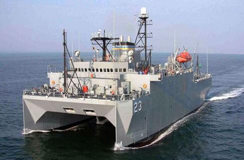
US Navy Ship
© APA military Sealift Command ocean surveillance ship is seen underway in 2009. The Navy plans to increase ocean warfare exercises, conduct more sonar tests and expand coastal training areas.
Washington - The Navy plans to increase ocean warfare exercises, conduct more sonar tests and expand coastal training areas by hundreds of square miles - activities that could injure hundreds of thousands of marine mammals or disturb their habitats, federal records show.

Training areas already are established along most of the continental U.S. coastline, so the Navy is seeking federal permits to broaden an existing range off the Pacific Northwest and dramatically expand exercises and sonar use in the Gulf of Alaska.

The service also plans to increase training substantially in the Pacific around the Mariana Islands.

The Navy estimates in federal permit applications that its activity in those areas will impact about half a million sea mammals each year, including seals, sea lions and whales, some of which are endangered.

The effects range from brief interruptions in normal feedings to significant injury and, in very rare instances, death.

Already, 2.3 million marine mammals are affected similarly each year by the Navy's training on its ranges on the Atlantic and Pacific coasts, Navy studies show.
Fish

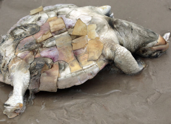
Flashback US: Dead Sea Turtles Wash Ashore in Mississippi

dead turtle
© AP Photo
The carcasses of 23 sea turtles have been found along Mississippi's 70 miles of coastline, and have been retrieved for examination by the Institute for Marine Mammal Studies in Gulfport, said Moby Solangi, the group's president and executive director.

The carcasses were placed in garbage bags that were stacking up in the institute's necropsy lab refrigerator unit.

Although this is the time of year when dead turtles are often found on the beach, scientists say the number is more than double what they would expect. Necropsies will be conducted Monday afternoon by a team of four veterinarians. It's unclear whether the deaths are related to the oil spill, which is still offshore.

Bizarro Earth

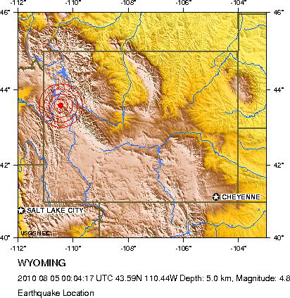
US: Earthquake Magnitude 4.8 - Wyoming

Image
© USGS
Date-Time:
Thursday, August 05, 2010 at 00:04:17 UTC

Wednesday, August 04, 2010 at 06:04:17 PM at epicenter

Time of Earthquake in other Time Zones

Location:
43.585°N, 110.440°W

Depth:
5 km (3.1 miles) set by location program

Region:
WYOMING

Distances:
30 km (20 miles) ENE of Jackson, Wyoming

65 km (40 miles) W of Dubois, Wyoming

95 km (60 miles) NNW of Pinedale, Wyoming

535 km (335 miles) WNW of CHEYENNE, Wyoming

Bizarro Earth

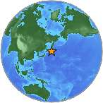
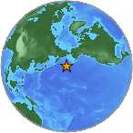
Kuril Islands: Earthquake Magnitude 6.0 - East of Kuril Islands

Kuril Is. Quake_040810
© USGSEarthquake Location
Date-Time:
Wednesday, August 04, 2010 at 23:48:02 UTC

Thursday, August 05, 2010 at 09:48:02 AM at epicenter

Time of Earthquake in other Time Zones

Location:
45.964°N, 153.216°E

Depth:
33.6 km (20.9 miles)

Region:
EAST OF THE KURIL ISLANDS

Distances:
425 km (265 miles) ENE of Kuril'sk, Kuril Islands

570 km (350 miles) SSW of Severo-Kuril'sk, Kuril Islands, Russia

775 km (480 miles) ENE of Kushiro, Hokkaido, Japan

7245 km (4500 miles) NE of MOSCOW, Russia 1

Fish

Mississippi, US: Thousands of Dead Fish Floating in Biloxi Waters

dead fish
© WLOX
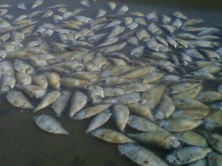
If you saw tens of thousands of dead fish floating in Biloxi waters Tuesday, the deaths are not related to the oil spill.

Phone calls began coming into WLOX Tuesday afternoon from people who'd been at Beau Rivage reporting hundreds of dead fish floating in the water and washing up along the boom south of the casino resort. Witnesses said the smell was terrible.

Officials from the Department of Environmental Quality said a company that catches the small, silver Menhaden, or pogey fish, lost its catch when a net was torn.

The dead fish were floating Tuesday night near the shore at the Biloxi Lighthouse on Porter Avenue, all the way to the waters behind the Hard Rock and Beau Rivage casinos.

Fish

Flashback Mississippi, US: Fish Kill Covers Shore in Gulfport Near Jones Park

dead fish
© WLOX
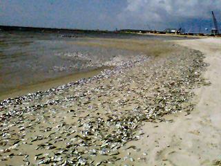
Something besides oil washed ashore along a section of beach in Gulfport. Construction workers at Jones Park called WLOX Monday morning with news about a fish kill.

You could smell the problem before seeing it. Dead menhaden, or pogeys, washed ashore along the beach.

The large fish kill created quite a mess. Piles of the small, silvery fish cover much of the shoreline just east of Jones Park from 15th Avenue to Moses Pier.

While many laid baking in the late morning sun, others were pushed ashore by the gentle surf.

Bizarro Earth

Papua New Guinea: Earthquake Magnitude 7.0 - New Britain Region

Image
© USGS
Date-Time:
Wednesday, August 04, 2010 at 22:01:45 UTC

Thursday, August 05, 2010 at 08:01:45 AM at epicenter

Time of Earthquake in other Time Zones

Location:
5.804°S, 150.767°E

Depth:
54 km (33.6 miles)

Region:
NEW BRITAIN REGION, PAPUA NEW GUINEA

Distances:
75 km (45 miles) ESE of Kimbe, New Britain, PNG

140 km (90 miles) ENE of Kandrian, New Britain, PNG

565 km (350 miles) NE of PORT MORESBY, Papua New Guinea

2415 km (1500 miles) N of BRISBANE, Queensland, Australia

Bizarro Earth

US: Earthquake Magnitude 5.3 - Utah

Image
© USGS
Date-Time:
Thursday, August 05, 2010 at 00:04:50 UTC

Wednesday, August 04, 2010 at 06:04:50 PM at epicenter

Location:
41.800°N, 112.111°W

Depth:
25.4 km (15.8 miles)

Region:
UTAH

Distances:
1 km (1 miles) SSE (157°) from Fielding, UT

3 km (2 miles) ESE (106°) from Riverside, UT

9 km (5 miles) NNE (30°) from Garland, UT

24 km (15 miles) WNW (287°) from Logan, UT

118 km (73 miles) N (351°) from Salt Lake City, UT

Umbrella

England records wettest ever July despite heatwave... and more rain is on the way

Image
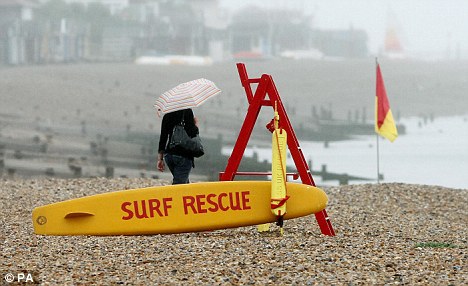
© Press AssociationUnseasonal: A beachgoer is forced to pull out an umbrella at Herne Bay, Kent, last week. The unsettled weather is set to continue across the country
The month that brought us a hosepipe ban, melting tarmac, health warnings about too much sun and a lot of very sunburnt bodies was also the wettest on record.

Despite a heatwave and the hottest temperature in decades, England suffered the wettest July ever recorded - and there is more to come forecasters have recorded.

According to provisional statistics from the Met Office, the UK was 46 per cent wetter than average and parts of the country also faced devastating floods.

Yet at the same time, the south east of the country was basking in temperatures well into the twenties as thousands of southerners took to parks, beaches and gardens to enjoy the heatwave.

But Scotland, Wales and Northern Ireland had 50 per cent more rain than usual in July.

The wettest place was Capel Curig in Wales where 340mm of rain fell in just one month.

But in the south of the country it was a completely different story.

Overall the south east had just 27mm of rain - only 40 per cent of the average expected for the month - and some places saw only 5mm, less than 20 per cent of the normal average.

It followed June conditions which were the driest since 1995 and led to low rivers and reservoirs, parched soils and increased water demand as well as a ban on hosepipes in some places that continued into July.

But weather forecasters say the dry spell in the south east is about to end.

Bizarro Earth

Alaska: Earthquake Magnitude 6.4 - Andreanof Islands, Aleutian Islands

Alaska Quake_040810
© USGSEarthquake Location
Date-Time:
Wednesday, August 04, 2010 at 12:58:24 UTC

Wednesday, August 04, 2010 at 03:58:24 AM at epicenter

Time of Earthquake in other Time Zones

Location:
51.426°N, 178.607°W

Depth:
27 km (16.8 miles) set by location program

Region:
ANDREANOF ISLANDS, ALEUTIAN IS., ALASKA

Distances:
40 km (25 miles) ENE of Amatignak Island, Alaska

60 km (40 miles) SSW of Tanaga Volcano, Alaska

2055 km (1280 miles) WSW of Anchorage, Alaska

2880 km (1790 miles) W of JUNEAU, Alaska