Earth ChangesS


Bizarro Earth

World is running out of places to catch wild fish, study finds

Image
© Randy Olson/National Geographic Stock
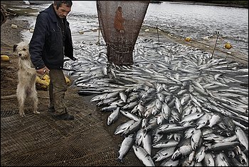
Global fisheries have expanded so rapidly over the past half-century that the world is running out of places to catch wild fish, according to a new study conducted by researchers in Canada, the United States and Australia.

The findings, published Thursday evening in the online journal PLoS ONE, are the first to examine how marine fisheries have expanded geographically over time. Looking at fleets' movements between 1950 and 2005, the five researchers charted how fishing has been expanding southward into less exploited seas at roughly one degree latitude each year in order to compensate for the fact that humans have depleted fish stocks closer to their shores in the Northern Hemisphere.

During that same period the world's fish catch increased fivefold from 19 million metric tons in 1950 to a peak of 90 million in the late 1980s, before declining to 87 million tons in 2005. It was 79.5 million tons in 2008, according to the U.N. Food and Agriculture Organization, the most recent year for which figures are available.

Daniel Pauly, a co-author who serves as principal investigator of the Sea Around Us Project at the University of British Columbia Fisheries Centre, said the global seafood catch is now dropping "because there's essentially nowhere to go." The fact that fish catches rose for so many decades "looks like sustainability but it is actually expansion driven. That is frightening, because the accounting is coming now."

Bizarro Earth

Australia: Monster locust swarm from NSW heading for Victoria

Image
Millions of locusts forming part of the biggest swarm to threaten Victoria in decades is about to enter the state, placing farmers and motorists at risk. The swarm, 25 kilometres wide and at least one kilometre deep, was in the Hay and Conargo region of New South Wales yesterday afternoon and travelling south-west. With Echuca and Swan Hill less than 200 kilometres away it was expected they would start arriving there overnight or this morning.

State Controller for Locusts Russell McMurray said vegetables and pasture were most at risk and urged farmers to consult agronomists to ensure the best treatment for their property. But he warned that no treatment offered 100 per cent protection. Up to 2000 locusts can be found in a square metre on the ground and up to 100 in the air, but Mr McMurray said density varied and he estimated this swarm contained ''millions and millions''.

Motorists in the areas have also been warned to add insect-cleaning agent to windscreen washer systems and to consider attaching an insect screen to the external radiator air-inlet.

Better Earth

White-out UK: Satellite pic shows nation under blanket of snow & ice

Image
University of Dundee pic reveals extent of ice-covered UK
This striking satellite image shows the extent of the big freeze that is currently paralysing the UK.

The snow and ice almost completely covers the entire nation and the Met Office is warning of worse to come.

The University of Dundee Satellite Receiving Station captured the startling image at 11.45am today from the NASA satellite Terra.

The white-out that is affecting virtually the entire country is clearly visible.

The latest Met Office forecast confirms the snow and icy conditions have continued to cause widespread disruption across many parts of the UK as temperatures fell as low as -21.1 °C at Altnaharra in Scotland.

Met Office severe weather warnings are in force across Scotland, eastern England, East Anglia and the South East, where further snow is likely to fall.

Igloo

Snow strands hundreds on New York highway

Image
© AP Photo/David DupreyVehicles are stranded on the New York State Thruway during a winter storm in Buffalo, N.Y., Thursday, Dec. 2, 2010.
Hundreds of cold and hungry motorists were stranded on a western New York highway Thursday after an accident caused a backup and the idling trucks and cars got stuck overnight in heavy snow. Authorities said 16 miles of eastbound lanes along Interstate 90 were shut Thursday in Buffalo's eastern suburbs, along with a 10-mile westbound stretch. Matt Welling was hauling a double tractor-trailer full of groceries when traffic came to a standstill a few miles east of Buffalo.

He spent the night "sitting back, playing a little Solitaire on the computer, taking a nap," the Wegmans driver said at midmorning, 8 1/2 hours into his wait. "I'm pretty chilly, hungry. A nice cup of coffee would do pretty well right now," he said by cell phone. State Trooper Daniel Golinski said the highway was closed shortly before 3 a.m. Thursday after vehicles backed up behind a truck accident were buried in blowing snow. The truck jackknifed around 8 p.m. Wednesday and has been removed, but crews were still working Thursday to free the stranded vehicles, Golinski said. "There's a lot of work to do yet," he said.

The storm buried the southern neighborhoods of Buffalo and the city's southern and eastern suburbs under two feet of snow, but largely spared downtown. "Very, very light flurries are blowing in the air, but streets downtown are pavement. Maybe an inch is on the ground," police spokesman Michael DeGeorge said from headquarters.

Attention

Mercury Poisoning Makes Male Birds Homosexual

Image
© Roy Toft/Getty ImagesPoisoned partners?
Low levels of mercury in the diet of male white ibises cause the birds to mate with each other rather than with females. As a result many of the females can't breed, and fewer chicks are produced.

It's the first time a pollutant has been found to change an animal's sexual preference. Many chemicals can "feminise" males or reduce fertility, but males affected in these ways still prefer females.

Mercury is extremely toxic, particularly in the form of methylmercury, which reduces breeding in wild birds by disrupting their parenting behaviours. To find out if it also affected mating, Peter Frederick of the University of Florida in Gainesville and Nilmini Jayasena of the University of Peradeniya, Sri Lanka, captured 160 young white ibises from south Florida. They gave them food laced with methylmercury and monitored them closely.

The birds were split into four groups. One group ate food with 0.3 parts per million methylmercury, which most US states would regard as too high for human consumption. A second group got 0.1 ppm, and the third 0.05 ppm, a low dose that wild birds would be exposed to frequently. The fourth group received none.

Igloo

UK: Millions endure second nightmare journey home from work as forecasters predict eight inches of snow tonight

Image
© PACrawling along: Motorists edge their way forward in the centre of York today
  • Woman dies after falling into freezing lake in West Yorkshire
  • Body of man in his 50s pulled from stream in Surrey
  • Eight inches of snow forecast tonight for London and South East
  • 900 flights cancelled as Gatwick and Edinburgh airports close
  • Shops running out of basics as lorries struggle to deliver
  • Passengers stranded overnight on freezing trains in South East
  • Police advise people not to go out unless absolutely necessary
  • Temperatures set to fall to -6c, with winds making it feel even colder
Britain's workforce was tonight embroiled in a second night of snow chaos with forecasters warning there is worse to come.

Police in several counties have been urging people to leave work early - with up to eight more inches of snow predicted in London and the South East tonight.

Eurostar said that half of its services would be cancelled today. It advised passengers to only make essential journeys.

Bizarro Earth

Papua New Guinea: Earthquake Magnitude 6.9

Image
© USGS
The U.S. Geological Survey says a powerful earthquake has shaken Papua New Guinea. The agency says the quake had a preliminary magnitude of 6.9 and struck Thursday about 20 miles (32 kilometers) beneath the ocean floor. It hit near the island province of New Britain, 295 miles (470 kilometers) northeast of the national capital Port Moresby.

From USGS:

Date-Time:
Thursday, December 02, 2010 at 03:12:10 UTC

Thursday, December 02, 2010 at 01:12:10 PM at epicenter

Time of Earthquake in other Time Zones

Location:
6.059°S, 149.851°E

Depth:
34.8 km (21.6 miles) set by location program

Region:
NEW BRITAIN REGION, PAPUA NEW GUINEA

Distances:
40 km (25 miles) ENE of Kandrian, New Britain, PNG

65 km (40 miles) SSW of Kimbe, New Britain, PNG

475 km (295 miles) NE of PORT MORESBY, Papua New Guinea

2400 km (1490 miles) N of BRISBANE, Queensland, Australia

Radar

Tremors of earthquake under Atlantic Ocean felt on New York's Long Island

Image
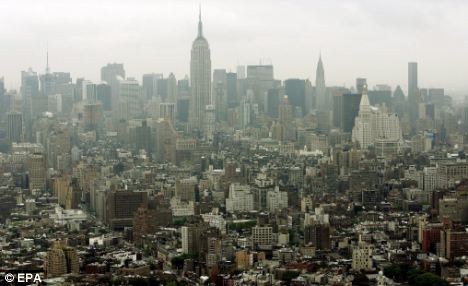
© Environmental Protection AgencyTremors: The earthquake, which measured 3.9 Ritcher Scale, was felt as far away as New York City
An earthquake under the Atlantic Ocean was felt by thousands of U.S. east coast residents yesterday - including people as far away as New York City.

The quake, which was recorded at 10.46am local time, measured 3.9 on the Richter Scale, according to the U.S. Geological Survey.

The event occurred about 80 miles south-east of Southampton, on New York's Long Island, and about 120 miles east of Toms River, New Jersey.

Most reports of light shaking came from Long Island and Connecticut.

Bizarro Earth

US: Winds lash the East, knock out power; roads flood

Image
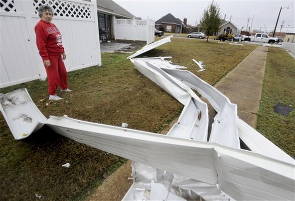
© AP Photo/Montgomery Advertiser, Mickey WelshPeggy Gaines looks at what is left of an awning and fence at her home in Prattville, Ala. following a severe storm on Tuesday, Nov. 30, 2010.
New York - Wind-whipped rain knocked out power Wednesday to thousands along the East Coast, closed the Statue of Liberty and delayed flights at three major airports. At least three people were killed.

Tornado watches were issued for parts of the Virginias, and sandbags were handed out in Washington, D.C., to protect homes from flooding. Thousands were without electricity in the mid-Atlantic region and New York, and some schools delayed openings.

Suspected tornadoes have touched down from Louisiana to South Carolina since Monday as part of the storm system, which reached the Northeast late Wednesday, with colder air turning the rain into snow.

Bizarro Earth

Fiji Region: Earthquake Magnitude 6.1 - 1st December 2010

Fiji Quake_011210
© USGSEarthquake Location
Date-Time:
Wednesday, December 01, 2010 at 16:01:27 UTC

Thursday, December 02, 2010 at 04:01:27 AM at epicenter

Time of Earthquake in other Time Zones

Location:
15.905°S, 178.948°W

Depth:
15.2 km (9.4 miles)

Region:
FIJI REGION

Distances:
185 km (115 miles) ENE of Lambasa, Vanua Levu, Fiji

195 km (120 miles) SSW of Sigave, Ile Futuna, Wallis and Futuna

375 km (230 miles) NE of SUVA, Viti Levu, Fiji

2400 km (1490 miles) NNE of Auckland, New Zealand