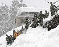
At least 21 people have been killed in east-central China by freezing temperatures and heavy snow that have disrupted the annual New Year travel rush, state media said Monday.
Eleven people were killed and 51 injured when an overloaded bus rolled off an icy road in eastern Anhui province late Sunday near Mingguang city, Xinhua news agency said.
It said the passengers were mostly migrant workers returning home to celebrate the Spring Festival on February 7, China's most important holiday.
The driver of the bus has been arrested for carrying 72 passengers, 21 more than allowed, it said.

|
| ©Unknown
|


Comment: An interesting speculation on the effect of asteroid 2007 TU24's close passage on our planet. It is also interesting to note that there are no articles on this event from the mainstream media, whereas Ron Paul's campaign team released a YouTube video. All the available articles on the net are from bloggers and forum members.