Earth ChangesS


Bizarro Earth

Indonesia: Over 2,000 evacuated in Mount Lokon eruption

Over 2,000 people have been displaced in the latest eruption from Indonesia's Mount Lokon, which is located on the northern tip of the island of Sulawesi, officials said Wednesday.

North Sulawesi Disaster Management Agency (BPBD) chief Hoyke Makarawung told Antara news agency that the total number of refugees, as of Wednesday at noon local time, was 2,116 people. The evacuees are all residents of Kinilow, Kinilow I and Kakaskasen villages, which are located in the sub district of North Tomohon, near the erupting volcano.

According to reports, one person died during the evacuation, which was carried out by BPBD, local authorities, the Indonesian Red Cross, military personnel, and local youth groups. However, Hoyke said the individual had previously suffered from strokes, and it is still uncertain whether the death was directly related to the eruption.

Cloud Lightning

US, Idaho: Severe Thunderstorms Move Through Upper Snake River Plain

A severe thunderstorm warning remains in effect until 315 pm mdt for north central Bonneville county, At 248 pm mdt, national weather service doppler radar continued to indicate a severe thunderstorm with hail up to 1 inch in diameter. This storm was located near Iona, or 8 miles northeast of Ammon, moving northeast at 20 mph. Locations that could be affected include, rural northern Bonneville county, Precautionary/preparedness actions, Stay tuned to this broadcast for the latest updates and information. To report severe weather only, call 1 800 8 7 7 1 9 3 7.

Severe Thunderstorm Warning: The NWS in Pocatello has issued a severe thunderstorm warning for: central Bingham county in southeast Idaho, this includes the city of Blackfoot, Until 330 pm mdt. At 242 pm mdt, national weather service doppler radar indicated a severe thunderstorm capable of producing quarter size hail, and damaging winds in excess of 60 mph. This storm was located near Gibson, or near Blackfoot, and moving northeast at 15 mph. Locations that could be affected include, Blackfoot, Rose, Precautionary/preparedness actions, This is a dangerous storm. If you are in its path, prepare immediately for damaging winds, destructive hail, and deadly cloud to ground lightning. People outside should move to a shelter, preferably inside a strong building but away from windows. Stay tuned to this broadcast for the latest updates and information. To report severe weather only, call 1 800 8 7 7 1 9 3 7.

Bizarro Earth

Iceland: Glacier flood confirmed from Vatnajökull glacier, flood is from Hamarinn volcano (Loki-Fögrufjöll area)

The harmonic tremor that started yesterday has been confirmed to be coming from Hamarinn volcano (Bárðarbunga volcano), but they are also known as Loki-Fögrufjöll in GVP database.

So far there is nothing that indicates an eruption is taking place at the moment in Hamarinn volcano. But that might change without warning. At the moment nobody is sure where the glacier flood is coming from. But this appears to be a new area of hydrothermal activity in Hamarinn volcano that is releasing water at the moment. This new hydrothermal area is most likely created by new dike intrusions into the bed rock in the affected area. There are no pictures of the affected area, as the area is impassible to air plains at the moment due to cloud cover or fog. Lack of earthquakes also makes it hard to locate the source of this glacier flood.

Currently the glacier flood has peaked and is getting lower. There not expected to be any damage from this glacier flood on human structures or roads. This area of Iceland is unpopulated. The water is going into large lakes in the area where the effects of this glacier flood are almost none. The glacier flood did flow into a dam lake that is collecting water from rivers that this glacier flood did go into. This did make the lake rise about 70 cm in several hours and fill it. No damage is expected from this glacier flood to the dam or other structures in this area connected to the dam. But it is estimated that 26 gigaliters did flow into the dam lake during the night from this glacier flood.

Bug

US: Stinky Kudzu Bug Invades South

Kudzu Bug
© D. Suiter / Univ. GeorgiaKudzu bugs, which feed on the infamous vine, showed up in Georgia in 2009.
As if kudzu, the invasive "vine that ate the South," weren't trouble enough, one of its little friends from Asia has joined it in the United States.

The kudzu bug, known formally as Megacopta cribraria, is a type of stinkbug that feeds the kudzu vine in its native Asia. While the invading vine is its favorite meal, the bug also attacks soybeans, and as it spreads from Georgia to neighboring states, there are fears it will broaden its palate and target other legume crops, including peanuts.

Kudzu was brought to the East Coast more than a century ago to control erosion. Its quick growth wreaked havoc on the ecosystem: It smothers and strangles other plants, uproots trees and breaks branches with its weight. The bug appears to have hitched a ride by accident much more recently. Just how remains a mystery.

Bizarro Earth

US: Supersize Dust Storms Could Become Southwest Norm

Phoenix Haboob
© Wired.com
The massive dust storm that engulfed Phoenix last week was unusual for the 20th century, but could become more common in the 21st.

The storm resulted from thunderstorm-cooled air plummeting into the ground like mist pouring from an open freezer, only exponentially more powerful. Combine those winds with extremely dry conditions, and the result was a wall of dust 100 miles wide and 5,000 feet high.

Dust storms are common in the U.S. southwest, but not storms this big. No formal records are kept, but meteorologists said it was the largest such storm in at least 30 years. It was on par with storms seen in China's Gobi desert and Australia. Some commentators invoked the apocalyptic storms of the 1930's Dust Bowl.

Bizarro Earth

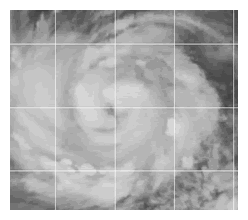
Typhoon Ma-on Poses New Threat to Japan

Typhoon Ma-On
© Joint Typhoon Warning CenterSatellite image of Typhoon Ma-on at 10:00 a.m. ET.
Still in the midst of its long recovery from the earthquakes and tsunami of early March, Japan must now keep a watchful eye on typhoon Ma-on, rapidly intensifying in the western Pacific. The storm could impact the disaster-ravaged country early next week.

The Joint Typhoon Warning Center (JTWC) reports this morning that Ma-on, about 655 miles east-southeast of Iwo-Jima, has shown "steadily improving organization" over the past six hours, with convection "consolidating around the core" and the emergence of an eye.

The storm's current peak winds are 75 mph, equivalent to category 1 hurricane.

The storm is expected to remain within a tropical airmass with low wind shear and warm sea surface temperatures as it continues west through the northern Philippines Sea. Consequently, significant intensification is forecast over the next 72 hours, with peak winds predicted to reach 125 mph by Saturday morning, equivalent to a category 3 hurricane. JTWC cautions there is no reason to expect signficant weakening until the storm makes landfall.

Bizarro Earth

Chile: Rare Snow in Atacama Desert

Atacama Desert_1
© MODIS Rapid Response Team at NASA GSFCAcquired - July 7, 2011
Atacama Desert_2
© MODIS Rapid Response Team at NASA GSFCAcquired - July 7, 2011
Ordinarily, the flashes of white in South America's Atacama Desert rise from salt pans. But on July 7, 2011, when the Moderate Resolution Imaging Spectroradiometer (MODIS) on NASA's Terra satellite acquired these images, the white came from a far rarer commodity: snow.

Starting on July 3 and lasting several days, a cold front dumped up to 80 centimeters of snow (32 inches) on the driest desert in the world, reported BBC News.

The images above show the largest snowfall the region has witnessed in a half-century. The top image provides a photo-like, natural color view of the snow. A few clouds hang over the white desert, marring the view slightly. The lower image, which includes both visible and infrared light, helps distinguish between snow and clouds. Snow is dark red, while clouds are lighter shades of orange and white.

Snowman

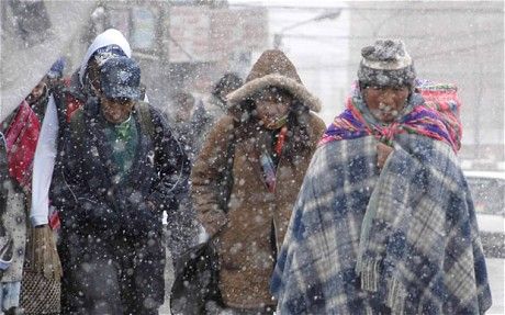
Thousands Stranded by Worst Snows in Bolivia for 20 Years

snow to the capital La Paz
© EPAA cold snap that brought fog and snow to the capital La Paz at the start of this month killed at least 35 people
Thousands of people have been left stranded by the worst snow storms in Bolivia for 20 years.

President Evo Morales was reported to be considering declaring a state of emergency in the region of Potosi to mobilise the army and national guard.

Some 7,000 people belonging to farming families are in need of help in the region, according to officials.

More than 40,000 llamas and alpacas are also without food and farmers have lost their crops under a thick blanket of snow.

The snow has hit the remote highlands of Potosi, which lies in the south-west of the country and generally remains dry.

Bizarro Earth

Costa Rica: 5.3 Earthquake in Upala Alajuela

earthquake damage
© n/a
Today at approximately 2:11pm in the afternoon, Upala was rattled by a 5.3 magnitude earthquake that shook products off store shelves and rattled off home furnishings. No immediate damages were reported however later in the afternoon something strange was discovered as a result.

While reporting on the earthquake in Upala today, a local news station discovered that a district near the epicenter was missing a river. That's right...A RIVER.

Apparently in the moments following the earthquake, a community stood watch as their river disappeared in to the Earth. As of this writing it is still unknown exactly which community this occurred in however once we have the name we will update this article. The affected citizens were interviewed and expressed concern for the loss of this substantial water supply to the area. Not only will this affect humans but also the livestock raised in the area.

Additionally there was also a 4.8 earthquake registered in Guanacaste near Santa Rosa de Bagaces today.

Cloud Lightning

Heavy rains strike north of Sweden

Image
© Per Eriksson/Scanpix
On Tuesday torrential rain flooded many roads in Sundsvall on the eastern coast of Sweden, a major power outage in the area was caused by the ensuing thunderstorms and a man in his sixties was taken to hospital after being struck by lightning.

Emergency services in Sundsvall are now putting all their efforts into draining the infrastructure. Head of local emergency services, Mats Granat, is counting on being busy all night - if the weather clears.

"If the rains continue we'll be working much longer," he told news agency TT.

So far the water level hasn't risen enough to pose a threat to the general public, according to Granat.