Earth ChangesS

No Entry

M2 motorway closed in Kent, England after monster 15ft-deep sinkhole suddenly opens up in central reservation

The Highways Agency said the hole measured 16ft (5m) by 6ft (2m) and was 50ft (15m) deep

M2 sinkhole

Thousands of motorists were caught up in travel misery tonight after a monster, 15ft-deep sinkhole appeared in the middle of a busymotorway.

A ten-mile section of the M2 in north Kent was closed off this afternoon when the 16-foot-wide hole appeared in the central reservation.

Highways Agency experts are examining the hole - the size of a double decker bus - which is believed to have been caused by recent heavy rainfall.

It is thought that both carriageways between junction 5 near Sittingbourne and junction 6 near Faverham would not re-open until tomorrow at the earliest.

A Highway Agency spokesman said: "We have had to close both carriageways because of the discovery of a hole in the central reservation."

Comment: Note the comment here by AA president Edmund King:
"Thankfully this was on the central reservation. If a hole of this nature had opened up on a carriageway it could well have led to tragedy. I don't think this is anything to do with potholes or general maintenance. There seems to have been some structural anomaly - perhaps some sort of geological fault or an old mineshaft.

Clearly, it's a concern that this has happened on a busy motorway that leads to and from the coast. Engineers will want to deal with this as soon as possible. If the stretch of motorway stays shut it will cause traffic problems, but safety must come first."


Attention

Winter storm wallops the Southern U.S.; 4 killed in Texas

Image
© AP Photo/ Atlanta Journal & Constitution, Curtis Compton
The city dodged the first punch of a dangerous winter storm Tuesday, but forecasters warned of a potentially "catastrophic" second blow in the form of a thick layer of ice that threatened to bring hundreds of thousands of power outages and leave people in their cold, dark homes for days.

The streets and highways in metro Atlanta were largely deserted as people in the South's business hub heeded advice from officials to hunker down at home, especially after the epic snow jam two weeks ago that saw thousands of people stranded on icy, gridlocked roads for hours when two inches of snow fell.

"Last time I was totally unprepared, I was complete blindsided," said Lisa Nadir, of Acworth, who ended up spending the night in her car after sitting in traffic 13 hours when the storm hit Jan. 28. "I'm going to be prepared from now on for the rest of my life."

Nadir was telecommuting from home Tuesday and she had kitty litter in her trunk in case she needed to put it down on icy roads for extra traction.

The forecast drew comparisons to an ice storm in the Atlanta area in 2000 that left more than 500,000 homes and businesses without power and an epic storm in 1973 that caused an estimated 200,000 outages for several days. In 2000, damage estimates topped $35 million.

Ice Cube

Coming Winter storm in U.S. 'could be biggest of the season'

Image
© Chip Somodevilla/Getty Images
A major winter storm is expected to barrel up the East Coast mid-week, bringing a potentially significant snowfall to the already winter weary Washington region.

The powerful Nor'easter will blow into the mid-Atlantic region sometime after dark Wednesday is forecast to dump between 6 inches and a foot of snow on the area before blowing north Thursday afternoon.

"There's even a chance of more than a foot, especially just north and west of the District," meteorologist Bill Deger said.

WUSA 9 meteorologist Topper Shutt also believes the storm has the potential to be a monster.

"This could be the biggest storm of the season," said Shutt.

A mix of rain and sleet could decrease accumulations in southern Maryland and eastern Virginia, but the immediate Washington region should primarily see snow.

A Winter Storm Watch has been issued for the entire D.C. and Baltimore metro areas from 7 p.m. Wednesday to 10 p.m. Thursday. A Winter Storm Watch means there is a potential for significant snow accumulations that may impact travel, according to the National Weather Service.

Nebula

Atmospheric changes: Rare rainbow cloud appears over Canterbury, NZ

Image
© Pauline BennettAn iridescent 'rainbow' cloud photographed above the Molesworth hills.
A tramper has spotted an unusual "rainbow" cloud in North Canterbury.

Pauline Bennett, of Hanmer Springs, took a photo of the iridescent cloud while walking along a ridge above the Clarence River.

She said the cloud hung above the Molesworth hills for about five minutes, giving the trampers a chance to photograph it before the light changed.

MetService meteorologist John Law said Bennett's images were a "great example" of iridescent clouds.

"They are higher-level clouds made of small ice particles or water droplets of similar size which scatter sunlight to give this great effect," he said.

Law said the clouds were rare and hard to spot. "They normally form relatively close to the sun in the sky, so can be hidden by the glare."

Attention

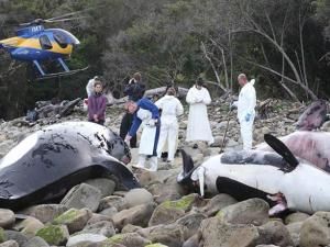
9 Killer whales beach near Tuatapere, New Zealand

Image
© SouthlandScientists examine orcas who stranded on New Zealand beach
Nine whales are understood to have died when they were beached near Tuatapere today.

Tuatapere woman Tracy Thomas said she went to take photos of the beached whales, which she believed were Orca whales, after a neighbour called her to say he had spotted them.

The whales beached at Trackburn, west from Bluecliffs Beach near Tuatapere, Mrs Thomas said.

"There were nine of them and they were all dead, which is quite sad," she said.

She believed they were Orcas because of their black and white colour.

Mrs Thomas took her camera with her to photograph the whales at about 7.30pm.

"I was very lucky because while I was there a helicopter was taking one away," she said.

"It seemed to be the smallest one."

It was uncommon to see Orcas in the waters near Tuatapere, she said.

"I photographed them a couple of years ago."

"The last time a whale beached here was when my husband was a child," she said.

A Department of Conservation spokeswoman said they were aware of the incident, but no further information would be available until tomorrow.

Source: The Southland Times

Cloud Lightning

Storm kills 3 in Pacific Northwest U.S.

Image
© Rich Pedroncelli/AP ImagesDrought-stricken California is getting some relief as a storm system the likes of which the region has not seen in more than a year, according to forecasters.
A sizeable storm contributed to three deaths and several school closures in the Pacific Northwest this weekend, but weather officials say it will take weeks of similar weather to stave off drought in California - on the brink of a Stage 3 water emergency,

The National Weather Service says the first significant storm to hit Northern California in 14 months has produced impressive amounts of rain and snow, but forecasters cautioned Sunday that it would take weeks of similar drenching to end the state's immediate drought worries.

Parts of the northern San Francisco Bay Area saw sizable amounts of rain, along with flooding, downed trees and power outages. By late Sunday, the Sonoma County town of Guerneville had received more than 15 inches of rain since the storm moved in Thursday, while downtown San Francisco got more than 3 inches, said Bob Benjamin, a National Weather Service forecaster in Monterey.

The storm, powered by a warm, moisture-packed system from the Pacific Ocean known as a Pineapple Express, was expected to bring more rain Sunday before moving east.

In the Pacific Northwest, in central Oregon, the Deschutes County sheriff's office was investigating three storm-related deaths, including that of a 61-year-old Bend man who collapsed while shoveling snow outside his home. An elderly couple was also found Saturday buried in snow, and authorities believe they were walking through heavy snow on an unplowed driveway to their home.

Comment: San Francisco: Pineapple Express storm brings rain, flight delays


Life Preserver

Valentine's Day Massacre: Major weather event will smash UK on Friday

Image
© NTIHeavy rain has caused devastating flooding in Ironbridge near Telford, Shropshire.

Britain is in the firing line for yet another violent storm to unleash chaos next weekend.

Forecasters have warned the entire country to be on alert for 80mph gales and torrential downpours.

A deep low pressure system is currently swirling over the Atlantic and heading straight for our shores.

Forecasters warned Britons to expect a "Valentine's Day massacre" as the frenzied storm rips into the UK on Friday night.

Weather models show a system even worse than this weekend's 'Storm Charlie', which tore across parts of the country, is forming in the Atlantic and on a direct course for Britain.

It comes as shocking new video footage emerged of reckless members of the public standing just INCHES from a cliff edge near Sennan, Cornwall as hurricane force 11 gales lashed the coast on Saturday.

The intense storm system is on course to crash into Britain next weekend pummeling regions already in flood crisis including Somerset and Berkshire, where today the Thames was threatening to burst its banks.

Waves of more than 50 feet will threaten southern coasts as the low pressure drags a colossal 'sea swell' towards land.Forecasters warned next week's 'major event' will be the third fresh Atlantic depression to hit this week after a big storm hits western Britain overnight tonight with another violent spell of weather due on Wednesday.

Arrow Up

Volcano in Ecuador causing crop shortage, rising prices

Image
After a week of eruptions, the Tungurahua volcano in Ecuador has damaged thousands of hectares of crops, leaving a feed shortage for 110,000 head of livestock. The volcano erupted on Feb. 2, sending an ash plume about 13 km high, followed by two other moderate-sized explosions that sent ash about five kilometers into the sky. Since then, the volcano has continued to erupt.

The thick ash is coating crops and monsoon winds are causing the ash to spread around the countryside widely. In order to minimize the losses incurred by the volcano's eruption, farmers have begun to harvest tomatoes, potatoes and corns before they reach maturity. According to local media reports, the spreading volcanic ash has led to vegetable shortages in some large and medium-sized cities in the country. In Guayaquil, the biggest city in Ecuador, prices for onions, corn and potato have risen for about 10 per cent, the report said.

Snowflake Cold

NYC to shiver before pre-Valentine's Day storm threat

Image
Following the snow ending the weekend, a pre-Valentine's Day storm is being monitored.

A storm that moved through the Northeast early Sunday night left a fresh 1 to 2 inches of snow across the New York City area.

Frigid air is following the snow and will hold temperatures to the lower 30s on Monday. Highs between 26 and 30 F are in store for Tuesday and Wednesday with lows in the teens during the early morning hours.

Snowflake Cold

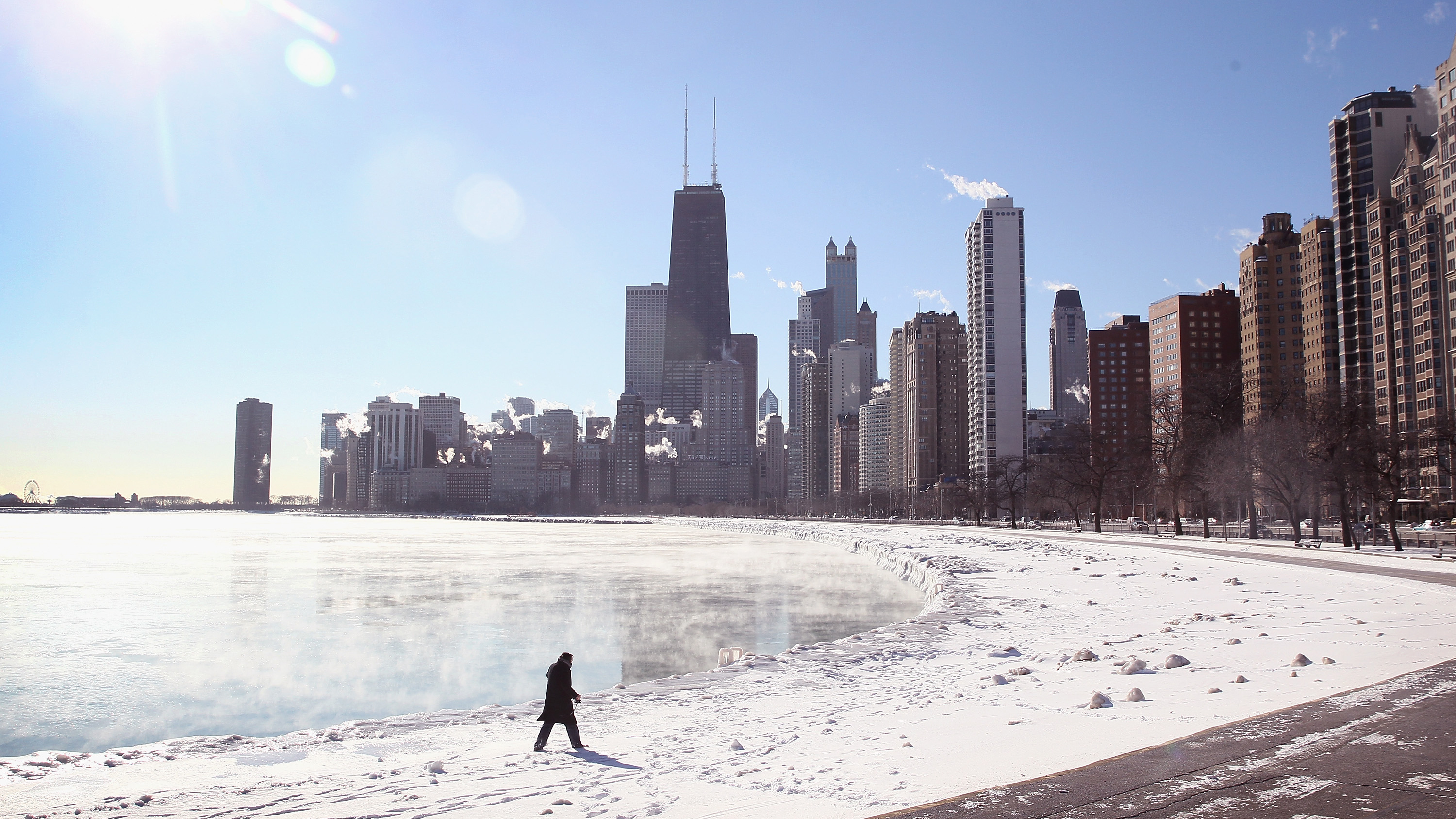
Chicago nearing record for days below zero

Image
© Scott Olson/Getty ImagesWith temperatures hovering around -10 degrees steam rises from Lake Michigan January 27, 2014 in Chicago, Illinois.
With temperatures plunging below zero again overnight, Chicagoans were starting another work week in frigid conditions, and the city was approaching the record for number of days of subzero cold.

As Monday morning's temperature dipped to 3 below zero at O'Hare International Airport, Chicago now has had 20 days of below zero temperatures this winter. Temperatures were even colder in the outlying suburbs, where it was up to 14 below in Aurora and McHenry, and 13 below in Kankakee.

Only six winters on record have had more days of below zero weather in Chicago: 1884-85, 1935-36, 1962-63, 1981-82, 1874-75, and 1978-79.

The record for most days of below zero temperatures was set in the winter of 1884-85, when there were 25 such days. With more than a month left until the first day of Spring, and at least one more day of subzero temperatures this week, it's quite likely Chicago will break that record.