Earth ChangesS


Ice Cube

Slow ice melt on the Great Lakes could lead to chilly summer

Image
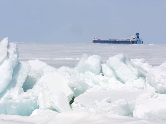
© Photo: Eric Seals, Detroit Free PressA freighter makes its way along after passing under the Mackinac Bridge on April 15. The shipping season is off to a very slow start because of unseasonably heavy ice.
The Winter of 2013-14 demands that it be remembered.

A relatively cool spring will give way to a colder-than-usual summer locally, all because of the continuing impacts of the intensely frigid, snowy winter, scientists said. And at least one Great Lakes ice researcher thinks that the domino effect could continue into a chilly fall and an early start to next winter - and beyond.

The reason is the unusually late ice cover that remains on the Great Lakes. Heading into May, the Great Lakes combined remain 26% ice-covered, with Lake Superior still more than half-blanketed in ice. By comparison, at this time last spring the lakes were less than 2% covered with ice.

The remaining levels of ice cover are amazing, said Jia Wang, an ice climatologist at the National Oceanic and Atmospheric Administration's Great Lakes Environmental Research Laboratory in Ann Arbor.

"This prolonged winter will affect summer temperatures. This summer will be cold, and then a cooler fall," he said.

In addition to wreaking havoc on the Great Lakes shipping industry and impacting fish and other aquatic species, the miles of ice cover serve as a vast, white reflector.
Ice Cube

Obama's top climate advisers make embarrassing blunder over fundamental climate patterns

'Houston, we have a dumbass problem'

I'm truly sorry about the title, but nothing else really describes the ridiculousness of the pronouncement by the White House aide John Podesta over these two satellite images in a maddeningly idiotic story from the Washington Post.
Image
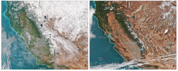
In a Feb. 24 Oval Office meeting, two of President Obama's top climate advisers presented these sharply-contrasting images of California's snowpack on Jan. 13, 2013 (left) and a year later (right), as a way to underscore how global warming is changing conditions on the ground in the United States.
The satellite images viewed by President Obama before a meeting with eight Western governors were stark, showing how snowpack in California's mountains had shrunk by 86 percent in a single year.

"It was a 'Houston, we have a problem' moment," recalled White House counselor John D. Podesta, one of two aides who briefed the president that February day. Obama mentioned the images several times as he warned the governors that political leaders had no choice but to cope with global warming's impact.

After years of putting other policy priorities first - and dismaying many liberal allies in the process - Obama is now getting into the weeds on climate change and considers it one of the key components of his legacy, according to aides and advisers.

Bizarro Earth

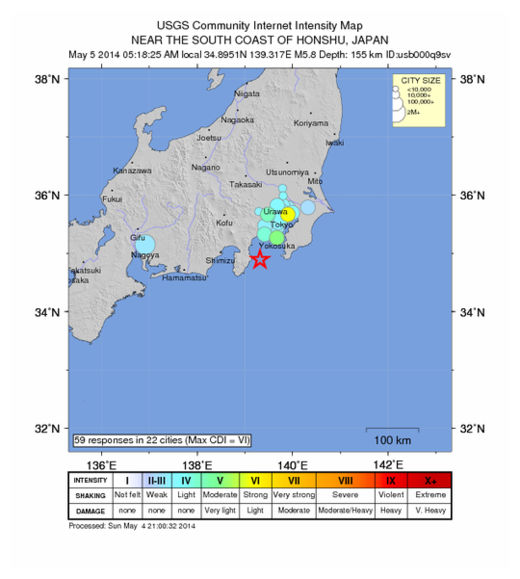
USGS: Earthquake Magnitude 6.0 - 23km ESE of Ito, Japan

Ito Quake_040514
© USGS
Event Time
2014-05-04 20:18:24 UTC
2014-05-05 05:18:24 UTC+09:00 at epicenter

Location

34.862°N 139.312°E depth=155.1km (96.4mi)

Nearby Cities
23km (14mi) ESE of Ito, Japan
33km (21mi) SE of Atami, Japan
38km (24mi) SE of Yugawara, Japan
39km (24mi) ENE of Shimoda, Japan
98km (61mi) SSW of Tokyo, Japan

Technical Details

Comment: As you can see from the chart below there have been a LOT more earthquakes recently!


Bizarro Earth

Record high levels of seismic activity at undersea volcanoes near Mariana Islands, eruptions imminent

Underwater Volcano
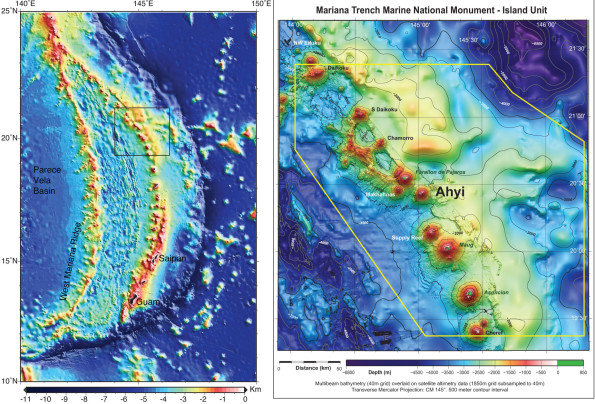
© Susan Merle/NOAABathymetric maps showing the islands and seamounts that make up the Mariana volcanic island arc (left) and the area of Ahyi seamount in the northern part of the arc (right). Susan Merle of NOAA’s Earth-Ocean Interaction Program created these maps.
During the past week, we have been keeping a close watch on the Northern Mariana Islands (NMI), as seismometers on the islands record high levels of seismicity from an undersea volcano near the island of Farallon de Pajaros.

The seismic signals almost certainly herald an eruption. In fact, submarine explosions were heard by scuba divers who are conducting coral reef research in the area. The divers even felt the shock waves from the explosions, and one of the most powerful ones reverberated through the hull of the NOAA base ship, Hi'ialakai, leading the crew to think something had happened to the ship. Shipboard personnel also reported a large sulfur slick on the southeast coastline of Farallon de Pajaros.

Unfortunately, the ship had to leave the area under threat of an advancing typhoon. If they can get back to the vicinity soon, they may be able to investigate the source of the explosions with great caution, keeping in close contact with U.S. Geological Survey (USGS) and CNMI emergency management personnel, who are monitoring the seismicity.

The CNMI emergency management office and the volcano observatories of the USGS have been working together for over 30 years to establish volcano monitoring networks and assess volcanic hazards in the Mariana Islands.

Binoculars

Rare nonmigratory Arctic bird seen on Point Peninsula, New York

Image
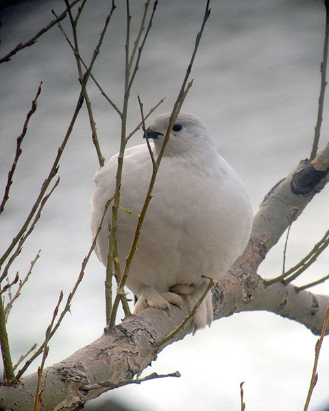
© Jeff Bolsinger.A Willow Ptarmigan along eastern Lake Ontario. The sighting this week is a first for New York State.
Carloads of birders from across the region have visited the shore of Lake Ontario, near Watertown, over the last few days hoping to glimpse a rare avian visitor from the Arctic tundra.

Late last week, Eugene Nichols was birding near Point Peninsula and found an all white bird that didn't belong in northern New York. Nichols contacted Jeff Bolsinger, a bird biologist at Fort Drum, who confirmed that it's a Willow Ptarmigan. Bolsinger says the bird normally lives only in northern Canada and Alaska. He says the sighting this week is the first documented sighting of a Willow Ptarmigan in New York State, and the second recorded in the lower 48 states in a century.

Bolsinger told Todd Moe he's not sure how the bird ended up this far south, but it's become an instant celebrity in the birding community.


Windsock

Wildfire, powerful winds, triggers mass evacuation near Los Angeles

Image
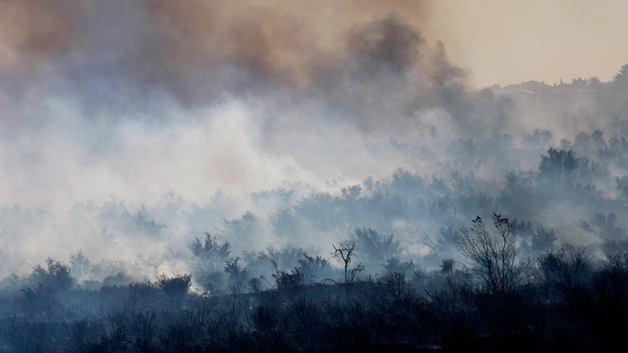
© Reuters/David McNewSmoke rises from a charred landscape as a wildfire driven by fierce Santa Ana winds spreads in Rancho Cucamonga, California, April 30, 2014.
A rapidly spreading wildfire in Southern California forced the evacuation of more than 1,600 homes Wednesday, as powerful winds drove it closer and closer to a city just east of Los Angeles.

The fire initially began around 8 a.m. Wednesday morning in the Etiwanda Preserve of the San Bernardino National Forest. Although it started off covering only about 20 acres of forest, strong and unpredictable gusts of wind from the neighboring mountains quickly spread the fire through 200 acres in a span of two hours.

By the middle of the day, the fire had scorched through more than 1,000 acres of land, buoyed by winds up to 80 miles per hour. According to the Los Angeles Times, the fire had only been 10 percent contained by Thursday morning.

Bizarro Earth

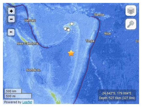
USGS: Earthquake Magnitude 6.6 - South of the Fiji Islands

Fiji Quake_050414
© USGS
Event Time
2014-05-04 09:15:53 UTC
2014-05-04 21:15:53 UTC+12:00 at epicenter

Location
24.642°S 179.084°E depth=527.6km (327.8mi)

Nearby Cities
497km (309mi) SSW of Ndoi Island, Fiji
703km (437mi) SW of Nuku'alofa, Tonga
722km (449mi) S of Suva, Fiji
777km (483mi) SSE of Nadi, Fiji
911km (566mi) S of Lambasa, Fiji

Technical Details

Newspaper

Sinkhole appears in Panama City beach, FL neighborhood

panama city beach sinkhole
© Unknown

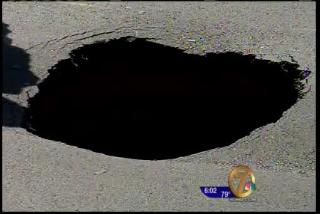
A sinkhole is inconveniencing some residents in a Panama City Beach neighborhood Saturday.

Bay County Sheriff's deputies received a call shortly before 2 P.M. from a neighbor about a sinkhole. Officials say the sinkhole off Boca Lagoon Drive is at least 15 feet wide and 4 feet deep.

Deputies closed portions of the road for safety reasons and are making cars drive on the grass to avoid the sinkhole. The Bay County Roads and Bridges Department and the Panama City Beach Water Department are trying to figure out who's jurisdiction the road is in before they fix it.

Newspaper

Villages, FL sinkhole re-opens, being filled a second time


A sinkhole that officials filled over the weekend in The Villages has reopened.

Question

Early fish die off in Maryland waters centered on Baltimore remains a mystery

Baltimore fish die off
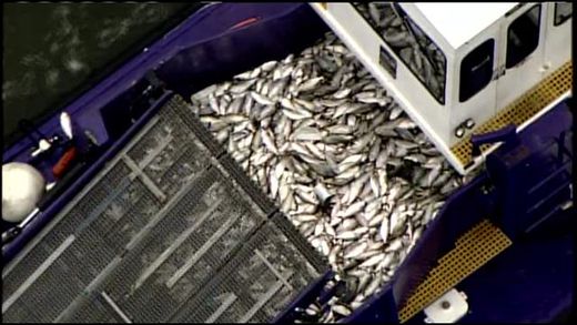
A skim boat filled with dead fish from Baltimore's Inner Harbor.
As quickly as it started, a fish kill in Baltimore's Inner Harbor appears to be easing.

Alex DeMetrick reports what triggered the sudden die-off is still guesswork.

The city moved fast to remove the die-off, with skim boats collecting hauls more commonly seen on commercial fishing boats and as menhaden and shad died from the Inner Harbor out to the Key Bridge.

"And some of them were struggling at the surface, looking like they were trying to catch their breath. It was sad to see; it was just so widespread," said John Tapscott, Chesapeake Bay Foundation.