Earth ChangesS


Nuke

When We Tested Nuclear Bombs

Since the time of Trinity -- the first nuclear explosion in 1945 -- nearly 2,000 nuclear tests have been performed, with the majority taking place during the 1960s and 1970s. When the technology was new, tests were frequent and often spectacular, and led to the development of newer, more deadly weapons. But starting in the 1990s, there have been efforts to limit the future testing of nuclear weapons, including a U.S. moratorium and a U.N. comprehensive test ban treaty. As a result, testing has slowed -- though not halted -- and there are questions about the future. Who will take over for those experienced engineers who are now near retirement, and should we act as stewards with our enormous stockpiles of nuclear weapons? Gathered here are images from the first 30 years of nuclear testing. See also "Can We Unlearn the Bomb?" and "Atomic Weapons on Film."

Image
© US DODA fireball begins to rise, and the world's first atomic mushroom cloud begins to form, nine seconds after Trinity detonated on July 16, 1945.

Comment: Still think smoking is to blame for lung cancer? Could the truth be more revealing? They are blaming the victims for their own evil...

Also, see SOTT's Best of the Web A Time-Lapse Map of Every Nuclear Explosion Since 1945.


Bizarro Earth

Loyalty Islands: Earthquake Magnitude 6.8

Image
© USGS
Date-Time:
Tuesday, May 10, 2011 at 08:55:09 UTC

Tuesday, May 10, 2011 at 07:55:09 PM at epicenter

Time of Earthquake in other Time Zones

Location:
20.252°S, 168.273°E

Depth:
14.9 km (9.3 miles)

Region:
LOYALTY ISLANDS

Distances:
134 km (83 miles) SW of Isangel, Tanna, Vanuatu

149 km (92 miles) NNE of Tadine, Loyalty Islands, New Caledonia

276 km (171 miles) S of PORT-VILA, Efate, Vanuatu

1741 km (1081 miles) ENE of BRISBANE, Queensland, Australia

Bizarro Earth

US: Earthquake Magnitude 3.9 - Colorado

Image
© USGS
Date-Time:
Monday, May 09, 2011 at 23:28:53 UTC

Monday, May 09, 2011 at 05:28:53 PM at epicenter

Location:
37.139°N, 104.726°W

Depth:
4.9 km (3.0 miles)

Region:
COLORADO

Distances:
9 km (6 miles) W (266°) from Cokedale, CO

18 km (11 miles) W (278°) from Starkville, CO

20 km (12 miles) W (260°) from Trinidad, CO

126 km (78 miles) S (184°) from Pueblo, CO

288 km (179 miles) S (176°) from Denver, CO

Binoculars

US: Mississippi Delta sees flooding from mighty river

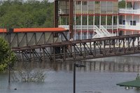
Memphis - Parts of the Mississippi Delta are beginning to flood, sending white-tail deer and wild pigs swimming to dry land, submerging yacht clubs and closing casino boats, and compelling residents to flee from their homes.

The sliver of land in northwest Mississippi, home to hardship and bluesman Muddy Waters, is in the crosshairs of the slowly surging river, just like many other areas along the banks of the big river.
Image
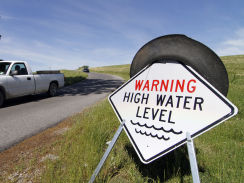
© Associated Press/Rogelio V. SolisA walkway to the Lighthouse Point Casino lies underwater as the waters in Lake Ferguson begin to rise as does its feeder source, the Mississippi River, May 5, 2011 in Greenville, Mississippi.
To points much farther north, thousands face the decision of whether to stay or go as high water kept on rolling down the Mississippi and its tributaries, threatening to soak communities over the next week or two. The flooding is already breaking high-water records that have stood since the 1930s.

"We're getting our mamma and daddy out," said Ken Gelston, who helped pack furniture, photos and other belongings into pickup trucks in Greenville, Miss.

Cloud Lightning

US: Thousands in Memphis told to evacuate as flood waters close in

Image
© My 5Flood waters near Riverside Drive Friday morning in Memphis.
Memphis, Tennessee - Teams from Shelby County and the city of Memphis conducted a door-to-door operation Friday to tell thousands of residents it is time to evacuate.

Meanwhile, the parking lot of the Raleigh Springs mall was an oasis Friday for Shelby County residents being targeted by flood waters.

Elizabeth Benson checked in to see if her house off Thomas and Frayser Boulevard was in danger. The news wasn't good.

"I need to prepare for the possibility of being flooded out," she said.

Local authorities were uncertain whether they had legal authority to order evacuations, and hoped the fliers would persuade people to leave. Bob Nations, director of emergency management for Shelby County, which includes Memphis, said there was still time to get out. The river is not expected to crest until Wednesday.

Radar

US: Coast Guard reopens part of Mississippi River

Image
© Associated Press/Rogelio V. SolisA sightseer drives down from the levee road in Greenville, Miss., May 5, 2011.
River monitoring will continue and navigation will be restricted when necessary, says Coast Guard captain

From Illinois to Mississippi, record flooding is getting worse everyday, causing river communities to evacuate. Mark Strassmann reports from Finley, Tenn. on the disaster in slow motion.

Memphis - Children played in front yards and neighbors chatted under a cloudless sky Friday in a south Memphis neighborhood, yards away from the rising water of the Nonconnah Creek.

The unforgiving creek has soaked Johnny Harris' house as the rest of Memphis awaits flood waters from the Mississippi River. Harris estimated he had more than 3 feet of water in his small, rented house on a low-lying section of Hazelwood Street.

"It's like an ocean," he said.

Bizarro Earth

US: Great white zeroes in on whale off Vineyard

Image
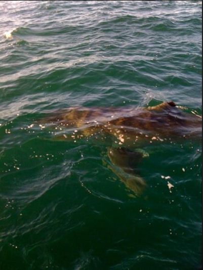
© Jeff Lynch / Boston HeraldPhoto of a great white shark spotted near the carcass of a dead minke whale off Martha’s Vineyard.
Buddies out mackerel fishing today came upon a giant great white shark like they've never seen before "bumping" and "nudging" a dead whale and then circling their boat off Martha's Vineyard.

The line from the seminal shark flick "Jaws" quickly came to mind for the crew -- "We're gonna need a bigger boat."

The monster of the sea was "20 feet" long, said captain Jeff Lynch of Chilmark. "To see something that big was crazy. It was as big as my boat."

The shark had zeroed in on a dead minke whale that was tangled in lobster gear and died. The shark, he said, kept at the whale but never chomped down - possibly sensing it was long dead.

"I was very surprised to see it," Lynch told the Herald.

Bizarro Earth

US: Mysterious Maine Earthquakes Caused by Ice Age Rebound

Mid Coast Earthquakes
© Wire.comMid coast earthquakes.
On the last day of April and first five days of May, dozens of tiny earthquakes caused Maine's eastern coast to tremble. What could have shaken this geologically quiet region, located in the middle of a tectonic plate, far from any active faults?

The last ice age, say geologists. Like a trampoline's surface after liftoff, Earth's crust along the eastern seaboard is still springing back from the pressing weight of a massive ice sheet that has since melted. The earthquakes are a present-time reminder of processes that are prehistoric at a human scale, but from a geological perspective still ongoing.

"This action is still taking place," said Robert Marvinney, director of Maine's Bureau of Geology. "Five or ten thousand feet of ice weighs a lot."

Bizarro Earth

Close Call: Ozone Hole Nearly Opens Over Arctic

Polar Clouds
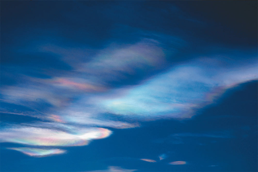
© Markus Rex, Alfred Wegener InstituteThese polar clouds, which are composed of frozen nitric acid and sulfuric acid, form when temperatures in the stratosphere fall below minus 108 F (minus 78 C). This is currently the case in vast sections of the Arctic. Chemical processes on the surface of the cloud particles transform the initially harmless chemicals from chlorofluorocarbons (CFCs) into aggressive ozone-depleting substances.
The loss of ozone over Antarctica has been well-known since the late 1970s, when a major report exposed the crisis happening on the continent. But this spring, an Arctic hole in the ozone nearly opened up over the northern United Kingdom, Scandinavia and Russia.

Unusually cold temperatures in the stratosphere, the second layer of Earth's atmosphere, caused the Arctic near-miss, according to a statement by Jonathan Shanklin, the head of meteorology and ozone monitoring for the British Antarctic Survey (BAS). Most years, Shanklin wrote, the Arctic stratosphere is too warm for ozone-depleting chemical reactions to take place. This year, however, temperatures dove enough to destroy more than 40 percent of Arctic ozone.

Without the protective sheeting of ozone, more ultraviolet (UV) radiation reaches the Earth's surface. That makes ozone levels important for public health, said Ross Salawitch, a professor of chemistry and biochemistry at the University of Maryland who studies atmospheric chemistry.

Fish

US: Hundreds of fish die in Wichita park's pond

dead fish
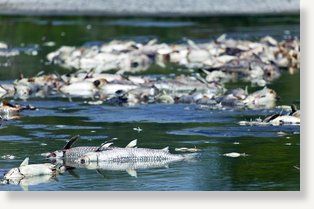
© Mike Hutmacher/The Wichita EagleHundreds of fish have died at Buffalo Park pond in west Wichita because of lack of water, and the city expects the toll to climb to about 1,000.
Hundreds of fish have died at Buffalo Park pond in west Wichita because of lack of water, and the city expects the toll to climb to about 1,000.

A combination of three factors have contributed to the kill, said Doug Kupper, the city's parks and recreation director.

The pond, near Central and Maize Road, has been leaking from the bottom and suffering from an invasive plant that has been removing oxygen from the water for a couple of years. Recent hot weather has evaporated more of the water, he said.