Earth ChangesS


Bizarro Earth

US: Sinkhole At Hillsborough Landfill Expands as Walls Collapse

Sinkhole_1
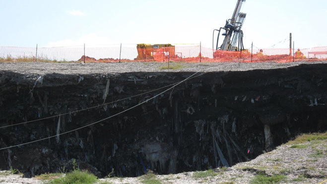
© Tampa Bay OnlineThe sinkhole is in an older part of the 3,300-acre tract at 1596 County Road 672, which opened as a landfill in 1984.
The sides of the sinkhole that swallowed up part of the Southeast County Landfill in Lithia four months ago collapsed last night. The avalanche of dirt did not widen the gaping 129-foot crater, but did deepen it by about 10 feet, officials said.

No one was injured and it is believed the dirt collapse was caused by the process that is aimed at filling the hole that is now estimated to be about 60 feet deep.

"We anticipated some movement, some additional sloughing of sidewall as a result of the pressure grouting," said Richard Siemering with HDR Engineering, which works with the Hillsborough County Solid Waste Department. He said the collapse delayed the process only a couple of hours until assessments could be made.

The grout is forced into the ground to shore up the bottom of the hole, he said, and it exerts pressure in all directions, including up. That can cause the bottom of the hole to shift and that's what caused the sides to fall in.

Extinguisher

US: Hawaii wildfire threatens protected rainforest

hawaii,fire
© Unknown
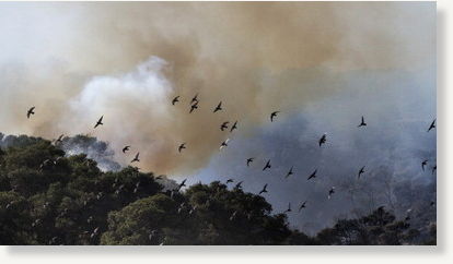
Honolulu - Specialized firefighting teams Wednesday battled a remote wildfire touched off by the eruption of the Kilauea volcano on Hawaii's Big Island, which has burned some 2,000 acres of national park land.

The fire threatens a fragile, protected rain forest, officials said.

Authorities do not know when they will be able to contain the spreading fire, which was being fanned by strong, gusty trade winds, said Gary Wuchner, a spokesman for the National Park Service.

Fish

Illinois: Glen Ellyn resident fears 'fish kill' not natural

dead fish
Fish found dead in a pond in the Maryknoll subdivision southwest of the intersection of I-355 and Roosevelt Road.

Glen Ellyn, Illinois - Concerns are still looming for some after a fish kill was said to have killed hundreds of fish earlier this month in the Maryknoll Estates subdivision.

"I have been a field editor for MidWest Outdoors magazine and have witnessed dozens of winter fish kills," Glen Ellyn resident Jim Janik wrote in an email to the Glen Ellyn News. "I have never seen a fish kill like the one which occurred in our subdivision."

Hundreds of dead fish were found floating and washed ashore in a pond March 10 in Maryknoll Estates, southwest of Interstate 355 and Roosevelt Road in Glen Ellyn.

Attention

US: Biologist Says Dead Fish in Misery Bay 'No Cause for Alarm'

Dead Fish Lake Erie
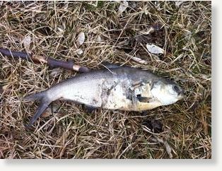
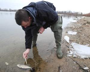
© Jack Hanrahan / Erie Times-NewsJim Grazio, Great Lakes Biologist with the DEP inspects a dead gizzard shad along the northern shore at Misery Bay at Presque Isle State Park on March 22. Thousand of the fish have washed up on the shoreline of Misery Bay. Grazio said that the fish died from natural causes related to temperature changes and that it was a natural event. There were also some other species found along the shoreline including several carp, northern pike and a smallmouth bass. Grazio said that it is the spawning time for northern pike and all of the dead pike found were females. He attributes their death to spawning stress.

Cathy Pedlar and Kathryn Hamilton were walking by Presque Isle State Park's Misery Bay on Tuesday afternoon when they spotted thousands of dead fish along the north shore.

Pedlar said she's seen dead fish before, but never like this.

"I haven't seen this density before," she said.

Park and state officials were notified and a Pennsylvania Department of Environmental Protection official investigated.

"This is a natural fish kill, no cause for alarm," Jim Grazio, a Great Lakes biologist with DEP's Office of the Great Lakes, said after inspecting the dead fish.

He said 99 percent were gizzard shad and he believed their death was a natural event caused by temperature change.

Grazio said the gizzard shad, a freshwater herring, is notoriously sensitive to cold temperatures and temperature changes.

He also said more than the usual number of the fish were born in 2010 for unknown reasons.

"A lot of them didn't survive," he said.

The fish began dying in January and were under the ice, unseen until warmer temperatures caused a melt and the fish began washing up on shore, he said. There wasn't much decay because of the cold.
Bizarro Earth

Earthquake Magnitude 4.7 - Mariana Islands Region

Magnitude 4.7
Date-Time

* Wednesday, March 23, 2011 at 00:50:34 UTC
* Wednesday, March 23, 2011 at 10:50:34 AM at epicenter
* Time of Earthquake in other Time Zones

Location 21.892°N, 143.104°E
Depth 242.9 km (150.9 miles)
Region MARIANA ISLANDS REGION
Distances 239 km (148 miles) NW of Farallon de Pajaros, N. Mariana Islands
368 km (228 miles) SSE of Iwo Jima, Volcano Islands, Japan
790 km (490 miles) NNW of SAIPAN, Northern Mariana Islands
1563 km (971 miles) SSE of TOKYO, Japan
Location Uncertainty horizontal +/- 19.2 km (11.9 miles); depth +/- 2.7 km (1.7 miles)
Parameters NST=106, Nph=106, Dmin=584.4 km, Rmss=0.59 sec, Gp= 61°,
M-type=body wave magnitude (Mb), Version=8

Attention

6.0 Magnitude Quake Jolts Northern Japan, No Immediate Reports of Damage

An earthquake with a preliminary magnitude of 6.0 jolted parts of northern Japan near a quake-stricken nuclear power plant Wednesday, national broadcaster NHK said.

There were no immediate reports of damage. Numerous aftershocks have been rocking the country following a devastating quake and tsunami on March 11.

Bizarro Earth

Vietnam: Mud Eruption in Ninh Thuan is Defined as Volcano Mud

Mud Volcano
© VietNamNet Bridge
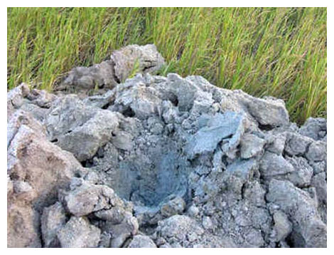
Dr. Dinh Doan Lam, a senior official from the Institute for Geology of Vietnam, said that mud eruption in Ninh Thuan is not dangerous. Mud volcano or mud dome are used to refer to formations created by geo-excreted liquids and gases, although there are several different processes which may cause such activity. Hot water mixes with mud and surface deposits. Mud volcanoes are associated with subduction zones. Temperatures are much cooler in these processes than at igneous volcanoes.

About 86 percent of the gas released from these structures is methane, with much less carbon dioxide and nitrogen emitted. Ejected materials are often a slurry of fine solids suspended in liquids which may include water, which is frequently acidic or salty, and hydrocarbon fluids.

Bizarro Earth

US: At Least 32 Musk Oxen Freeze to Death After Winter Storm Produces Tidal Surge, Flooding

Frozen Oxen
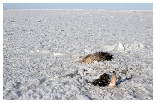
© Associated Press / National Park ServiceIn this March 15, 2011 photo provided by the National Park Service, the carcass of a musk ox is shown frozen in ice at Bering Land Bridge National Preserve, Alaska. The frozen musk oxen were found on Tuesday, March 15, 2011, during a routine flight to track at least four musk oxen that had been fitted with collars to conduct research.
Anchorage, Alaska - At least 32 musk oxen were found frozen in the ice on the northern coast of Alaska's Seward Peninsula, killed in the aftermath of a tidal surge and flooding from a winter storm blowing in off the Chukchi Sea, the National Park Service said Tuesday.

Researchers found the frozen animals March 15 while flying over the Bering Land Bridge National Preserve to track at least four of the animals, which had been outfitted with radio collars.

"Basically, the radio collars led us to the dead animals," National Park Service spokesman John Quinley said.

Officials planned to fly over the area again Tuesday to determine the fate of another 23 animals in the herd. It wasn't immediately clear if any of those were fitted with collars.

"We didn't see any carcasses, but we didn't see them walking around," he said.

The remainder of the herd could be buried deeper in the snow. If so, the bodies wouldn't be visible until spring.

Bizarro Earth

US: Earthquake Magnitude 2.6 - Southern Alaska

Magnitude 2.6
Date-Time

* Wednesday, March 23, 2011 at 02:33:31 UTC
* Tuesday, March 22, 2011 at 06:33:31 PM at epicenter

Location 59.757°N, 153.199°W
Depth 136.8 km (85.0 miles)
Region SOUTHERN ALASKA
Distances

* 52 km (32 miles) E (93°) from Pedro Bay, AK
* 79 km (49 miles) ENE (71°) from Pope-Vannoy Landing, AK
* 79 km (49 miles) SE (129°) from Port Alsworth, AK
* 247 km (153 miles) SW (231°) from Anchorage, AK

Location Uncertainty horizontal +/- 0.6 km (0.4 miles); depth +/- 0.2 km (0.1 miles)
Parameters NST= 38, Nph= 0, Dmin=11.7 km, Rmss=0.69 sec, Gp= 94°,
M-type=local magnitude (ML), Version=1

Bizarro Earth

US: Landslide Blocks Roads Leaving Residents Isolated

Landslide
© Shannon BurkeyA massive landslide in an unincorporated area of the county has blocked the only road in and out of the neighborhood, stranding residents.
Updated - California: Residents of 33 homes in an unincorporated area of the county are in their second day of being stranded from the outside world after a landslide on Monday afternoon blocked the only road to their homes.

According to Scotts Valley Fire District Cpt. Mike Pasquini, the slide, which occurred near Scotts Valley on Nelson Road at Sky Meadow Lane, does not present any immediate danger to residents.

"The homes are affected in the sense that they have no access," Pasquini said.

About 57 people live in the affected area and three to four houses are still without power, according to April Murray, public information officer for the Santa Cruz County Sheriff's Office.

Sheriff's officers contacted all of the residents on Monday and most said they were planning on staying in their homes.

"We have seen some people leave though," Murray said. "People with babies and animals have been making their way out."