Earth ChangesS


Radar

US: USGS seismic monitors for Oregon's Newberry volcano

The U.S. Geological Survey is proposing to install seismic and GPS monitoring stations around the Newberry Volcano in central Oregon this summer.

The Bulletin newspaper in Bend reports the $225,000 project would add eight monitoring stations to the one that's already on the volcano, to detect movements in and beneath the surface.

Image
© AP Photo/Rick BowmerVisitors view a lava flow as they stand atop the 500-foot cinder cone at Newberry National Volcanic Monument south of Bend. U.S.G.S. is proposing to install seismic and GPS monitoring stations around the volcano.
The seismic monitors measure earthquakes that happen when magma moves and starts breaking rocks below the surface - they can pick up tremors that would be undetectable to someone on the ground.

And the GPS will pick up changes in the shape of the surface that could be caused by the shifting magma.

Eye 1

Rush to get rid of radioactive water at Japanese nuclear plant: 11,500 tons of radioactive water will be dumped into the Pacific Ocean

nuclear plant
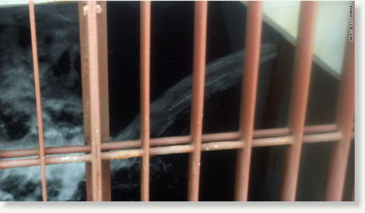
A Tokyo Electric Power Company picture from April 2 shows water gushing from the cracked concrete shaft.

Tokyo -- The dumping of tons of radioactive water from a waste treatment facility at the crippled Fukushima Daiichi nuclear facility into the ocean has started, Tokyo Electric Power Company officials said Monday. The additional dumping of water from reactors Nos. 5 and 6 will begin within hours, they said.

In all, about 11,500 tons of radioactive water that has collected at the nuclear facility will be dumped into the Pacific Ocean, officials said Monday, as workers also try to deal with a crack that has been a conduit for contamination.

The radiation levels were highest in the water from reactor No. 6, the officials said.

Bizarro Earth

Thailand flood toll reaches 40

The death toll from heavy flooding in southern Thailand has risen to 40, the government said Sunday, with thousands of people forced to live in temporary shelters.

More than a week of heavy rain -- in what is usually one of the hottest months -- has caused floods in 10 of Thailand's 77 provinces, submerging homes, triggering landslides and washing away roads and bridges.

Image
© Unknown
As of Sunday, the death toll stood at 17 in hard-hit Nakhon Si Thammarat province, 10 in Surat Thani, seven in Krabi, and two in each of Phatthalung, Chumphon and Trang, the department of disaster prevention and mitigation said.

A mudslide swamped at least one whole village in Khao Phanom district, Krabi province.

Bizarro Earth

7.1-magnitude quake strikes off Indonesian island, tsunami warning issued

Jakarta -- A powerful earthquake struck off the Indonesian island of Java on early Monday morning, seismologists said, prompting a tsunami warning for some local regions.

The 7.1-magnitude earthquake at 3.06 a.m. local time (2006 GMT Sunday) was centered about 279 kilometers (173 miles) south-southwest of Tasikmalaya on Java. It struck about 10 kilometers (6.2 miles) deep, making it a shallow earthquake, according to Indonesia's seismological agency.

Authorities in Indonesia immediately issued a tsunami warning for some coastal areas, while the Pacific Tsunami Warning Center said there was no threat of a Pacific-wide tsunami.

Bizarro Earth

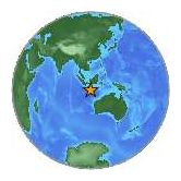
Indonesia - Earthquake Magnitude 6.7 - South of Java

Indon Quake_030411
© USGSEarthquake Location
Date-Time:
Sunday, April 03, 2011 at 20:06:42 UTC

Monday, April 04, 2011 at 03:06:42 AM at epicenter

Time of Earthquake in other Time Zones

Location:
9.786°S, 107.749°E

Depth:
24 km (14.9 miles)

Region:
SOUTH OF JAVA, INDONESIA

Distances:
241 km (149 miles) ENE of Christmas Island

277 km (172 miles) S of Tasikmalaya, Java, Indonesia

318 km (197 miles) S of Bandung, Java, Indonesia

412 km (256 miles) SSE of JAKARTA, Java, Indonesia

Bizarro Earth

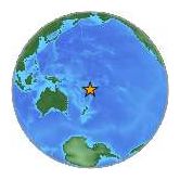
Earthquake Magnitude 6.4 - Fiji Region

Fiji Quake_030411
© USGSEarthquake Location
Date-Time:
Sunday, April 03, 2011 at 14:07:09 UTC

Monday, April 04, 2011 at 02:07:09 AM at epicenter

Time of Earthquake in other Time Zones

Location:
17.649°S, 178.578°W

Depth:
551.9 km (343.0 miles) set by location program

Region:
FIJI REGION

Distances:
252 km (156 miles) W of Lambasa, Vanua Levu, Fiji

321 km (199 miles) W of SUVA, Viti Levu, Fiji

335 km (208 miles) N of Ndoi Island, Fiji

2230 km (1385 miles) W of Auckland, New Zealand

Bizarro Earth

Pennsylvania: Residents Fearful of Growing Sinkhole Danger

Image
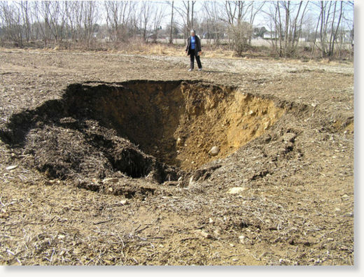
© Kristine PorterThe Brookwood Group estimates that this sinkhole opened up within the last month.
Sinkholes are an undermining fact of life in the Lehigh Valley - a region where rainwater relentlessly wears away limestone.

But residents who keep a close eye on gaps in the ground say recent heavy rains have made the problem visibly worse.

Some fear for the safety of youngsters, who might meet danger in places like Tatamy, where a 40-foot sinkhole (known locally as the "Forty Footer") yawns about a mile from Trisha Street.

Nuke

Radioactive Material Found in Illinois

radioactive symbol
© Unknown
Radiation believed to be from the nuclear plant disaster in Japan has been detected in Illinois.

The radioactive iodine similar to what was released in Japan was found in a grass clipping in the Joliet area by the Radiological Assessment Field Team, which regularly checks on vegetation, air, milk and eggs to determine if any radiation is leaking from Illinois' nuclear reactors.

In this case, the grass clippings were taken as part of a drill for the emergency plan at the Dresden nuclear power plant.

Once that grass sample tested positive for radioactive iodine, an air sample in Springfield was taken, which also detected the radioactive material.

Patti Thompson of the Illinois Emergency Management Agency says the levels are low: The amount of radiation would have to be 200,000 greater than what was detected to meet the regulatory limit for emission from a nuclear power plant.

Nevertheless, the state will now conduct more tests in other parts of the state.

Bizarro Earth

Kashmir: Sixth Tremor Hits Valley in 11-days

Kashmir Valley
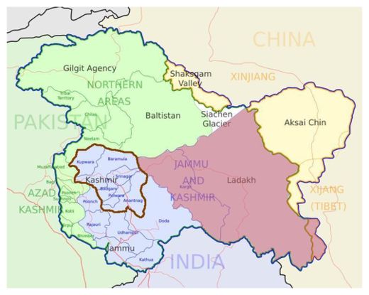
© Opus88888 / WikipediaMarking the three regions of the Indian state of Jammu and Kashmir: Jammu, Kashmir valley and Ladakh.
Srinagar - A moderate intensity earthquake, sixth within a span of 11 days, was felt in Kashmir Valley on Saturday morning.

The Coordinator of Disaster Management Cell Kashmir, Aamir Ali said that an earthquake of magnitude 4.7 on Richter scale occurred at 0924 hours.

The jolt was epicentred in Xinjiang border in Ladakh-China at 36.5 degree north latitude and 70.9 degree east longitude, Aamir said in a statement.

The tremor follows one on previous night at 1900 hours when an earthquake of magnitude 4.9 was felt with epicentre at Hindukush Afghanistan at 36.54 N, 70.91E, the he said, adding that no damage was reported from any part of the Valley.

Megaphone

Philippines: Stay away from Taal, Palace warns tourists and residents

On Saturday, Malacañang appealed to residents and tourists to heed warnings by state volcanologists to keep away from the crater of Taal Volcano in Batangas, due to high carbon dioxide levels there.

Deputy presidential spokeswoman Abigail Valte said tourists and residents should also heed the calls of local officials to evacuate once the need arises.

Cooperate with local officials on the ground (Inn such situations, our first appeal would be to heed the authorities in staying away from the volcano's crater. And those residents living at the foot of the volcano should heed village leaders' call to evacuate if the need arises)," Valte said on government-run dzRB radio.