Earth ChangesS


Snowflake Cold

Killing freeze predicted for U.S. Midwest this Fall

simon atkins weather
Simon Atkins
An early freeze in the Great Plains may cut corn production by 8%, according to Simon Atkins, CEO of Advanced Forecasting Corporation, who presented his long-range forecast in a webinar on Monday.

The cause: above-average volcanic eruptions around the world for the last nine months, including three in the last month - in Eastern Russia, Alaska and Indonesia. The release of sulfur into the atmosphere from volcanic eruptions reflects sunlight back out to space.

The meteorologist predicted cooler-than-normal summer temperatures "because of well-above-normal volcanic eruptions going back to the fall of 2013. We are not going to see many hot periods. Sure, there will be a few days here and there where temperatures reach 100 degrees in Oklahoma, but it's not going to be very common."

"What's going to be more common is more moisture coming in off the Eastern seaboard of the U.S., and it will be pushing frontal boundaries from east to west, cooling down even parts of the Midwest in July and August," he continued. "We think the first two weeks of September will be warmer. But then it will be getting quite a bit colder toward the end of September, and even into October."

These cooler temperatures could damage the corn crop, Atkins explained.

"We think there's going to be an early frost [in the Plains west of Kansas], which could reduce the number of bushels per acre of corn - maybe by around 8%, our current rate of prediction," he said. "It will be a killing freeze, at least 10 to 15 days earlier than normal."

Meanwhile, Atkins expects flash flooding in the Midwest this week, from Nebraska down to Arkansas, even reaching into parts of the Tennessee River Valley. "Some of these winds will reach 80 miles per hour with hail, producing lots of flash flooding. Some fields in the Midwest will suffer from too much rain," he said.
Comment: As happy as the increase in rainfall will make some farmers in the short term, this is one of the precursors of the onset of a new Ice Age. The increase in rainfall, coupled with temperatures that don't reach expected summer highs, means that winter snows never really go away. This increases the reflection of solar radiation away from Earth, further causing the temperature to fall. The cycle is self-reinforcing. Add to that the reflecting properties of volcanic eruptions, and the cycle speeds up even more.

Fire and Ice: The Day After Tomorrow
Volcanoes Played Pivotal Role In Ancient Ice Age, Mass Extinction
Forget warming - beware the new ice age


Windsock

Series of rare mini-tornadoes stun southern Norway

Image
A succession of rare 'mini tornadoes' have drawn crowds in the city of Arendal as they circled dramatically above the Skagerrak strait between Norway and Denmark.

"It looked like the sort of thing you'd see on an American documentary or something," Espen Bierud from Norway's Institute of Marine Research, which faces onto the sea, told The Local. "Many people standing around me said they'd never seen anything like it in Norway."

He said that work at the Institute had ground to a halt as the researchers made their way outside to enjoy the spectacle.

"It didn't take too many seconds before everyone at the Institute was down at the balcony or on the dock taking pictures," he said. "It lasted for about 20 or 30 minutes, and there were at least four different tornadoes."


Snowflake

First June snowfall in Tromso, Norway since records began

Image
The northern Norwegian city of Tromso experienced a freak summer snowfall on Monday after freezing wind from the North Pole saw temperatures plummet.

It was the first time since records began that the city had seen snowfall in June. Local meteorologist Trond Lien said that sleet and snow showers hit the city on Monday night, and there has even been some snow lying on the ground. He said that the situation was "very rare", noting that it must have been a long time since it snowed on 16 June. He added that he had found records showing that Tromso had experienced snowfall in July, but he could find nothing to indicate snow in June.

Motorist Odd Arne Thomassen told reporters that he was driving over roughly four centimetres of snow when he was in Kvaenangsfjellet, in North Troms, early on Monday morning. He explained that it was not bad enough to make him feel he needed his chains on, but that there was certainly about four centimetres lying on the ground.

Yr.no, the weather forecasting venture between the Meteorological Institute and TV station NRK, predicted that other areas of the country would also experience snowfall. It said that high-lying areas of western and southern Norway would likely see snow, despite the fact that the capital Oslo is lapping up temperatures in excess of 20C.

Bizarro Earth

USGS: Earthquake Magnitude 6.6 - 52km E of Buldir Island, Alaska

Buldir Quake_240614
© USGS
Event Time
2014-06-24 03:15:41 UTC
2014-06-24 15:15:41 UTC+12:00 at epicenter

Location
52.307°N 176.693°E depth=35.0km (21.7mi)

Nearby Cities
52km (32mi) E of Buldir Island, Alaska
1220km (758mi) E of Petropavlovsk-Kamchatskiy, Russia
1237km (769mi) E of Yelizovo, Russia
1237km (769mi) E of Vilyuchinsk, Russia
3035km (1886mi) W of Whitehorse, Canada

Scientific Details

Snowflake

Minnesota still has snow on the ground from last winter

Image
© Chris Kuball, ABC 6
There is still snow on the ground in southern Minnesota.

You read that correctly. ABC 6 Meteorologist Chris Kuball tweeted a photo of a snow pile, that looks more like a rock, at Marcusen Park in Austin, Minnesota, Monday morning.

The park is a dumping site for snow in the area, Kuball says, and on June 23 there was still a pile of snow that was about 10 feet tall, 50 feet long and 30 feet wide, Kuball said in a Facebook post.

Check out this then-and-now photo:
Image

Comment: Many areas have been experiencing the lingering effects from last winter.

See related:


Attention

8.0-Magnitude Alaska earthquake prompts tsunami advisory for Pacific Coast

Image
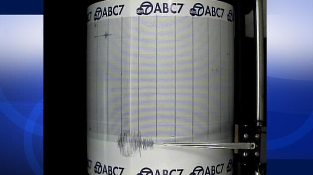
© ABC7The ABC7 Quake Cam shows an 8.0-magnitude earthquake that struck Alaska on Monday, June 23, 2014.
An 8.0-magnitude earthquake struck at 1:53 p.m. in Alaska, prompting a tsunami warning for the U.S. Pacific coast. A preliminary report indicated the quake was a 7.1 magnitude. That was revised minutes later to 8.0 by the U.S. Geological Survey.

The warning for Southern California was downgraded to a tsunami advisory by the National Weather Service.

The NWS reported that water was leaving the harbor of the city of Adak, Alaska, at 3:23 p.m. The Adak city manager confirmed to ABC News that water in the harbor was receding and people in that area were heading for higher ground.

The earthquake struck 244 miles southeast of Attu Station in Alaska, about 15 miles off Little Sitkin Island.

The earthquake occurred at a depth of 71.1 miles, according to the USGS.

Comment: The Aleutian volcanoes in Alaska are waking up and showing more activity than has been seen for decades in an already volatile region. The Pacific Ring of Fire has been quite active this year and will certainly be something to watch.

See related:


Bizarro Earth

USGS: Earthquake Magnitude 6.9 - 96km SSE of Raoul Island, New Zealand

Raoul Island Quake_230614
© USGS
Event Time
2014-06-23 19:19:16 UTC
2014-06-23 07:19:16 UTC-12:00 at epicenter
Location
30.118°S 177.670°W depth=20.0km (12.4mi)

Nearby Cities
96km (60mi) SSE of Raoul Island, New Zealand
973km (605mi) NE of Whangarei, New Zealand
999km (621mi) NNE of Whakatane, New Zealand
1014km (630mi) NE of Tauranga, New Zealand
1025km (637mi) SSW of Nuku'alofa, Tonga

Scientific Details

Bizarro Earth

USGS: Earthquake Magnitude 7.9 - 24km SE of Little Sitkin Island, Alaska

Alaska Quake_230614
© USGS
Event Time
2014-06-23 20:53:10 UTC
2014-06-23 11:53:10 UTC-09:00 at epicenter

Location
51.797°N 178.759°E depth=114.4km (71.1mi)

Nearby Cities
24km (15mi) SE of Little Sitkin Island, Alaska
1370km (851mi) E of Petropavlovsk-Kamchatskiy, Russia
1387km (862mi) E of Vilyuchinsk, Russia
1388km (862mi) E of Yelizovo, Russia
2957km (1837mi) W of Whitehorse, Canada

Scientific Details

Arrow Up

Hawaii: World's largest active volcano shows signs of life

dark clouds, volcano eruption
© www.hawaiipictures.com"Ash and Fire," Mauna Loa
Mauna Loa, the world's largest active volcano, has rumbled back to life in Hawaii over the past 13 months with more seismic activity than at any time since its last eruption, scientists say, while calling it too soon to predict another blast. The volcano, which last erupted in 1975 and 1984, has been rattled since March 2013 by earthquakes of the same type and in the same location as the temblors that preceded those explosions, said Wes Thelen, a seismologist for the US Geological Survey's Hawaiian Volcano Observatory.

"The earthquakes we are seeing at Mauna Loa lead us to believe that some of the same things that happened before the 1975 and 1984 eruptions are happening right now," Thelen told Reuters. "We don't see this kind of activity outside of pre-eruptive earthquake sequences," he said.

The USGS posted a photo of Mauna Loa on Instagram on Wednesday with the caption: "After a 30-year repose, this sleeping giant may be stirring slowly to life."

Thelen said the earthquakes so far had not been regular or sustained enough to lead the observatory to forecast an eruption or raise the color-coded volcano warning system. But seismologists were keeping a close eye on the volcano.

Comment: Previously thought to be extensions of a single volcano, Mauna Loa is actually flanked by a curving line of individual volcanoes that include Kilauea, Mauna Kea and Kohala. Its summit is 56,000 feet above its base on the sea floor. Four distinct earthquake swarms have occurred since March 2013, all less than magnitude 2.2, save one that registered 3.5 on May 9, 2014, and have been occurring in the same areas of the volcano as those in the years prior to 1984. They are, so far, consistent with a model requiring rocks around the core to adjust to stress changes within the core. While Mauna Loa is not located along the Ring of Fire, it is likely that whatever disturbances and earth changes provoking recent Pac Rim activity are also escalating changes in other areas under the ocean.


Target

Oklahoma's increase in earthquakes linked to oil well wastewater

wastewater well
© business.financialpost.comWastewater well above-ground injection process.
Between 1978 and 2008, Oklahoma had just two earthquakes with a magnitude over 3.0. In 2014, thus far, there have been around 200 such earthquakes there, more even than the highly unstable state of California. (They've had 140.) Experts believe the unusual increase in earthquakes is linked to the number of wastewater wells connected to oil and gas drilling.

diagram, wastewater effect
© theresilientearth.comWastewater's effect on earthquake faults.
Wastewater wells occur when oil and gas companies inject wastewater deep underground. Scientists believe that the wastewater acts as a lubricant in existing fault lines, causing more movement. Hydraulic fracturing, commonly known as fracking, has also been linked to earthquakes, though the majority of Oklahoma's tremors were caused by wastewater wells.


Comment: The principal seismic hazard from injection-induced earthquakes comes from the disposal of wastewater into deep strata, i.e: basement formations. When the balance of applied shear stress is less than the strength of contact, the fault remains locked. Injection wells can promote a slip by increasing pore pressure, compounded by a change of load above a fault (such as the removal of oil). As faults slip, earthquakes release stored energy. The intensity of the earthquake is proportional to the stored energy and the triggers for release.


Comment: Proponents of fracking believe that a few small tremors are nothing more than the price of our modern technological civilization and environmentalists are merely creating another brouhaha. What they fail to consider is that large earthquakes around the globe have been found to specifically remote-trigger earthquakes near well sites via surface waves. A U.S. Geologic Service survey studied sites that had a long history of regional subsurface injection. Each triggered site had potential to host a moderate magnitude earthquake, suggesting critically stressed faults. And, each site had a relatively low level of seismicity rate before the first triggering episode. Industrial activity has a strong correlation to the increase in tremors. At least half of the 4.5 magnitude or larger earthquakes to strike the interior of the U.S. in the past decade have occurred in regions of injection-induced seismicity, with the seismic onset following injection by merely days or weeks.