Earth ChangesS


Arrow Down

Flashback NOAA: Summer Temperature Below Average for U.S.

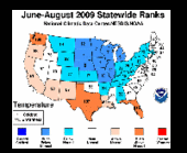
The average June-August 2009 summer temperature for the contiguous United States was below average - the 34th coolest on record, according to a preliminary analysis by NOAA's National Climatic Data Center in Asheville, N.C. August was also below the long-term average. The analysis is based on records dating back to 1895.

U.S. Temperature Highlights - Summer
    Image
    © NOAA
  • For the 2009 summer, the average temperature of 71.7 degrees F was 0.4 degree F below the 20th Century average. The 2008 average summer temperature was 72.7 degrees F.
  • A recurring upper level trough held the June-August temperatures down in the central states, where Michigan experienced its fifth, Wisconsin, Minnesota, and South Dakota their seventh, Nebraska its eighth, and Iowa its ninth coolest summer. By contrast, Florida had its fourth warmest summer, while Washington and Texas experienced their eighth and ninth warmest, respectively.
  • The Michigan, Wisconsin, Iowa and Minnesota region experienced its sixth coolest summer on record. Only the Northwest averaged above normal temperatures.

Igloo

Flashback Denver breaks 104 year old cold temperature record as Arctic chill sets in

The Arctic blast of cold air that has settled in across much of the nation's midsection arrived in Colorado Friday night and allowed the Mile High City to set two low temperature records. Two more weather records may be set today and tonight before we start to warm up on Sunday.

Friday night the cold front moved in and temperatures plummeted 23 degrees in five hours. Before midnight the mercury read 18 degrees thus shattering the old low temperature record for October 9th of 25 degrees. That record dated to 1970.

This morning the low temperature at Denver International Airport has dropped to 17 degrees. That sets a new record low temperature for October 10th as well. The previous record low of 25 degrees was set more than a century ago in 1905.

Igloo

Flashback British Columbia interior hit with record-breaking cold snap

With turkey on the table and frost on the ground, it seems more like Christmas than Thanksgiving in B.C.'s central and southern Interior.

The region is in the midst of a record-breaking cold snap, with temperatures reaching as low as minus 19 degrees in some regions.

Greg Pearce of Environment Canada blames the chilly days on an arctic pressure system that moved in from the Northwest Territories Thursday.

"We usually don't get these situations until November," he said.

"On Friday and over the weekend this high pressure system's been the dominant weather factor here for the entire province and so everybody's had these cold temperatures."

But it's not here to say. A low pressure system developing off the west coast of B.C. is expected to start pumping milder, moist air across the province beginning Tuesday.

Arrow Down

Flashback October Cold Snap Sets 82-Year Record in Chicago

Image
© CBSThe skies looked almost wintry in Chicago on Oct. 13, 2009, when temperatures topped out at 47 degrees for an 82-year low.
October in Chicago is usually equal parts balmy T-shirt weather and nippy light jacket temperatures, but if it's felt more like winter coat weather this year, it's not your imagination.

Chicago has spent the last 17 days with below-average temperatures, and a high of a mere 47 degrees made Tuesday the coldest Oct. 13 in 82 years, CBS 2's Mary Kay Kleist says.

Comparing temperatures for the first 14 days of October 2008 to this year seems like comparing the tropics to the tundra.

Last year, there were 10 days with highs in the 60s and three with highs in the 70s between Oct. 1 and 14. There was even a warm spell more befitting of early September - it was 72 degrees on Oct. 10, 79 on Oct. 11, 84 on Oct. 12, and 77 on Oct. 13.

Igloo

Flashback Record-setting cold in Laurel, Montana

Image
© Larry TanglenLaurel cheerleaders wore warm headbands and stocking caps to protect themselves from the cold temperatures at Friday night’s football game against the Dawson County Red Devils. Laurel won 49-7. The unseasonably cold temperatures dipped into the teens.
The first day of winter is more than two months away, but area residents received a reminder last week of what is in store for them as the seasons change.

The unexpected record setting cold brought freezing temperatures, freezing rain and snow to the area last week, brought road construction to a halt and left unprepared residents with frozen sprinkler lines and damaged garden produce.

The four-day record-setting cold blast tied the all time low temperature of 18 degrees on Oct. 9, set in 1993. The 1987 record low of 21 degrees for Oct. 10 was shattered with a 16 degree reading. Sunday, Oct. 11, the 1959 record low of 22 degrees was broken when the thermometer dropped to 14 degrees. Monday, Oct. 12 the temperature continued to drop to break the 1969 record low of 22 degrees with a bone-chilling 13 degree reading.

Snowman

Flashback Earliest snow on record blankets Pennsylvania State

Image
© Aaron Tyburski / National Weather ServiceA storm dropped lots of heavy, wet snow in northern Pennsylvania on Oct. 15 and 16, 2009. It was the earliest snowfall on record for State College, Pa.
Snow showed up historically early - and with a vengeance in northern Pennsylvania, from the Poconos past State College, Pa.

Trees and powerlines were down all over State College this morning because of a heavy, wet snow that started accumulating yesterday, according to meteoroogist Aaron Tyburski of the National Weather Service office there.

Five to six inches was on the ground in some of the higher elevations in north-central Pennsylvania, and nine inches was measured this morning on Center Hall Mountain, a few miles northeast of Penn State's main campus, he said.

In the Poconos, 6.1 inches was measured on Mount Pocono at 8:30 this morning. Just to the north, Tobyhanna had 4.3 inches as of 7 a.m.

A second storm system on the way could boost the totals.

"We may see another one or two inches tomorrow," Tyburski said this morning.

Cloud Lightning

Flashback Earliest ever snowfalls In New York and New Jersey

Image
© Associated Press
State College, Pa. - An autumn storm brought snow to parts of Pennsylvania, New York and New Jersey, the earliest snow on record in some towns used to harsh winters.

Cornell University weather scientists say the snow that started Thursday set records for the earliest date with an inch of snow in Binghamton, Ithaca and Olean in New York and Altoona and State College in Pennsylvania.

The National Weather Service says there's 4.5 inches of snow in State College, Pa., and 2 more inches are possible through Saturday morning.

Arrow Down

Flashback Friday coldest October 16 in DC in 138 years

Friday was the coldest Oct. 16 in 138 years in the nation's capital.

For the first time since the National Weather Service began compiling data, the city's high temparature for the day was below 50 degrees.

Friday's highest temperature was recorded at Reagan National Airport at 3:34 p.m. It was 45 degrees.

The previous record for coldest Oct. 16 was in 1940 when the temperature reached no higher than 51 degrees.

The hottest temperature recorded on Oct. 16 in Washington is 89 degrees - just a degree short of being twice Friday's high.

Cloud Lightning

Flashback November, China: Hebei capital experiences heaviest snowfall since records began

Nearly 50 centimeters of snow fell over two days in Shijiazhuang, capital of Hebei Province to turn the city into a winter wonderland. The heavy snow broke a record set 54 years ago and paralyzed traffic.

Heavy snow blanketed Shijiazhuang, capital of North China's Hebei Province, for a second day and paralyzed all transport, provincial authorities said Wednesday.

Meteorological officials said the city recorded 7.44 centimeters of precipitation in the 24 hours till 6 am Wednesday, with the accumulated snow 48 centimeters thick in most areas.

It was the heaviest snowfall in the city since 1955 when the city began to make meteorological records, reports said.

Arrow Down

Flashback New Zealand: Coldest October in 64 years

It will come as little surprise to most New Zealanders that the country shivered through the coldest October in 64 years.

In its climate summary for the month, the Niwa said the average temperature nationwide was 10.6degC _ 1.4degC below average.

Such a cold October has occurred only four times in the past 100 years, the last time in 1945.

It was only fractionally warmer than August, which recorded a warmer-than-normal average temperature of 10.4degC.

Niwa said October was shaped by a series of southerly fronts, all-time record low temperatures in many areas, and unseasonable late snowfalls.

The heaviest October snowfall since 1967 occurred in Hawke's Bay and the central North Island on Octobe 4 and 5 stranding hundreds of travellers, closing roads, and resulting in heavy lambing losses.

Not only was it cold, but it was also wet.