Earth ChangesS

Black Cat

Prepare for the upcoming rare event! Super Moons, what are they?

The astronomer Richard Nolle coined the term "Super Moon" which means a new or full moon at 90% or greater of its closest perigee to Earth. Well on March 19th the moon will be at perigee (its closest position in its orbit to Earth). This will be the closest perigee in 18 years.


The largest effect will be on the tide which occurs at the full moon every month as the closer to the earth the moon orbits, so the effect on tides increases. A 5% increase in proximity makes about 20% difference in the power the moon exerts so those in coastal regions should anticipate stronger tides.

Bizarro Earth

100 Mexican Navy Men Save Beached Whale in Manzanillo

Stranded Whale
© Hispanically Speaking NewsStranded Mexican Whale

After almost 24 hours of work, personnel from the Mexican Navy floated a humpback whale about a year old, 9.40 meters long and weighing six tons, which was stranded on the beach Eden , south of Punta Campos, in Manzanillo.

Over 100 men were involved in the rescue along with two bulldozers belonging to the company DRAGAMEX, which made pools on the beach to provide buoyancy.

Within eight days Mexico's Department of the Navy has made the rescue of two whales stranded on the coasts of Colima. Biologists report that this situation occurs due to changing sea temperatures when the whales look for warmer water near shore.


Visit msnbc.com for breaking news, world news, and news about the economy

Bomb

SOTT Focus: The Christchurch Tragedy: A Message from the Universe

Wake Up Call
© jcestnik/Flickr

On February 22nd, 2011 a 6.3 magnitude earthquake struck the center of Christchurch, New Zealand. The force from the earthquake popped glass from windows, leveled buildings and laid waste to almost half of the city. New Zealand's former premier, Helen Clark, has even remarked that "[t]he building damage [she's] seen compared with Haiti." People are now evacuating the city in droves, with thousands forced to relocate, and the remaining citizens are without water and sewerage in some parts. Unspeakable tales have found their way into the media of people, trapped under buildings, sending text messages in desperation to the outside world, pleading for help, help that was ultimately too late. At this point all hope is given up for finding any more survivors; the families of the missing are just looking for closure now. The citizens of Christchurch are beat, shell-shocked, and some are only able to cope in the lowest possible ways. The situation in Christchurch is beyond tragic.

According to geologists, the fault that set off the Christchurch earthquake had laid dormant for thousands of years and only recently awoke last September when a magnitude 7 earthquake struck the outer regions of the city. This initial jolt caused considerable damage, but nothing on the scale of what was experienced recently. These earthquakes in Christchurch have caught geologists by surprise, since the major New Zealand fault, the Alpine faultline, is nowhere near Christchurch. Something is definitely going on here. The planet seems to be in the grips of a veritable pandemic of earthquakes occurring all over the globe - in places we never thought possible before. It's as if this recent earthquake in Christchurch sprung from the shadows of the past: a traumatic past that humanity has largely forgotten.
Cloud Lightning

US: Flood Risk: A Month of Rain in Days

A storm, moving at a snail's pace, will produce heavy, flooding rain from the Ohio Valley into New England Friday through next Monday. In many areas, the storm will be responsible for producing the amount of rain typically observed during an entire month of March in just a few days.

A heavy rain-making storm will organize over the Midwest Friday before arriving in New England by the latter half of the weekend.

Many rivers and streams are already swollen or exceeding flood stage from southern Illinois to Indiana and Ohio.

In the flood weary city of Findlay, Ohio, residents are just recovering from flooding earlier this week.

"Every time it rains I get nervous," Sharon Hill told TheCourier.com in Findlay, Ohio. With more rain in the forecast for Ohio, a mutual feeling may be felt across other cities.

Image
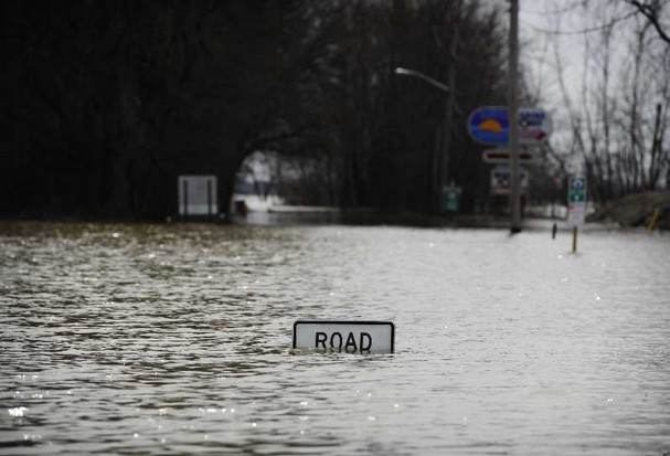
© AccuWeather.com Facebook Fan Ryan S.Flooded roadways in Lima, Ohio earlier in the week. Lima is located about 30 miles southwest of Findlay, Ohio.

Umbrella

US: Oahu, Kauai Remain Under Flash Flood Watch

Heavy Rain, Thunderstorms Possible Through Friday

Forecasters with the National Weather Service say the threat of thunderstorms and heavy rains for Kauai and Oahu remain through Friday.

Heavy showers and thunderstorms rolled through Kauai Thursday, prompting a flood advisory and severe thunderstorm warning. The advisories were canceled Thursday afternoon. There were no reports of major flooding.

Kauai and Oahu remain under a flash flood watch through Friday afternoon. A developing storm to the west of the state has brought moist and unstable air from the tropics over the Hawaiian Islands, according to the NWS. A cold front associated with the storm is expected to bring more heavy rainfall to Kauai and Oahu Friday.

Cloud Lightning

US: Flooding Rains Threaten Indiana

Image
© FEMA/Leo SkinnerMunster Indiana September 13, 2008
Indianapolis -- More heavy rain is expected to overspread Indiana on Friday night and into the day on Saturday, heightening the flood threat across the region.

A strong low-pressure system with ample moisture will move through the area. More than 2 inches of rain could fall in central Indiana.

Several flood watches and warnings were issued as rain began falling Friday morning.

The heaviest rain is expected to fall from Friday night through Saturday morning.

There could be a couple of rounds of thunderstorms as the storm system moves through the area. The storms are not expected to be severe, but they will include very heavy rain.

Rainfall of 2 inches or more will likely again cause street flooding, because the ground is saturated and there is no place for the water to go.

River flooding, which is still ongoing in central and southern Indiana after last week's heavy rains, are expected to be worsened by the latest round of heavy rain.

As the storm system pulls away late Saturday, there could be some snow showers or snow flurries, but they will be short-lived.

Bizarro Earth

Philippines: 3 Rockfall Incidents Recorded at Bulusan; 3 Quakes at Mayon

Mount Bulusan volcano
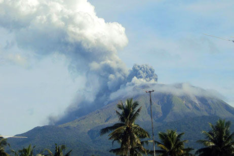
© Maria Ignacio / EPA Mount Bulusan volcano spews ash in Sorsogon province, eastern Philippines, Nov 2010.
One volcanic earthquake and at least three rockfall incidents were recorded near restive Bulusan Volcano in Sorsogon in the last 24 hours, the Philippine Institute of Volcanology and Seismology said Friday.

In its 8 a.m. update, Phivolcs also noted weak steaming activity at the southeast thermal vent.

"Bulusan Volcano's status remains at Alert Level 1. This means that the source of activity is hydrothermal and shallow. Entry to the 4-kilometer radius Permanent Danger Zone (PDZ) is strictly prohibited, since the area is at risk to sudden steam and ash explosions," it said.

Citing the prevailing wind direction, Phivolcs reminded residents in the northwest and southwest sectors of the volcano to take precautions against ash falls.

It also said civil aviation authorities must warn pilots to avoid flying close to the volcano's summit as ejected ash and volcanic fragments from sudden explosions may be hazardous to aircraft.

Umbrella

US: Heavy Rain to Pummel Tri-State This Weekend

Image
© Denny Simmons / Courier & PressMost of Waterworks Road in Evansville is now underwater because of the slowly rising waters of the Ohio River. More rain this weekend may cause the river to rise above flood level in Evansville, according to the National Weather Service in Paducah, Ky.
A storm system could bring some heavy rain to the area the first half of the weekend.

Rainfall amounts of 1 to 3 inches will be possible the next two days, with the heaviest downpours tonight and Saturday morning, according to the National Weather Service in Paducah, Ky.

Since the ground is still saturated from recent rains, runoff could cause sharp rises in area streams.

Meanwhile, the Ohio River has reached the 40-foot flood stage at Owensboro, Ky.

The river is forecast to reach the 42-foot flood stage at Evansville by Sunday.

Cloud Lightning

U.S.: Forecasters warn of flash floods in Midwest

'Widespread rains' expected to sweep across parts of the Midwest and South

Image
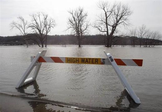
© Al Behrman/APA high water barricade blocks a public landing along the Ohio River, Thursday in Cincinnati. The parking lot for the landing normally extends past the trees surrounded by water. The Ohio River is not expected to reach flood stage.
Heavy rain and thunderstorms were hitting parts of the Midwest Friday, with meteorologists warning flooding was likely in parts of several states.

The complex storm system means severe storms in parts of eastern Oklahoma, and heavy rainfall from the Lower Mississippi Valley on east, The Weather Channel reported, with the possibility of some snow following on its heels over the weekend and into next week.

Central and northern New York would likely see a mix of rain and snow because of the system, The Weather Channel said, before rain would hit northern New England.

A series of systems bearing rain and snow was expected to start moving across the Pacific Northwest and Northern California, the forecasters said.

'Widespread rains'

The National Weather Service issued flash flood watches for parts several states.

Bizarro Earth

Compass Direction, True North Parting Ways

Compass
© CorbisEvery 100,000 years or so, the field flips, meaning that compasses would point south, rather than north. It's been about 780,000 years since the last reversal.

Follow the direction of a compass needle and you'll end up at the North Pole, right? Not these days.

The planet's magnetic field is on the move, a normal enough phenomenon, but one that has some rather bizarre implications, such as the need to renumber airport runways.

Tampa International Airport on Florida's west coast just finished renaming its three runways, a laborious project that interrupted airport traffic for a month while runways were shut down for repainting.

"Everything had to be changed," airport spokeswoman Brenda Geoghagan told Discovery News. "It was a huge project."

Tampa's busiest runway was called 18R/36L, a designation indicating the runway is -- or was -- lined up 180 degrees from north when approached from the north and 360 degrees from north when approached from the south. (The letters "R" and "L" differentiate between the airport's two parallel runways.)