Earth Changes
More than 50 homes were evacuated in Terrace, Smithers and Mount Currie, and thousands more throughout the province placed on alert, as rivers overspilled their banks and threatened homes and livestock.
The biggest flood threat is in Smithers and the Kitimat-Stikine Regional District, where up to 400 homes are at risk, while the Lower Mainland is expected to see the effects of flooding by Friday.
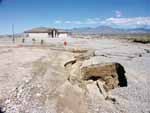
Fissures are a southwestern phenomenon aggravated by our need for water. Underground water tables hold up the earth above. As we pump out the water the earth has nothing to support it and collapses on top of itself creating a fissure. The on -going drought and constant demand for water has lowered the water table below compounding the fissure problem.
The U.S. Geological Survey said in a bulletin sent by email that the quake struck the Moluccas islands in the Banda Sea at 1128 GMT and put the magnitude at 5.8.
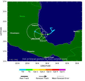
The errors in track forecasts (which tell where a hurricane is most likely to head next and are the foundation of the warning process) have roughly half the errors that they did just 15 years ago.
Forecasts for tracks generally appear in what is called a cone: the middle portion on the cone is where the storm is most likely to hit, but it can veer anywhere inside the total cone's area. Over the past decade, forecasters have honed their predictions so that the length of coastline under warning from that cone has decreased from 454 miles to 317 miles, meaning there's less chance of a false warning.
At a presentation at the Hotel Krasnapolsky in Paramaribo, representatives of US-based Conservation International (CI) told government officials, reporters and others that among the 24 new species there is a purple fluorescent frog (Atelopus species).
CI also issued a statement reporting on the extraordinary discovery of so many species outside the insect realm. Scientists warned however that the new found creatures are threatened by illegal small-scale gold mining, hunting and other forestry activities.
The creation of rain is the result of a variety of physical processes. These processes influence each other and play out both at an extremely small scale (several micrometres) and on a very large one (100 kilometres). The spatial scale of weather models is a few kilometres, and physical processes which occur at a smaller scale have to be approximated. Cloud formation is an example of this. The complexity and differences in scale make weather modelling inaccurate in predicting the time and place of a downpour, and the quantity of rain which will ultimately fall.
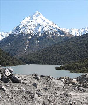
Using radar images acquired by European ERS-1 and -2 satellites, scientists from British Antarctic Survey (BAS) tracked the flow rate of over 300 previously unstudied glaciers. They found a 12% increase in glacier speed from 1993 to 2003. These observations - that echo recent findings from coastal Greenland - indicate that the cause is melting of the lower glaciers, which flow directly into the sea. As they thin, the buoyancy of the ice can lift the glaciers off their rock beds, allowing them to slide faster.