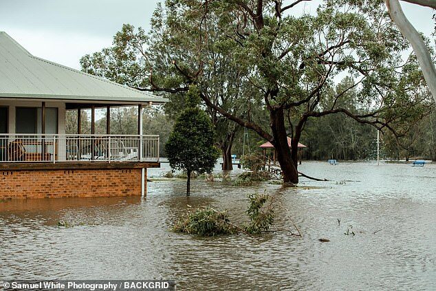
A low pressure system off Australia's east coast brought 120km/h winds overnight and dumped more than 180mm of rain across several areas of New South Wales.
Dramatic pictures captured the extent of severe flooding, which forced some residents to evacuate and left about 14,500 homes and businesses without power.
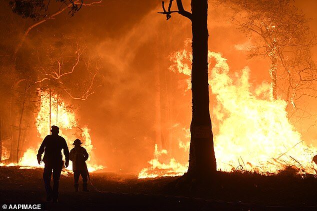
The towns in Shoalhaven, on the NSW south coast, had only just began recovering from the bushfires, which left hundreds homeless.
'It's been a shocker. It's terrible we have to go through this all over again,' Shoalhaven City Mayor Amanda Findley told Daily Mail Australia on Tuesday.
'This is actually our second flood since the bushfires.
'Around the Shoalhaven, the fact that another east coast low pressure system has landed upon us, people are just thinking what's next? Can we really take more of this?'
Australia's unprecedented summer bushfires burned through 18.6 million hectares of bushland, destroyed about 3,500 homes, claimed the lives of 34 people and is estimated to have killed more than one billion animals.
Small communities along the state's south coast were among the worst hit by the devastating crisis.
Terrified residents were forced to flee their homes as a wall of fire beared down on them - now, they're fleeing another deluge after an evacuation order was put out on Monday night.

'Sussex Inlet was threatened by fire and they've had a terrible time of it.'
But so far there have been no reports of serious injuries.
'One thing in the Shoalhaven is that we know how our catchments react very well and we have very good warning systems in place,' Ms Findley said.
'With those warning systems in place, we did have a few people evacuated overnight at Sussex Inlet and we are expecting another peak again today at 2pm, so there may be some further evacuations taking place.'
In other areas, parts of southeast Queensland saw the wettest July day in 15 years.
The Hunter Valley had flash flooding along with the Central Coast of NSW, which had 152mm of rain overnight.
Further south of Shoalhaven, Batemans Bay recorded 164mm of rainfall - the highest July total ever seen.
'Since midnight Saturday 25 July, NSW SES has received more than 2,000 requests for assistance,' a NSW SES Spokesperson told Daily Mail Australia.
'On the Central and South Coasts, we have received 33 calls for help from motorists stuck in floodwaters. It is important motorist remember not to drive through floodwaters, even if it looks shallow.'
Although Ms Findley admitted the barrage of natural disasters has taken its toll on south coast residents, she said: 'We will pick ourselves up and dust off the mud.'
'We have a really resilient community who work really tightly together when it comes to times of crisis. '
Ms Findley has urged anyone struggling to cope, to reach out for help.
'People don't have to be stoic and they can reach out for mental health services.'
Residents in the region were told to 'leave now and move to safety' at 11pm on Monday as water levels rose past knee level in some areas.
The aggressive low pressure system will ease by Tuesday afternoon as it slowly makes its way off shore, but not before wind gusts reach upwards of 120km/h.
'Leave now, leave the high danger area and move to safety,' a statement from the State Emergency Service read on Monday night.
'Once floodwater enters low lying areas of Sussex Inlet, properties will be flooded above floor level, road access will be lost, sewerage lines and power to the area may be lost.
'If you remain in the area you may be trapped, and it may be too dangerous for NSW SES to rescue you.'
'This system is weakening in trend but is still significant,' BoM meteorologist Shuang Wang said.
'By evening there will only be a remnant along the coast as it moves east.'
Sunshine will return to Sydney by Wednesday, Ms Shuang said, with a maximum of 19 degrees and a ten per cent chance of rain.


Reader Comments
to our Newsletter