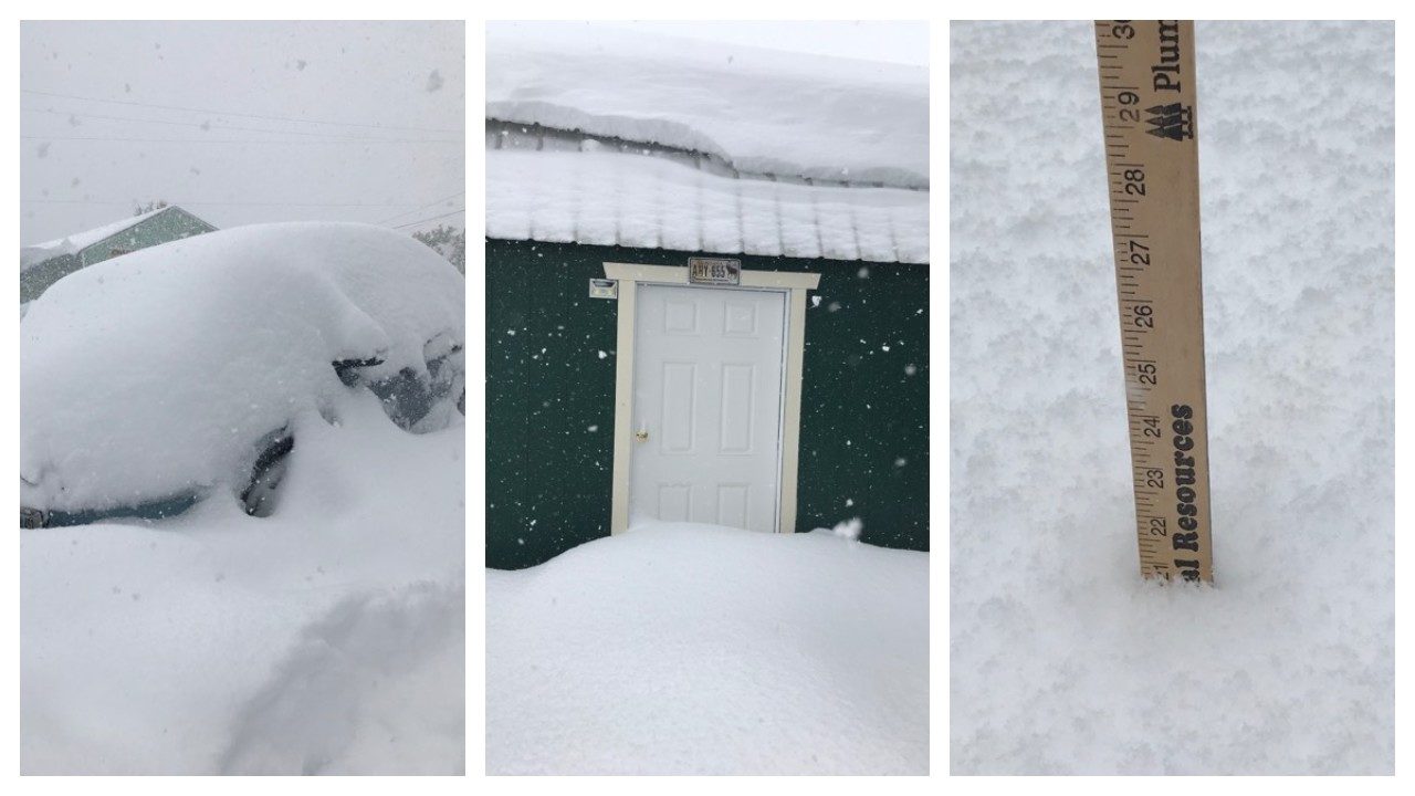
© Carlene Whitney SaloisSnow piles high in East Glacier, Montana, September 28, 2019
Extreme weather caused by a wavy jet stream has kicked off the first 10 days of fall across the United States, leading to a series of
record-breaking and unusual weather events to start the new season.
Here's a look some of the weird things we've experienced so far this fall.
All-Time Record Heat For OctoberDaily record highs were set on several days during fall's first week in the South. Now, that has been capped off by
all-time record heat for the month of October.
More than a dozen cities in the East, from upstate New York to the Florida Panhandle, set all-time October record highs on Tuesday.
Nashville, Tennessee, hit 98 degrees on Tuesday, crushing its previous all-time October heat record of 94 degrees.
Monday's high of 97 degrees in Louisville, Kentucky, also easily toppled the city's previous October record of 93 degrees.
Meridian, Mississippi, preliminarily broke the Mississippi state record high for October when it hit 101 degrees on Tuesday, according to Weather Underground historian Christopher Burt.
At least 45 locations in the East set or tied new all-time October record highs on Wednesday, from Connecticut to Arkansas and the Florida Panhandle.
Just after 1 p.m. EDT Wednesday, Reagan National Airport
hit 97 degrees, the hottest official temperature for any October in Washington, D.C., in
records going back to 1872.
Atlanta broke its all-time October record high of 95 degrees on Wednesday, hitting 96 degrees. Similar readings could occur on Thursday.
Knoxville, Tennessee, set an all-time October high of 95 degrees on Tuesday and promptly broke it by reaching 96 degrees on Wednesday.
Record Cold in the NorthwestOn the opposite end of the spectrum,
record cold temperatures have gripped parts of the Northwest to begin fall.
Great Falls, Montana, had a record number of hours with freezing temperatures to end the month of September.
Temperatures were 32 degrees or lower for
65 consecutive hours from Sept. 27-30, according to the National Weather Service (NWS). That's the city's
most consecutive hours with temperatures at or below 32 degrees in the month of September in records dating to 1937.
Tuesday's low in Great Falls, Montana, was just 9 degrees, which ranks as
their coldest temperature ever recorded so early in the fall season dating to 1886.
Although not all-time record cold, daily record lows were broken in several other locations in the Northwest.
Cut Bank, Montana, set daily record lows of 6 degrees on Sept. 30, and 1 degree on Oct. 1.
Astoria, Oregon (35 degrees), and Olympia, Washington (29 degrees), both tied daily record lows on Oct. 1.
Record Snow in the NorthwestA historic snowstorm in September's final days blasted parts of the northern Rockies with heavy, wet snow and high winds, leading to power outages and tree damage.
The top snow total from the storm was
52 inches about 10 miles south of the Canadian border in Babb, Montana. Five additional locations in northwest Montana tallied up
more than 40 inches of snow.
In Great Falls, Montana, this snowstorm not only shattered September records, but was also
one of their heaviest snowstorms of all time.
Sept. 28 (9.7 inches) and Sept. 29 (9.6 inches) were the two heaviest September snowfall days on record in the city. The two-day total of 19.3 inches was second only to April 27-28, 2009 (24.2 inches) for the
city's all-time heaviest two-day snowfall, the NWS in Great Falls said.
Missoula, Montana, also shattered its snowiest September record, picking up 1.7 inches on Sept. 29 to top the previous September record of 1.5 inches
set in 1934 in the western Montana city.
Spokane, Washington, had only its second measurable September snowfall in
records dating to the late 19th century.
The NWS said 1.9 inches of snowfall was recorded Sept. 28, and another 1.4 inches of snowfall was measured the following day. This storm total more than doubled the previous record September snow event there - 1.4 inches - which occurred on a single day, Sept. 23, 1926.
Midwest Feels More Like SummerThe upper Midwest and Great Lakes have also seen some unusual weather conditions.
Monday's dew point - a measure of moisture in the air - reached 72 degrees in Minneapolis-St. Paul. That's
the highest dew point the Twin Cities have recorded so late in the year.
Dew points at
70 degrees or higher are considered very humid and are something the Twin Cities more commonly experiences in mid-summer.
The warm and humid conditions moved toward the Great Lakes on Tuesday morning.
Traverse City, Michigan, had
a temperature of 80 degrees at 4 a.m. on Tuesday. That's equivalent to the city's average high temperature during its hottest time of year in the middle July.
Hurricane Lorenzo the Easternmost Atlantic Category 5Hurricanes are common in the Atlantic during early fall, but
Lorenzo's intensification into a Category 5 was unusual.
Lorenzo rapidly intensified Saturday from Category 3 status with estimated maximum sustained winds of 115 mph at 11 a.m. EDT to Category 5 status with winds of 160 mph just 12 hours later.
This is
by far the farthest east in the Atlantic Ocean any of the previous 35 Category 5 hurricanes have occurred in records dating to the 1920s.
National Hurricane Center forecaster Eric Blake noted Lorenzo became a Category 5 hurricane almost
650 miles farther east than the previous easternmost Category 5 hurricane, Hugo in 1989.
Reader Comments