Jalisco State
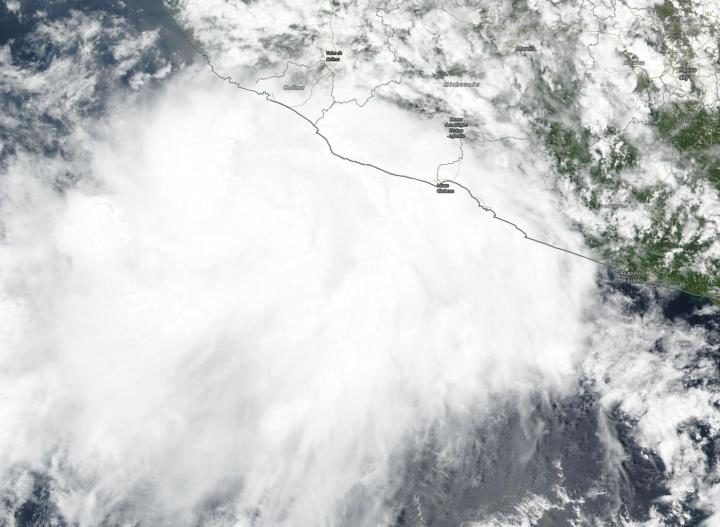
Media reported that around 200 people were evacuated and over 50 houses and some roads were flooded in Jalisco State.
Civil Protection said they rescued two men who were trapped in their home after flooding from the Villa Purificación river in the town of Agua Caliente in La Huerta. Civil Protection also carried out flood rescues in Chamela.
Baja California Peninsula
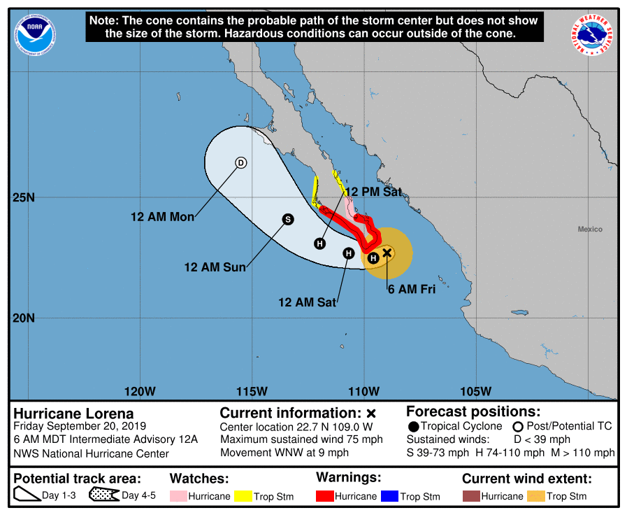
The National Hurricane Center (NHC) in the USA said a Hurricane Warning is in effect for the Baja California peninsula from La Paz to Puerto Cortes.
NHC warned that Lorena is expected to produce rainfall accumulations of 3 to 6 inches, with maximum amounts around 8 inches, across the far southern Baja California Sur. This rainfall may result in flash flooding.
The center also warned that swells generated by Lorena will affect portions of the southwestern coast of Mexico and the southern Baja California peninsula during the next few days. These swells are likely to cause life-threatening surf and rip current conditions.


Reader Comments
to our Newsletter