The 2019 season for noctilucent clouds (NLCs) has been remarkable, maybe
the best ever, with NLCs appearing as far south as Los Angeles CA and Albuquerque NM. What's going on? Researchers aren't sure, but Lynn Harvey of the University of Colorado's Laboratory for Atmospheric and Space Physics has just found an important clue.
"The mesosphere is quite wet," she says. "Water vapor concentrations are at their highest levels for the past 12 years."

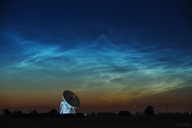
© Piotr MajewskiNoctilucent clouds over Piwnice, Poland, on June 18th.
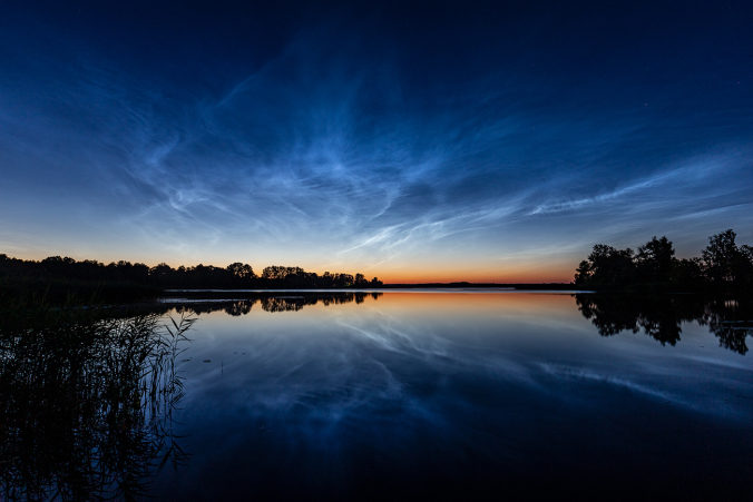
Noctilucent clouds form when summertime wisps of water vapor rise to the top of the atmosphere. Water molecules stick to specks of
meteor smoke, gathering into icy clouds that glow electric blue when they are hit by high altitude sunlight.
When noctilucent clouds began appearing at unusually low latitudes in early June, Harvey took a look at data from NASA's Microwave Limb Sounder-a satellite-based sensor that can measure water in the upper atmosphere. Her results are shown in the animated plot below.
"The red line is 2019, while other colors trace previous years," explains Harvey. "The plot cycles from low to high latitudes," showing a wave of moisture in the mesosphere.
It's a veritable tidal wave. Water vapor concentrations at lower latitudes (35 to 45 N) have nearly doubled their normal values, providing a surplus of H
2O molecules for noctilucent clouds. Researchers aren't sure where the water is coming from, though.
"
Planetary wave activity could be transporting cold air and high water vapor to the 'noctilucent zone,'" speculates James Russell of Hampton University's Center for Atmospheric Sciences. "We've
seen this happen before during mid-latitude outbreaks of noctilucent clouds."
The solar cycle may be helping, too. Right now a deep Solar Minimum is underway. Ultraviolet radiation that would normally destroy water in the mesosphere is at low ebb.

© Ivo DinsbergsNoctilucent clouds over Riga, Latvia,on June 18th.
The wave appears to be breaking. "As we enter the 3rd week of June, the water has stopped increasing," notes Harvey. "Poleward of 70N the water content has been dropping for a few weeks, and right around the north pole it's getting quite dry. At mid-latitudes (35-65N), water content is still high, but it's leveling off."
No one knows what will happen next. Another wave could bring renewed sightings of NLCs at low latitudes. Or conditions could return to normal, restoring the clouds to their usual habitat near the Arctic Circle. Says Russell, "this all points to mysteries of the atmosphere that have not been solved." Stay tuned!


Reader Comments