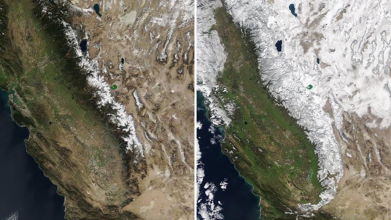
Winter storms this year have produced incredible levels of snow in the Sierra Nevada, and more rainfall is expected.
A photo from NASA showed the mountain region in February of 2018 and February this year. The side-by-side snapshot shows extensive snow this year covering the western slopes of the region:"The Sierra Nevada is really living up to its name 'snowy mountain range' this year. With snow reports coming in feet & snow storms still moving in, it's now home to the snowiest ski resort in the U.S.," NASA tweeted.
The Sierra Nevada is really living up to its name "snowy mountain range" this year 🏔. With snow reports coming in feet & snow storms still moving in, it's now home to the snowiest ski resort in the U.S. Our @NASAEarth satellites captured its 2019 look: https://t.co/OKycnJWwI0 pic.twitter.com/zKqPOQvCa3
— NASA (@NASA) February 14, 2019
Much of that snow can be experience in areas close to Southern California like Mammoth Mountain, where NASA says more than 37 feet of snow have fallen since the beginning of winter, leading to it becoming the "snowiest ski resort" currently in the U.S.
According to the California Department of Water Resrouces, the mountain range has received the snow water equivalent of 130 percent of normal as of Feb. 11. In just Nov. 2018, the range was 44 percent of of normal.
And it could mean good news going into 2019 and dealing with drier months down the road.
"Spring and summer melt from the Sierra Nevada plays a crucial role in recharging California's reservoirs. Though conditions could change, California drought watchers are cautiously optimistic that the boost to the snowpack will insulate the state from drought this summer," NASA's Earth Observatory blog reports.


Comment: Also pertinent: Mammoth Mountain in California has received 37 feet of snow for the season so far - with further heavy falls forecast
Lake Tahoe weather: Season snow totals near 400 inches
As regards that last report (dated the 11th of February) a total of 8 feet of new snow can be added after taking into account these subsequent reports:
Storm snow totals surge to 5 feet at some Lake Tahoe area ski resorts in 48 hours
Lake Tahoe ski resorts hit by another 3 feet of snow in 24 hours
Which would take the season snowfall total thus far for some of those resorts to 41 feet.