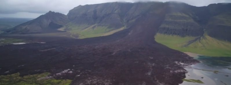
The landslide was mapped with drones, Icelandic Coast Guard airplane and satellites.
Based on these images, the debris covers an area of about 1.8 km2 (0.69 mi2). In addition, satellite imagery showed an old crater in the same place in the mountain and a slope below it, suggesting this is not the first landslide in this area.
The slide has blocked a well-known salmon fishing river with mud and rock, almost completely changing the landscape.
This is a big dam and there is no risk that it will break, says Magni Jónsson, a specialist in the flood at the Icelandic Meteorological Office. "There will be some flooding, but this will happen slowly."
"May was the wettest on record in Reykjavik, and June was no better, suffering the lowest number of hours of sunshine in June in recorded history. Thus, it seems likely that the landslide was a consequence of the high levels of recent rainfall," landslides expert Dr. Dave Petley said.
Comment: Iceland isn't alone in suffering record breaking dark skies: A dark December: In one month Moscow totals 6 minutes of sunlight while Belgium bears just 10.5 hours


Comment: These massive landslides happening all over the world do seem to be connected to torrential rainfall, but there appear to be other factors to consider: