OF THE
TIMES
"We have about 50% of the world's wealth but only 6.3% of its population. This disparity is particularly great as between ourselves and the peoples of Asia. In this situation, we cannot fail to be the object of envy and resentment. Our real task in the coming period is to devise a pattern of relationships which will permit us to maintain this position of disparity without positive detriment to our national security. To do so, we will have to dispense with all sentimentality and day-dreaming; and our attention will have to be concentrated everywhere on our immediate national objectives. We need not deceive ourselves that we can afford today the luxury of altruism and world-benefaction."
~ US State Department, 1948
Interesting in ancient time women were considered the shamans of the society. Some societies in the ancient world, was not through the male...
This interesting analysis from the Judge interview with Max Blumenthal [Link] Max Blumenthal: Hamas Still Stands.
This article and so called research demonstrates to me nothing more than a sophisticated to use of language to describe the Darwinian theory of...
"It may be the first piece of evidence that people in the West have made a decision to liquidate him. Be afraid, clown!" Seems about right to...
I would take this info with a pinch of salt if the Russian admin didn't know too much about the supposed assassin. There really isn't any worth in...
To submit an article for publication, see our Submission Guidelines
Reader comments do not necessarily reflect the views of the volunteers, editors, and directors of SOTT.net or the Quantum Future Group.
Some icons on this site were created by: Afterglow, Aha-Soft, AntialiasFactory, artdesigner.lv, Artura, DailyOverview, Everaldo, GraphicsFuel, IconFactory, Iconka, IconShock, Icons-Land, i-love-icons, KDE-look.org, Klukeart, mugenb16, Map Icons Collection, PetshopBoxStudio, VisualPharm, wbeiruti, WebIconset
Powered by PikaJS 🐁 and In·Site
Original content © 2002-2024 by Sott.net/Signs of the Times. See: FAIR USE NOTICE


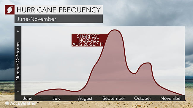
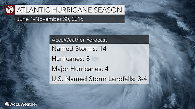
Comment: It looks at though we are in for more wild weather in September and October. See our latest SOTT Earth Changes Summary - July 2016: Extreme Weather, Planetary Upheaval, Meteor Fireballs to get an idea of what may lie ahead.